Cable cars and sourdough bread may be the first thing that comes to mind when thinking about San Francisco, but the city has a secret. The Bay Area offers some exceptional hiking trails nearby.
Miles of coastline, rolling fog, and numerous expansive vistas are only a few of the highlights you’ll discover hiking San Francisco and the surrounding area.
You can journey along the Pacific Ocean, walk through a towering forest in the middle of the city, or retreat to an island to trek your way up to a rewarding view point.
The point here being the Bay Area has some worthy trails to travel along for all ages and skill levels who are willing.
To showcase what this area has to offer, we rounded up our top picks for the best hikes near San Francisco. All of which are within a 30 mile radius of the city.
Related Read: The 12 Best Camping Spots Near San Francisco, California
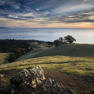
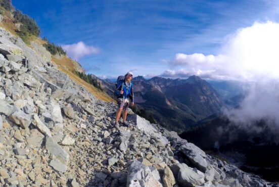
1. Mount Davidson Trail

Why you should go: Hike to the top of the highest peak in San Francisco.
- Difficulty: Easy
- Distance: 1.5 miles
- Elevation gain: 433 feet
Mount Davidson is the highest peak in San Francisco. Hike up the easy 1.5 mile Mount Davidson Trail to the flat summit and you’ll find yourself gazing straight up at the iconic 103 foot Mount Davidson Cross.
On the way there, you’ll hike through some wooded and grassy areas which offer hikers a fresh of breath air from bustling city life.
If you happen to hike on a clear day, you’ll be greeted by an expansive view once you reach the top. Bring a camera and a picnic to take it all in. We recommend hiking sunset or sunrise for prime photo-ops.
Related Read: The 11 Best Day Trips from San Francisco, California
2. Tennessee Valley Trail
Why you should go: A relatively flat, family-friendly trail where land meets the sea at the Marin Headlands.
- Difficulty: Easy
- Distance: 3.4 miles
- Elevation gain: 170 feet
Located in the Gold Gate National Recreation Area, the Tennessee Valley Trail is a wonderful adventure for both families and nature lovers alike.
Winding through the scenic Marin Headlands, the Tennessee Valley Trail takes you along a partially paved trail through grassy bluffs before popping you out at a sandy beach.
Time your hike just right and at low tide you’ll be granted the chance to see some of the SS Tennessee shipwreck.
From soaring raptors to grazing deer, this area is home to an array of wildlife. Pack the binoculars and keep a watchful eye.
Related Read: 9 Adventurous Things to Do in Yosemite National Park, California
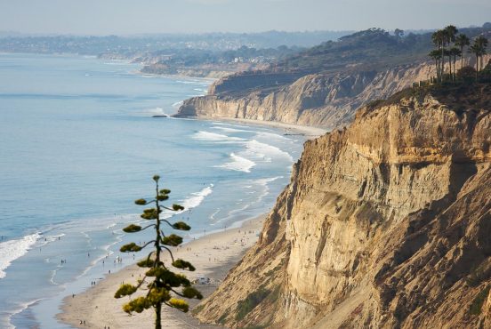
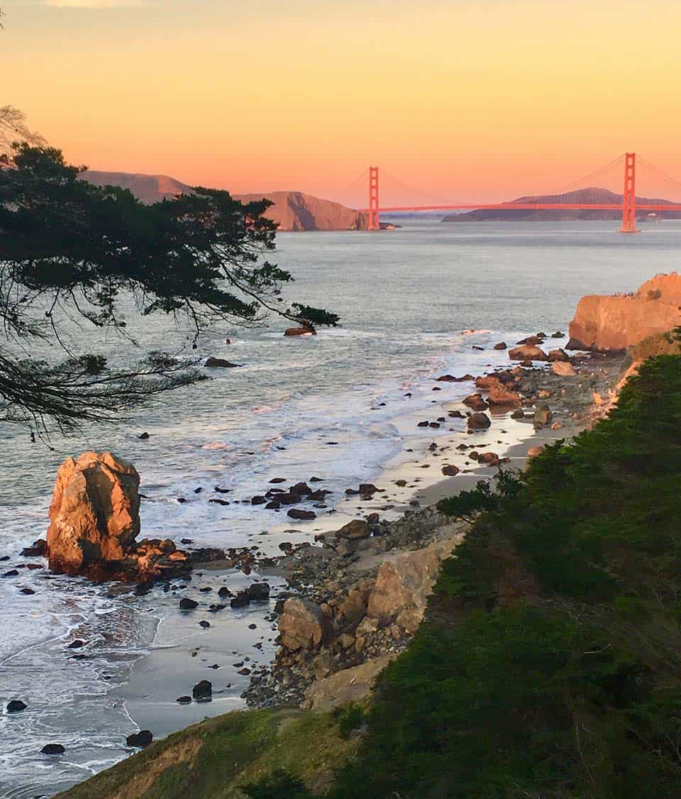
3. Coastal Trail to Golden Gate Bridge
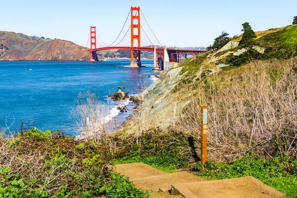
Why you should go: Take a scenic coastal walk to the iconic Golden Gate Bridge.
- Difficulty: Easy
- Distance: 3.2 miles
- Elevation gain: 260 feet
While the California Coastal Trail spans over 1,000 miles, the short section that extends from Baker Beach to the Golden Gate Bridge shouldn’t be missed.
Starting at Baker Beach, you’ll follow along a scenic coastal stretch that offers wonderful views of the Pacific Ocean.
As the path begins to climb, you’ll be approaching the Golden Gate Overlook. Stop to admire the beauty if you like, then continue down the gently grade slope until you reach the Golden Gate Bridge.
A marvel of engineering, the Golden Gate Bridge is about as iconic a symbol for San Francisco as it gets.
Once you’re ready, trace your steps back to where you began your trip.
Related Read: The Ultimate Los Angeles to San Francisco Road Trip
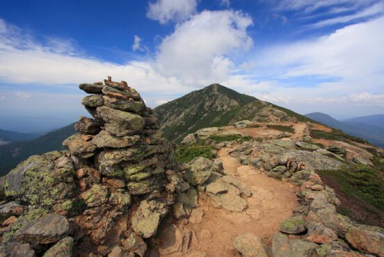
4. North Ridge and Sunset Trail Loop
Why you should go: Trek to the highest peak on Angel Island and experience views of Alcatraz, Mount Diablo, and the San Francisco skyline along the way.
- Difficulty: Moderate
- Distance: 4.8 miles
- Elevation gain: 777 feet
If you have time to make a day of it, hop on the ferry and head over to Angel Island for the North Ridge and Sunset Trail Loop. This loop offers some stellar bay views including the one on top of Mount Livermore, the highest peak on the island.
Starting on the North Ridge Trail, you’ll hike uphill through coast live oak, California bay, chaparral, and a grassy plateau. Around mile 2, you’ll reach the summit of Mount Livermore.
Peer out into the distance and see if you can spot Alcatraz Island or the peak of Mount Diablo. When you’ve had your fill, continue on the North Ridge Trail to reach the Sunset Trail.
As you make your descent, you’ll travel along a series of switchbacks with even more spectacular views.
Related Read: The 10 Best Hikes in Redwood National Park, California
5. Devil’s Slide Trail
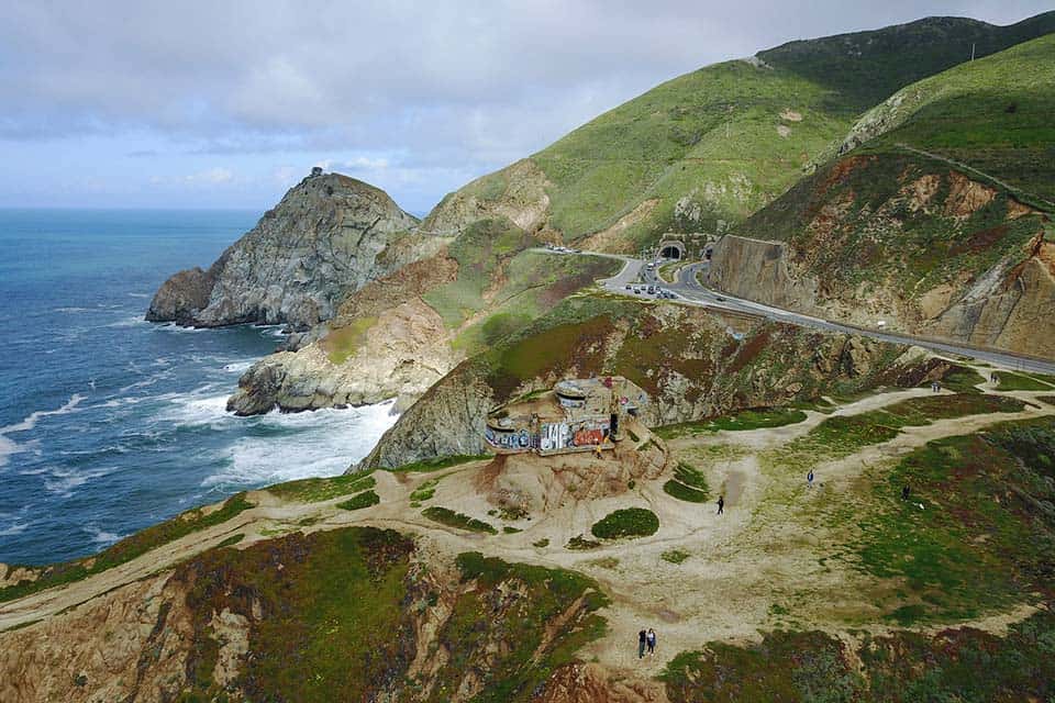
Why you should go: Leisurely stroll along a former section of Highway 1 right above the Pacific Ocean.
- Difficulty: Easy
- Distance: 2.5 miles
- Elevation gain: 269 feet
Visitors are drawn to Devil’s Slide Trail for one particular feature, the view. A former section of Highway 1, Devil’s Slide is a multi-use trail that cuts into a steep hillside above the Pacific Ocean.
Located in Pacifica, Devil’s Slide Trail is a short drive south of San Francisco. For anyone looking to get in some exercise, this trail is a refreshing escape.
Devil’s Slide Trail is wide and paved which makes it ideal for all ages and skill levels. You’ll find several benches to rest and take in the view, along with interpretive signs at various significant points.
Related Read: 14 Wow-Worthy Hikes at Mount Shasta, California
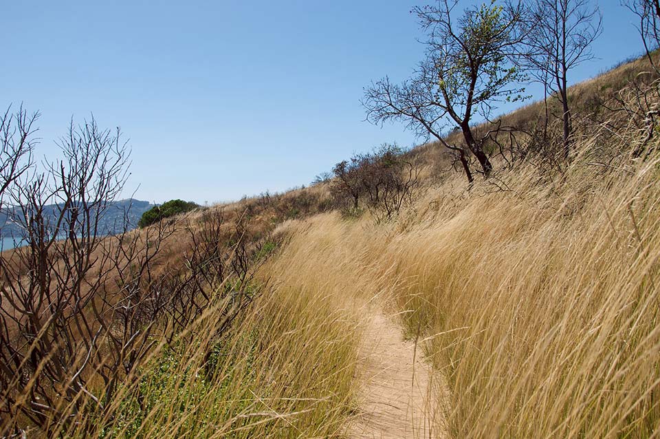
6. Sweeney Ridge Via Sneath Lane
Why you should go: Hike to the top of a sweeping vista that is home to the former Nike missile control site.
- Difficulty: Moderate
- Distance: 3.6 miles
- Elevation gain: 586 feet
History, wildlife, and one very scenic vista are why hikers flock to Sweeney Ridge.
There are a few ways to reach the 1,200 foot summit. However, we recommend getting there via Sneath Lane. The climb from Sneath Lane is a bit gentler with a paved path.
Once you reach the top you’ll have an expansive view of the rolling grassy ridgeline covered in coastal scrubs. The views of the bay aren’t too shabby either.
Fog and wind are frequent conditions on top of the exposed ridge so plan accordingly.
Related Read: 14 Unforgettable Hikes in Northern California
7. Twin Peaks

Why you should go: An incredibly popular hike that rewards visitors with an iconic panoramic view of San Francisco and the Bay Area.
- Difficulty: Easy
- Distance: 3.8 miles
- Elevation gain: 511 feet
If a view is what you want, then a view it what you’ll get when you hike up Twin Peaks. This iconic vantage point offers visitors a panoramic view of San Francisco and the bay.
Across from the parking lot, you’ll see a series of stairs leading up to the north peak. Stay on the designated path and watch out for poison oak.
Once you reach the top, you can continue on to reach the south peak. This peak tends to be less crowded than the other one. Hang out and enjoy.
Take note, this is an extremely popular trail so expect a crowd.
Related Read: 7 Awesome Weekend Road Trips from San Francisco, California
8. Panoramic Loop
Why you should go: A 4.5 mile loop through the Muir Woods National Monument featuring towering redwoods.
- Difficulty: Moderate
- Distance: 4.5 miles
- Elevation gain: 943 feet
The best way to explore the Muir Woods National Monument is by taking a journey on the 4.5 mile Panoramic Loop.
Home to a remarkable ecosystem, you’ll trek among giants in a lush forest setting. Gaze up at the towering old growth and take a moment to appreciate the oldest living trees.
From there, the forest will give way to meadows and chaparral which has its own beauty.
Note that picnics are not allowed in the forest so plan to chow down ahead of time.
Related Read: Stay in San Fran: 9 Best Airbnbs in San Francisco, California
9. Lands End Trail
Why you should go: A windy coastal trail with shipwrecks and views of the Golden Gate Bridge.
- Difficulty: Easy/Moderate
- Distance: 3.5 miles
- Elevation gain: 534 feet
Soak up some incredible coastal views on the Lands End Trail.
Located in the Golden Gate National Recreation Area, Lands End Trail travels along rocky, windy bluffs with promising views.
A few highlights along the way being the Golden Gate Bridge, Point Bonita Lighthouse, and shipwrecks. Pack a lunch and bring the pup.
Before you leave the area, we also recommend checking out the Sutro Baths.
Related Read: 11 Epic Winter Camping Spots in California
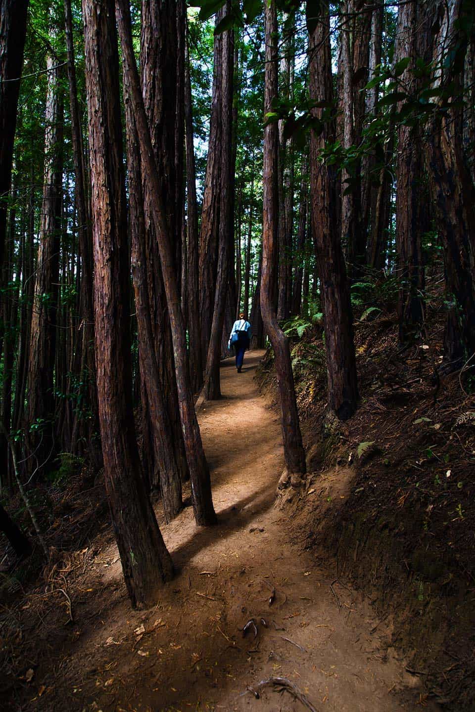
10. Mount Sutro Loop
Why you should go: A short, forested hike smack dab in the middle of the city.
- Difficulty: Moderate
- Distance: 2.2 miles
- Elevation gain: 583 feet
Owned by UCSF, Mount Sutro Reserve is a 61 acre green haven nestled in the middle of a buzzing concrete jungle. Take a break and soothe your soul by taking a hike in a forested setting along the Mount Sutro Loop.
This loop connects a network of trails to take you on a journey to the top of the 900 foot summit.
One of the coolest times to hike this loop is during the fog. The towering trees and cooling mist have a magical vibe making the forest feel enchanted.
We recommend going during the week to avoid the weekend crowds so you can find some inner peace.
Related Read: 15 Best Glamping Spots in California for a Retreat from Civilization
11. Stonewall Panoramic Ridge
Why you should go: A popular, dog-friendly trail located in a 208 acre preserve in Berkeley.
- Difficulty: Moderate
- Distance: 2.6 miles
- Elevation gain: 895 feet
Also referred to as the East/West Trail, the Stonewall Panoramic Ridge Trail is a popular route in the Claremont Canyon Regional Preserve. This trail offer an exceptional vantage point of the Bay Area.
However, these views don’t come without a challenge. Hikers will tackle several ascents, gaining around 900 feet total in elevation.
If your game, pack your day pack and get moving. There’s a network of trails here so you can extend your journey if you choose.
Related Read: 10 Invigorating Hikes in the East Bay Area
Explore Northern California
Get epic travel ideas delivered to your inbox with Weekend Wanderer, our newsletter inspiring more than 10,000 readers every week.
Seen in: California, Destinations, Hikes, Hiking in California