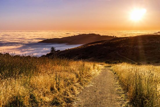
There’s no need to travel to Tahoe or Big Sur for a hike when you’re in the East Bay Area – there are plenty of awesome trails just outside your doorstep.
When you think about California’s Bay Area, rugged backcountry and wide open natural spaces aren’t what first come to mind. But the Bay Area is actually chock full of excellent hiking trails, especially in the East Bay. From the heights of prominent peaks like Mount Diablo to the low marshes of the local wildlife refuges, there’s tons to explore.
Dozens of trails crisscross the East Bay’s hills and wetlands, offering up stunning sights and even some chances to spot wildlife. Here are 10 East Bay hikes you need to check out.
1. Mission Peak Loop
- Difficulty: Challenging
- Distance: 5.8 miles
- Elevation gain: 2135 feet
Why you should go: The best view and hardest challenge in the East Bay.
Mission Peak is among the most challenging, rewarding, and popular hikes in the East Bay Area. It’s a long and steep ascent, but on any day of the week, you’ll see many others scaling this trail to catch a glimpse of the view from the top.
That’s because it’s a beautiful hike that winds in and out of lush steep-walled hollows and over grassy hillocks on your way to the summit. Once at the top, you’ll have a panoramic view of the South Bay Area and the Ohlone Regional Wilderness. Day or night, there’s no better view on this side of the San Francisco Bay.
There are two main trailheads of about equal length and difficulty. From the Stanford Avenue Staging Area, the hike is steeper but shorter. From Ohlone College, which is adjacent to Mission San Jose (which the peak is named after), the hike will be a little over a mile longer, but the climb more gradual. Either way, you’re in for a challenge and a treat.
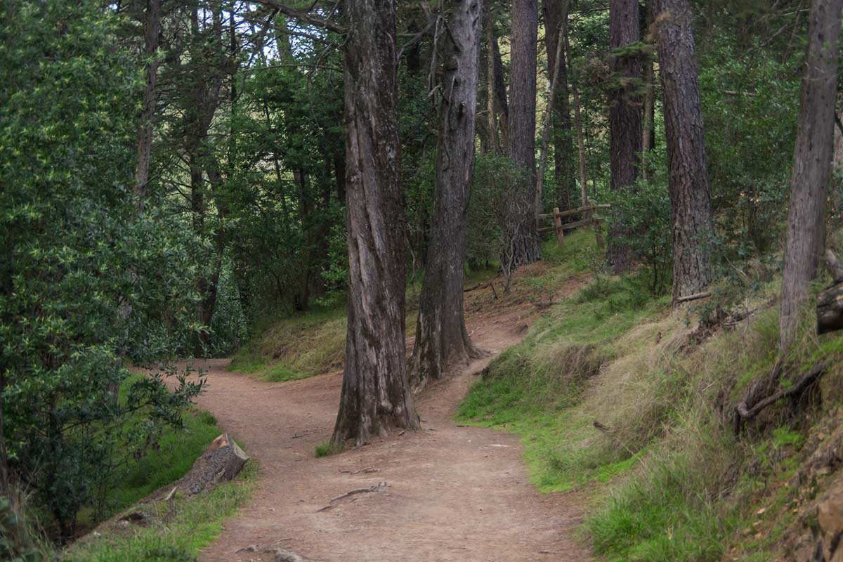
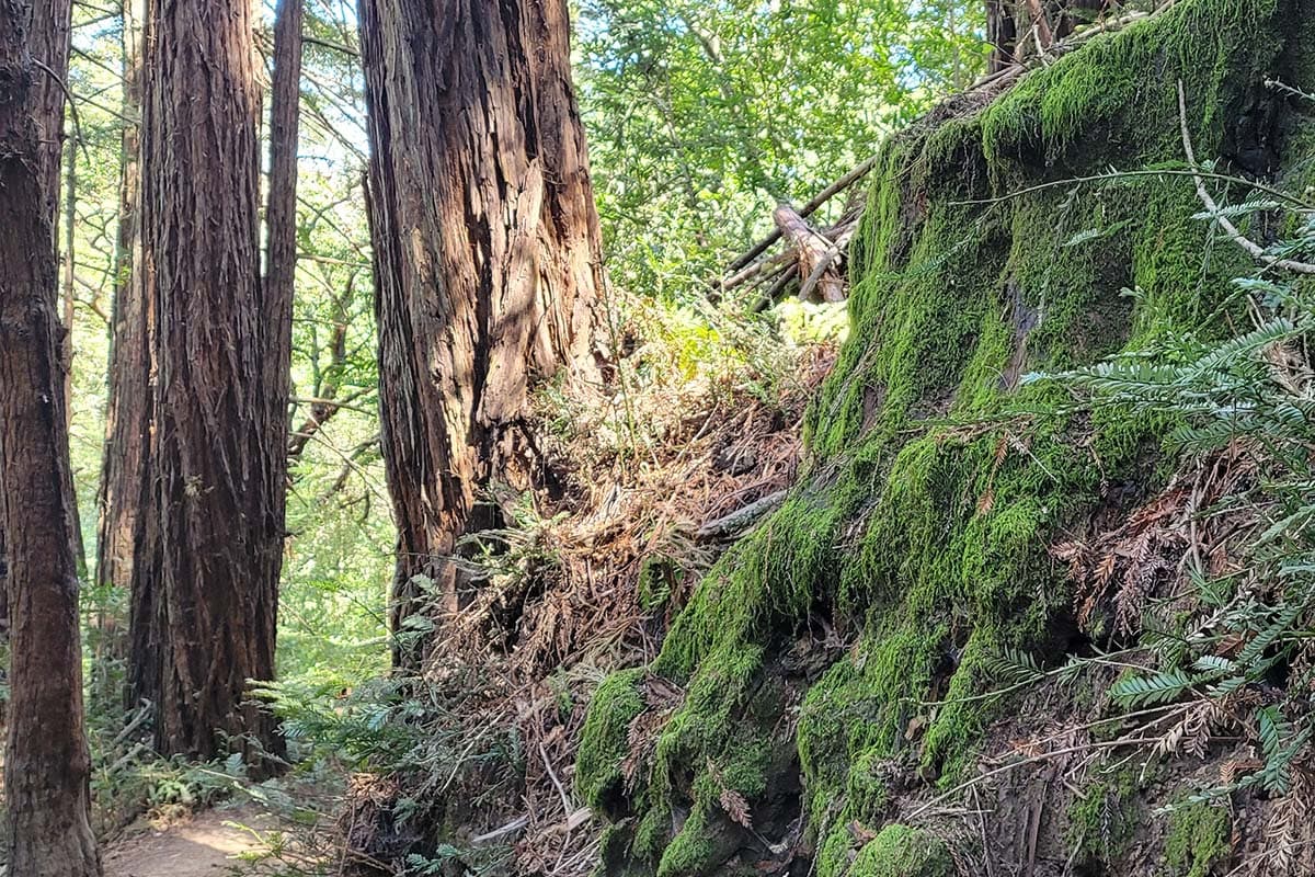
2. Sequoia Bayview Trail
- Difficulty: Easy
- Distance: 3 miles
- Elevation gain: 239 feet
Why you should go: A gentle, well-shaded forest trail accessible from Oakland.
The Sequoia Bayview Trail is the perfect quick escape from the city. This lollipop loop winds through a mixed forest with patches of towering redwood trees. The gently graded, wide path is frequently used by joggers and dog walkers, so expect to see a few friendly (and furry) faces on the trail.
Along the trail, you’ll likely spot banana slugs, turkeys, and glimpses of the bay between the trees. This trail is the highlight of Joaquin Miller Park, and it connects with many intersecting trails that stretch out and across Redwood Regional Park. It’s an ideal spot for an easy forest walk or as a starting point for a longer journey.
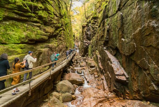
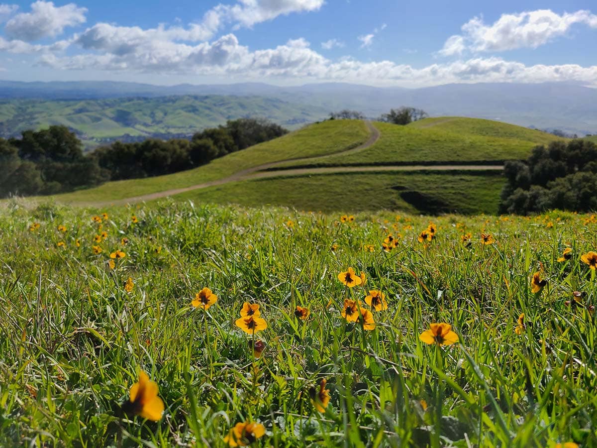
3. Little Yosemite
- Difficulty: Moderate
- Distance: 2.1 miles
- Elevation gain: 203 feet
Why you should go: A touch of Yosemite’s magic and mystery right in the East Bay.
A great trail for wildflower viewing, birding, and swimming, Little Yosemite will amaze you with its beauty. New sights to see can be found around every turn and over each hill – which are both plentiful on this short hike.
The rocky terrain and continuous uphill and downhill walking could be a challenge for some, but if you take your time and venture out during the cooler times of the day, you’re sure to enjoy the route’s diversity of flora, fauna, and topography.
Near the trailhead, the Sunol Wilderness Visitor Center provides a wealth of information about the area’s Native American history and how it can still be seen along the trail.
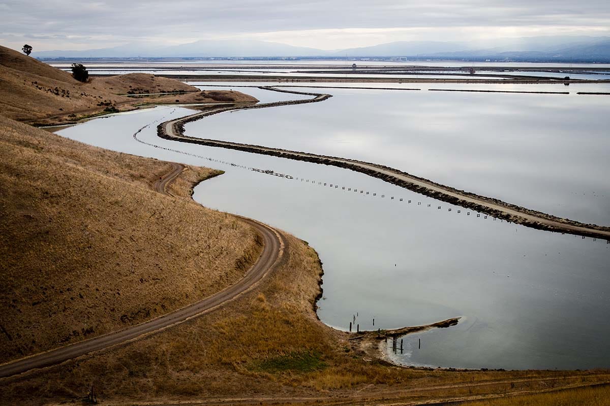
4. Bayview Loop
- Difficulty: Easy
- Distance: 3.1 miles
- Elevation gain: 170 feet
Why you should go: A wetland respite from the urban sprawl on the edge of the bay.
Coyote Hills Regional Park is a sanctuary for wetland wildlife. It’s also a wonderful stress-melting escape after a long workday in the city (it’s just a quick drive from Silicon Valley). The Bayview Loop is one of several easy loop hikes to choose from in the park, so feel free to explore further once you arrive.
However, this loop trail showcases the best of what Coyote Hills has to offer. You’ll walk alongside carp-filled channels, on boardwalks over a reed-filled marsh, around waterfowl-laden ponds, and next to the vast bay. There’s so much wildlife here that each time you visit, you’re bound to spot something new.
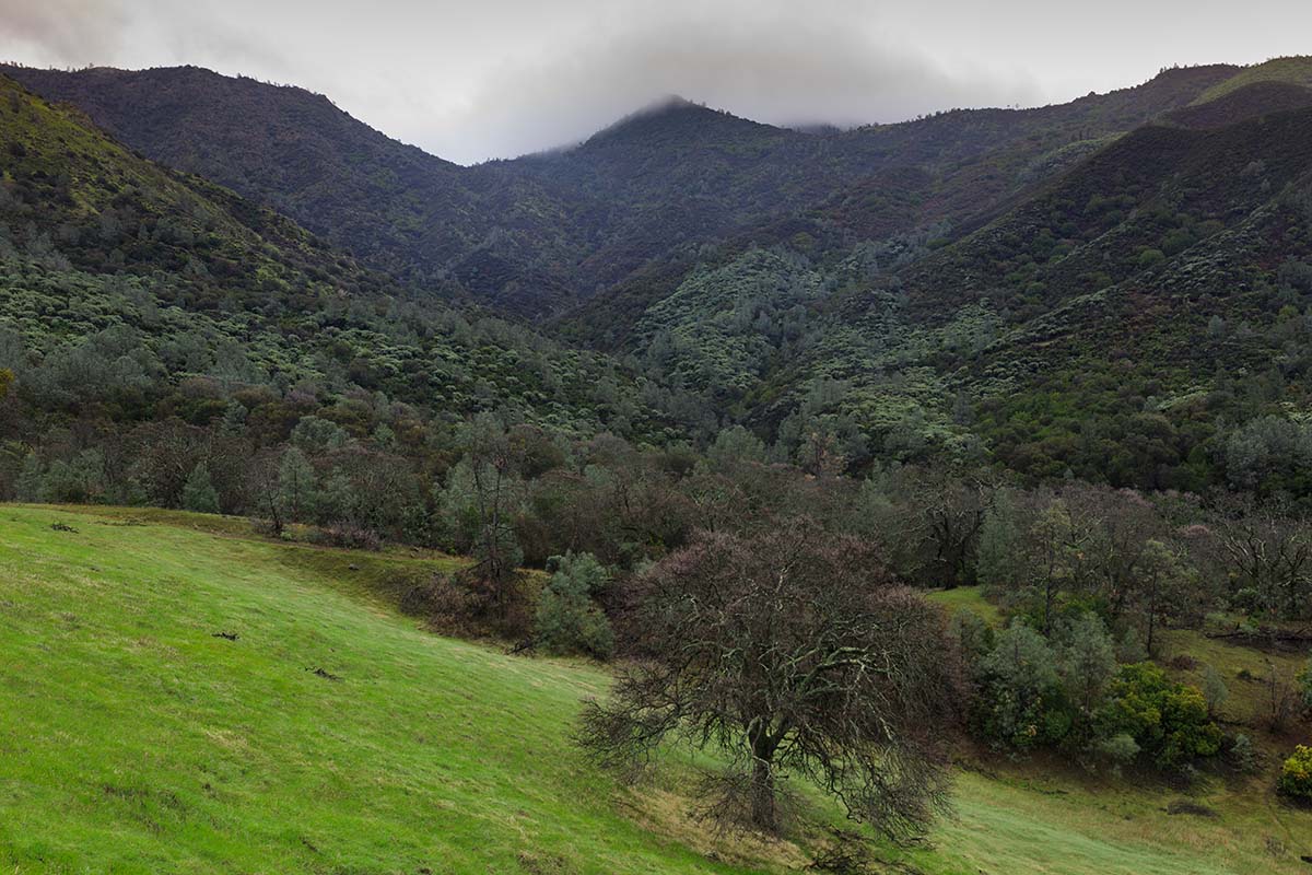
5. French, Bridle, & Stream Trail Loop
- Difficulty: Moderate
- Distance: 8.1 miles
- Elevation gain: 1325 feet
Why you should go: A long, remote trail that’s only minutes from the Bay Area.
The French, Bridle, and Stream Trail Loop in the Reinhardt-Redwood Regional Park is a long, moderately challenging trail just a short drive away on Highway 580.
This trail meanders under tall redwood trees and on top of sky-high ridges. You’ll be trekking through the forest with a fern-dominated understory at your side for long stretches, but every so often, you’ll climb to an open ridgeline with astounding views of the area.
Mountain creeks flow year-round here, and the thick canopy keeps the area wet long after the last rainy day. That means you may come across various salamanders, frogs, and fungi – a nice change of pace from the drier portions of the Bay Area.
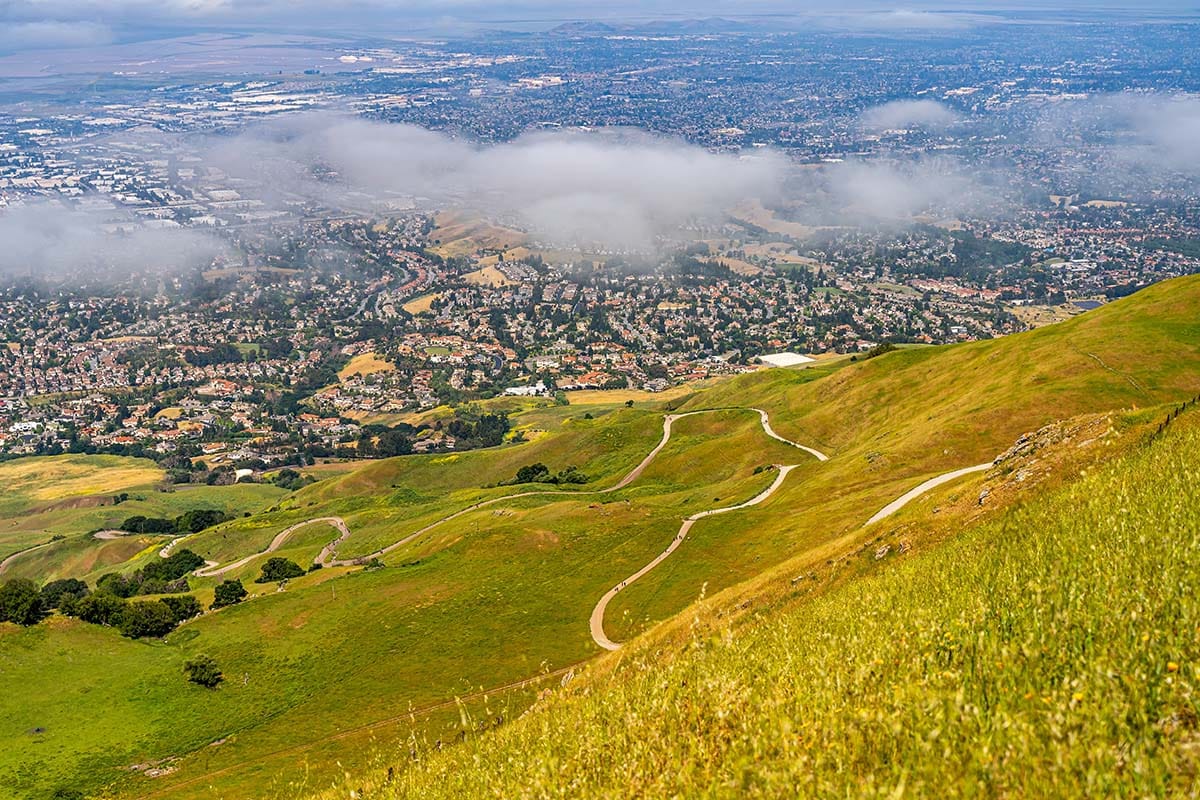
6. Pleasanton Ridge
- Difficulty: Moderate
- Distance: 6.5 miles
- Elevation gain: 1427 feet
Why you should go: Head to the easternmost stretches of the Bay Area for stunning views of Amador Valley.
Pleasanton Ridge resides on the eastern edge of the Bay Area. This hike begins at Castle Ridge Trailhead, the primary gateway into this extensive trail system. You’ll ascend to the ridge for the first two miles of this hike where you can then choose your own path – each with its own outstanding ridgetop vistas to discover.
What’s most unique about this trail system is the breathtaking views of Amador Valley. The rolling hills, pastures, and suburban neighborhoods paint a much different picture than the bay views further to the west. It’s far from the major highways and city skyline, so you can enjoy the peace and serenity of a true escape.
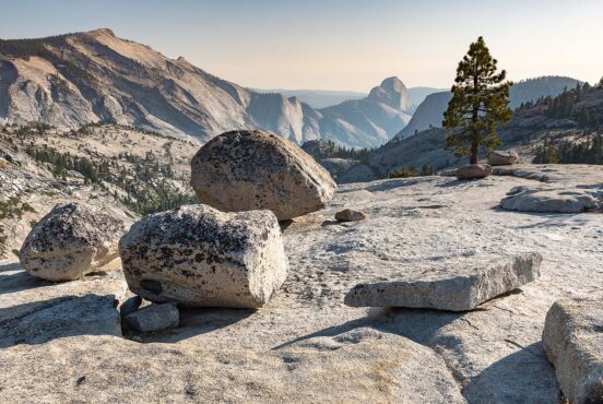
7. Mount Diablo Grand Loop
View this post on Instagram
- Difficulty: Challenging
- Distance: 6.2 miles
- Elevation gain: 1801 feet
Why you should go: Take in a bird’s eye view of the Bay Area and far beyond.
Mount Diablo is the tallest peak in the entire Bay Area. Fortunately, you can drive all the way to the top! Once you arrive, take a hike along The Grand Loop, which encircles the summit.
This trail can be challenging, and it doesn’t offer much shade during the peak daylight hours. However, the views and altitude make it worth the trek. On a clear day, you’ll be able to see San Francisco, all of the Bay Area, and the snow-capped Sierra Nevada Range.
Closer to your feet, the trail cuts through vast stretches of wildflowers, over rolling grassy hills, and next to rocky outcroppings. The trail crosses through Juniper Campground (if you want to stay the night), and the Summit Museum makes for an excellent pit stop.
8. Lake Elizabeth Trail
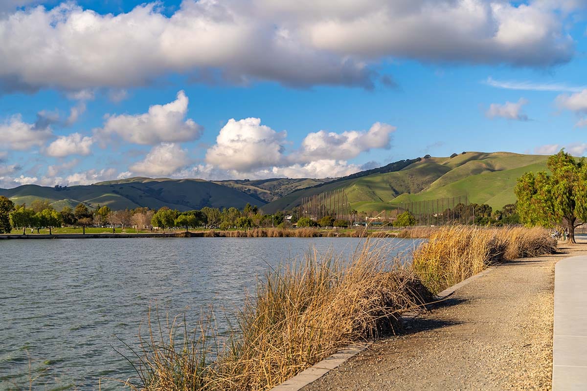
- Difficulty: Easy
- Distance: 2.1 miles
- Elevation gain: 9 feet
Why you should go: An accessible and relaxing stroll in the heart of Fremont.
Located smack dab in the middle of Fremont, Lake Elizabeth is where local families gather for picnics, sports, and frolicking. The Lake Elizabeth Trail is a handicap-accessible paved pathway that hugs the lake’s edge for its entire route.
Herons, coots, geese, and other waterfowl frequent the waters, making this an excellent hike for birders, and benches and concessions make it perfect for families who need to take a few breaks. Plus, the lake’s marina offers different types of boat rentals so you can spend an afternoon on the lake.
9. Round Top Loop
View this post on Instagram
- Difficulty: Easy
- Distance: 1.7 miles
- Elevation gain: 246 feet
Why you should go: A fun family hike with lots of variety and activities.
Located in the Sibley Regional Volcanic Preserve, Round Top is an ancient volcanic mass that is now home to forests, fields, and labyrinths! The Round Top Loop Trail is a straightforward route that goes around the summit, but there are many short offshoots you can venture down to make your own adventure out of it.
Labyrinths have been constructed alongside the trail that are fun for the entire family to solve together. Plus, multiple short trails lead off to various viewpoints like the water-filled quarry and Round Top’s peak.
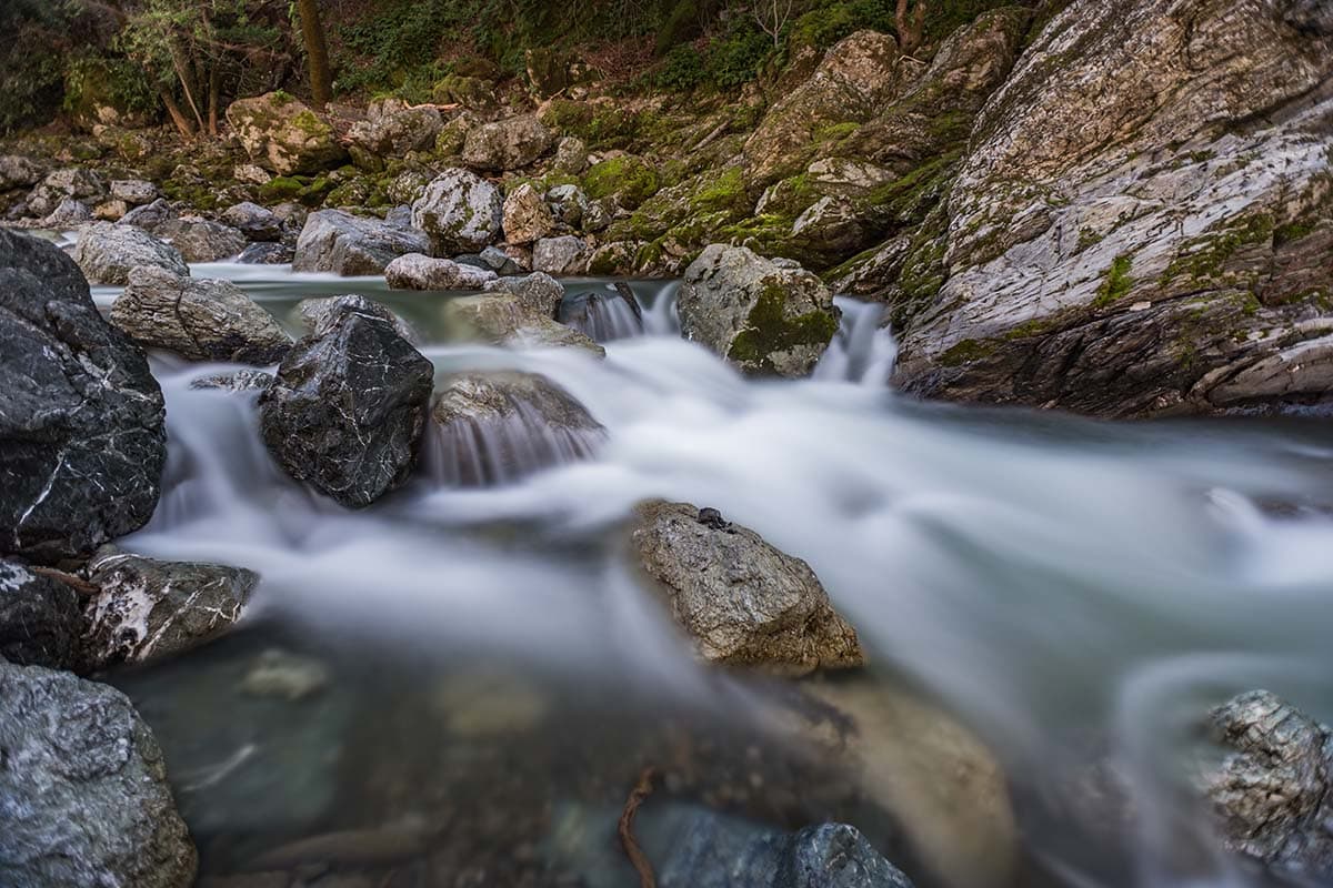
10. Donner Canyon, Middle Earth, and Falls Loop
- Difficulty: Moderate
- Distance: 5.1 miles
- Elevation gain: 1161 feet
Why you should go: Interesting rock formations and numerous cascading waterfalls.
This scenic lollipop loop starts at the base of Mount Diablo on its northern side and follows the babbling waters of Donner Creek towards a handful of waterfalls. On this stretch, you’ll likely encounter wildlife like deer, frogs, lizards, butterflies, and so much more.
As you approach the Falls Loop portion of this trail, the gentle creek will transform into a craggy rush of cascading water. There are five possible waterfalls to see, though some may dry up during the summer months. Regardless, it’s a beautiful hike any time of year and always offers stellar views.
Explore California
Get epic travel ideas delivered to your inbox with Weekend Wanderer, our newsletter inspiring thousands of readers every week.
Seen in: California, Hikes, Hiking in California