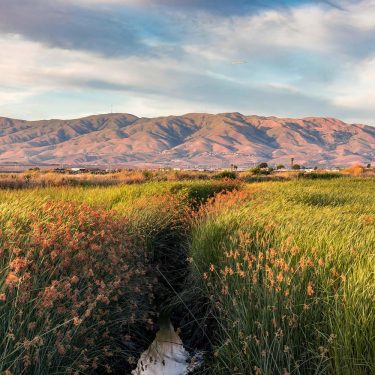
The breaks and Boardwalk may draw the biggest crowds, but those who know Santa Cruz know it’s a prime hiking destination.
Santa Cruz County is filled with nature preserves, state parks, and miles of coastline — all of which offer exceptional terrain for hiking trails.
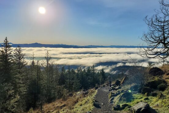
Retreat into the woods for the day at California’s oldest state park or walk among the picture-perfect coastal bluffs at sunset.
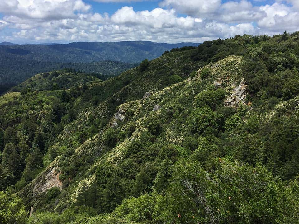
The Santa Cruz mountains will take you up to 3,000 feet, while under the forest canopy you’ll find falls flowing and plant life thriving. Meanwhile, a walk along the iconic California coastline invigorates the soul.
From the mountains to the sea, here’s our list of the Santa Cruz hikes you won’t want to miss — just don’t forget to pick up a Santa Cruz trails map before you go.
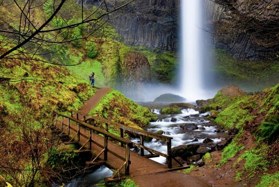
1. Berry Creek Falls
Why you should go: A Rigorous day hike through a thriving forest setting with a handful of waterfalls along the way.
- Distance: 11.2 miles
- Elevation gain: 2,335 feet
- Difficulty: Challenging
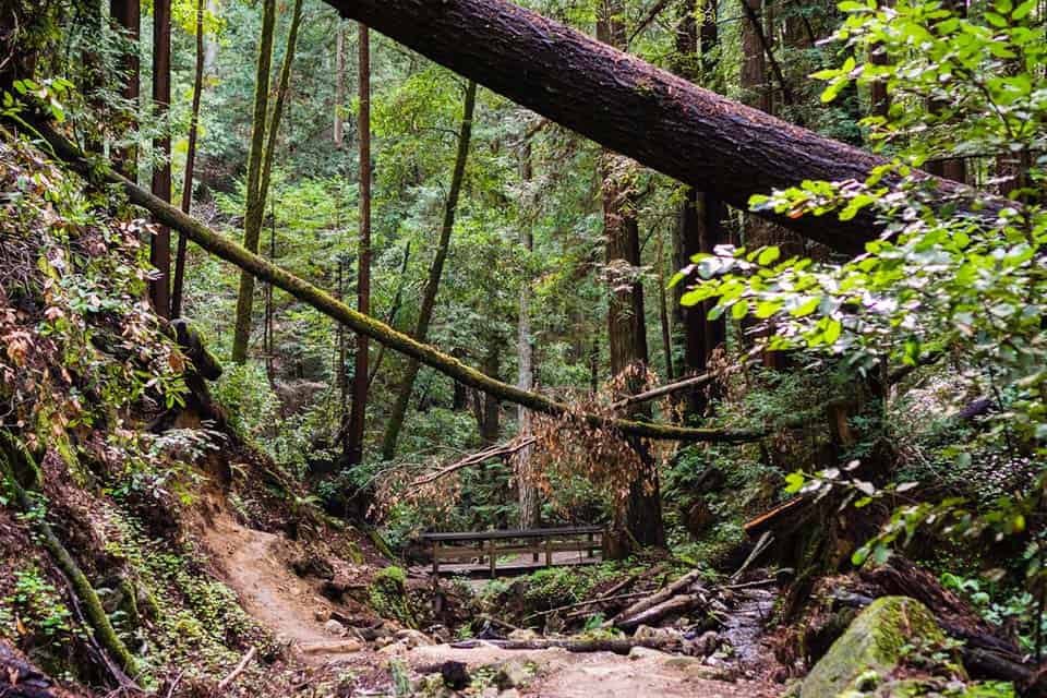
If you want to experience the best of what California’s oldest state park has to offer, you better be willing to work for it. For those that are up for the challenge, get ready to embrace Berry Creek Falls.
Berry Creek Falls is a long and difficult trek through 11 miles of Big Basin Redwoods State Park. So there’s that.
Then there’s the handful of cascading waterfalls, trickling creeks, lush forested basin, and of course, redwoods. Pack a jacket, because sections of the forest rarely see sunlight.
Another word of advice: do the loop counterclockwise for the best experience.
Additional Info: AllTrails
2. Sunset Skyline Short Loop
Why you should go: Get your quick nature fix in by hiking through lowland and upland redwood forest.
- Distance: 2.9 miles
- Elevation gain: 298 feet
- Difficulty: Easy
For those that don’t have time to backpack the whole Skyline to Sea Trail, you can still get a sense of what Big Basin Redwoods State Park is all about by hiking the Sunset Skyline Short Loop.
Crossing the footbridge at Opal Creek, the trail winds through lowland redwoods before you make your ascent up Middle Ridge. After the peak of your elevation gain, you’ll descend the other side of the ridge to the Sunset Trail.
Densely forested, the Sunset Skyline Short Loop is a small dose of forest therapy, taking about two hours max to complete.
If you have a few days to spare, we recommend taking the full prescription and backpacking the entire 25 miles plus Skyline to Sea Trail.
Additional Info: AllTrails
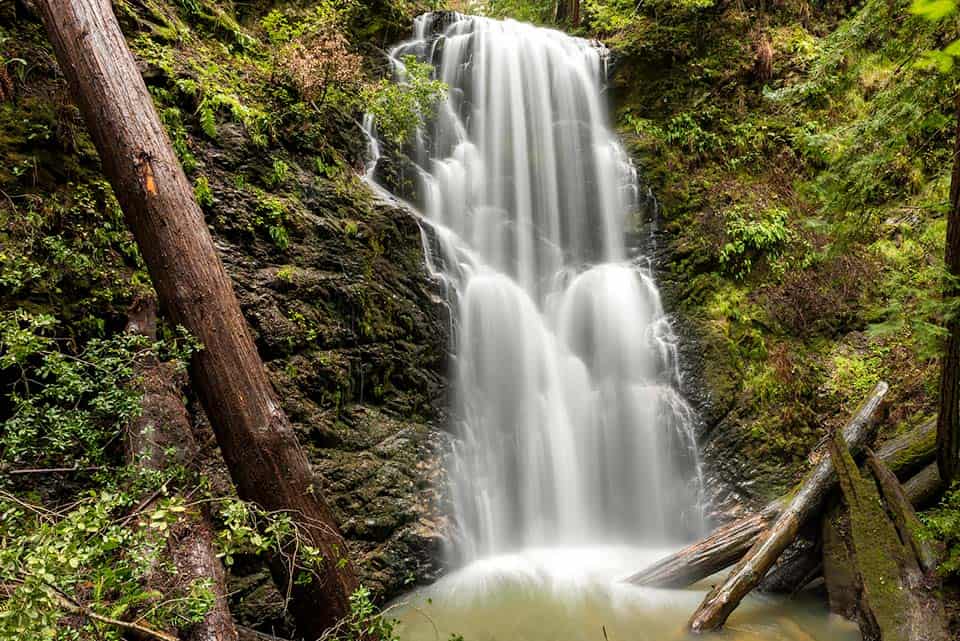
3. Sempervirens Falls Via Sequoia Trail
Why you should go: A family-friendly saunter through redwood forest to a small, tranquil waterfall.
- Distance: 3.1 miles
- Elevation gain: 262 feet
- Difficulty: Easy
Experience the soothing nature of cascading water at Sempervirens Falls. This waterfall is located in Big Basin Redwoods State Park and is accessed via the short out-and-back Sequoia Trail.
Family-friendly and gentle on the knees, the Sequoia Trail is one of the most popular hikes this state park has to offer.
The trail takes you through majestic redwoods and old-growth trees with peculiar five-finger ferns emerging from the forest. All this sets the mood for the small yet tranquil 20-foot Sempervirens Falls.
Additional Info: AllTrails
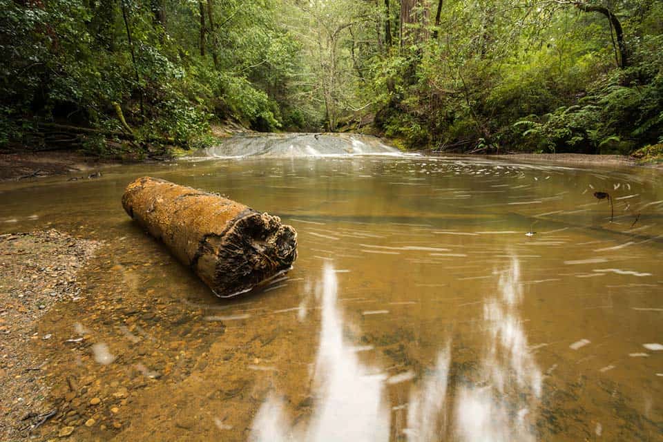
4. Fall Creek Trail
Why you should go: Take a walk in the woods along the bank of a babbling creek.
- Distance: 6 miles
- Elevation gain: 854 feet
- Difficulty: Easy
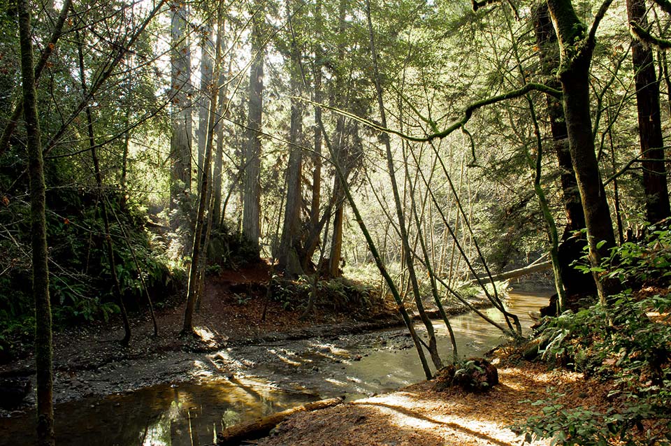
Hiding in the northern section of Henry Cowell State Park is the Fall Creek Trail. Covered by a thick forest canopy, the Fall Creek Trail is a serene experience.
Following along the banks of the babbling Fall Creek, hikers are surrounded by plants that rely on it’s yearly run. Ferns, redwood sorrel, and trillium are a few you’ll find thriving here.
The out-and-back hike is a peaceful stretch for anyone looking to take a walk in the woods.
The peace, however, is at times disrupted by fallen trees. Tree roots have been known to give way to erosion here so be ready to climb over a log or two.
Also, be on the lookout for poison oak.
Additional Info: Hiking Project
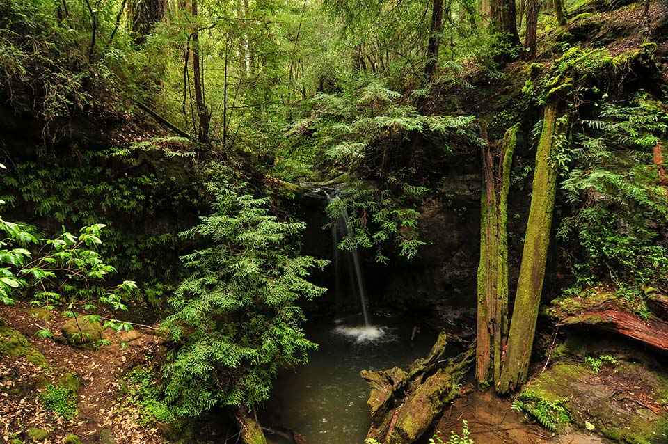
5. Saratoga Gap and Ridge Trail Loop
Why you should go: Visit Castle Rock Falls, Castle Rock, and Goat Rock on a moderate half-day hike.
- Distance: 4.8 miles
- Elevation gain: 1,010 feet
- Difficulty: Moderate
The Saratoga Gap and Ridge Trail Loop is a moderate hike located in Castle Rock State Park.
We say moderate because some sections can be noticeably steep and rough, and some scrambling is required. With good footing, however, it’s nothing you can’t handle.
Along the half day hike, the Saratoga Gap and Ridge Trail Loop offer some of the best features Castle Rock State Park has to offer. A few highlights being Castle Rock Falls, Castle Rock, and Goat Rock.
From the forest canopy to the rocky slopes, the Saratoga Gap and Ridge Trail Loop is a worthy landscape for the adventurous hiker looking to put in some work for a big return.
The one downside to this hike is you can sometimes hear the firing range nearby. To block out the most noise pollution, hike this loop in the winter.
Additional Info: Redwood Hikes
6. Maple Falls
Why you should go: Spend the day in a dense forest landscape following a creek to a misty waterfall.
- Distance: 7.7 miles
- Elevation gain: 823 feet
- Difficulty: Moderate
Break away from town and retreat into the woods for the day at Maple Falls. Tucked away in The Forest of Nisene Marks State Park, the Maple Falls route is a scenic stretch through dense forest.
To reach the falls, you’ll follow the Aptos Creek fire road to the Loma Prieta (“dark hill”) Grade Trail. A short distance in, you’ll follow the Bridge Creek Trail the rest of the way.
Along your route, take notice of the creek bed. Fossilized seashells have been found here that are millions of years old.
You will have to cross the creek at several points so keep this in mind when hiking during the wet season.
Additional Info: California State Parks
7. Old Growth Loop
Why you should go: A pleasant walk through giant redwoods that the whole family will enjoy.
- Distance: 1.6 miles
- Elevation gain: 159 feet
- Difficulty: Easy
For a quick, soothing stroll, stride along the Old Growth Loop in The Forest of Nisene Marks State Park. This gentle hike is perfect for families with little tykes or those who are short on time.
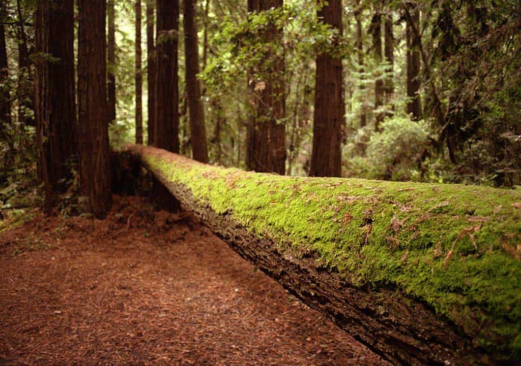
Giant towering redwoods and lush forest paint the scene while the trickle of Aptos Creek and chirpping of native birds provide the soundtrack. Scan the forest floor and you may notice a striking pop of yellow. This is the ever popular banana slug that resides in the area.
If you’re don’t mind veering off the planned course a bit, follow along the Twisted Grove Trail when you reach the fork. Here you’ll find fallen redwoods that are a result of the big one that hit in 1989, the Loma Prieta earthquake.
Additional Info: Hiking Project
8. Monarch Trail

Why you should go: A chance to experience the monarch butterfly migration through an effortless footpath that’s well suited for all ages and skill levels.
- Distance: 0.6 miles
- Elevation gain: 22 feet
- Difficulty: Easy
From late fall to winter, a fluttering sea of black and orange can be found swarming the eucalyptus groves at the Natural Bridges State Beach. For a close-up encounter with this magical spectacle, follow the Monarch Trail.
The Monarch Trail is an effortless footpath designed for nature lovers of all ages and skill levels. Meander through the trail and experience the wonders of the monarch butterfly migration.
Part shelter, part food source, the flowering eucalyptus trees serve as a mere pit stop on the monarchs’ journey.
When you’re ready to continue yours, make your way on down to the beach and explore the tidepools bursting with ocean life.
Additional Info: California State Parks
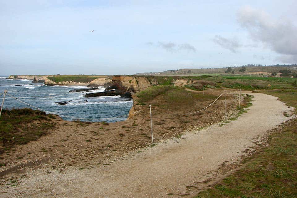
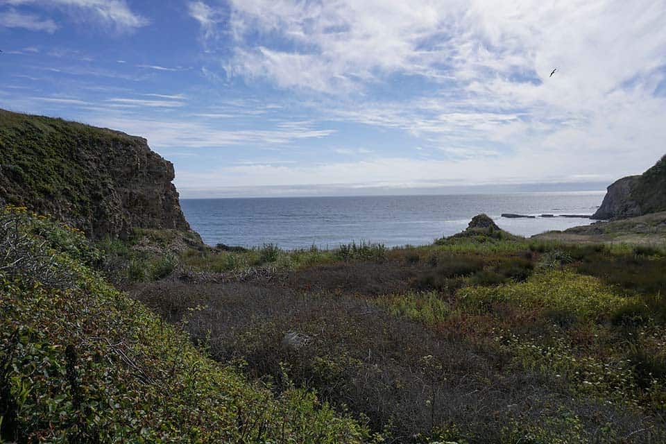
9. Old Cove Landing Trail
Why you should go: A picture-perfect location for beach sunsets along with ample bird watching.
- Distance: 2.5 miles
- Elevation gain: 85 feet
- Difficulty: Easy
It’s an easy stroll to a scenic coastal bluff along the Old Cove Landing Trail. Located at Wilder Ranch State Park, the Old Cove Landing Trail is a relatively flat hike with big rewards.
Following a dirt path, you’ll cross over railroad tracks and walk beside an array of coastal shrubs before embarking upon the Wilder Beach overlook.
Have your cameras ready because the Wilder Beach Natural Preserve is home to the threatened snowy plover.
From here, you’ll skirt along the Ohlone Bluff with the option of taking a couple spurs down to the beach. Depending upon your laziness factor, you can choose a new adventure or head back to your car.
If you don’t happen to spot any snowy plover, you’re still in luck. This area is also frequented by oystercatchers, pelicans, cormorants, and of course, seagulls. So there’s ample bird watching along this route.
Additional Info: California State Parks
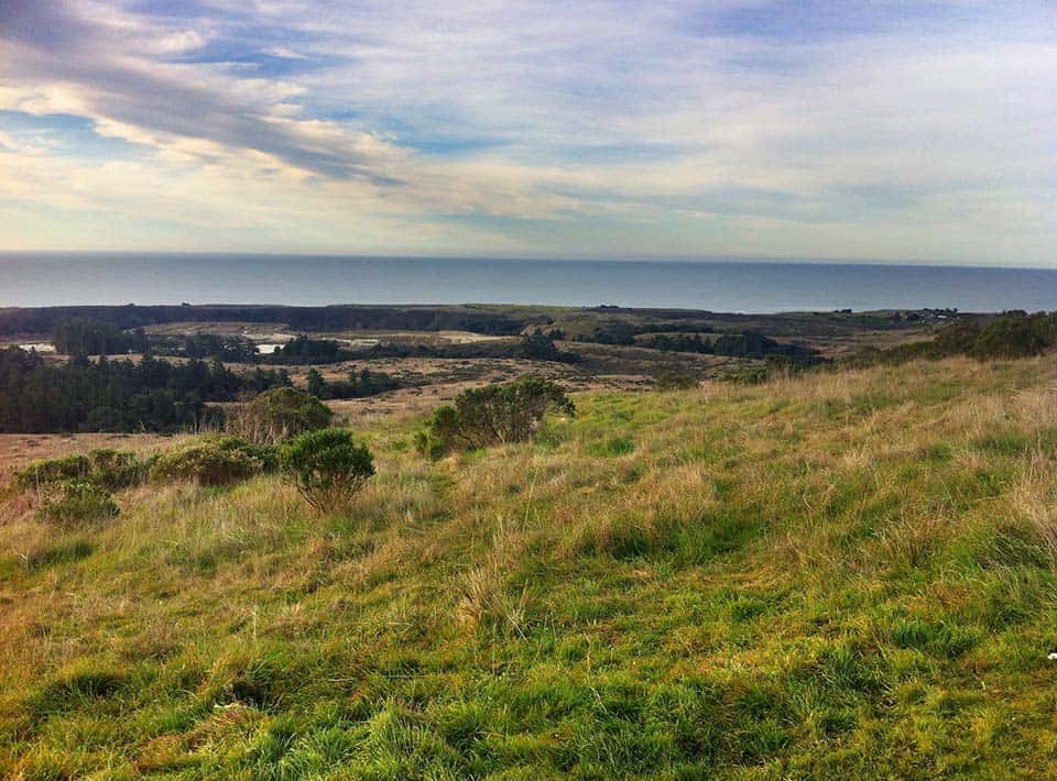
10. Wilder Ridge Loop
Why you should go: Wide open terrain featuring a short ascent to an overlook of the Pacific Ocean and Monterey Bay.
- Distance: 6.3 miles
- Elevation gain: 600 feet
- Difficulty: Moderate
A breathtaking view awaits at the Wilder Ridge Trail. If you’re game, slap on your trail shoes and get trekking.
Two miles into your hike, you’ll reach a short and sweet 600-foot climb to what is arguably one of the best vistas in Santa Cruz. From here, you can backtrack to shorten the hike or press on for more.
Should you choose the latter, you’ll find yourself walking among grasslands dotted with native trees. Test your knowledge and see if you can properly identify any of the species.
It may be a long way, but the expansive terrain is worth the extra mileage.
Additional Info: California State Parks
11. Cotoni-Coast Dairies National Monument
Why you should go: 6,000 acres of protected natural landscape that spans from redwoods to the ocean and is only accessible via booked tours.
- Distance: N/A
- Elevation gain: N/A
- Difficulty: N/A
In 2017, 6,000 acres along the coast of Santa Cruz County were officially designated as a national monument. This land is the Cotoni-Coast Dairies National Monument.
Located north of Wilder Ranch, the Cotoni-Coast Dairies span from the San Vincente Redwoods down to the shoreline. Consisting of a handful of beaches, redwood forest, agricultural land, and six crucial watersheds, this area has some incredible scenery and ocean views to go along with it.
While public access is still in the works, you can hike the Cotoni-Coast Dairies National Monument by booking a guided tour. For more information, contact the Bureau of Land Management in the link below.
Additional Info: Bureau of Land Management
Keep Exploring California
Sign up for our free email to join thousands of readers getting epic travel, hiking, camping and gear ideas every week.
Seen in: California, Hikes