We research, evaluate and select travel destinations based on a number of factors, including our writers’ experience and expertise, user reviews and more. We may earn a commission when you book or purchase through our links. See our editorial policy to learn more.
“To cross this valley to the peninsula (Point Reyes) is to leave modern California and enter an island of wilderness, forgotten by progress, a quiet land misplaced in a noisy world.” – author Stephen Trimble.
In 1962, President John F. Kennedy officially created Point Reyes National Seashore, preserving the peninsula for generations to come.
As a child growing up in the Bay Area, my family and I often sought to escape the mundane world of the suburbs and made the trip to Point Reyes for some respite. The lighthouse was the main attraction, but the trails were a maze of wonderment.
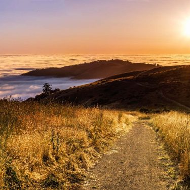
Hike along any portion of the 150 miles of trail and you too will discover what makes Point Reyes National Seashore so special.
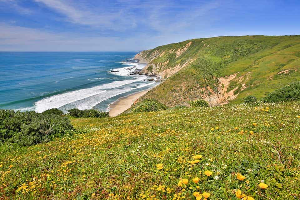
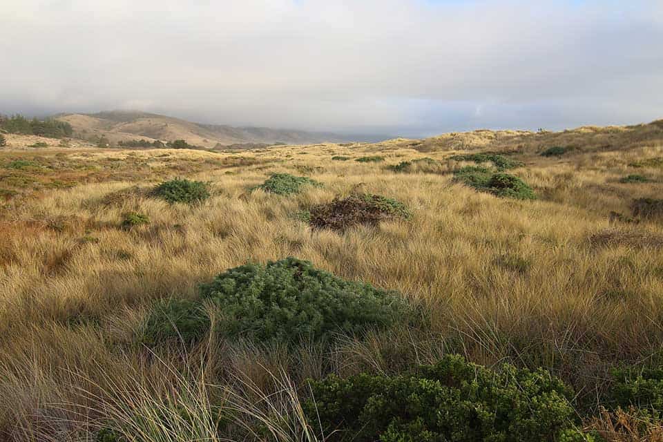
Dramatic coastal bluffs, Douglas fir and bishop pine forests, sprawling grasslands, and vegetated sand dunes are only a handful of the habitats you’ll encounter.
Along the way, you’ll be in the presence of an array of plant and animal species including tule elk and elephant seals. And, not to mention also have one heck of an ocean view to go along with it.
If you’re ready to escape the modern world for a trek in a natural sanctuary, here’s our list of Point Reyes hikes — and be sure to grab a Point Reyes trails map before you head to the coast!
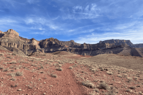
1. Tomales Point Trail
Why you should go: Hike through the Tule Elk Reserve to views of Tomales Bay and Bodega Bay.
- Distance: 9.5 miles
- Elevation gain: 1,177 feet
- Difficulty: Moderate
Although the mileage may be long, the Tomales Point Trail is a must for any hiker visiting the Point Reyes National Seashore.
The Tomales Point Trail winds through the grasslands of the Tule Elk Reserve and is perhaps the quietest trail in the area as it’s the most remote.
Given the season, you’re likely to sight elk herds grazing the hillsides. Regardless of wildlife sightings, you’re still guaranteed a stunning Pacific Ocean view once you reach the point.
To protect the preserve and yourself, wandering off trail is not advised as this leads to habitat degradation and can cause adverse reactions from the tule elk.
Additional Information: National Park Service
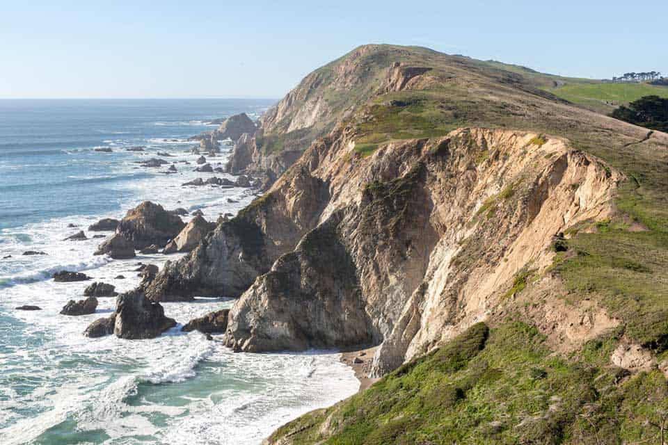
2. Chimney Rock Trail
Why you should go: A scenic coastal hike offering a chance to see elephant seals and grey whales migrating.
- Distance: 1.6 miles
- Elevation gain: 269 feet
- Difficulty: Easy
The sprawling grassy bluffs and coastal views along the Chimney Rock Trail are not to be missed.
Beginning at the Elephant Seal Overlook, the Chimney Rock Trail travels above rocky cliffs out to the edge of a scenic peninsula.
The ocean views and short mileage make Chimney Rock a very popular hike among the weekend crowd.
This is especially true during the winter and spring when the elephant seals return for their pupping season and grey whales make their yearly migration through Drake’s Bay.
One thing to note is the lack of tree cover which can make this a foggy and blustery hike at times, so pack accordingly.
Additional Information: National Park Service
3. Point Reyes Lighthouse
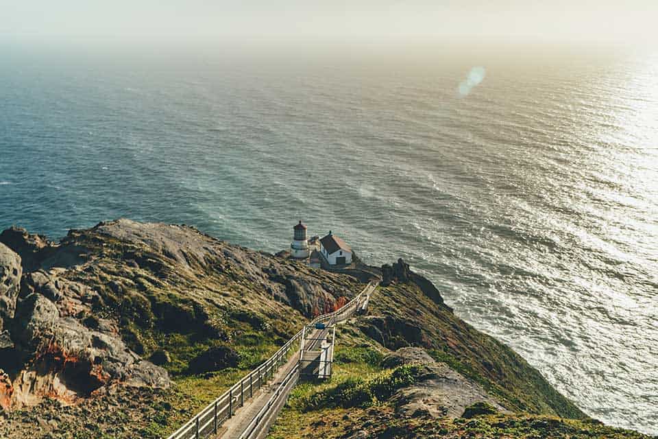
Why you should go: Snap a photo of a historic lighthouse on top of a dramatic coastal bluff.
- Distance: 1.3 miles
- Elevation gain: 357 feet
- Difficulty: Easy/Moderate
A trip to Point Reyes would not be complete without a hike out to the historic lighthouse. Okay, it’s more like a walk, but a walk worth doing to say the least.
To reach the Point Reyes Lighthouse, you’ll hoof it up a paved path, then descend down a flight of 308 steps. Of course, what goes down must come back up. This being the reason we rated this hike as moderate.
Don’t forget your camera. The image of the 1870s lighthouse on top of the rugged headland is a dramatic sight to behold.
Additional Information: National Park Service
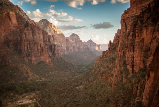
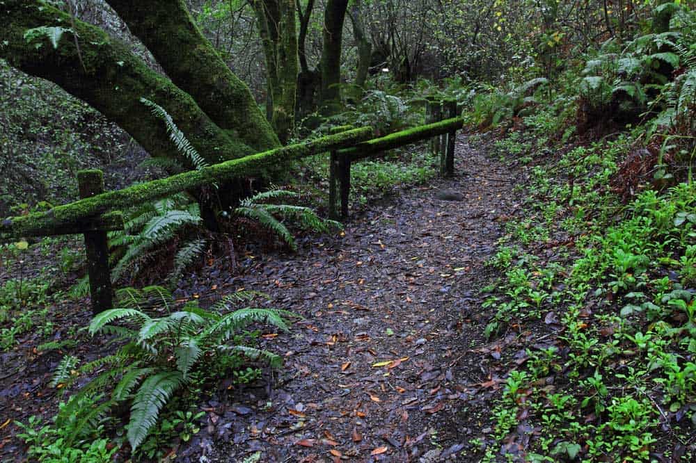
4. Bear Valley Trail
Why you should go: A very popular hike through forest, meadow, and grassland.
- Distance: 8.2 miles
- Elevation gain: 734 feet
- Difficulty: Moderate
When you arrive at the Bear Valley Trailhead, expect the place to be buzzing with hikers.
A handful of trails fork off from the Bear Valley Trail, so take some comfort in knowing you’ll lose a bit of the crowd along the way. As for the rest of the trip, take note this is also a very popular trail.
This hike is relatively flat and a good way to kick off your Point Reyes exploration.
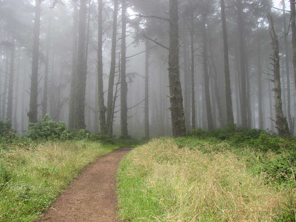
It winds through a thick Douglas fir and alder forest into the Divide Meadow. A babbling stream guides you along a good portion of the way before entering a lush canyon and coastal grassland, ending at the Coastal Trail junction.
Note, this trail did once go to Arch Rock but has been closed off due to the arch’s collapse that caused a fatality.
Additional Information: National Park Service
5. Mount Wittenberg Loop
Why you should go: Mount Wittenberg is the highest peak in Point Reyes at 1,407 feet.
- Distance: 5 miles
- Elevation Gain: 1,299 feet
- Difficulty: Moderate
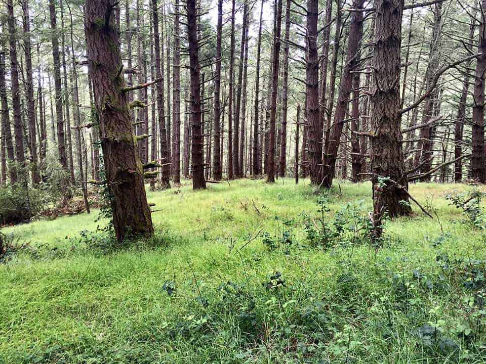
Snag a view atop the highest peak in Point Reyes along the Mount Wittenberg Trail. Mount Wittenberg rises to 1,407 feet where it offers hikers coastal views through pockets of Douglas fir.
Beginning at the Bear Valley Trail, you’ll be greeted by a short jaunt through a grassy meadow before making your ascent through a dense forest canopy. Breathe in the refreshing scent of oak and pine as you switchback up the slope.
Once you reach the summit, you’ll have the option of returning the way you came or looping via the Meadow-Sky Trail junction. The latter is a bit longer, but allows for a gentler descent.
Additional Information: National Park Service
6. Muddy Hollow Trail
Why you should go: Observe the tule elk grazing along a short, easy hike.
- Distance: 4 miles
- Elevation gain: 203 feet
- Difficulty: Easy
If Tomales Point is too far of a stretch to get a glimpse of tule elk, hike the Muddy Hollow Trail. A few years ago, a number of tule elk from Tomales Point were relocated to this section of the national seashore so you’re odds are pretty good.
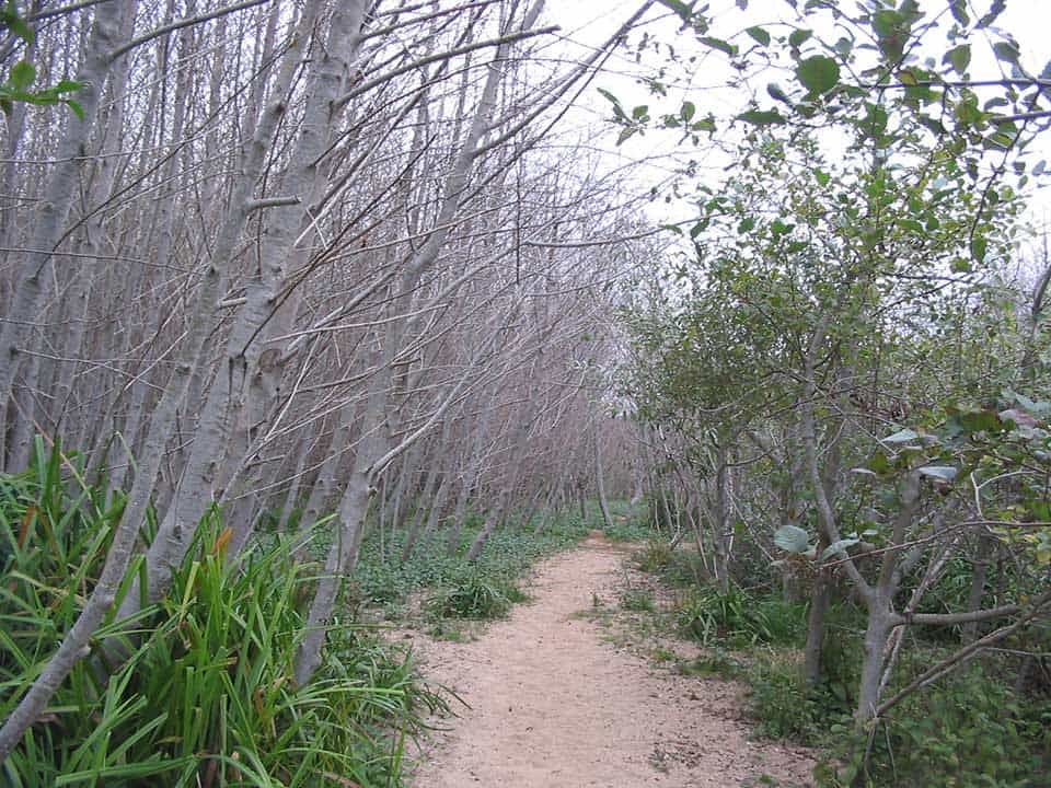
Starting at the Muddy Hollow Trailhead, you’ll travel along a riparian zone before entering a clearing filled with coastal shrubs. All of which provides an ideal habitat for those interested in bird watching.
As for the trail, you’re less likely to get your foot stuck in the muck than you may think given the name. In 2011, the Muddy Hollow Trail was rerouted with the addition of footbridges to avoid the muddy floodplains, turning this hike into an easier one.
Additional Information: National Park Service
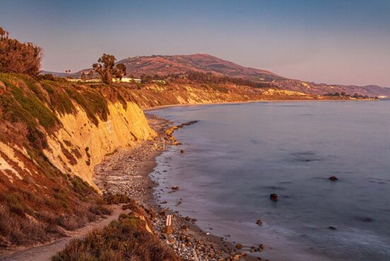
7. Laguna-Coast Loop
Why you should go: Bluffs, beach, and dense vegetation with scenic ocean views and a mild grade to get you there.
- Distance: 5.1
- Elevation gain: 362 feet
- Difficulty: Easy/Moderate
Hiking the Laguna-Coast Loop is a terrific way to get a glimpse into the diverse habitats that are protected within the boundaries of Point Reyes National Seashore.
The trail takes you through open grassland, vegetated dunes, sensitive coastal bluffs, a lush valley, and a riparian zone. Once you reach the Coast Campground, you’ll also have access to Santa Maria Beach, should you choose to romp around in the sand.
With mild grades and plenty of scenic views, the Laguna-Coast Loop is one that should be at the top of the list.
Additional Information: Hiking Project
8. Abbotts Lagoon
Why you should go: Hit the reset button by leisurely meandering through a placid lagoon to a sandy beach.
- Distance: 2 miles
- Elevation gain: 140 feet
- Difficulty: Easy
Of the many gentle strolls Point Reyes has to offer, Abbotts Lagoon is perhaps the most tranquil.
Slap on your hiking sandals and leisurely make your way through the lagoon along the narrow dirt trail, and at times, wooden boardwalk. In the spring, this area is bursting with an array of wildflowers including poppies and lupine.
After the first mile, the trail turns to sand as you reach the beach. Chill out for a while, then slowly retrace your footsteps back.
Additional Information: National Park Service
9. Woodpecker Trail
Why you should go: Picnic in a grassy meadow, then teach the family about the Bear Valley ecosystem on a gently graded stroll.
- Distance: 0.7 mile
- Elevation gain: 144 feet
- Difficulty: Easy
Grab a brochure and get schooled on the local fauna and flora along the Woodpecker Trail. This short and gently graded nature loop gives you a glimpse into the life that thrives in Bear Valley.
As you wind through the grassy meadow and forest mixed with deciduous trees and evergreens, see how many species you can identify with the family.
You’ll find a healthy dose of Douglas fir, California Live Oak, and California Bay Laurel. Meanwhile, the decomposing logs resting on the forest floor are a haven for an array of mushrooms.
As for woodland creatures, keep an eye out for fox dens and woodpeckers drumming into trees as they claim their territory.
Additional Information: AllTrails
10. Earthquake Trail
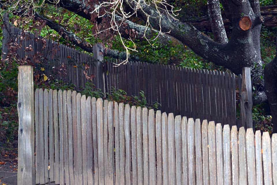
Why you should go: Geologists and kids will delight in marveling at a displaced fence and learning about the magnitude of the San Andreas Fault.
- Distance: 0.6 mile
- Elevation gain: 39 feet
- Difficulty: Easy
Geologists and kids will have a field day, or more so session, exploring the short and shady Earthquake Trail.
This paved trail explores the notorious San Andreas Fault zone with informational panels discussing the 1906 earthquake that shook the region.
“The Pacific plate is estimated to creep northwestward about two inches a year, but the most dramatic displacement of this fault occurred in 1906 when the Point Reyes Peninsula leaped 20 feet northwestward,” said the National Park Service.
Veer off course onto a short side trail and let the kids marvel at a fence that was moved 20 feet along the fault line. For a more in depth hike, check the schedule for ranger led tours.
Additional Information: AllTrails
11. McClures Beach Trail
Why you should visit: A steep descent down to a picturesque secluded cove.
- Distance: 0.8 miles
- Elevation gain: 226 feet
- Difficulty: Easy
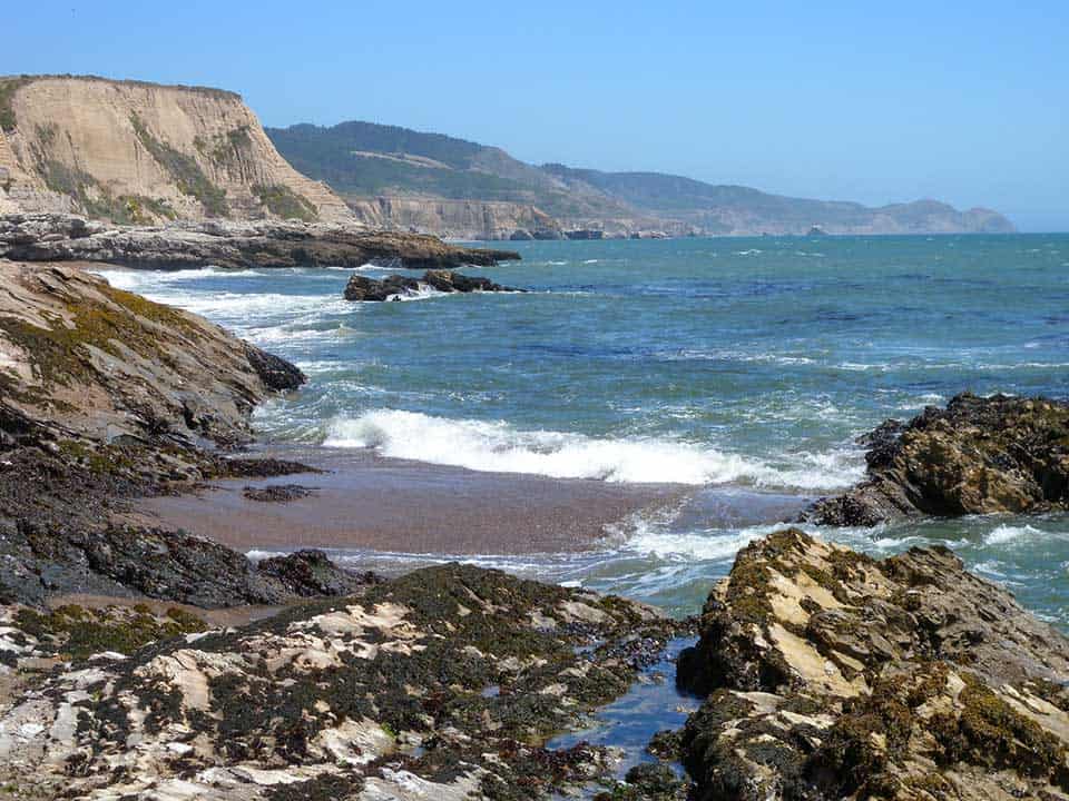
If you can’t resist the urge to walk upon the sand, follow the McClures Beach Trail to a serene, secluded rocky cove.
To get there, you’ll have to hike down a rugged trail through a steep ravine. The trek out, however, is worth it.
Spend some time exploring the tidepools and walking barefoot in the sand. The remote setting and sound of crashing waves is a peaceful escape from the heavily trafficked trails.
Be sure to check the tide calendar and the weather because the surf here can be hazardous and unforgiving.
Additional Information: Hiking Project
12. Coast Trail to Bass Lake
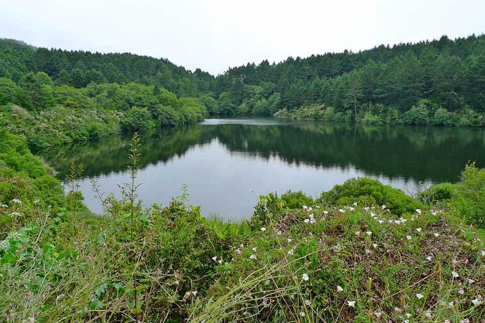
Why you should go: Take a dip in the refreshing waters of Bass Lake.
- Distance: 6 miles
- Elevation gain: 784 feet
- Difficulty: Moderate
While the strong currents at McClure Beach may not allow for swimming, Bass Lake does. If a sunny lakeside afternoon is right up your alley, grab your swimsuit and get trekkin’.
Starting at the Palomarian trailhead, you’ll follow along the Coast Trail. This trail winds through coastal shrubland filled with sagebrush and coastal brush lupines, offering ocean views.
Soon the open trail gives way to the cooling shade of the Douglas fir tree canopy, telling you you’re close. Pass the Lake Ranch Trail junction and you’ve arrived.
When you’re ready to mosey along, return the way you came or extend your journey a few more miles and explore Alamere Falls.
Additional Information: AllTrails
13. Limantour Spit Trail
Why you should go: Grab the binoculars and saunter along a primo bird watching trail.
- Distance: 2 miles
- Elevation gain: 4 feet
- Difficulty: Easy
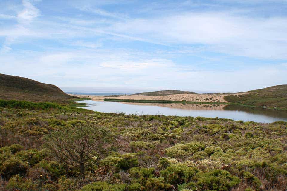
If you’re looking for the prime spot to do some bird watching, saunter along the Limantour Spit Trail.
This brief trail parallels sand dunes and marsh filled with a sea of beachgrass. Bring your binoculars to spot waterfowl about in the estuary. Herons, osprey, and even the western snowy plover have been spotted here.
Also, don’t forget your favorite floppy sunhat. While it certainly completes the ensemble, this trail is fully exposed.
If you’re haven’t had your fill, continue on for a couple more miles to the end of the spit.
Additional Information: Hiking Project
14. Kule Loklo Trail
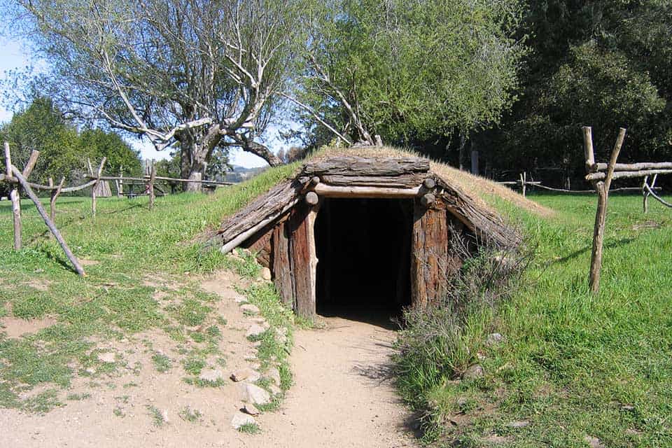
Why you should go: Get cultured and visit a replica of a native Coast Miwok village at the end of a shady path.
- Distance: 0.8 mile
- Elevation gain: 118 feet
- Difficulty: Easy
Another brief yet engaging field trip for the family is the Kule Loklo Trail.
The Kule Loklo (meaning valley of the bear) interpretive trail educates visitors about the native Coast Miwok tribe that inhabited the area before European settlers arrived.
From the Bear Valley Visitor Center, you’ll follow a wide, shady path to a horse pasture. The trail then takes you to a replica of a Coast Miwok village.
Come on Sunday and join the National Park Service for a free walking tour.
Additional Information: National Park Service
Trekkin’ California
Sign up for our free email to join thousands of readers getting epic travel, hiking, camping and gear ideas every week.
Seen in: California, Hikes, Hiking in California, National Parks, West