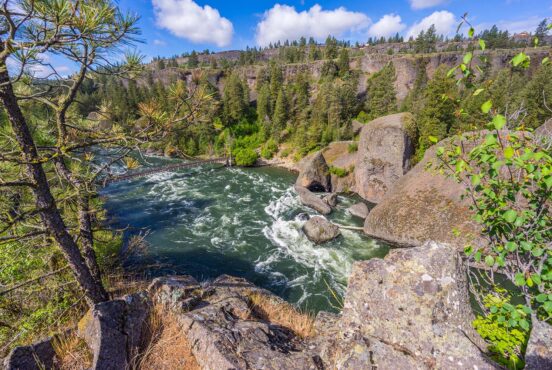
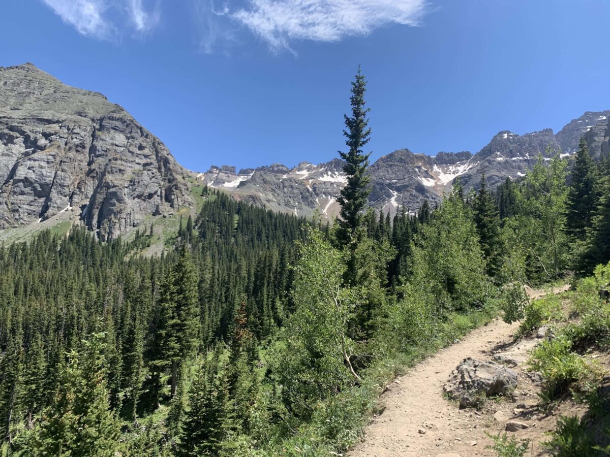
Telluride is celebrated as a year-round outdoor mecca with amazing skiing in the winter and world-class hiking trails in the summer.
Whether you’re hiking, biking, horseback riding, or behind the wheel of an ATV, there is a ton of adventurous things to do in Telluride.
All of the trails are dog-friendly, too, so it’s a great place to bring your furry friend along for some afternoon exercise. During the winter, these same trails are great for cross-country skiing, snowshoeing, and snowmobiling, so there’s always an excuse to explore the area whenever you visit.
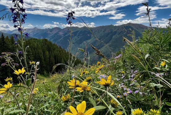
Of course, if we were to pick the best time of year to explore Telluride’s trails, late-summer to early-fall would easily take the top prize. You can enjoy rocky peaks, alpine lakes, and gorgeous waterfalls year-round, but in July and August the meadows erupt in a colorful display of wildflowers that’s tough to beat. On a recent trip to the area, our family spent hours just wandering through flower-laden meadows, marveling at the sheer volume of beautiful lacy petals. Even our kindergartener couldn’t stop exclaiming over ‘all of the pretty colors’!
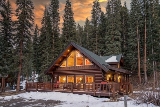
I live a few hours north of the San Juan Mountain Range and visit the region a lot, often staying at one of the many quaint lodging options in Telluride. Whether you’re looking to summit a mountaintop, spend the afternoon fishing at a secluded lake, or appreciate one of the areas many picturesque waterfalls, we’ve got your covered with our favorite hikes in the region.
Editor’s Note: This article was updated on October 5, 2023 to reflect new imagery and updated trail options that have changed over the past few years.
1. Bear Creek Trail
Why you should go: One of the most popular hikes in Uncompahgre National Forest with an 80-foot waterfall and sweeping views of Telluride.
- Difficulty: Moderate
- Distance: 5 miles
- Elevation gain: 1,092 feet
The Bear Creek Trail is an excellent family-friendly hike that starts in downtown Telluride. From the trailhead at the end of South Pine Street you’ll head into the Bear Creek Preserve, a public open space preserved by the San Miguel Conservation Foundation in partnership with the Town of Telluride.
As the mellow mountain trail winds through Bear Creek Canyon, you’ll be surrounded by aspen and pine groves with sporadic views of the surrounding area. The scenery gradually improves as you climb in elevation, ultimately delivering dramatic views of the cliffs around Telluride.
The first waterfall appears about 1.7 miles into your hike, but it’s not the main attraction. Press on another half-mile and you’ll enjoy an incredible view of Bear Creek Falls — an 80-foot waterfall cascading down a rocky cliff at the head of a small basin. Kids love to explore the area around the waterfall, while adults will appreciate the simple pleasure of enjoying an afternoon picnic with the splashing falls in the background.
When you’re finished exploring Bear Creek Falls, you can head back to Telluride or continue your hike up the rugged cliffs of Bear Creek Canyon on the Wasatch Trail.
Related Read: 7 Rad Campgrounds in San Juan National Forest, Colorado
2. Jud Weibe Memorial Trail
Why you should go: Aspen groves, mountain meadows, and panoramic views of Telluride from Bridal Veil Falls to the valley floor.
- Difficulty: Moderate
- Distance: 3.1 miles
- Elevation gain: 1,300 feet
“Hiking the Wiebe” is a rite of passage for the locals in Telluride, so it definitely deserves a spot on your travel itinerary. The trail conveniently starts and finishes downtown, offering hikers a sublime sampling of mountain meadows, colorful aspen groves, and valley views.
The Jud Wiebe Memorial Trail is a quick loop with a fair amount of elevation gain, peaking at about 10,000 feet. It’s a great family-friendly hike, but considering you climb about 1,200 feet in a little over a mile it’s not for every little hiker out there.
The entire trail is fairly scenic, though you’ll enjoy the best views from the apex of the hike at 10,000 feet. There are a few benches where you can catch your breath and appreciate the views before beginning your descent.
On the way down (or up, if you hike the loop clockwise) we recommend following the side trail up Cornet Creek to see Cornet Creek Falls. Many hikers (especially younger ones) find this 80-foot waterfall the most exciting feature of the whole hike, so it’s well-worth the quarter-mile detour.
3. Lewis Mine Hike
Why you should go: A day-hike through Bridal Veil Basin featuring alpine lakes, waterfalls, wildflower-covered hills, and the fully-preserved five-story Lewis Mill.
- Difficulty: Challenging
- Distance: 8.8 miles
- Elevation gain: 2,300 feet
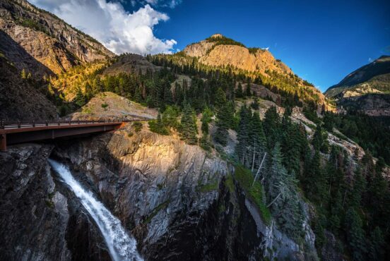
The Lewis Mine Hike begins at the gate blocking access to the historic power plant. Parking is extremely limited here, so it’s best to park 0.8 miles down the road at the base of Bridal Veil Falls and hike up to the trailhead. The road to Bridal Veil Falls is a little rough, so you’ll want to bring a high-clearance vehicle with four wheel drive.
After you duck under the gate, follow the old mining road to the left to enter Bridal Veil Basin. Following Bridal Veil Creek, you’ll pass several cascades and waterfalls while enjoying picturesque views. If you’re able to visit from mid July to early August, the hillsides along the trail are covered in wildflowers.
The old mining road will continue to climb through meadows and across several creeks until you reach the Lewis Mine at 12,448 feet. The five-story Lewis Mill was built in 1907, and served as a 60-ton capacity ore-concentration facility in the early 20th century. The historic building was stabilized in 2001 and received a new roof in 2006, so it’s perfectly safe to explore.
Beyond the mill, the mining trail climbs a steep rocky drainage for 0.4 miles to reach the dam at the end of Lewis Lake. Sitting at 12,700 feet, the lake is set in a large rocky basin surrounded on three sides by towering peaks.
Related Read: 10 Best Hikes in Colorado for Getting Out into Nature
4. Ajax Peak
Why you should go: Summit the most prominent peak in Telluride for jaw-dropping views at 12,785 feet.
- Difficulty: Challenging
- Distance: 5 miles
- Elevation gain: 2,785 feet
Looming large over the Telluride Valley, Ajax Peak is the backdrop for many a postcard in the local giftshops. Summiting this picturesque peak isn’t easy, but it’s a relatively short hike for peak baggers with their eye on one of Colorado’s iconic peaks.
From the Pandora Mill on the edge of town, you’ll hike up the gravel road towards Bridal Veil Falls. After appreciating the largest waterfall in Colorado, continue climbing the trail up to the other major waterfall on Bridal Veil Creek — Ingram Falls. You’ll need to cross over Ingram Falls, so keep an eye on water levels during the spring when the snow is melting.
After crossing Ingram Falls, it’s a pretty straightforward climb to the summit. From the apex of Ajax Peak, you’ll enjoy unrivaled views of the surrounding area in every direction. In addition to a birdseye view of the Town of Telluride, you’ll see Mt. Sneffels, Wilson Peak, Lizard Head, Silver Lake, Black Bear Pass, Imogene Pass, and even the La Sal Mountains of Utah in the distance.
Related Read: Traveler’s Guide to the Best Colorado National Parks
5. Sneffels Highline Loop
Why you should go: Experience the high alpine country of the San Juan Mountains with stellar views, alpine basins, and meadows with thigh-high fields of wildflowers.
- Difficulty: Challenging
- Distance: 13 miles
- Elevation gain: 3,520
The Sneffels Highline Loop is the most challenging hike in Telluride, but if your legs can handle the arduous journey it might become your favorite local hike. Come prepared for a full-day journey with plenty of food and water, ideally a few days into your Colorado vacation when you’ve acclimated to the altitude.
The best place to start the Sneffels Highline Loop is at the Jud Wiebe Trailhead on Aspen Street. The locals recommend taking the loop counterclockwise. It’s much more demanding at first due to the swift elevation gain, but you get to attack the elevation with fresh legs. Assuming you start your hike early, this also limits the chances of facing an afternoon thunderstorm at high altitude.
The trail initially winds through fir forests until the path opens to Pack Basin, a verdant meadow spotted with boulders and wildflowers. When you reach the summit between Pack and Mill Basins, you’ll enjoy expansive views to the southwest including Lizard Head, El Diente, Wilson Peak, and the Telluride ski areas. Looking north, you’ll also see Dallas Peak and Gilpin Peak with Mill Creek Basin below.
As you descend the summit, you’ll proceed down rocky switchbacks to a lush wildflower meadow with thigh-high daisies, columbine, and delphinium. You’ll finish with a walk through an aspen forest before returning to the Town of Telluride.
6. Imogene Pass
Why you should go: A high-altitude hike through the second-highest drivable pass in Colorado, featuring stellar views and an abandoned mining town.
- Difficulty: Moderate
- Distance: 17.5 miles
- Elevation gain: 4,374 feet
Ever heard of the Imogene Pass Run? The local tradition dates back to 1974, when a local mountain runner caught people’s attention while running from Ouray to Telluride via Imogene Pass. The first official race kicked off a few months later, and each year the event attracts throngs of participants to attempt the 17.5-mile journey. I’ve considered running it for over a decade but….I haven’t yet worked up the gumption!
If you can’t make it to the annual Imogene Pass run in September, you can still take the challenge on your own anytime from mid-July to September when the Pass isn’t blocked by snow. Even if you don’t feel like completing the full 17.5-mile hike from Telluride to Ouray, it’s worth hiking a portion of the trail for the stellar views and a tour of the area’s mining history.
One of the highlights of the Imogene Pass trail is the Tomboy Townsite in Savage Basin. Once the most active mining town in Colorado, the ghost town is littered with old mining debris. Most of it is on private property and too dangerous to explore, but it’s a fun glimpse into the area’s rich mining history.
It’s worth noting that Imogene Pass is particularly popular for jeep tours and off road vehicles, so you’ll have to share the narrow road with passing vehicles. On that note, Imogene Pass is absolutely worth an afternoon drive if you don’t have time to hike it. As the second highest drivable pass in Colorado, it’s one of the most thrilling scenic drives in the entire state.
Related Read: 9 Woodsy Cabin Rentals Near Durango, Colorado
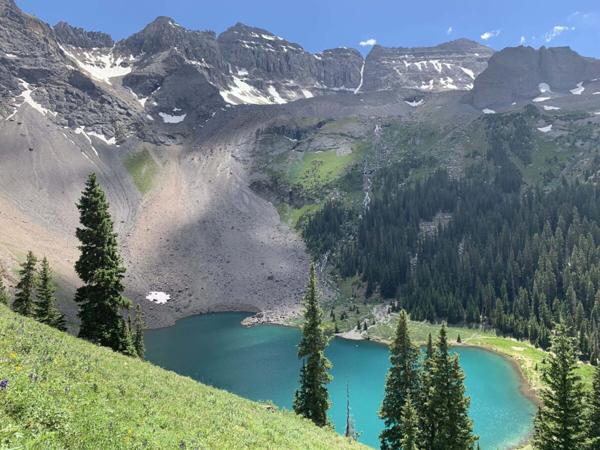
7. Blue Lakes Trail

Why you should go: Ascend through wildflower-filled meadows to a set of dazzling alpine lakes with impressive views.
- Difficulty: Challenging
- Distance: 7.9 miles
- Elevation gain: 2,519 feet
It’s a bit of a drive from Telluride to the Blue Lakes Trail, but trust us — it’s worth 45 minutes in the car to see Colorado’s renowned Blue Lakes. Bring your backpack and you can even spend the night camping along the shore of the lower lake. Or, do what we did and camp in the wildflower meadows high above the lake and tack on a summit of nearby Mount Sneffels.
Not to be confused with Telluride’s other Blue Lake (you can access that singular lake on the shorter Bridal Veil Falls to Blue Lake hike), the Blue Lakes on this hike are high in the San Juan Mountains between Telluride and Ridgway. The three lakes are located in a glacial basin in the Mount Sneffels Wilderness near the flanks of Gilpin Peak, Dallas Peak, and Mount Sneffels.
Most hikers embark on this trail for the picturesque alpine lakes with blue-green water that’s reminiscent of the Caribbean, but if you’re able to time your visit for July or August you’ll enjoy a wildflower paradise along the way. The mountain meadows on the Blue Lakes Trail are filled with a wide variety of wildflowers, including aster, columbine, king’s crown, bluebells, buttercups, and paintbrush.
Caveat: In recent years, this has become a very popular trail among tourists, so it can be crowded. Get there early to snag parking. And if you’re after solitude, definitely plan on backpacking in—most everyone there leaves in the afternoon.
Related Read: 11 Easiest 14ers in Colorado for Newbies to the High Peaks
8. Ballard Mountain Trail
Why you should go: A secluded summit with 360° views of alpine lakes, waterfalls, rocky ridgelines, and snowy basins across the San Juan Mountains.
- Difficulty: Challenging
- Distance: 7.9 miles
- Elevation gain: 3,809 feet
Ballard Mountain is an overlooked gem in the San Juan Mountains. The 13,000-foot peak is a prominent feature in the Telluride skyline, but few hikers follow the steep, unmarked trail to its summit. That’s great for those who are bold enough to bag Ballard Peak, as you’ll enjoy pristine alpine forests and spectacular views in solitude.
The path to the summit follows an old mining route that was recently restored in 2007. The switchbacks are relentless and make for a grueling start, but the path is mostly shaded by the thick spruce forest on your way up.
After a few hours of traversing the switchbacks you’ll reach an open basin with rock spires and large boulders. The summit is fairly close, though you’ll need to scramble over the ridgeline to reach the peak.
When you reach the summit of Ballard Mountain, you’ll enjoy sweeping views in every direction. To the left is Jackass Basin, Silver Lake, and Ingram Falls. To the right is Wilson Peak and Gold Hill. Turn around and you’ll enjoy a bird’s eye view of the Town of Telluride with the Sneffels Range in the background.
Most hikers head back down after soaking in the panoramic views, but the truly adventurous mountaineers like to scramble across the ridgeline further to Ballards Horn at 13,000+ feet.
Related Read: 9 Natural Hot Springs in Colorado for Soaking Away Your Troubles
9. Ridge Trail
Why you should go: A quick hike through aspen forest to the top of the gondola line, with plenty of benches to sit and soak in the valley views.
- Difficulty: Moderate
- Distance: 1.8 miles
- Elevation gain: 1,023 feet
There isn’t exactly an “easy” hike around here thanks to the elevation gains, so the Ridge Trail is as close as you’ll get to a beginner hike in Telluride. There are benches to catch your breath along the way, and when you reach the top you can take a free gondola ride back into town.
Starting from the bottom of the gondola in Mountain Village, the Ridge Trail climbs through gorgeous aspen forest for a little over 1,000 feet. The peaceful switchbacks afford great valley views on your way up, though you’ll enjoy the best views from the top.
The fun thing about this trail is that you can take it in either direction. If you’re not up for a 1,000-foot climb, just ride the gondola to the top and descend the Ridge Trail from top to bottom. Adventurous hikers who want to skip the gondola can also hike back down after they get to the top for a 3.6-mile out-and-back hike.
Related Read: 11 Best Winter Hiking Destinations in Colorado
10. Bridal Veil Falls to Silver Lake
Why you should go: A short hike to an icy mountain lake at the foot of Ballard Mountain.
- Difficulty: Challenging
- Distance: 3.2 miles
- Elevation gain: 1,688 feet
Like many great Telluride hikes, the Silver Lake hike begins at Bridal Veil Falls. The trail includes two creek crossings, so be prepared to get your feet wet!
After crossing the first creek, you’ll climb a rocky trail that’s probably the hardest part of the hike. The ascent eases up when you reach a set of switchbacks, and you’ll enjoy excellent views of the mountain landscape as you continue to climb.
You’ll pass through a forested area with a second creek crossing before reaching a mountain meadow. If you make this hike during July or August, the meadow is filled to the brim with beautiful wildflowers.
Silver Lake is a short distance past the wildflower-filled meadow at the foot of Ballard Mountain. The lake is stocked with trout, so bring your rod and reel for some afternoon fishing on the shore. The locals like to take a “polar bear plunge” in Silver Lake, so don’t be surprised if you see a couple brave souls dive into the frigid water while you’re visiting!
Related Read: 11 Beautiful National Forests in Colorado for Outdoor Recreation
Explore More of the Rockies
Get epic travel ideas delivered to your inbox with Weekend Wanderer, our newsletter inspiring more than 10,000 readers every week.
Seen in: Colorado, Colorado Hiking, Hikes, Rockies