We research, evaluate and select travel destinations based on a number of factors, including our writers’ experience, user reviews and more. We may earn a commission when you book or purchase through our links. See our editorial policy to learn more.
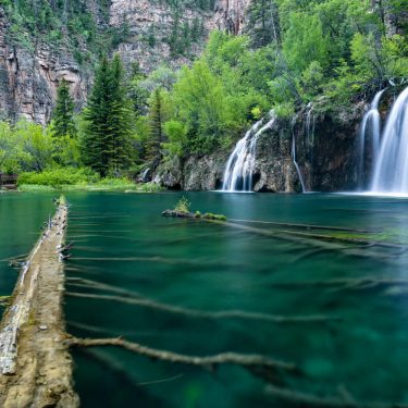
Discover the high desert of the American Southwest in Grand Junction.
Home to the world’s largest flat top mountain (Grand Mesa), hundreds of canyons, dinosaur footprints, and Colorado National Monument, there is plenty to experience in the area. Whether you are looking for a day hike, or a long backpacking trail on the Western Slope, Grand Junction has a myriad of opportunities.
Leave No Trace principles are a little different in desert landscapes. Watch this short LNT video to learn the best practices in sensitive desert environments. To continue to promote access to these wonderful natural areas, abide by any rules posted at trailheads and obtain any permits you will need — most overnight permits in the Grand Junction area are free.
Dogs are not allowed on the trails in Colorado National Monument. With all the Bighorn sheep in the area, it’s probably for the best. However, your furry friends are allowed in Dominguez-Escalante National Conservation Area, Black Ridge Canyon Wilderness, Grand Mesa National Forest, and some other trails specifically marked.
Be sure to pick a Grand Junction trails map before you head out!
Monument Canyon Loop
View this post on Instagram
Why you should go: Find yourself at the base of Grand Junction’s most historic tower, Independence Monument, deep in the canyon.
- Distance: 6.9 miles
- Elevation Gain: 815 feet
- Difficulty: Moderate
Follow this popular loop trail up the shady Wedding Canyon and into Monument Canyon where you will find Independence Monument. Keep your eyes peeled for a boulder with the Declaration of Independence carved onto it by John Otto who described Grand Junction’s rugged and deep red rock canyons as “the heart of the world.”
Deep in Bighorn sheep country, you’ll also find collared lizards at your feet and eagles up above.
Don’t let the shade in Wedding Canyon fool you, the hike out through Monument Canyon has zero shade and the sun can be brutal in this high desert. Bring plenty of water!
This loop is one of the few trails you can do without having to drive through the main park entrance where you’ll have to pay the fee for Colorado National Monument.
I highly recommend taking some time and driving into the main park area, where you can visit numerous viewpoints or find an abundance of other trails to explore. Perhaps enjoy a sunrise at a lookout high above Monument Canyon with sweeping views of the entire valley and canyons below.
More Info: Rocky Mountain Hiking Trails
Big Dominquez Canyon
View this post on Instagram
Why you should go: Get lost in Dominguez Canyon Wilderness along this watery oasis of a desert trail.
- Distance: 12.2 miles
- Elevation Gain: 1,160 feet
- Difficulty: Easy
Big Dominguez Canyon Trail follows water for the majority of the trail, and even features a waterfall! Whether you splash around for fun or to cool off, the rushing water here is a refreshing feature in this canyon country.
Dominguez Canyon Wilderness and its 66,280 acres lies within Dominguez-Escalante National Conservation Area and is managed by the Bureau of Land Management. Wilderness camping is permitted here and is an experience I highly recommend. Deep in the canyon, and a ways out of town, steer your eyes up toward the Milky Way.
Liberty Cap Trail
Why you should go: Work your way up to the vistas and reward yourself with stunning views of Colorado National Monument down below.
- Distance: 12.9 miles
- Elevation Gain: 2,000 feet
- Difficulty: Moderate / Challenging
The trail is quite steep, but the views are well worth the trek.
“One of the most rewarding hikes in the valley,” says Caleb Martin on AllTrails.
Wildlife and wildflowers are abundant in this protected National Monument. Entire herds of Bighorn Sheep can be spotted year-round.
It is very easy to break up long hikes or create your own adventure entirely in Colorado National Monument. Overnight Wilderness Camping permits are free after purchasing the park entry fee. Grab a trail map from the Visitor Center and consider linking up with other trails in the area.
More Info: National Park Service
Mee Canyon
Why you should go: Drop deep into Mee Canyon on this primitive and technical trail into the desert canyons of Black Ridge Canyon Wilderness.
- Distance: 5.6 miles
- Elevation Gain: 1,500 feet
- Difficulty: Moderate
Walk along a red cliff face and climb Navajo-style ladders on this out and back trail. Mee Canyon is one of the best day hike options in Black Ridge Canyon Wilderness.
Mee Canyon Trail is relatively easy to follow if you keep your eyes peeled for cairns. While this trail is rated as moderate, it is technical and exposed in areas.
Situated West of Grand Junction, Black Ridge Canyon Wilderness offers wilderness camping and an expansive trail system through deep and wide canyons.
More Info: Bureau of Land Management
Palisade Rim Trail
View this post on Instagram
Why you should go: Discover ancient Petroglyphs in this sacred and historic desert landscape of Western Colorado on the Palisade Rim Trail.
- Distance: 3.3 miles
- Elevation Gain: 610 feet
- Difficulty: Moderate
Just east of Grand Junction, Palisade is known for its wineries and farm-fresh produce. You can experience the amazing flavors of Palisade year-round, and you won’t have to hike too far to find this petroglyph site.
No hike here is complete without snacking on world-famous peaches — be sure to stop by one of the farmer’s stands on your way to the trailhead.
There are a few parts to this trail to make it shorter or longer depending on your skill level. For the shortest route, follow the signs to the petroglyphs (look, but don’t touch, please). This will loop back to the trail you came in on and will be 3.3 miles.
For a 6.5-mile trip, follow the trail and do the Lower Rim Trail. You will see signs for an Upper Rim Trail from there as well. Follow these upper loops for sweeping views of the wine country below.
More Info: Visit Grand Junction
The Gunny Loop
View this post on Instagram
Why you should go: An easy getaway closer to town, with amazing views of Colorado National Monument and Grand Junction.
- Distance: 9.9 miles
- Elevation Gain: 1,350 feet
- Difficulty: Easy / Moderate
This easy-going loop trail takes you in and out of a canyon, and up to a great viewpoint overlooking the city, canyons, and valleys below. You’ll be able to see the Rocky Mountains to the east from this high vantage.
The Gunny Loop Trail and the surrounding trails are heavily used by mountain bikers, so be aware of them while hiking. If you’re a mountain biker, be sure to bring your bike down to Grand Junction! Grand Junction and Fruita are home to some of the best mountain biking trails in the U.S.
Rattlesnake Arches Trail
View this post on Instagram
Why you should go: Backpack deep into canyon country and be awed by the natural bridges, arches, and sandstone windows in the Black Ridge Canyon Wilderness.
- Distance: 14 miles
- Elevation Gain: 2,450 feet
- Difficulty: Challenging
Rattlesnake Arches Trail is a great overnight backpacking trail. Break the trail up or create a “home base” and enjoy primitive recreation here.
The solitude in Black Ridge Canyon Wilderness is almost frightening as you explore the high desert landscape without seeing a soul. A bit out of town and swaddled by canyons, you’ll never want to leave these arches.
This is a technical trail, but don’t be deterred; the geological features here are stunning. You’ll forget you’re in the same state as the alpine Rocky Mountains. Trail finding can be tricky along Rattlesnake Arches, but there are cairns to mark the way.
More Info: Bureau of Land Management
Ute Canyon Trail
View this post on Instagram
Why you should go: Shout from the base of Ute Canyon and listen to the surreal echoes bounce off towering canyon walls.
- Distance: 11 miles
- Elevation Gain: 1,910 feet
- Difficulty: Moderate / Challenging
South of Independence Monument in Colorado National Monument, you’ll find yourself away from crowds and able to enjoy Ute Canyon in solitude.
You won’t have to pay for a park entry fee to get to this trailhead, but if you want to turn this into a backpacking trip, you will have to get free overnight permits from the National Monument Visitor Center.
Ute Canyon is a bit on the challenging end of “moderate” due to steep, technical sections. Accessible year-round and featuring a river, Ute Canyon is a true test of skill.
More Info: National Park Service
Turkey Flats Loop Trail
View this post on Instagram
Why you should go: Experience amazing fall colors and migrating elk in the forested landscape atop Grand Mesa.
- Distance: 10.3 miles
- Elevation Gain: 1,380 feet
- Difficulty: Moderate
Grand Mesa National Forest is home to the world’s largest flat top mountain rightfully named, Grand Mesa. Covered in shady forests, this cool mesa draws in the elk moving through the region.
This longer loop trail is ideal for backpacking. There are numerous locations along the trail great for camping, and lots of trees and vegetation provide shade for camping and hiking.
Turkey Flats Loop Trail is not only shady but also features a beautiful lake! These factors make this a great option for hiking in the Grand Junction area in the hot summer months.
More Info: AllTrails
Devil’s Canyon Loop Trail
View this post on Instagram
Why you should go: Find yourself among desert towers and a historic cabin in this vast web of trails.
- Distance: 6.7 miles
- Elevation Gain: 764 feet
- Difficulty: Easy-Moderate
Devil’s Canyon Loop can link up with several trails in the area and is very well marked. One of the most popular hikes in the Grand Junction, Devil’s Canyon will not disappoint.
Short enough to be a quick-and-easy day hike, don’t underestimate the views in Devil’s Canyon. In the middle of Summer, take a splash in the creek that runs along the trail.
As T.J. Hines said on AllTrails, “good hike. Always a great way to start the day.”
More Info: AllTrails
Explore More
Sign up for our free email to join thousands of readers getting epic travel, hiking, camping and gear ideas every week.
Seen in: Colorado, Colorado Hiking, Hikes, Rockies, Southwest