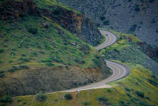
Any Arizonan hiker will tell you that our state offers up great hiking any time of year.
The Grand Canyon State is famous for, well, the Grand Canyon obviously — and a broad expanse of Sonoran Desert in the southern part of the state too. But with high elevation areas like the San Francisco Peaks, Mogollon Rim, and White Mountains creating colder and wetter climates, there are many more options than just wintertime strolls among the cactus.
As a born and bred Arizona local, I’ve put together this list of the 12 “best” hikes in Arizona. But look, there are probably 100 or more hikes that deserve a spot here. Consider this a small sampling of what Arizona has to offer. I’ve included options for novice hikers all the way up to hike-all-day summit-obsessed fanatics — there’s something for everyone.
But before you head out on the trail, be sure to prepare with plenty of water, snacks, and weather appropriate gear. Your destination may be colder, hotter, wetter, drier, or windier than you expect, and it doesn’t hurt to make a call to the local ranger station to get their advice based on the current conditions. A little extra due diligence before your hike can make all the difference between a not-fun hike and an amazing one!
Related Read: 13 Waterfalls in the Grand Canyon You Won’t Believe are Real
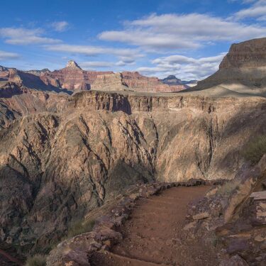
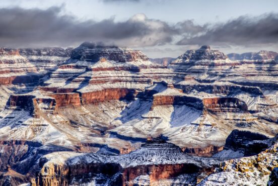
Grand Canyon National Park
1. South Kaibab Trail to Cedar Ridge
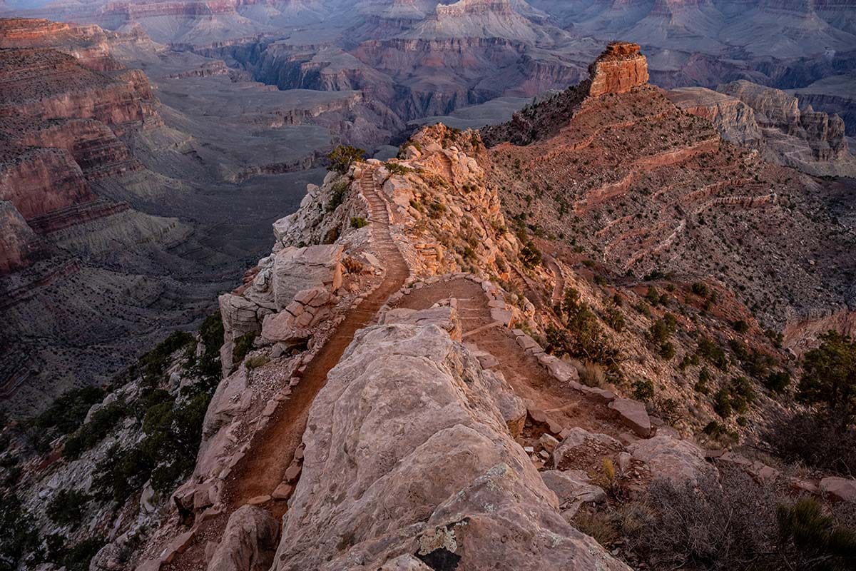
Why you should go: Ridgetop hike with world-class panoramic views.
- Nearest town: Grand Canyon Village
- Difficulty: Moderate
- Distance: 2.4 miles round-trip
- Elevation gain: 1,200 feet
Let’s be honest, you could pick pretty much any Grand Canyon trail at random and it would fit right in on this list. I chose South Kaibab because it offers a nice mix of accessibility, views, and options to extend the hike longer if you want. I recommend turning around at Cedar Ridge for most hikers because it gives you a nice taste of canyon hiking without having to commit to a massive hike.
You also have the option of cutting the hike short and turning back after three-quarters of a mile at Ooh Ahh Point. However, Cedar Ridge is a great destination as it offers plenty of space to spread out and have a snack break, plus the option explore the quarter-mile of red rock terrain out to the end of point.
Other destinations further down the trail include Skeleton Point, the Tip-Off, or the Colorado River. No matter which destination you choose, be sure to study the NPS guide for safe hiking at Grand Canyon. If you are interested in backpacking, put your name in the lottery for a permit at Bright Angel Campground on the north side of the Colorado.
Related Read: 10 Best Backpacking Trips in Grand Canyon National Park, Arizona
Oak Creek Canyon
2. West Fork of Oak Creek
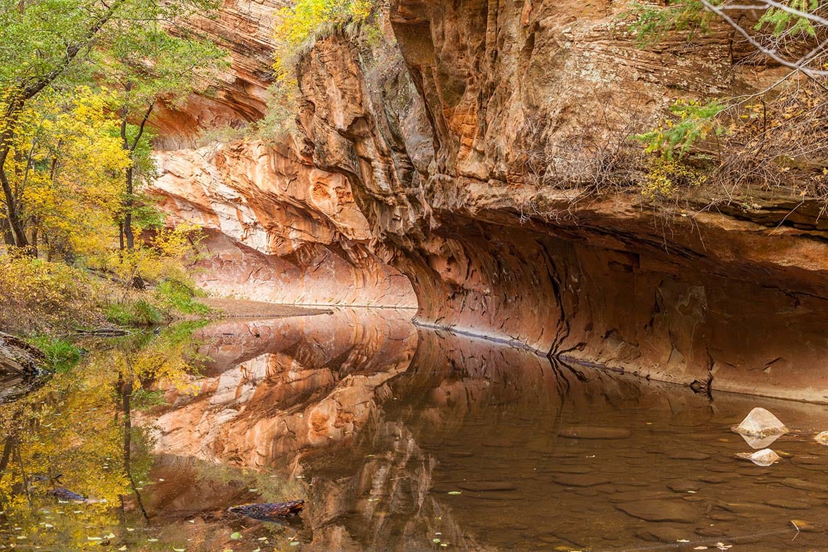
Why you should go: Unreal combination of red rocks, lush forest, and a crystal clear creek.
- Nearest town: Sedona
- Difficulty: Easy / Moderate
- Distance: 6 miles round-trip
- Elevation gain: 200 feet
During the height of fall colors — or pretty much any summer weekend — the West Fork Trail is packed to the gills with hikers. But for good reason: this creekside jaunt meanders through maple, ash, and alder trees below red-rock cliffs and overhangs.
This is yet another hike with many natural turn-around points before the end of the trail, with most hikers turning around before the end of the maintained trail. In fact, many folks don’t make it past the first reflecting pool, which is an easy half-mile from the trailhead. However, if you keep going you’ll find stunning scenes at nearly every turn — just to ready to get your feet wet as the trail crosses the creek eight times.
If you wish to continue further, an intermittent social trail continues up-canyon — and you’ll often find yourself wading through long, waist-deep pools and spectacular scenes reminiscent of Zion National Park’s Subway. Backpacking is allowed at West Fork, but the rules require you to hike in six miles from the trailhead before setting up camp.
Related Read: Backpacking West Fork of Oak Creek: From Populous to Seclusion
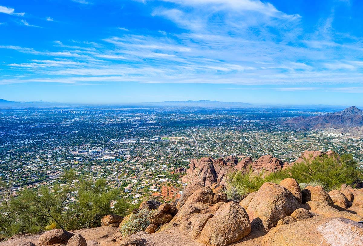
Phoenix Mountains
3. Camelback Mountain
Why you should go:
- Nearest town: Phoenix
- Difficulty: Challenging
- Distance: 2.3 miles
- Elevation gain: 1,300 feet
The instantly recognizable Camelback Mountain is one of the Valley’s most iconic landmarks, and one of the most beloved hikes for locals. Two trailheads provide access to Camelback — Echo Canyon and Cholla — but the stats above reflect the slightly shorter hike starting at Echo Canyon.
No matter where you start, be ready for a “short” but incredibly steep hike. Both routes will treat you to awesome vistas and interesting geology along the way, with the panoramic views across the valley from the top. Camelback is a popular hike, and the Echo Canyon parking lot fills up fast, so be ready with a plan B — like Piestewa Peak, another classic (and popular) Phoenix hike that has a much larger parking capacity.
San Francisco Peaks
4. Humphreys Peak via Inner Basin
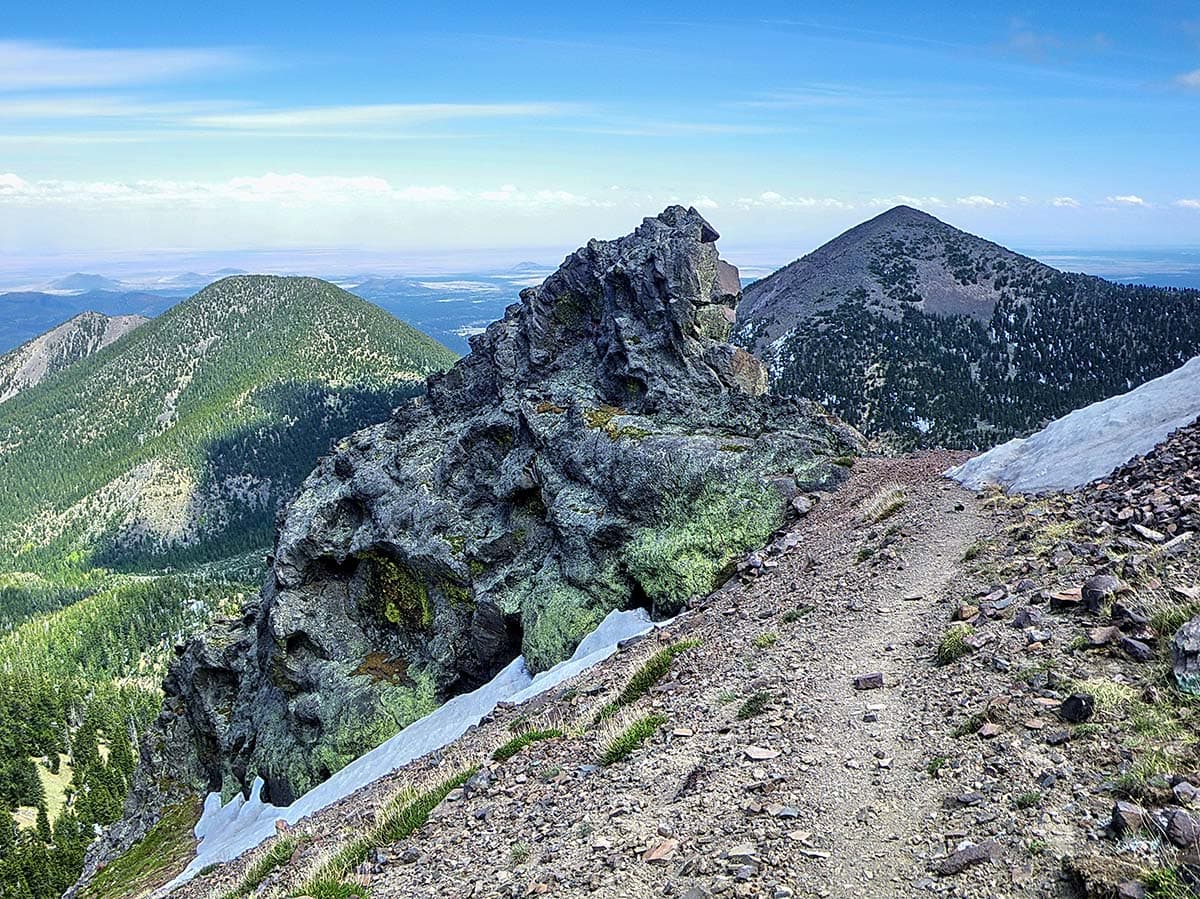
Why you should go: Visit unbelievable aspen groves, alpine tundra, and Arizona’s highest peak.
- Nearest town: Flagstaff
- Difficulty: Challenging
- Distance: 15.8 miles
- Elevation gain: 4,400 feet
Every Saturday in June, July, and August, hundreds of folks tackle the tough 10.5-mile hike on the Humphreys Summit Trail. It’s a good hike, but it’s mostly about getting to the destination: 12,633 feet, the highest point in Arizona. So what if I told you there was a better way to get there? If you’re down for something a little longer, Humphreys via Inner Basin is an epic all the way through.
Starting out on the Inner Basin Trail, you’ll meander through the most incredible aspen grove in Northern Arizona — and that is NOT an empty claim, I promise you — then through a meadow surrounded by 11,000 and 12,000 foot peaks. As you shake off the confusion of whether you’re in Arizona or Colorado, you’ll continue up through the forest until you reach the Weatherford Trail. On the final epic stretch until reaching the summit, this hike stays above treeline for over two miles as you cross Arizona’s only meaningful area of alpine tundra.
If you’re an avid and experienced hiker, this is a less-crowded, more scenic, and more rewarding way to conquer Humphreys.
Related Read: 30 Incredible Flagstaff Hikes
Grand Canyon National Park
5. Bright Angel Point
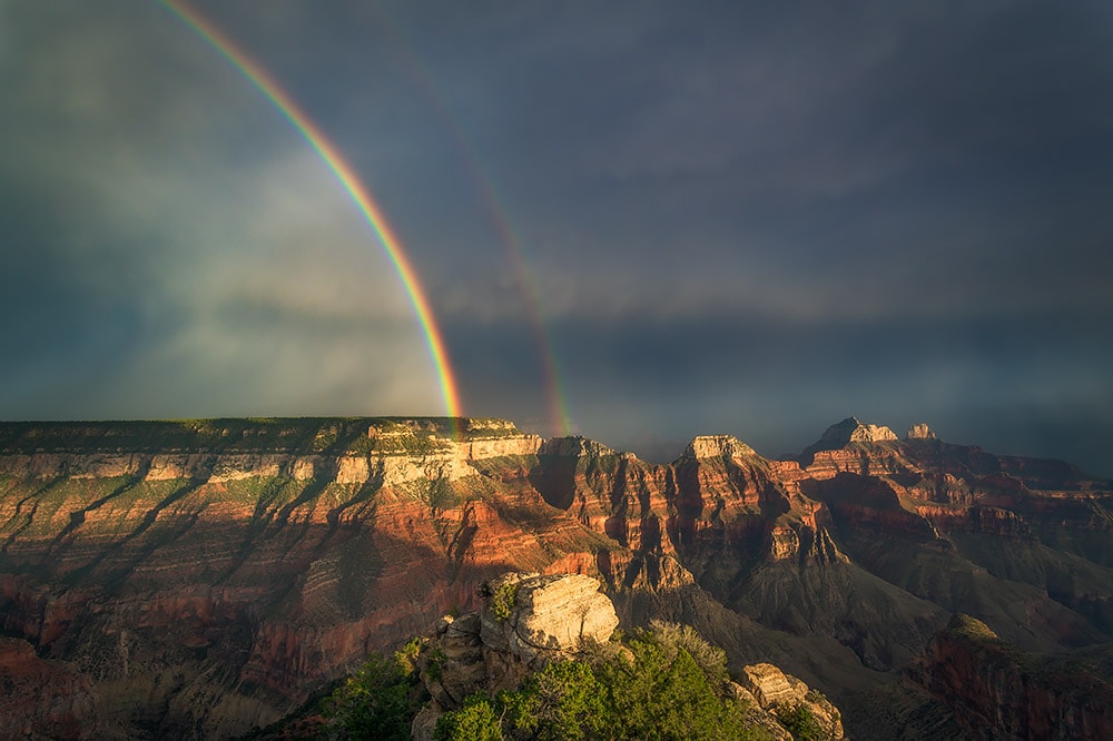
Why you should go: Easy, paved stroll to an unbelievable view from the Grand Canyon’s North Rim.
- Nearest town: North Rim
- Difficulty: Easy
- Distance: 1 miles
- Elevation gain: 100 feet
Sometimes the most memorable hikes are the easiest ones. Case in point: the Bright Angel Point. Not to be confused with the Bright Angel Trail at the South Rim, the Bright Angel Point Trail takes off from the North Rim Lodge, following a ridgetop for a half-mile. It’s paved the whole way, making for an accessible route that almost anyone can enjoy.
You’ll enjoy excellent views along the way, and then a broader panorama at the railing-lined platform. On any given day you’ll see Brahma Temple and Zoroaster Temple jutting up on the distant ridge — and if the air is clear, you can see out to the San Francisco Peaks, 60 miles to the south. And if you’re really lucky, an afternoon thunderstorm will roll through and collaborate with the sun to make a classic Grand Canyon rainbow.
Sedona
6. Bear Mountain
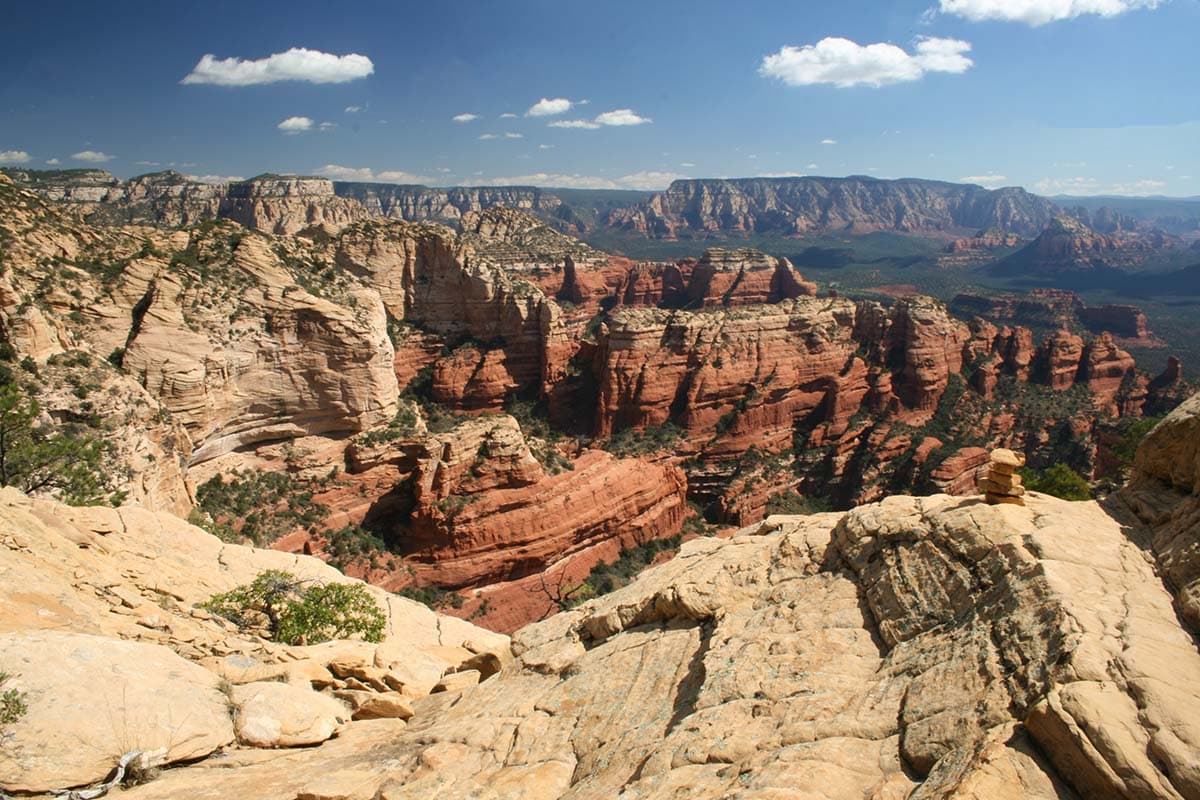
Why you should go: Action packed ascent to one of Sedona’s most spectacular views.
- Nearest town: Sedona
- Difficulty: Challenging
- Distance: 5 miles
- Elevation gain: 2,100 feet
While Sedona has dozens of world-class hikes, Bear Mountain is definitely a local favorite. Located on the western end of the Sedona area, getting up on this mountain makes you feel a little more separated from town and closer to the wilderness.
The hike itself is beast, with the rugged trail climbing up multiple benches of red and tan sandstone and through scraggly pinyon and juniper woodlands. On the final stretch to the summit, you’ll cross a memorable patch of Coconino sandstone slickrock that feels reminiscent of the Checkerboard Mesa area of Zion National Park. Reach the top you’ll enjoy what many locals consider the best view in Sedona.
Related Read: Red Rock Hiking: 16 of the Best Sedona Hikes
White Mountains
7. Mount Baldy
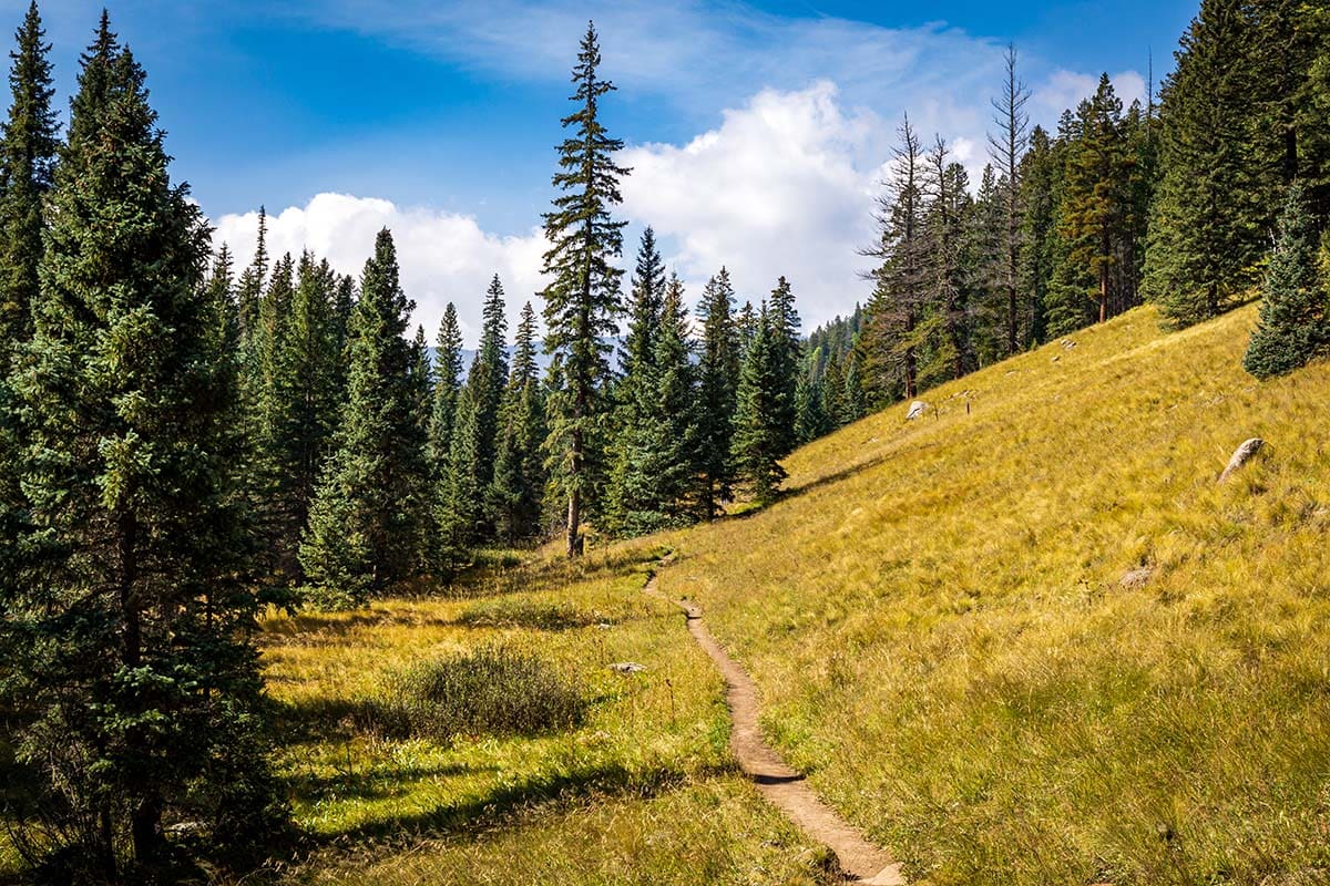
Why you should go: Hike up high through mixed-conifer forests on the flanks of Arizona’s 7th highest peak.
- Nearest town: Greer
- Difficulty: Challenging
- Distance: 13 miles
- Elevation gain: 2,200 feet
One of the best ways to spend a summer day in Arizona is hiking Mount Baldy, the tallest peak in the White Mountains. While this hike is long, the climb is more gradual than other beasts like Humphreys or Bear Mountain, making for a more mellow walk in the woods that suits the laid-back attitude of Eastern Arizona.
There are actually two trails climbing the mountain — West Baldy Trail and East Baldy Trail. The stats above reflect an out-and-back hike on the slightly shorter and more popular West Baldy Trail. However, both trails are worth a visit, and it is possible to do a 13.5 mile shuttle hike (you’ll need two cars) or 17 mile loop hike (3 miles of road walking between trailheads). The two trails meet at a high saddle with a sweet view of the surrounding mountains — however, the nearby summit is on the White Mountain Apache Reservation, and is closed to non-tribal members, as it is considered a sacred site.
Lee’s Ferry
8. Spencer Trail
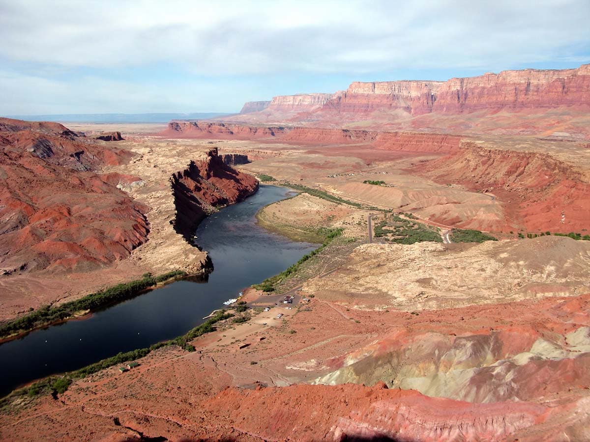
Why you should go: Climb to a spectacular view at the top of the Echo Cliffs.
- Nearest town: Page
- Difficulty: Moderate / Challenging
- Distance: 4 miles
- Elevation gain: 1,600 feet
Even if you just go sight-seeing, Lee’s Ferry is a must-see place that most Arizonans have never been. Marking the end of Glen Canyon and the beginning of Grand Canyon, this riverside spot is surrounded by soaring the multi-colored hues of the Chinle Formation and soaring red rock cliffs above.
The scenery is amazing enough at river level, but it gets even more spectacular with an even-rising bird’s eye view as you ascend the Spencer Trail. The trails climbs in spurts of tight switchbacks through layers of sandstone and siltstone, making it tough in sections, but worth the effort to reach the top of the Echo Cliffs. From the trail’s end atop a narrow mesa, you’ll have broad views of Lee’s Ferry and the Colorado River below, the Vermilion Cliffs to the west, and Glen Canyon to the north.
Related Read: 11 Best Places to Go Camping Near Water in Arizona
10. Cibecue Falls
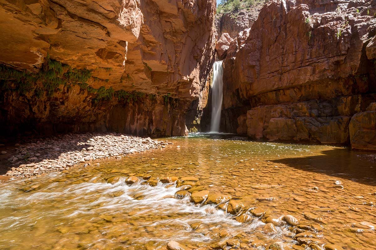
Why you should go: If the photo above isn’t reason enough, you might be a sociopath.
- Nearest town: Globe
- Difficulty: Easy
- Distance: 3.1 miles
- Elevation gain: 240 feet
The hike to Cibecue Falls is the favorite of many of our local waterfall enthusiasts. Cibecue Creek sits within the White Mountain Apache Reservation, so you will need to purchase a permit for each person in your party in order to legally visit.
Once you have permits squared away, and find your way to the remote trailhead, be sure to enjoy the journey on the way to your destination. This terra cotta walled canyon is a beauty all the way through, with a worthy climax at the end. Be ready to get wet as you’ll cross the creek numerous times along the way, and even wade through a wall-to-wall pool. Even though it is a fairly easy hike, a trip to Cibecue is an adventure all the way through.
Related Read: 21 Epic Arizona Waterfalls You Can Hike To
Santa Rita Mountains
10. Mount Wrightson
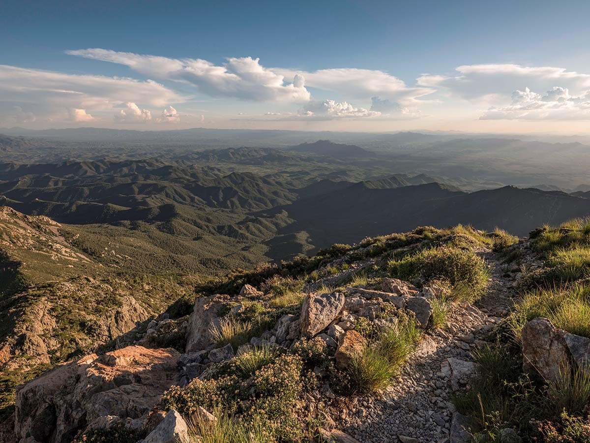
Why you should go: Conquer the scenic journey to the top of a this formidable “sky island.”
- Nearest town: Green Valley
- Difficulty: Challenging
- Distance: 10.4 miles
- Elevation gain: 4,100 feet
Nicknamed “Old Baldy,” Mount Wrightson stands tall over the far southern reaches of Arizona — topping out at 9,456 feet above sea level. Wrightson and other high peaks in the region (such as Mount Lemmon near Tucson) are known as the “Sky Islands” because they stick up like islands surrounded by a sea of desert.
If you like solitude, Wrightson is blessed with a location far away from cities and popular attractions — making it perhaps the least crowded hike on this list. There are two trails climbing the mountain — the Old Baldy Trail and the Super Trail — both starting from the same trailhead. The two trails intersect each other to make a figure eight formation, making for a fun loop hike. If you wish to take the shortest route up and down (reflected in the stats above), stay on Old Baldy Trail the whole way.
Related Read: The 7 Best Caves in Arizona for Subterranean Exploration
Aravaipa Canyon Wilderness
11. Aravaipa

Why you should go: Soak up the scenery in a desert canyon with a bubbling creek and desert bighorn sheep.
- Nearest town: Winkleman
- Difficulty: Moderate
- Distance: 11 miles
- Elevation gain: 500 feet
Aravaipa Canyon is one of the hidden gems of southern Arizona. It’s combination of sheer cliffs, spring-fed water, Saguaro-clad hillsides, and lush vegetation makes Aravaipa a bona fide oasis. And if you spend more than a day in this wilderness, you’re almost guaranteed to spot the resident herd of desert bighorn sheep.
While it is possible to day hike into Aravaipa, most users opt to stay overnight. Both day hikers and backpackers are required to book a permit — available on Recreation.gov up to 13 weeks in advance — with a 3-day maximum for backpacking trips.
The stats above reflect an out-and-back hike from the more popular Aravaipa Canyon West Trailhead to Horse Camp, a large open area about 5.5 miles in where most backpackers set up camp. You may opt to book your permit to hike in from the Aravaipa Canyon East Trailhead, which is much harder to get to — but is considered by many Aravaipa veterans as the most beautiful half of the canyon.
Related Read: Aravaipa Canyon Wilderness: an Underrated Desert Oasis
Chiricahua National Monument
12. Echo Canyon Loop
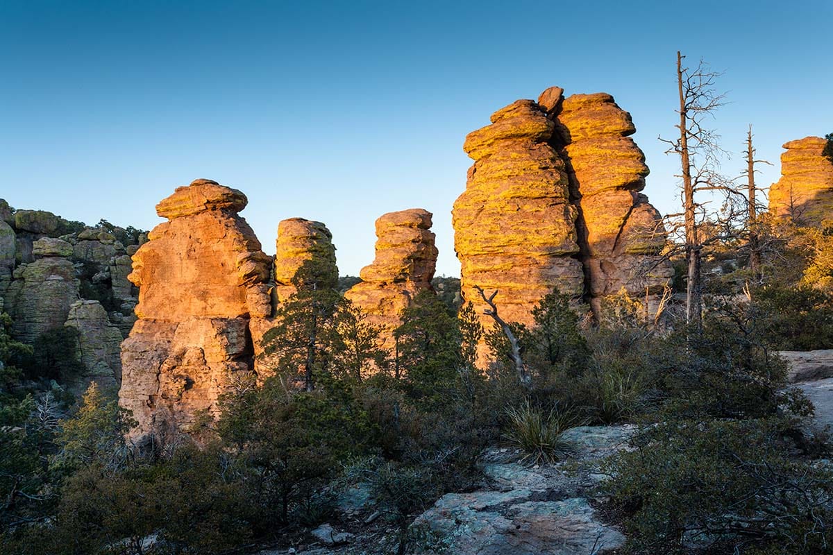
Why you should go: Hike among the hoodoos at this underrated National Monument.
- Nearest town: Willcox
- Difficulty: Easy / Moderate
- Distance: 3.3 miles
- Elevation gain: 550 feet
Chiricahua National Monument is one of the least visited parks in the West — but it’s well worth taking the time to travel to this sky island in south-eastern Arizona. The crown jewel of Chiricahua is Echo Canyon, a rugged high-altitude gulch chock-full of columnar rock formations called hoodoos. When you visit, I recommend the Echo Canyon Loop, which makes for a pleasant stroll that you can knock out in less than two hours. This loop uses three trails: Echo Canyon Trail, Ed Riggs Trail, and Hailstone Trail.
The Echo Canyon Trail winds through the most stunning features of the area, including The Grotto, Wall Street, and the Rhyolite Canyon Overlook. If you want to add a little something extra to your hike, you can take the spur trail to Masai Point (add a half-mile and 150 feet of elevation to your trip) which gives a commanding view of the hoodoo forest from above.
Explore More of Arizona
Get epic travel ideas delivered to your inbox with Weekend Wanderer, our newsletter inspiring more than 10,000 readers every week.