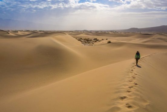
With almost 80% of the land forested within the state border, Vermont’s wildlands know no bounds.
Although both Maine and New Hampshire have higher percentages of forested land, Vermont has one of the lowest populations in the country. This leads to less traffic on trails and more nature for you to enjoy. Southwestern Vermont encompasses the largest contiguous public land area in the state, reaching just over 400,000 acres in size. Green Mountain National Forest, aptly named for the trees that often blanket their mountain summits, is Vermont’s crowning jewel.
But there are also 55 state parks to choose from and endless county and city parks throughout the state. Whether you’ve got kids tagging along with you or are up for a full-fledged thru-hike, the hikes recommended below are perfect no matter the adventure you are thinking of taking.
Related Read: 14 Best Hikes in Maine for Exploring the Great Outdoors
1. Sterling Pond Trail
Why you should go: walk the same trails as smugglers back in the day who defied American orders to quit trading with Canada.
- Difficulty: moderate
- Length: 2.5 miles
- Elevation gain: 900 feet
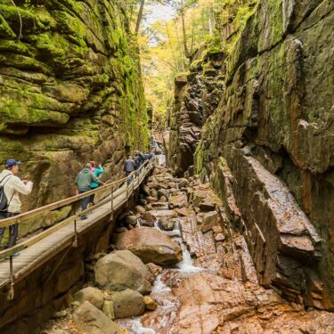
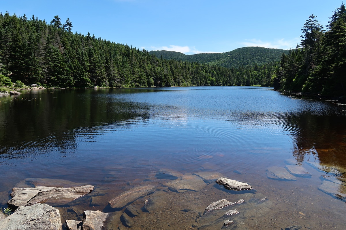
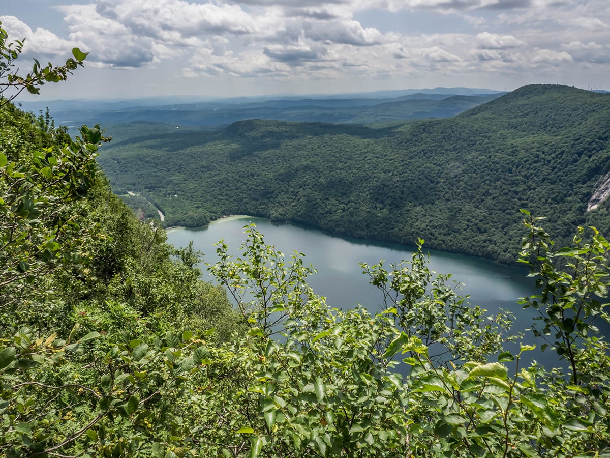
Lying just north of the town of Stowe, the Sterling Pond Trail might be short but it is, by no means, easy. Some might take a look at the distance and elevation and think the hike would be a walk in the park (Smugglers’ Notch State Park to be exact), but they would be wrong. You start the trek at the apex of Smugglers’ Notch, nestled between Mount Mansfield and Spruce Peak.
The State Park got its name from those who risked the wrath of the American government during the War of 1812 when it was forbidden to trade with Great Britain and Canada. The proximity to large cities in Canada (i.e., Montreal) made for a convenient place to trade a multitude of goods and livestock. The boulders in the area were a great place for smugglers to hide and conceal themselves.
Those same boulders dot the trail up to Sterling Pond which means there is a lot of climbing and your calves and thighs will be feeling the burn all the way up to the pond. Prepare yourselves for a consistent ascent with no relief until you reach the junction of the Long Trail. Once there, it’s a short jaunt down to the pond!
Related Read: 5 Best Backpacking Trips in Maine for a Wild Adventure
2. The Long Trail

Why you should go: walk along the oldest continuous footpath in the United States.
- Difficulty: very challenging
- Length: 272 miles
- Elevation gain: 65,000 feet
Look no further than Vermont’s crown jewel of trails if you are in need of a bit more than just a day hike. The Long Trail is a well-established long-distance hike that adventurers flock to every year. Along the 272 miles of trail, there are gorges, waterfalls, ridgelines, and some of the most beautiful backcountry campsites you will ever experience. It’s no wonder that it became the inspiration for the Appalachian Trail!
If you attempt the thru-hike, make sure to block off enough time to complete it. It has been completed in as short as five days (there are some very fit ultramarathoners that use the Long Trail to train) but most people take a few weeks to complete it. If thru-hiking isn’t your thing, you can always section hike the Long Trail meaning you do the entire trail in sections over the course of a few months rather than all at once. Or, you could do small day hikes along the trail to get a glimpse of what it would be like to hike the whole thing.
Related Read: 6 Free Camping Spots in Vermont
3. Brousseau Mountain
Why you should go: incredible autumn views.
- Difficulty: easy
- Length: 2.2 miles
- Elevation gain: 630 feet
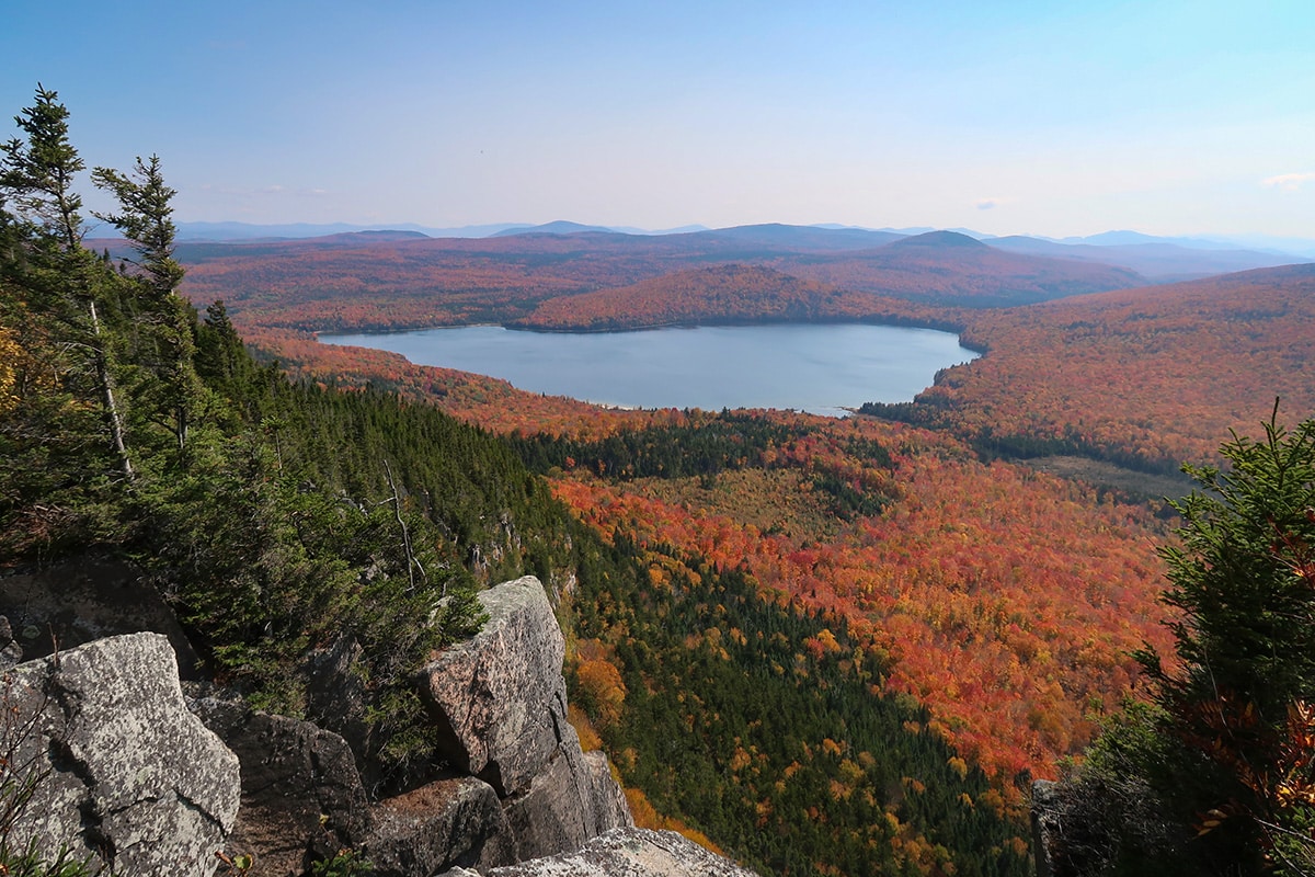
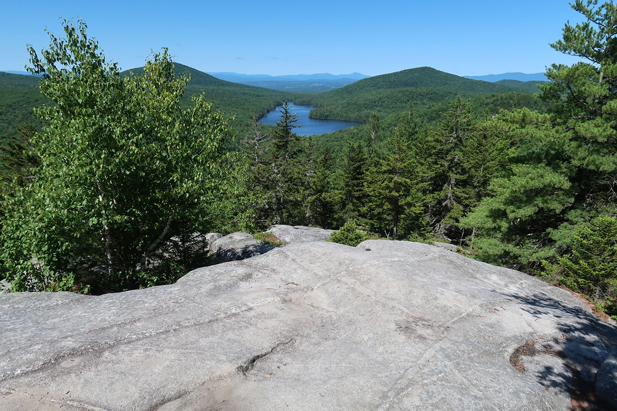
Tucked away in the far northern part of Vermont, lies the short but breathtaking hike up Brousseau Mountain. Due to its northern remote location, there are very few people who make the trek up there to hike it. This means way less people on the trail and more views for you to share only with the birds.
Speaking of birds, for almost half the year (approximately March 15-August 15) the trail is closed due to peregrine falcon nesting habitat. The cliffs that are located at the end are ideal habitat for the federally protected birds of prey and are known nesting spots for them. You can do this trail in the winter and late summer but the ideal time to go is during peak fall foliage. The views of Little Averill Pond and Great Averill Pond are extraordinary and should not be missed.
Related Read: Top 10 Romantic Getaways in Vermont to Keep the Romance Fiery
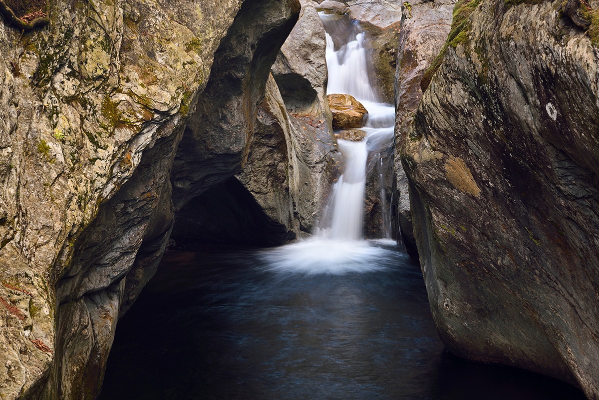
4. Texas Falls Recreation Area Loop
Why you should go: it has the most crystal clear water to gaze upon.
- Difficulty: easy
- Length: 1.0 mile
- Elevation gain: 200 feet
This is one of those trails that is good for everyone. Witness the power of water and the gorgeous, turquoise hues by visiting the Texas Falls Recreation Area. The trail is located in the heart of Green Mountain National Forest and a great place for people with all ability levels. At only one mile, the trail can take as long or as little as you like.
There are several spots to view the falls along the trail but tread carefully on the large stone steps as they get quite slippery after the rain or dew falls. You can also use the large picnic pavilion for small gatherings or a large picnic while fishing along both Hancock Branch and Texas Brook.
Related Read: 8 Beautiful New Hampshire Scenic Drives Worth Exploring
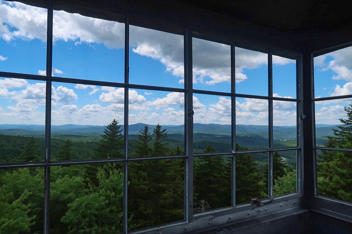
5. Mount Olga
Why you should go: 360-degree views at the fire tower.
- Difficulty: easy
- Length: 1.5 miles
- Elevation gain: 300 feet
There are a few different trailheads to start your easy jaunt up to Mount Olga, but the best one to start at is the Hogback and Mount Olga parking lot (you’ll learn why at the end). The trail brings you through mostly covered forests since it’s in the middle of Green Mountain National Forest within the boundary of Molly Stark State Park.
When you get up to the top of the mountain, there are still no views as the trees are too tall for you to see anything beyond them. Instead, head up the fire tower to take in the 360-degree views at the top. Use caution on the stairs as they are a bit wobbly and might not be appropriate for little kids or those with a fear of heights.
The best part of the hike though is that when you make it back to your car, there is both a distillery and brewery across the street and the perfect location for an après-hike beverage. Choose between Vermont Distillers, Inc. or Beer Naked Brewery depending on your favorite type of drink. For those not into breweries, the Southern Vermont Natural History Museum is also a worthwhile stop.
Related Read: 10 Best Hikes in the Berkshire Mountains to Get Away From it All
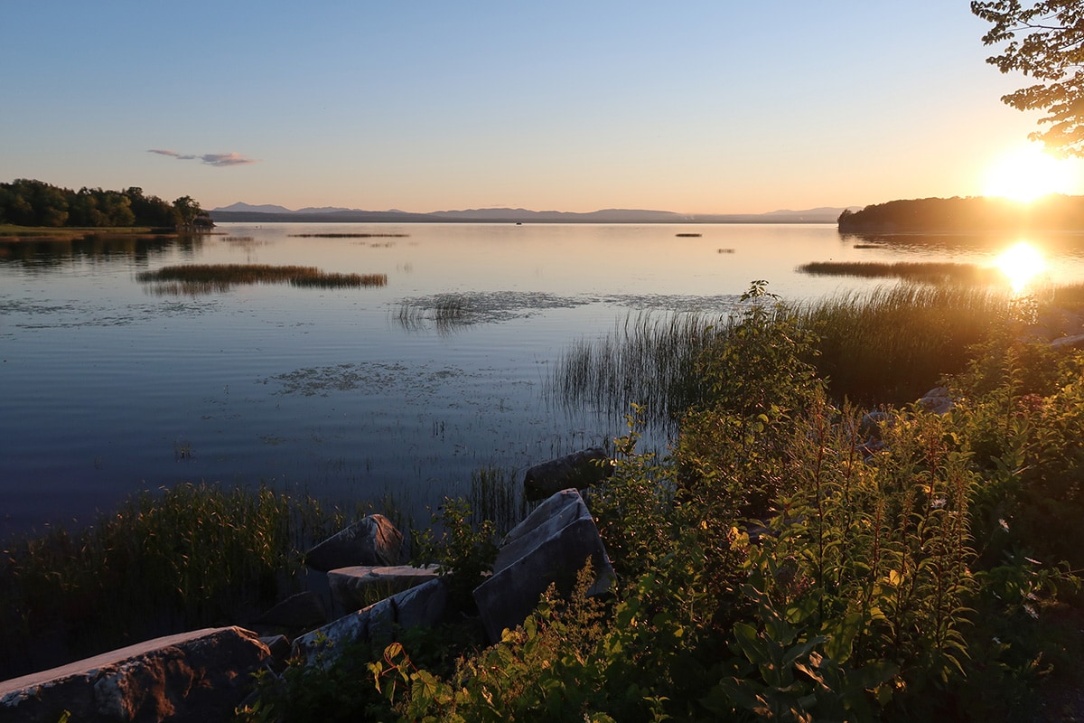
6. Colchester Causeway
Why you should go: you get to take a small boat ferry during the hike.
- Difficulty: easy to moderate
- Length: 11 miles
- Elevation gain: 100 feet
Although you can do this trail as a hike, it is best experienced on two wheels. So hang up your hiking boots and instead grab your mountain bike to traverse the flat and beautiful Colchester Causeway along Lake Champlain. The only reason this trail is rated as moderate is simply due to the distance and only if you are walking it. Otherwise, it’s a leisurely bike ride along one of the most beautiful lakes in the United States.
Lake Champlain sits between New York and Vermont. The Green Mountains to the east and the High Peaks of the Adirondacks to the west make for perfect backdrops for both sunrise and sunset. Be forewarned, though, that this is a popular area due to its beauty and easy access, so you won’t be alone on the trail.
Related Read: 7 Gorgeous Places to See Fall Foliage in the Adirondacks
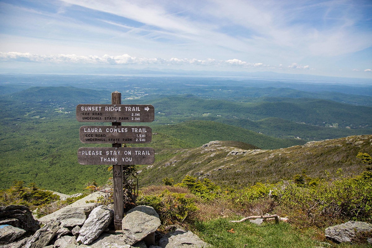
7. Mount Mansfield
Why you should go: you get to stand on top of Vermont.
- Difficulty: strenuous
- Length: 4.5 to 6.0 miles depending on the trail
- Elevation gain: 2,550 to 2,700 feet depending on the trail
There are several routes to the summit of Mount Mansfield but the two most popular ones are the Sunset Ridge Trail and Laura Cowles Trail. Regardless of the trail you take up, the views are spectacular. The highest mountain in Vermont sits at 4,393 feet above sea level. The mountain gets its name from its similarity to a profile of a human face and even has prominent points along its ridge that reflect it including the Chin (which is considered the summit), the Adams Apple (elevation 4,060 feet ), Nose (elevation 4,062 feet), and Forehead (elevation 3,940 feet).
A large portion of the trail is above treeline and enters into Vermont’s alpine zone. It’s extremely important to follow Leave No Trace principles throughout the hike but especially in alpine zones as the flora and fauna are extremely sensitive in these areas. Remember to stay on trail and do not trample the plants that surround the area.
Related Read: 10 Best Swimming Holes in Vermont to Cool Off
8. Mount Pisgah
Why you should go: you don’t have to hike the whole thing to get the best views.
- Difficulty: moderate
- Length: 4.0 miles
- Elevation gain: 1,650 feet
Like many trails across New England, there are several routes you can take up to the top of Mount Pisgah. Most who venture up this summit, though, take the South Trail. There is a small boardwalk at the beginning of the hike where you’ll sign the trail register and begin your hike. The trail almost immediately begins a steady incline and does not relent until the summit.
About one mile into the hike, there is a break in the trees where you can take in the views of Lake Willoughby on Pulpit Rock. This is the best view you’ll get of Lake Willoughby so if it’s all you came for, turn back around here. Otherwise, you can continue up the trail to the summit which is signaled by a small sign on a tree stating you’ve reached the summit.
Related Read: 10 Massachusetts Cabins for Getting Lost in the Wilderness
9. Camel’s Hump

Why you should go: it’s a pick your own adventure depending on the trail you want to take up it.
- Difficulty: challenging
- Length: 6 miles
- Elevation gain: 2,600 feet
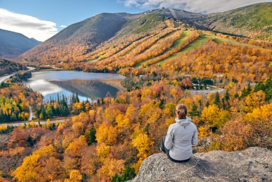
You can see the obvious mountain called Camel’s Hump from a distance away due to its distinct shape. It is one of Vermont’s four thousand footers (i.e., mountains 4,000 feet above sea level) and is the state’s third highest mountain. Like so many other trails on this list, Camel’s Hump is located in Green Mountain National Forest and the views at the top showcase exactly where the forest gets its name.
For miles, the views stretch across thousands of acres of green trees that vary between both hardwood and softwood trees. This means that there is a mixture of both deciduous trees (ones whose leaves fall every autumn) and coniferous trees (ones that keep their needles/leaves year-round). And all of that means that the views are incredible no matter the time of year!
Related Read: 10 Best Hikes in Stowe, Vermont to Experience Outstanding Views
10. Owl’s Head Mountain
Why you should go: almost zero effort to get to breathtaking views.
- Difficulty: easy
- Length: 0.2 miles
- Elevation gain: 150 feet
The quickest and easiest way up Owl’s Head Mountain near Peacham, Vermont is to drive up the dirt road named Owls head Scenic View. You end up at the small parking lot at the top and it’s a quick 0.2 miles to the summit and overlook. The road up to the this parking lot is only open from 10 am until 5 pm most days in the warmer months and closed the rest of the time. You can either walk up the road from the gate or take one of the other trails to get up to the summit during other times of the year.
When you get to the top, you’ll have great views looking west toward Kettle Pond and south toward Lake Groton and the Green Mountains. There is also a stone hut that was built by the Civilian Conservation Corps back in the 1930s. Franklin Roosevelt established the CCC to improve the public lands across the United States after the Great Depression and to get men back to work. Take a rest in the stone hut before heading back down to your car.
Find Your Next New England Adventure
Get epic travel ideas delivered to your inbox with Weekend Wanderer, our newsletter inspiring thousands of readers every week.
Seen in: Hikes, New England, Northeast, Vermont