We research, evaluate and select travel destinations based on a number of factors, including our writers’ experience, user reviews and more. We may earn a commission when you book or purchase through our links. See our editorial policy to learn more.
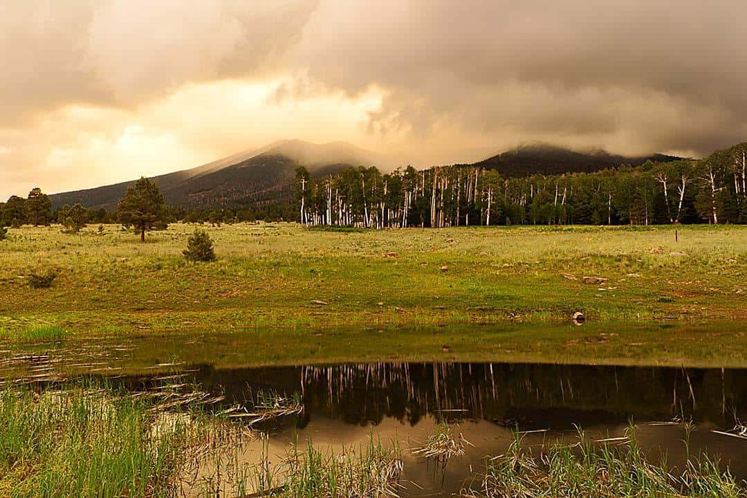
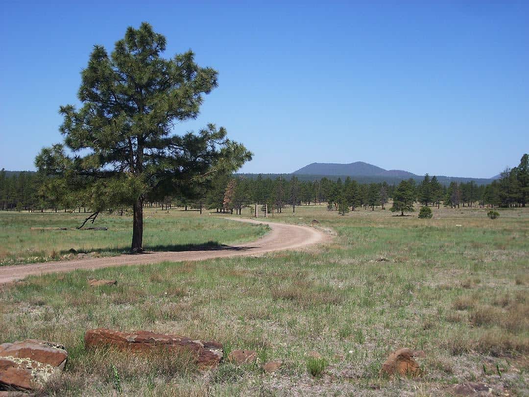
For locals and out-of-town visitors alike, Flagstaff is a hiking wonderland.
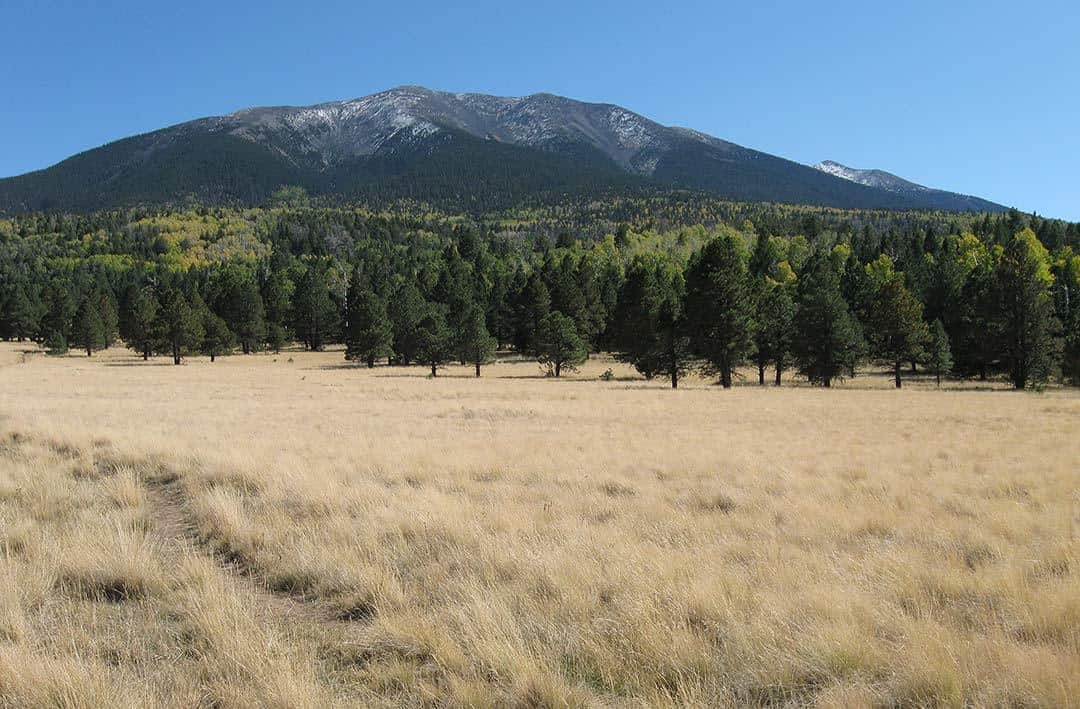
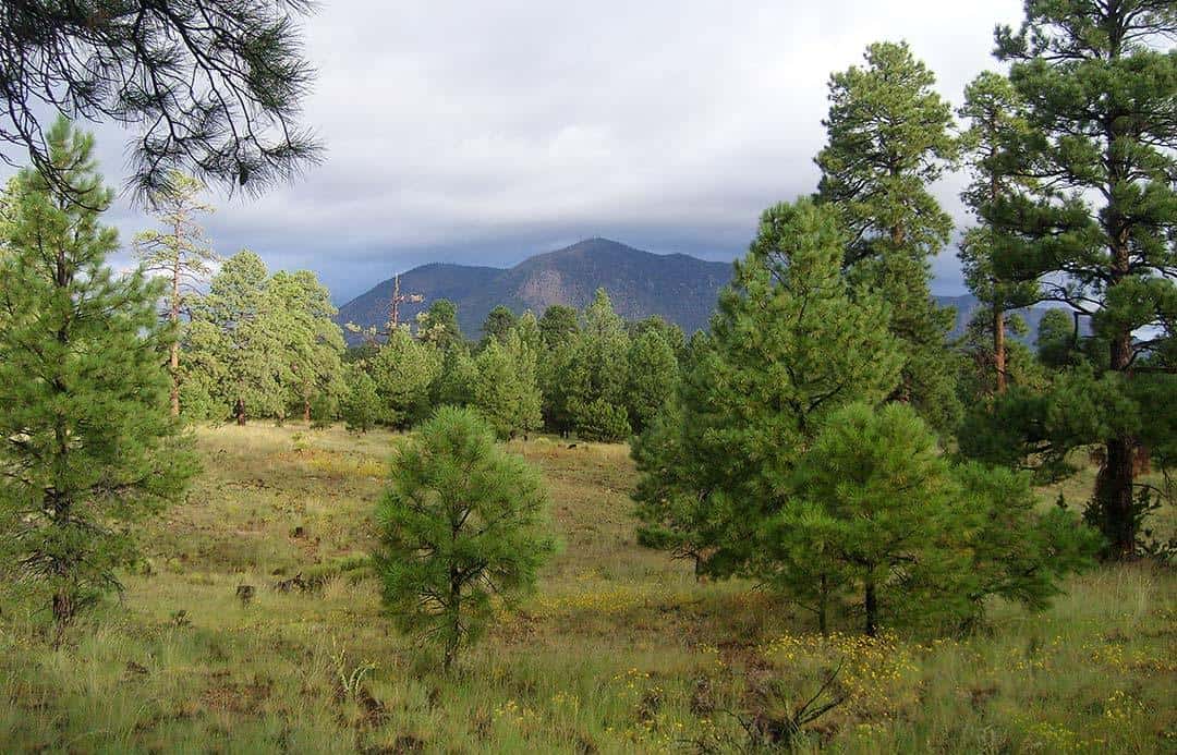
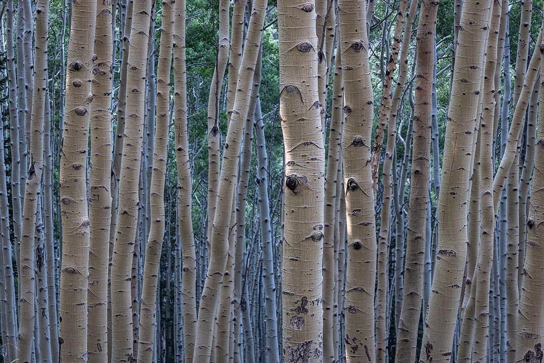
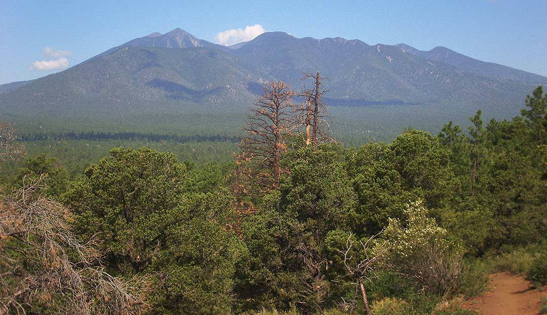
A high altitude region dominated by pine, aspen, and mixed conifer forests, it’s a beloved summertime stomping grounds among Arizona’s adventurers. Desert dwellers escape the heat for the cool of Flagstaff’s hiking trails, while the locals know the summer weather is the #1 reason to live in Flag.
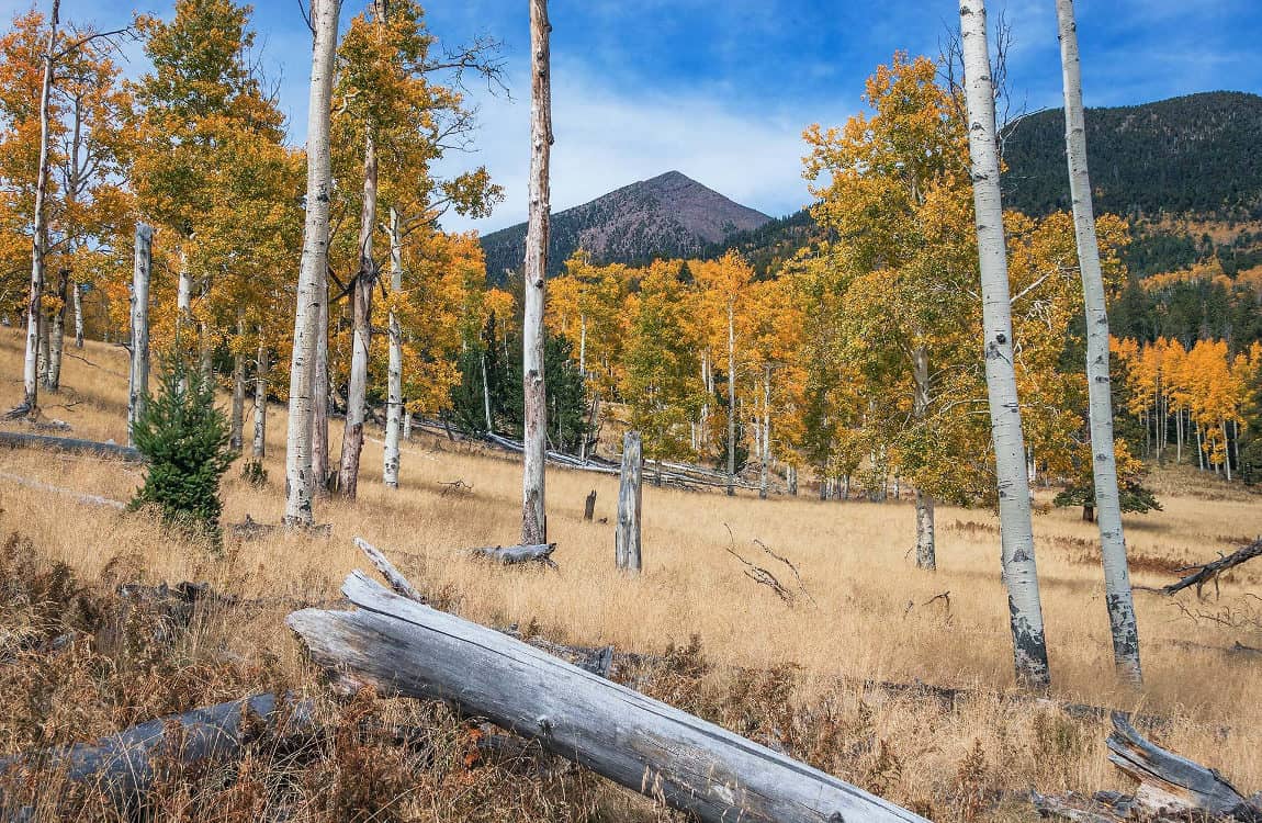
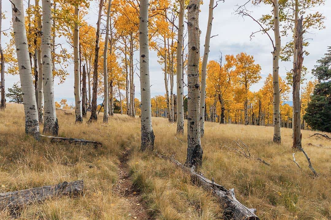
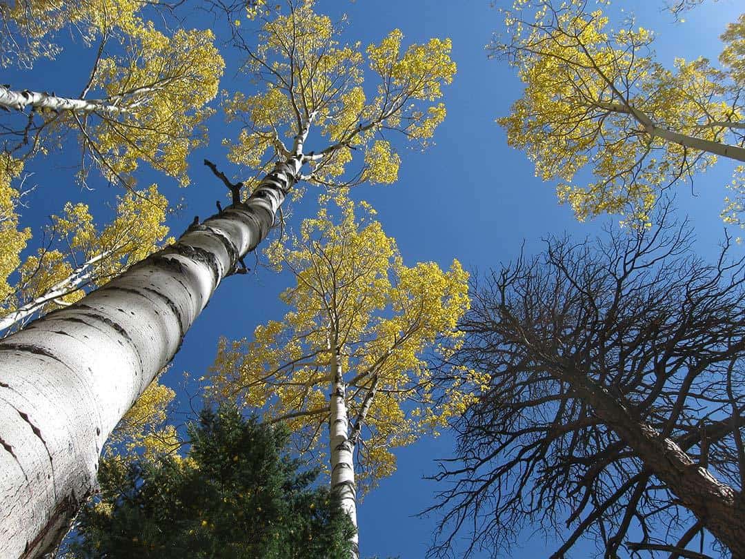
Don’t sleep on autumn either. Hit the primo aspen groves on the San Francisco Peaks, Bill Williams Mountain, or Mount Elden and immerse in a sea of technicolor eye-candy. And for the truly adventurous, Flagstaff’s snowy winters offer up mountaineering and snowshoeing opportunities like nowhere else in the state.
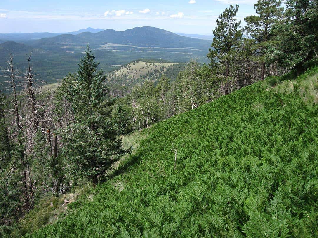
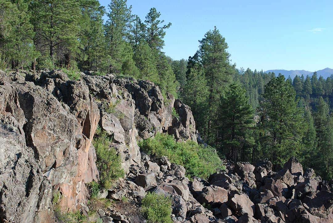
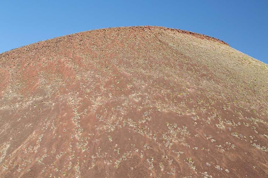
For the curious hiker, Flagstaff’s volcanic landscape is ripe with geology lessons. Known as the San Francisco Volcanic Field, every hill and mountain in the area is an extinct volcano. Each one has a story — with places like the Lava River Cave and Red Mountain surrounding the hiker in geologic wonder.
Before you head out, grab a copy of the Flagstaff Trails Map — its indispensable for navigating many of the selected routes. Unless you’re attacking Humphreys on a winter ascent, it doesn’t take expensive gear to hit the trail here. Just about any backpack will do. Grab some snacks, water, and a comfortable pair of shoes and enjoy yourself — just pack a rain jacket and watch out for those afternoon Monsoon thunderstorms!
Without further ado, a selection of thirty incredible Flagstaff hikes.
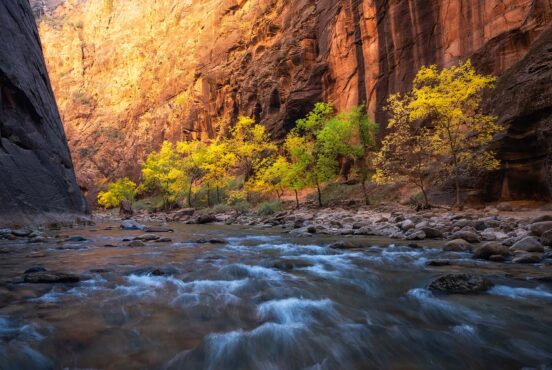
Related Read: 7 Spectacular Places to See Arizona’s Fall Colors
1. Abineau – Bear Jaw Loop
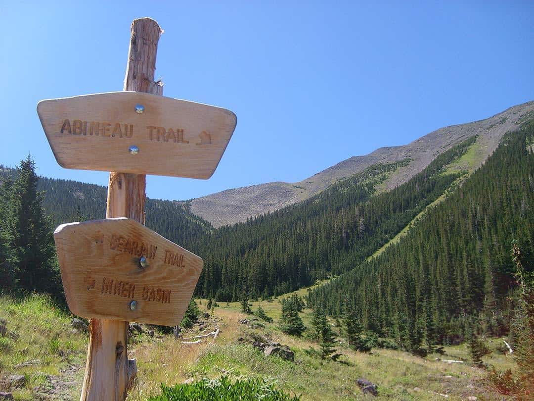
Why you should go: Otherworldly avalanche destruction and grizzly forests.
- Distance: 7 miles
- Elevation Gain: 2,100 feet
- Difficulty: Challenging
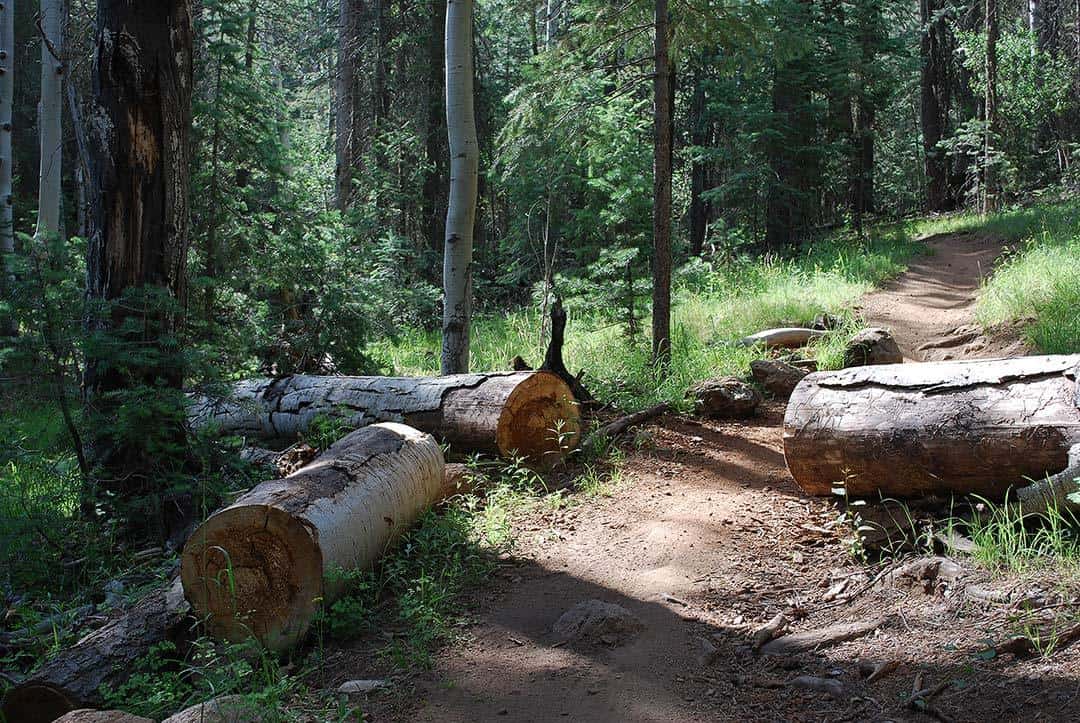
This sub-alpine loop traverses some of the most unique terrain on the San Francisco Peaks. I recommend hiking the loop counter-clockwise as the steep loose soil on Abineau is often tedious to descend. Starting on the Abineau Trail, the trail climbs steadily through mixed conifers and tall, mature aspens. Moss grows copiously here in the endless shade of Humphreys’ north face.
A little under two miles in, the forest engulfing the trailside gives way to a swath of downed trees over 100 feet wide and a half mile long. A massive avalanche ripped through here in 2005, bowling over the forest in a way not seen anywhere else in Arizona. The damage remains and it is still a sight to see.
From the Abineau Trail’s upper terminus, sweet views abound: views up into Humphrey’s avalanche chutes and distant desert vistas north toward Grand Canyon. Continue down the Waterline Road through photogenic aspen groves (a prime stretch of trail in autumn), and hang a left on the Bear Jaw Trail to return to the car. One of my favorite aspen groves on the mountain lies along the upper reaches of Bear Jaw.
Additional Info: Abineau – Bear Jaw Loop
2. Aspen Corner to Alfa Fia Tank
Why you should go: Short walk to a pond with photogenic views.
- Distance: 1 mile
- Elevation Gain: 150 Feet
- Difficulty: Easy
Aspen Corner is pretty self-explanatory. It’s a tight corner on Snow Bowl Road where there’s a metric crap-ton of aspen trees. In the fall, it’s an unbelievably popular spot to park while leaf-peeping. I recommend visiting in summer when crowds are much lighter. From the parking area along the fence, an unmaintained but well-used social trail takes off into the forest and heads downhill, soon opening up to the broad meadow of Hart Prairie.
Just before the meadow opens, the Arizona Trail passes by, making Aspen Corner a great access point to the State’s longest trail. Dramatic views open while descending the meadow. Glance over your shoulder and you’ll see the powerful silhouettes of Humphreys and Agassiz Peaks towering over a bank of tall aspens. You’ll soon reach Alfa Fia Tank, and old cattle pond dug deep enough to almost always hold water. A reflecting pool with mountain views as the backdrop — this is a photogenic spot indeed.
But don’t sleep on the views west either. The whole western end of the San Francisco Volcanic Field is visible, dotted with cinder cones plus the hulking domes of Kendrick, Sitgreaves, and Bill Williams Mountains. If you’re looking for an easy hike to some the finest scenery on the Peaks, Alfa Fia Tank is a perfect destination.
Additional Info: Aspen Corner to Alfa Fia Tank
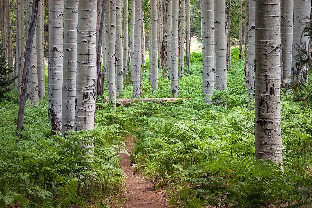
3. Aspen Nature Trail
Why you should go: Easy forest walk with “choose your adventure” options.
- Distance: 1.5 miles
- Elevation Gain: 270 Feet
- Difficulty: Easy
While the Humphreys Summit Trail garners most of the attention, the Aspen Nature Trail nondescriptly leaves from the same trailhead. Even on a busy summer Saturday, only a handful of folks take this trail less traveled while hundreds flock up Humphreys. Rambling back and forth between aspen and conifers, this is a great little loop if you want a short but pretty hike up on the mountain.
However, my favorite way to use this hike is as an access point for the Arizona Trail. The San Francisco Peaks section of the AZT connects at the lower end of the loop. This will double the mileage of what’s listed above but is well worth it if you have time.
Turn right on AZT and walk north for two-thirds of a mile to one of the finest aspen groves around. The ground is occasionally littered with large volcanic boulders, a perfect place to eat lunch or sit and listen to the quaking of aspen leaves. Catch it in the fall as this little wonder is to die for.
Additional Info: Aspen Loop Trail
4. Bill Williams Mountain Trail
Why you should go: Unique views atop a 6 million-year-old volcano.
- Distance: 7.7 miles
- Elevation Gain: 2,500 Feet
- Difficulty: Challenging
Watching stoically over the small town of Williams, the burg’s namesake Bill Williams Mountain is the oldest of the extinct volcanoes in the Flagstaff area. Six million years ago, hot lava bubbled out of the earth in massive quantities, piling up over 2,000 feet high.
In 1849, a mountain man and guide named Bill Williams was killed in a Ute ambush and buried nearby. Nowadays, Williams is the gateway to the Grand Canyon, and this mountain is a great place for a summer or fall hike.
The Bill Williams Mountain Trail climbs the mountain’s north slope, initially traversing pine, juniper, and oak forest before taking a switchbacking ascent through aspen and mixed conifer. In the upper reaches of a high ravine, some of the tallest aspens and Douglas fir imaginable tower overhead. The trail eventually connects to FR 111, leading to the summit after about a half mile.
The views from the top are some of the best in Northern Arizona. To the north and east, the cinder cones and pine forests of the San Francisco Volcanic Field spread out across the high country. To the south and east, the bottom drops out of the plateau into the Sycamore Canyon Wilderness and red rocks of Sedona. Top off your trip with a climb up the operational fire lookout tower.
Additional Info: Bill Williams Trail
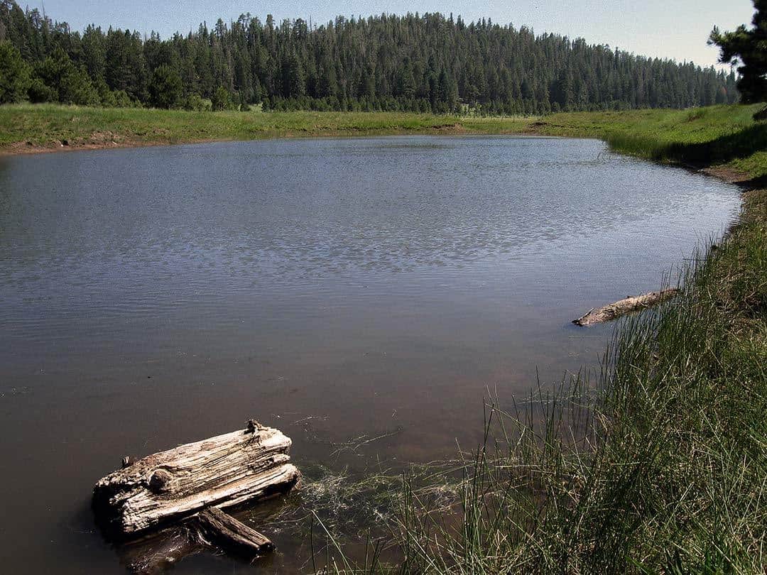
5. Bismarck Lake Trail
Why you should go: Mellow hike to an ephemeral pond and further exploration.
- Distance: 2 miles
- Elevation Gain: 200 Feet
- Difficulty: Easy
Hart Prairie Road (FR 151) is one of the grand scenic drives on the San Francisco Peaks. This narrow dirt road crosses some gorgeous stretches of forest and meadow on the mountain’s west flank. Endless hiking options abound around here, most involve both setting out off-trail and at some crossing private property. As such, the Bismarck Lake Trail is Hart Prairie’s lone easy and legal on-trail hike, and it’s a good one at that.
Bismarck Lake isn’t really a lake. It’s a cattle tank (a man-made pond) and is often more of a mudpit than anything. But stay with me here, because this hike isn’t really about the “lake” — although it’s pretty cool if you catch it full of water during a wet year!
Like most area hikes, this is simply about getting out into the forest and enjoying the scenery. During the 1-mile trek up the trail, you’ll find numerous openings in the woods to gawk in awe at Humphreys Peak to the east.
If you can budget time and energy to go past Bismarck Lake, there’s access to the Arizona Trail about a quarter mile east, and hanging a right on AZT here eventually leads to more sweet meadows and some nice aspen groves as well. Adding an extra mile or two of further exploration can go a long way around these parts.
Additional Info: Bismarck Lake Trail
6. Buffalo Park
Why you should go: Convenient in-town nature-fix, awesome kitschy buffalo statue.
- Distance: 2 miles
- Elevation Gain: 85 Feet
- Difficulty: Easy
In 1964, Buffalo Park opened as a wildlife zoo and Wild West attraction atop Flagstaff’s Switzer Mesa. Buffalo, elk, antelope, and deer called the park home for 5 years until the park went bankrupt. In 1973, the city of Flagstaff reopened the park as a 2-mile loop trail for use by hikers, runners, and bicyclists.
Officially named the Nate Avery Trail, this loop is a wide, mellow, and well-graded gravel path leading around the park’s native grasslands. Conveniently located smack in the middle of Flag, this is an ever-popular recreation area for the town’s exercise enthusiasts. Some will call it more of a walk than a hike, yet the humbling views of Mount Elden and the San Francisco Peaks make it feel special.
For those looking for a full-body workout to go with their stroll, exercise stations with instructions are placed every few hundred yards to practice your chin-ups and other aerobic movements. Don’t leave the park without paying respects to the odd but iconic buffalo statue at the front entrance — it’s a must-see.
If you want a hike in the area but out away from the crowds, an express trail bisects the main loop for quick to access the Oldham Trail. Oldham is a moderate trail through the dense forest below Mount Elden and the Dry Lake Hills.
Additional Info: Nate Avery Trail
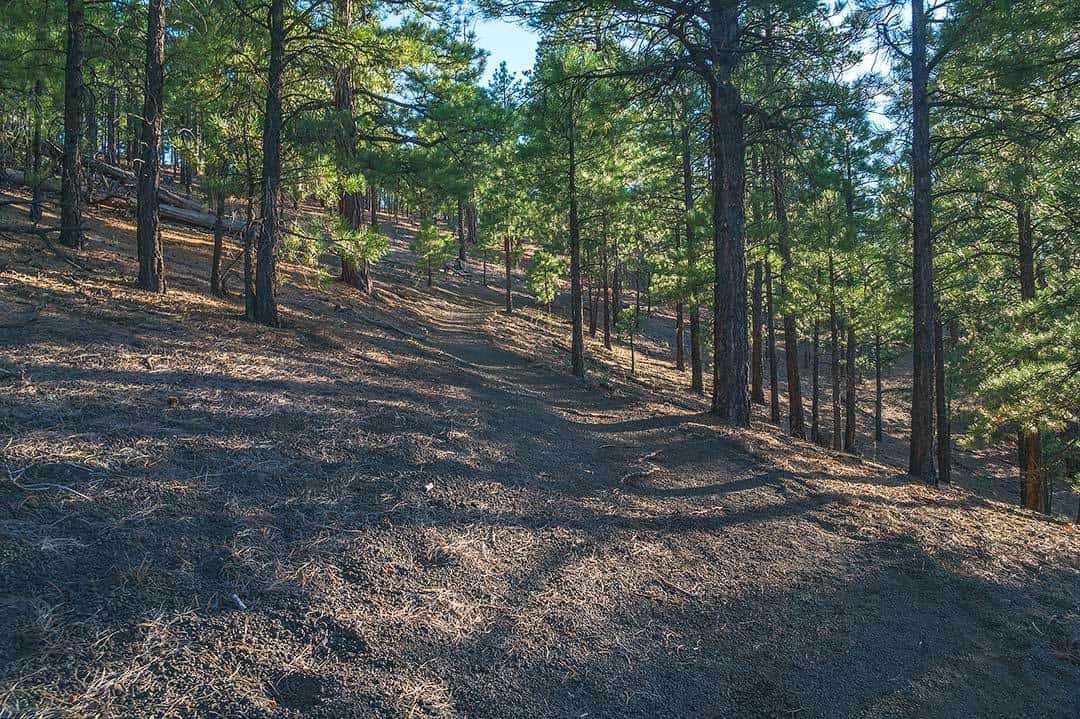
7. Campbell Mesa Trails
Why you should go: Old growth Ponderosas, numerous loop options.
- Distance: 11.3 miles
- Elevation Gain: 150 Feet
- Difficulty: Easy
As a whole, the Campbell Mesa Trail system has over 11 miles of trail, but you probably won’t go that far. As a “multi-loop” trail, it’s made of 5 interconnecting loops: Sinagua Loop, Continental Loop, Walnut Meadows Loop, Anasazi Loop, and Campbell Mesa Loop. Their lengths vary greatly: less than a mile (Sinagua) to 5.7 miles (Campbell).
No matter which you choose, each is fairly flat and inevitably winds through long stretches of old-growth Ponderosa forest. If you wanna a little vista on your walk, Continental Loop peeks to the west across town while Walnut Meadows Loop looks south across Walnut Canyon to Anderson Mesa.
If you’re new to hiking and looking to get your feet wet with some laid-back and easy forest hiking, Campbell Mesa is a great place to build your confidence. Just watch out for the occasional mountain biker!
Additional Info: Campbell Mesa Trail System
8. Dry Lake Hills Loop
Why you should go: Awesome “hidden” meadow, Schultz Creek Trail is a wonder.
- Distance: 9 miles
- Elevation Gain: 1,350 Feet
- Difficulty: Moderate
When looking north from downtown Flagstaff, the Dry Lake Hills are the handful of hump-like hills to the left of Mount Elden and in front of the Peaks. While Elden and the Peaks steal most of the local fanfare, the Dry Lake Hills fly under the radar of most hikers.
With lots of trails and numerous access points and trailheads, there are dozens of route options. The one described here is a nice moderate loop circumnavigating the bulk of the hills. Navigation is best done with a recent Flagstaff Trails Map.
From the trailhead at the bottom of Schultz Pass Road, head east on the Rocky Ridge Trail. It’s a pleasant enough trail, but push through it quickly and set your sights ahead. About 3 miles in, Rocky Ridge ends — hop on Elden Lookout Road for a quarter mile and look for the Brookbank Trail to come in on the left.
Brookbank makes a fairly steep ascent up the south face of the hills. Make sure to catch an unnamed and unsigned “social” trail named Little Gnarly on the left as you crest the hilltop. This leads into a meadow perched in an elevated valley with an unexpected cattle pond and plenty of room to explore.
For the return leg of the loop, take Little Gnarly northbound down to Schultz Creek Trail, where a left takes you back to the car. Schultz is a great rolling descent — and beloved by mountain bikers — so watch your back while hiking home through the forested canyon.
Additional Info: Brookbank Trail
9. Elden Lookout Trail
Why you should go: Convenient, hard hike great for training. Sweet views!
- Distance: 5.4 miles
- Elevation Gain: 2,400 Feet
- Difficulty: Challenging
Gaining almost a half-mile in elevation in less than 3 miles, Elden Lookout Trail is so steep, it always seems longer than it actually is. This hike is a beast, yet the super-easy access across from the Flagstaff Mall makes it a popular training hike. If your long-term goal is climbing Humphreys or a Colorado 14er, Elden makes for a convenient place to pound yourself into shape.
Sharing its first mile with the Fat Man’s Loop trail, morning hikes can be downright hot here on the sunbaked east-facing slopes. I recommend the shade of late afternoon on the hottest days of summer. If you’re like me, you’ll be huffing and puffing up this never-ending stone staircase. Each time you stop to catch your breath, turn around to enjoy the increasingly epic views.
A quarter-mile from the summit, the trail crests a high ridgeline, just make sure to go left at the junction with the Sunset Trail. Damage from the 1977 Radio Fire is still evident here, but passing through the young stands of quaking aspen is quite pleasant — they turn electric yellow in late September. The views from the summit are satisfying, but the real reward is the achievement of conquering this behemoth.
Additional Info: Elden Lookout Trail
10. Fatman’s Loop Trail
Why you should go: Test yourself at Fatman’s Gap! A quick, pleasant exercise hike.
- Distance: 2.5 miles
- Elevation Gain: 700 Feet
- Difficulty: Moderate
When you need a quick hike near town that can be done in an hour or less and has the terrain to keep your muscles ready to hike the big mountains, you’ll be hard-pressed to find a better candidate than Fatman’s Loop.
I prefer hiking the loop clockwise, which tackles the steepest stretch (the one that coincides with Elden Lookout Trail) on the uphill. From a training perspective, this offers the best chance for a cardio workout. But if you’re just coming for a leisurely stroll in the woods, maybe you’ll prefer the easier ramble of the counterclockwise direction. Such is the endless debate among Fatman’s Loop aficionados.
Either way, come out and enjoy the always enjoyable juniper, ponderosa, and oak forest. Sliding through Fatmans Gap, a narrow passage between two dacite boulders, is always fun, especially for first timers and kids. No matter how many times I’ve done this hike (surely over 100), I always return to the car in an air of euphoria. It’s surprising such a pleasant and invigorating hike can be so convenient to the city, and take under a hour to complete!
Additional Info: Fatman’s Loop Trail
11. Heart Trail
Why you should go: Solitude along a trailbuilding marvel, great geology underfoot.
- Distance: 8 miles
- Elevation Gain: 1,850 Feet
- Difficulty: Challenging
Let’s get the cheesy joke over with: Heart Trail has a special place in my heart. Yuk, yuk, yuk! But seriously, this a really cool hike, and sees less traffic than any other part of Mount Elden. Climbing the northeast slopes of the mountain, this area bore the brunt of the 1977 Radio Fire, from which the land and forest is still recovering, but has its own charm nonetheless.
To access the Heart Trail, I recommend starting at the Sandy Seep Trailhead off Highway 89A. Take the 1.5-mile Sandy Seep Trail through the juniper and ponderosa forest until its terminus at Little Elden Trail. Hang a right on Little Elden for just a tenth of a mile and Heart Trail comes in on the left.
The trail begins it’s ascent up the increasingly steep flank of Little Elden Mountain. It’s a trail building masterpiece, with elegant switchbacks hugging the curves of the hillside. Geology buffs familiar with the Grand Canyon may recognize the series of sedimentary rock layers laying out in reverse order as you climb. Pick up a copy of John V. Bezy’s book A Guide to the Geology of the Flagstaff Area to find out why.
Reach the top of the ridgeline at Heart Trail’s terminus for a commanding view to the east across a cinder cone dotted landscape. For the 8 mile trip, this is the turnaround point, or bring a trail map and create a longer loop of your choice using Elden’s vast trail system.
Additional Info: Heart Trail
12. Humphreys Summit Trail
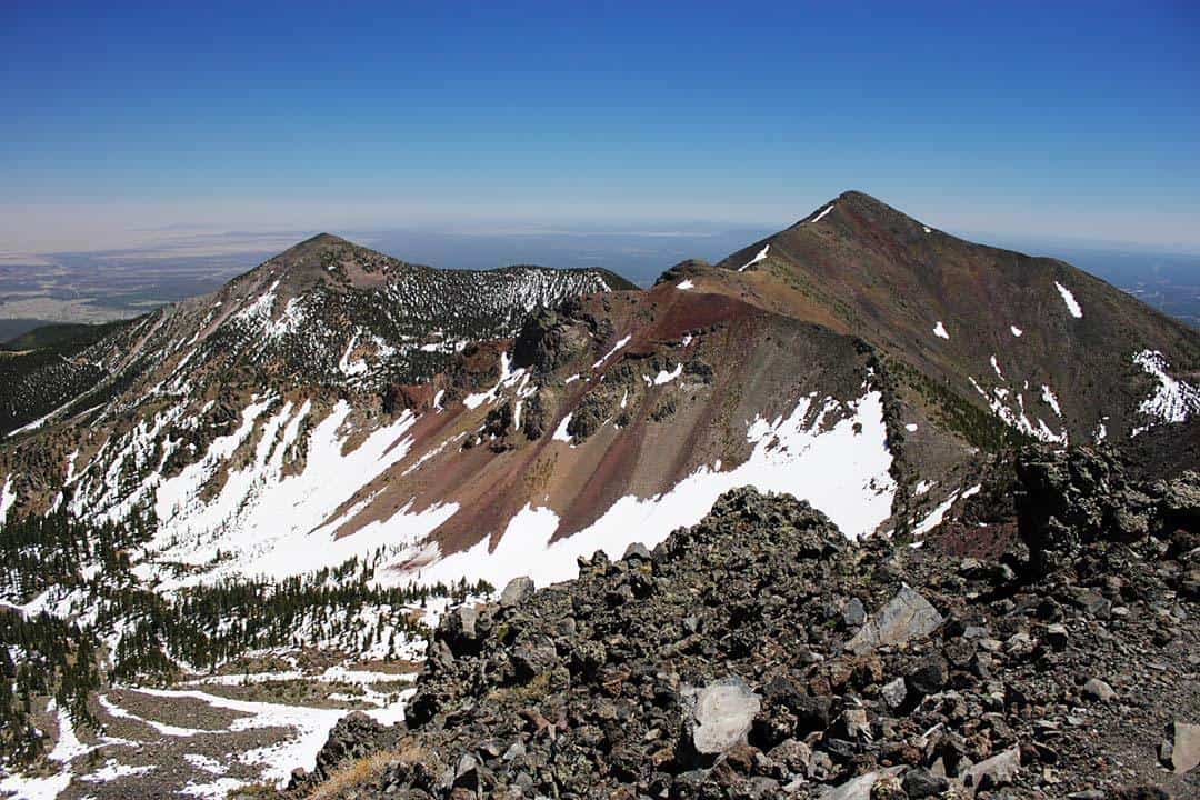
Why you should go: Get to the top of Arizona!
- Distance: 10.3 miles
- Elevation Gain: 3300 Feet
- Difficulty: Challenging
If ya haven’t heard, Humphreys Peak is the highest point in Arizona. Topping out at 12,633 feet above sea level, it’s treeless lid is home to the state’s largest swath of alpine tundra. The climate up here is often cold, usually windy, and definitely extreme. Not to mention the lack of oxygen. Air at 12,000 feet contains about 20% less oxygen than air at 7,000 feet (Flagstaff’s elevation), which makes for increasingly labored hiking as you ascend.
Afternoon downpours and lightning storms are the norm during monsoon season — hikes in July and August should start at sunrise and be off the summit by noon. Snowfall is common as early as September. Winter ascents are possible too (with proper knowledge and gear), and require a free winter backcountry permit.
From the trailhead at Snowbowl’s lower parking lot, the trail initially crosses the high grasses of a ski run. You’ll soon enter a dense mixed conifer forest as the trail makes a series of 7 long switchbacks over 3-and-a half-miles. Occasional views to the west open up as the switchbacks cross a rockstream. Those comfortable with exploring off-trail might consider a side trip to the WWII-era B-24 bomber wreck nearby.
When the trail crests a high saddle, you’re above treeline, and the views are like no other in Arizona. The last mile is rugged, high altitude slog over rocky terrain. The false summits up here are notorious — ignore ‘em and just keep pushing on until you can’t go any higher. When you stand atop the roof of Arizona, the view is to die for, and the feeling of accomplishment unparalleled.
Additional Info: Humphreys Summit Trail
13. Humphreys Via Inner Basin
Why you should go: A longer, more beautiful route to the summit.
- Distance: 14 miles
- Elevation Gain: 4,700 Feet
- Difficulty: Challenging
The longest and most challenging hike on the list is arguably the most spectacular too. While the standard Humphreys hike is a great one, coming up from Inner Basin is prettier, less crowded, and even more epic. Like the standard route, always be prepared for inclement weather and cold temperatures, especially during monsoon season and autumn.
Starting from the Lockett Meadow Trailhead, hike west on the beautiful Inner Basin Trail (detailed in its own section below). After passing through an unbelievable series of aspen groves, you’ll pop out into a meadow with spectacular views of Arizona’s highest peaks. The tallest one on the right is Humphreys, your goal for the day. IB Trail continues another 2 miles before connecting with the Weatherford Trail.
Turn right on Weatherford, and after passing the sweet view at Fremont Saddle (mislabeled on most TOPO maps as Doyle Saddle), continue across the most epic stretch of trail on the San Francisco Peaks. Nothing feels cooler than hiking the “lazy-Z” switchback as it crosses the tundra of Agassiz Peak’s east face. Snowpack often lingers here into May and June, so approach with caution if hiking early in the season.
Weatherford eventually connects to the Humphreys Summit Trail, where you’ll take the familiar 1-mile slog up to the summit. Bring energy food to keep you going because after 7 miles of demanding hiking, it’s easy to run of gas here. Enjoy the summit, but be ready for more abuse because it’s another 7 miles back to the car!
Additional Info: Humphreys via Inner Basin
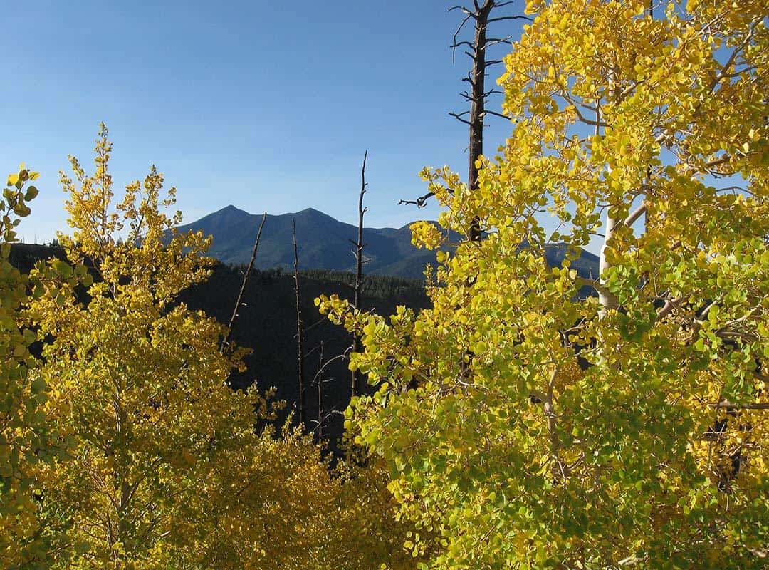
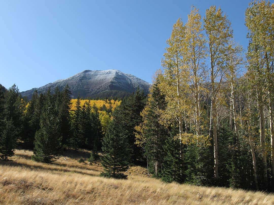
14. Inner Basin Trail
Why you should go: Best aspen groves on the Peaks, Colorado-esque views.
- Distance: 8.4 miles
- Elevation Gain: 2,400 Feet
- Difficulty: Moderate
The Inner Basin is our own little slice of Colorado. Seemingly endless aspen groves and a murderer’s row of tundra-topped alpine peaks are just a couple great reasons to hike here. A road trip to the trailhead alone is a worthwhile excursion — Lockett Meadow is perhaps the most photogenic place on the Peaks.
Access to the basin is via its eponymous trail, which climbs 4.25 miles until its terminus at the Weatherford Trail — the full hike to the trail’s end and back is represented in the stats above. However, most hikers turnaround at a large meadow 2.5 miles in. No matter how far you decide to go, you can’t go wrong in the IB.
The real fun starts about 3/4 of a mile up the trail. Here, the trail enters the most amazing aspen groves on the mountain. For a full mile, the trail winds through prime aspen territory — this is my favorite stretch of trail on the Peaks. After climbing through this incredible aspen grove, the trail pops out onto the Waterline Road and combines with it for a quarter mile or so.
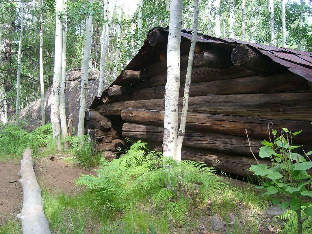
It’s another 3/4 of a mile through an aspen and mixed conifer forest to the famed meadow. It’s the only place in Arizona you can be almost completely surrounded by 11,000 and 12,000-foot peaks. If you get caught in a thunderstorm or cold blast of wind, there’s even a wooden hut for shelter. Turnaround here or continue on with your magical Inner Basin adventure.
Additional Info: Inner Basin Trail
15. Island Trail
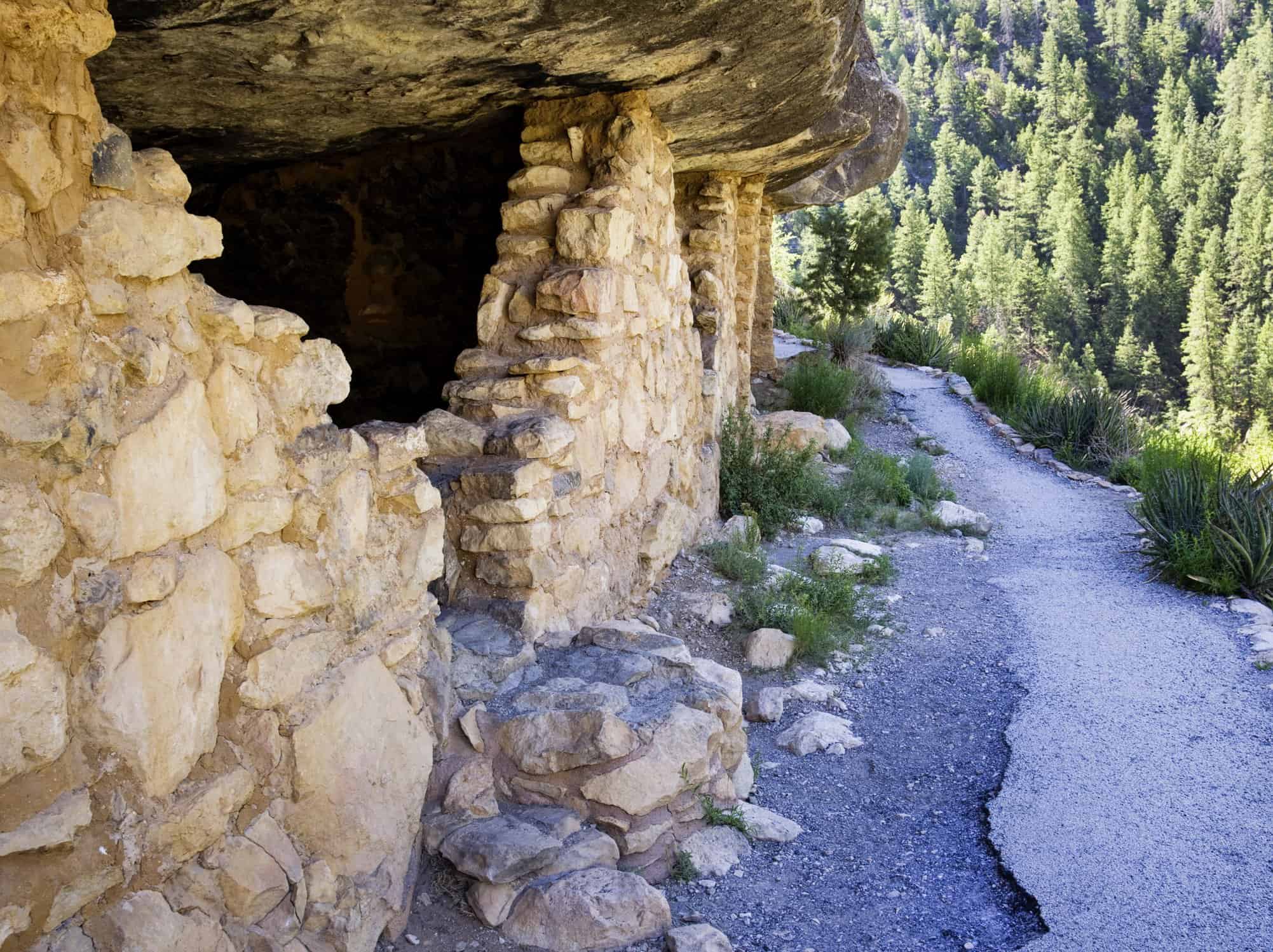
Why you should go: Ancient cliff dwellings at Walnut Canyon.
- Distance: 1 mile
- Elevation Gain: 200 Feet
- Difficulty: Easy
The Sinagua people called Walnut Canyon home over 700 years ago. Living in pueblos built in the cliffs, their lives were hard but they always had a great view! The ruins of these cliff dwellings stand today, preserved by Walnut Canyon National Monument. Pay the entrance fee at the visitor center, take a peek the exhibits, and then experience the peace of the canyon first hand.
The Island Trail is a highly developed trail built of railings, pavement, and modern staircases. Dropping almost 200 feet in a short distance, this is doable for most but may be challenging for some. Named for an “island” of rock formed by the canyon’s entrenched meanders, the trail passes about 25 stone-walled rooms under the island’s limestone overhangs. Also be on the lookout for isolated dwellings tucked in the cliffs and forest across the canyon.
Before you leave the park, also take a quick spin along the Rim Trail — a flat, easy, and handicapped-accessible three-quarter mile loop. It’s got some neat views and passes “mounds” of some clifftop pueblo ruins as well.
Additional Info: Walnut Canyon National Monument
16. Kachina Trail
Why you should go: Aspens and meadows on the Peaks’ southern slopes.
- Distance: 5.7 miles
- Elevation Gain: 750 Feet
- Difficulty: Moderate
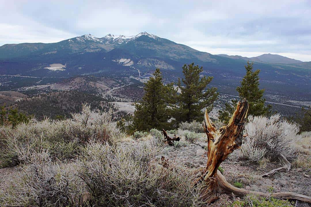
The San Francisco Peaks are sacred to all of the region’s Native Americans, including the Hopi, who believe spiritual deities called Kachinas live on the sacred mountain. In their honor, the mountain’s wilderness area is named the Kachina Peaks Wilderness, and a spectacular hiking trail on the southern slopes bears their name too.
Most folks hike the Kachina Trail as a 5.7-mile shuttle, dropping a car off at the Freidlein Prairie Trailhead, then carpooling up to Snowbowl to begin (this version is represented in the hike stats above). This is a great way to see the whole trail, but the first 3 miles or so are a bit forgettable. The real attraction is a series of sloping meadows and aspen groves along the trail’s lower reaches.
My preference is to start at Freidlein Prairie and make an out-and-back up to the highest meadow, with copious off-trail exploration amid views of Agassiz Peak towering to the north. Basking in the full sun of the south face, the aspens here are among the last to change in autumn and make a great mid-October destination. From the Freidlein Prairie Trailhead to the upper meadow and back, it’s about 5 miles round-trip.
Additional Info: Kachina Trail
17. Kendrick Mountain Trail
Why you should go: Great views from a high mountain west of the Peaks.
- Distance: 9 miles
- Elevation Gain: 2650 Feet
- Difficulty: Challenging
Topping out at over 10,000 feet elevation, Kendrick Peak is the area’s highest mountain outside the San Francisco Peaks. While the peak boasts three individual trails climbing its flanks, it’s eponymous trail is its finest. Gaining a half-mile of elevation over 4.5 miles, it’s not a super-steep trail but climbs steadily up through mixed conifer forest.
Ready for switchbacks? This trail has tons of ‘em! Ready for some awesome terrain? It’s got that too! Just below the summit, a high ridge contains a sweet little meadow lined with fir and spruce. Definitely the most idyllic spot on the mountain, this is a great place to relax and hang out. There’s even an old cabin up here that provides shelter to ride out a summer thunderstorm — I’ve done this myself.
At the summit is helipad and an operational fire lookout tower. Every one of the fire lookout rangers I’ve met up here has been chatty and friendly. The views of the surrounding high country are stupendous, especially looking east toward the Hart Prairie side of the Peaks.
Additional Info: Kendrick Mountain Trail
18. Lava Flow Trail
Why you should go: Easy, educational walk through a rugged lava-scape.
- Distance: 1 mile
- Elevation Gain: 100 Feet
- Difficulty: Easy
The Lava Flow Trail is Sunset Crater Volcano National Monument’s flagship trail. Exploring a rugged but varied section of the Bonito Lava Flow near the base of Sunset Crater, the trail features a self-guided tour of some badass volcanic features. Be sure to pick up a pamphlet at the trailhead and follow along with the numbered trail markers. The first 1/4 mile or so forms a paved, handicapped accessible inner loop. The other 3/4 of a mile of fairly rough trail is carved into sand-like cinders and jagged lava rock.
This black and red volcanic landscape born of fire only came to be a little over 950 years ago — incredibly young as far as geologists are concerned. As such, trees are sparse on the lava flow proper, and it’s fascinating to see the occasional Ponderosa pine heartily sprouting from the basalt. Fascinating rock formations appear at every turn, some with crazy names like “hornitos” and “squeeze-ups.”
While just about anyone interested in the outdoors will enjoy this hike, it’s a must do for the geology nerds out there. It’s a standard field-trip destination for local elementary schools and NAU geology classes, so you know it’s gonna be an educational experience. In addition to the informational pamphlet, the trailside is chock full of interpretive signs, explaining every detail of Sunset Crater’s “recent” eruption.
Additional Info: Lava Flow Trail
19. Lava River Cave
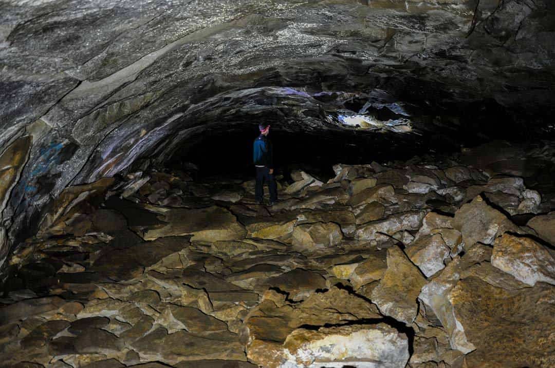
Why you should go: Flagstaff’s classic cave hike, fun for all ages.
- Distance: 1.2 miles
- Elevation Gain: 25 Feet
- Difficulty: Easy
Officially named the Lava River Cave, but more commonly known as the Lava Tubes, this is the most unique hike in the area! Formed 700,000 years ago during a volcanic eruption, the outsides of the lava flow cooled first, allowing the still-molten inner lava to continue flowing to leave behind a lava tube cave over half a mile long.
Yet another go-to field trip spot for elementary schools, this is one of the coolest geologic features around. Just be sure to bring extra flashlights or headlamps — God forbid you drop and break your only light source at the back of a long, pitch-black cave. Not only is it dark as hell in there, it’s also kinda cold. Interior temperatures typically range from 40–48 degrees Fahrenheit, so bring a jacket, even on the hottest summer days.
Entering the cave requires climbing down through a rough section of jagged rock. Then it’s pretty smooth sailing most of the way, although the tube does split in two at one point only to rejoin a few hundred yards later. The left fork is easier while the right fork contains a super-low ceiling only 3 feet high, making it easy to bonk your head if you don’t have a helmet. Either way, you can’t get lost as the tube has only one way in and out.
Additional Info: Lava River Cave
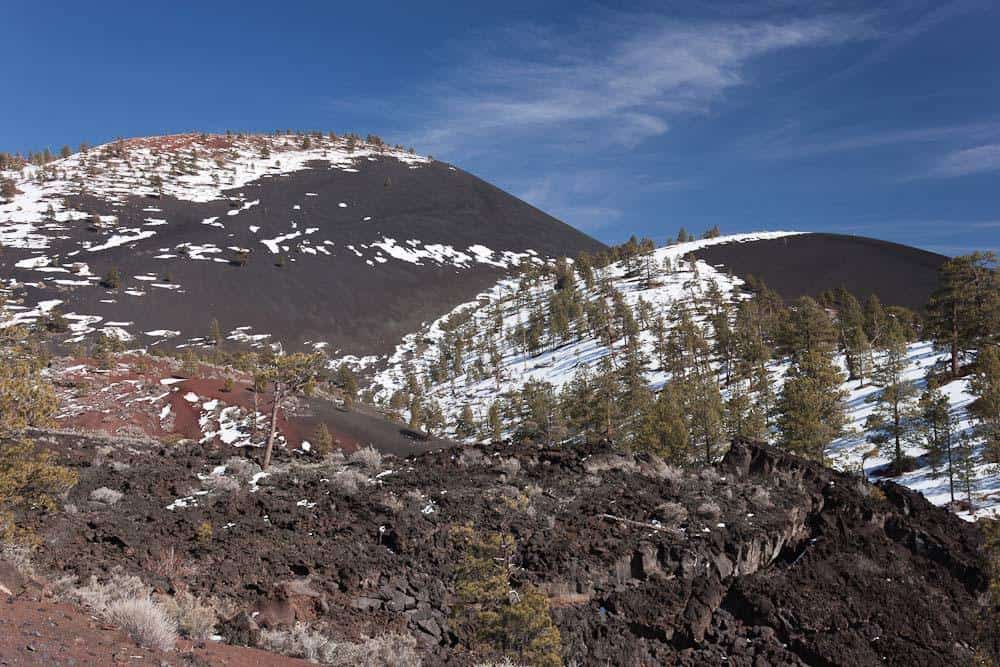
20. Lenox Crater Trail
Why you should go: The easiest way around to climb a cinder cone volcano.
- Distance: 1.2 mile
- Elevation Gain: 300 Feet
- Difficulty: Easy
While it’s illegal to hike to the top of Sunset Crater, nearby Lenox Crater gives park visitors the opportunity to explore a small cinder cone volcano. Once upon a time, the trail here shot straight up the steep-sided cinder slopes — making for an unpleasantly steep trail and excessive impact to the landscape. Recently the trail was redesigned and rerouted as a moderate-grade loop. The new trail is not only more sustainable for the environment, it explores more of the mountain to make for a much more interesting hike.
I recommend hiking the trail counter-clockwise. Climbing initially through Ponderosa pine forest, the trail eventually turns left as it crests the loosely defined crater rim. The trees fall away and a field of dark cinders opens up in the crater’s depression. Continue up to the Lenox Crater summit to find open views of the San Francisco Peaks to the west. Interpretive signs provided by NPS explain more about this otherworldly landscape.
As you descend the other leg of the loop, consider extending your hike further as the trail interconnects with all of the other park trails, including the Lava Flow Trail, A’a Trail, Lava’s Edge Trail, and Bonito Vista Trail.
Additional Info: Lenox Crater Trail
21. O’Leary Peak Trail
Why you should go: Long but mellow walk to an uncrowded summit.
- Distance: 9.7 miles
- Elevation Gain: 2,000 Feet
- Difficulty: Moderate
This trail is really a walk up a dirt road accessing the fire lookout atop O’Leary Peak. Of course, the road is closed to public traffic, so you don’t have to worry about motorized traffic. Well-graded, the road is long but climbs at only a moderate incline. Located on the sunny south-facing side of the peak — and in the “rain shadow” of the San Francisco Peaks — this hike is often among the first in the area to clear of snow, but also gets pretty toasty on summer days.
The hike begins near the O’Leary Group Campground at a small, paved trailhead. The first mile is fairly flat as the road skirts the edge of the rugged Bonito Lava Flow. When the road finally begins its ascent, the moderate grade goes on relentlessly for nearly 4 miles before reaching the summit and the fire lookout. Views through the climb are open to the south and look across a sea of cinder cones and forest.
While the road walking can get tedious, the views at the top worth it. Climb up the lookout tower for a fine 360-degree panorama with the San Francisco Peaks towering to the west, plus a look northeast to the Painted Desert. If there’s a ranger working the tower, they’re usually friendly and willing to chat too.
Additional Info: O’Leary Peak Trail
22. Old Caves Crater Trail
Why you should go: An easy summit with ancient Sinaguan caves.
- Distance: 2.4 miles
- Elevation Gain: 500 Feet
- Difficulty: Easy
Also commonly known as Cave Hill, this is the go-to neighborhood hike for the Doney Park area. Most folks hike from the main trailhead on Silver Saddle Road, with the stats above indicating a hike from the main trailhead to the summit and back the same way. This is indeed a great way to get a little exercise, enjoy some fine stretches of pine forest, and enjoy the views from the top. Avid hikers will find this hike short and easy, while novice hikers getting in shape might feel challenged by the moderately steep inclines.
Of course, there are other options too. First off, there’s a second (less popular) trailhead on the hill’s north side. Similar in length and difficulty, a 2.5-mile summit hike from the Landfill Road Trailhead is possible. No matter which trailhead you start from, a 3.5-mile loop trail circumnavigates Cave Hill’s base — allowing for numerous options of varying lengths.
As for the caves — there’s about a dozen of them up top, and they’re ruins from the ancient Sinagua civilization. Over 800 years ago, Old Caves Crater was home to a thriving mountaintop apartment complex. Bring a flashlight and explore ‘em, just take care as it’s not hard to take a spill or bash a body part in the dark, and the sharp lava rock is unforgiving.
Additional Info: Old Caves Crater Trail
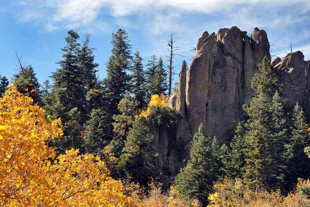
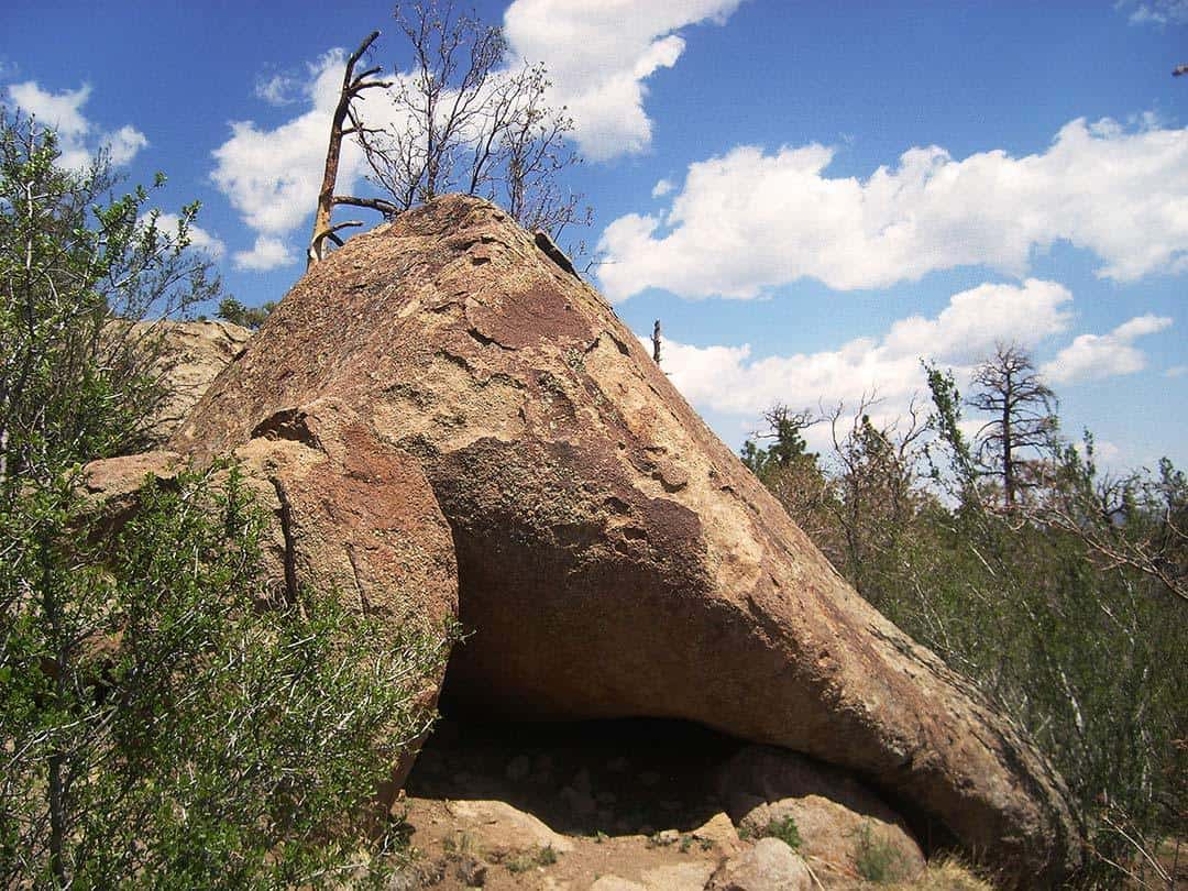
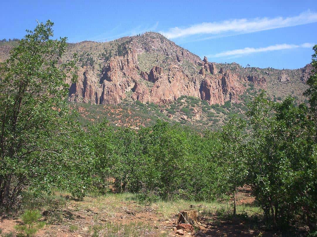
23. Red Mountain Trail
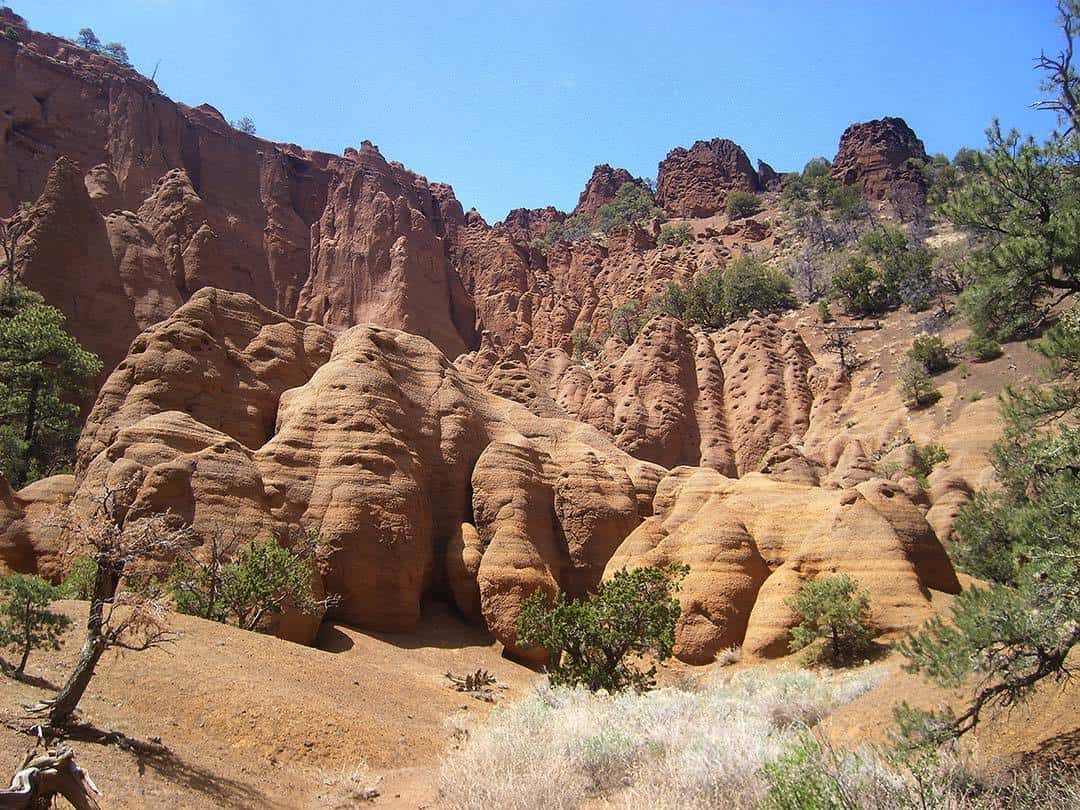
Why you should go: Sneaky-amazing natural amphitheater of volcanic hoodoos.
- Distance: 3.2 miles
- Elevation Gain: 350 Feet
- Difficulty: Easy
Red Mountain is somewhat of a hidden gem. It’s hoodoos, sculptured cliff faces, and intimate amphitheater are reminiscent of Bryce Canyon or Cedar Breaks up in Utah. And yet Red Mountain’s not a State Park or National Monument, so it’s easily overlooked as most hikers choose trails closer to town or blow right by on the way to the Big Ditch. In my experience, seeing three or more cars at the trailhead is common only on the busiest of Saturdays.
It’s lonely trail tramps through a sun-baked stretch of pinyon-juniper woodlands before dropping into the bottom of a sandy wash. Said wash drains from the mountain’s inner amphitheater. At one point, a short ladder ascends an old dam now clogged with sediment. The trail then passes through a gateway guarded by steep cinder slopes on both sides. You’ll soon enter the wondrous amphitheater filled with sepia-colored volcanic hoodoos and tafoni textured walls. Towering above is a hole-ridden band of cliffs appearing to hang past verticality.
There’s copious room for exploration in the nooks and crannies of this rock playground. Just be careful of the rock’s brittle nature. Breakage is almost inevitable, which can lead to injured hikers and destruction of this unique landscape. This place is one-of-kind, formed from a volcanic eruption dramatically altered by strong winds over 700,000 years ago.
Additional Info: Red Mountain Trail
24. Sandy’s Canyon to Fisher Point
Why you should go: A chill stroll through a valley to sandstone cliffs.
- Distance: 6.3 miles
- Elevation Gain: 730 Feet
- Difficulty: Moderate
Flagstaff’s classic canyon hike. It’s pretty mellow for the most part, with a couple sections of steep trail near the trailhead and on the climb up to Fisher Point. The hike initially takes the Sandy’s Canyon Trail as it drops through an oak-filled ravine before following the relatively flat bottom of its namesake gulch. After a mile or so, Sandy’s Canyon Trail ends at a junction with the Arizona Trail, but you’ll continue northbound on the AZT as it continues through the canyon bottom.
Another a mile of pleasant if not a bit mundane hiking reaches the beginning of Walnut Canyon below Fisher Point. This is the highlight of the hike for many as the forested slopes shift to textured Coconino Sandstone cliffs. Some folks turn back here, but I recommend continuing another mile and 400 feet of elevation to the top of Fisher Point. It’s a cool view overlooking the forested canyons to the south and makes a natural place to eat your lunch.
You also have the option of exploring into Walnut Canyon from the base of the point, and a decent social trail leads down canyon. There’s not anything extraordinary down there, but it’s a neat walk below the tan-gray sandstone walls of forested terraces. It’s reasonable to explore about a mile down canyon before turning back, adding two relatively flat miles to your excursion.
Additional Info: Sandy’s Canyon Trail
25. Slate Mountain Trail
Why you should go: Cool geology and sweet views in solitude.
- Distance: 4.5 miles
- Elevation Gain: 850 Feet
- Difficulty: Moderate
First things first, Slate Mountain is not actually made of slate. This ancient volcano blasted up through the Grand Canyon-series sedimentary rocks below, unearthing brittle slabs of shale, mudstone, and limestone. Geology buffs will love the rocks underfoot while sightseers will love the views from the top. Like the nearby Red Mountain, this trail sees little traffic. A Slate Mountain summit bid almost guarantees a view in solitude.
On the northwestern edge of San Francisco Volcanic Field, the forest out here is almost exclusively pinyon-juniper woodlands. The trail takes its time looping up and around. It’s not too steep, but you’ll work up a sweat. This south-facing hike gets full sun most of the day, so bring the sunblock. Views directly south to Kendrick Peak dominate the trailside.
At the summit is a lovely panorama. At an elevation of 8,215 feet — Slate is 2,000 feet shorter than Kendrick and 4,000 feet shorter than Humphreys. So the draw is not that it’s a high summit, but that it provides great views of the neighboring high summits. Whip around 180 degrees and spy views out to Grand Canyon as well. While lacking the allure of quaking aspens or fir-spruce forests, Slate Mountain is among the most underrated trails in the area.
Additional Info: Slate Mountain Trail
26. SP Crater
Why you should go: A challenging and epic off-trail cinder cone adventure.
- Distance: 1.6 miles
- Elevation Gain: 800 Feet
- Difficulty: Challenging
The second youngest volcano in the area, SP Crater spewed lava only a few thousand years ago. A large black lava flow protrudes for a few miles from the cone’s base. The lack of trees here on the parched north-edge of the volcanic field makes the flow quite obvious. As for the name: cowboys traveling the region during frontier times thought the volcano looked like a leaky toilet — the lava flow imagined as a stream of excrement. They coined its name Shit Pot Crater. When it came time to print maps, cartographers shortened the name to SP for obvious reasons.
You know it’s steep when a hike is described as challenging but only clocks in at 1.6 miles. Climbing 800 feet over eight-tenths of a mile, this is an off-trail slog straight up the side of a cinder cone. And it’s more like climbing 1200 feet — it’s two-steps-forward one-step-back as your feet slide backward in the loose cinders. The climb’s a beast, but standing on that crater rim is like no other summit. It’s the closest experience to climbing the off-limits Sunset Crater rim, and peers into an equally impressive volcanic crater.
Enjoy the views and the relatively fresh volcanic landscape. Volcanic bombs — lava chunks cooled while mid-flight into shapes roughly like footballs — dot the crater rim. The cone’s associate flow snakes like a deformed shadow to the north. The ever-present silhouette of the San Francisco Peaks dominates the northern horizon. SP Crater is a stark landscape, but the beauty found within the lava rocks, cinder slopes, and grasslands makes it one-of-a-kind.
Additional Info: SP Crater Hike
27. Sunset Trail
Why you should go: The longer and more varied route to Elden’s summit.
- Distance: 10.3 miles
- Elevation Gain: 2,250 Feet
- Difficulty: Challenging
Climb Mount Elden the long way! This route climbs almost as much elevation but does so in twice the distance. The Sunset Trail starts at Schultz Pass and gradually climbs the mountain’s much more moist north-west slopes. Aspen, Douglas fir, spruce, and old growth Ponderosa pine line the trail. At about 1.8 miles in, a meadow opens just below the crest of a hill, giving a peek of the San Francisco Peaks through the treetops.
After dropping in and out of a steep ravine, the trail pops up on the elongated ridge between Little Elden and Mount Elden. The land falls off dramatically on both sides of the trail here. Called the catwalk, it’s a breathtaking two-mile stroll with ever-present views facilitated by the lasting destruction of the 1977 Radio Fire. Quaking aspen are regenerating in the places at the trailside, and some small stands of Ponderosa survived the blaze, but otherwise the comeback is slow.
About 5 miles in, the Sunset Trail joins the Elden Lookout Trail, and it’s only another quarter mile to the summit. While it’s not nearly as calf-busting and lung-taxing as the Lookout Trail, the Sunset is an epic hike that’ll change the way you think about hiking Elden.
Additional Info: Sunset Trail
28. Veit Springs Trail
Why you should go: Easy walk through the forest to an old homestead.
- Distance: 1.5 miles
- Elevation Gain: 100 Feet
- Difficulty: Easy
An idyllic stroll with easy access via Snow Bowl Road. The Veit Springs Trail (Lamar Haines Loop) is a laid-back loop through a dense stretch of aspen and mixed conifer forest. On the far end of the loop, the trail passes the ruins of a frontier homestead with access to a boulder playground. Pictographs are seen under a rock overhang, although their origin is likely modern.
June, July, and August are my preferred times to hike here — the small trailhead parking lot is perpetually full during fall colors. Aspens are lovely when green too, and the small, grassy meadows near the homestead make for a prime picnicking spot.
Hikers looking to try out a few short and easy trails in a single day should consider hitting this in conjunction with Aspen Corner and the Aspen Nature Trail just up the road. I’ve hiked here on a variety of occasions — including a walk with my 88-year-old grandma and as a sixth-grader on a field trip — so you know it’s a great trail for non-hikers looking for a taste of the forest.
Additional Info: Veit Springs Trail aka Lamar Haines Loop
29. Weatherford Trail
Why you should go: The Peaks’ premier epic hike.
- Distance: 21 miles
- Elevation Gain: 4,500 Feet
- Difficulty: Challenging
Truth be told, most Weatherford Trail hikers don’t do the whole trail. It’s got lots natural turnaround points — you can even go as little as 2 miles up the trail into the quaint aspen groves of Weatherford Canyon. But if you wish to experience all the wonder Weatherford has to offer, biting off a big chunk of the trail is a must. If you’re willing to haul in a lot of water, it’s the best trail on the mountain for overnighting as well.
The trail is actually an old road, built by local entrepreneur John Weatherford, and opened as a toll road in 1926. Once upon a time, folks drove Ford Model T automobiles up what Weatherford named the San Francisco Mountain Boulevard. Beginning on the mountain’s southern slopes, the climbs through Ponderosa, aspen, Engelmann spruce, Douglas fir, and limber pine forests. At Doyle Saddle — 6 miles in and serving as both a great day hike or backpacking destination — awesome views open into the Inner Basin.
Now traversing the upper reaches of the Inner Basin’s north faces, the next few miles of trail is the most epic on the Peaks. This rollercoaster stretch of high trail hovers between 11,000 and 12,000 feet elevation. It tags Fremont Saddle — a windy mountain pass — before switchbacking across the north face of Agassiz Peak. The trail terminates at the Humphreys Summit Trail (continue another rugged mile to the Arizona highpoint). The very ambitious will hike a long loop utilizing Weatherford, Humphreys Summit, and Kachina Trails. No matter what itinerary you choose, Weatherford is perhaps the most special trail on the mountain.
Additional Info: Weatherford Trail
30. Wupatki National Monument Trails
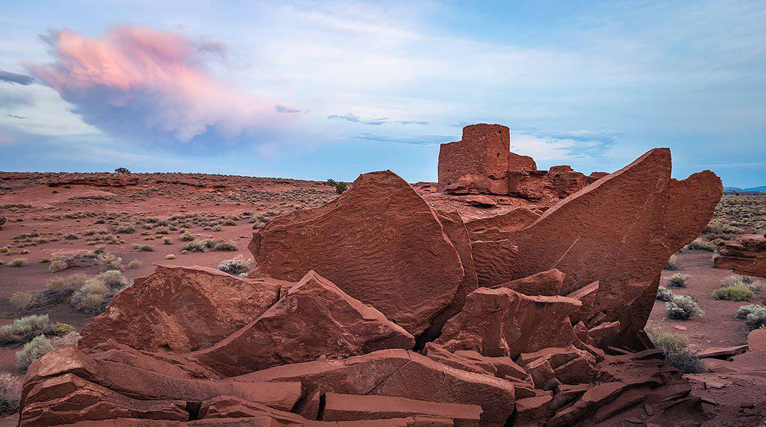
Why you should go: Flag’s most impressive collection of ancient ruins.
- Distance: 1.6 miles
- Elevation Gain: 270 Feet
- Difficulty: Easy
The largest local collection of Ancient Puebloan ruins, Wupatki National Monument’s most interesting areas include Wupatki, Lomaki, and Wukoki Pueblos. It’ll take 3 different stops to visit these ruins, plus another short bonus hike not reflected in the stats above: the Doney Mountain Trail (1 mile and 200 feet of elevation gain). Hiking the Wupatki Ruin Trail requires a park fee, so if you have a full day to explore and want bang for your buck, your fee is also good at nearby Sunset Crater Volcano National Monument.
Over 700 years ago, the Wupatki area thrived with activity, especially following the eruption of Sunset Crater to the south. Fresh layers of volcanic ash and cinders blanketed the grasslands, bolstering the fertility of the land for agriculture. Wupatki — meaning “tall house” in the Hopi language— is the largest pueblo in the area and the park’s centerpiece.
Replete with a self-guided tour, a paved trail loops around an impressive multiple-story sandstone ruin. Unique features abound at the ruins, like the “blow hole” and an ancient ball court. If you’re lucky, along the way you’ll meet a park ranger from whom you can get all the insider info.
My personal favorites, however, are Wukoki and Lomaki Pueblos. They’re smaller, more intimate, less developed, less busy, and more photogenic — albeit less educational. Wukoki is by far the best place in the park to enjoy the sunset, while Lomaki’s sunrise game is on-point with views of the San Francisco Peaks to the northwest.
Additional Info: Wupatki National Monument
Explore More of Northern Arizona
Sign up for our free email to join thousands of readers getting epic travel, hiking, camping and gear ideas every week.