Grab your hiking boots, trusty water bottle, and sense of adventure – it’s time to take a hike on my home turf, the beautiful Badger State.
There’s nothing better than a healthy dose of fresh air. No matter the weather, my fellow Wisconsonites and I appreciate nothing more than a hearty walk outside (and maybe a nice cold beer). But as a state that’s primarily known for its rolling farmlands and lack of mountains, it may come as a surprise that there are actually some pretty incredible hikes to be discovered.
There’s tons to do in Wisconsin, but with over 3,000 miles of hiking trails across the state, it’s a paradise for nature lovers. In the north, you’ll find hiking trails that lead to magnificent waterfalls or along the shorelines of a nationally protected archipelago. And in the south, there are epic trails that lead up towering bluffs and meander through the lush river valleys of the Driftless Area.
As a hiking buff, I’ve made it my mission to cross off as many of Wisconsin’s best hiking trails as possible. And now you can too, with this list of the best and most unique hikes across America’s Dairyland.
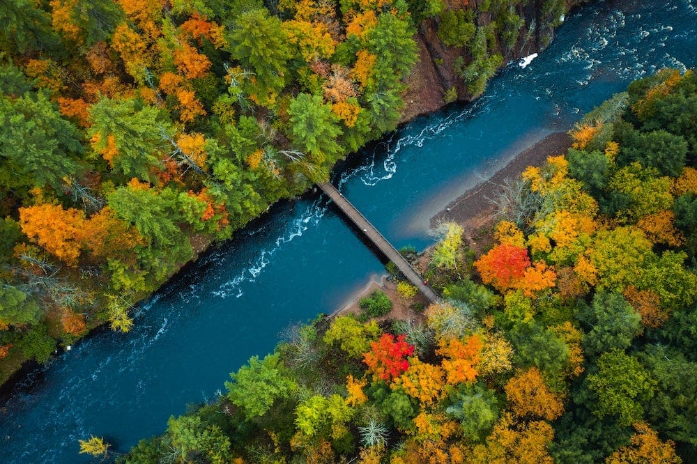
Ice Age National Scenic Trail
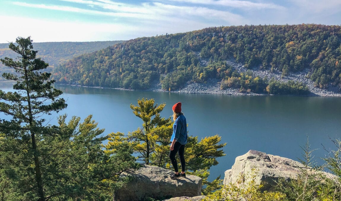
Devil’s Lake Segment
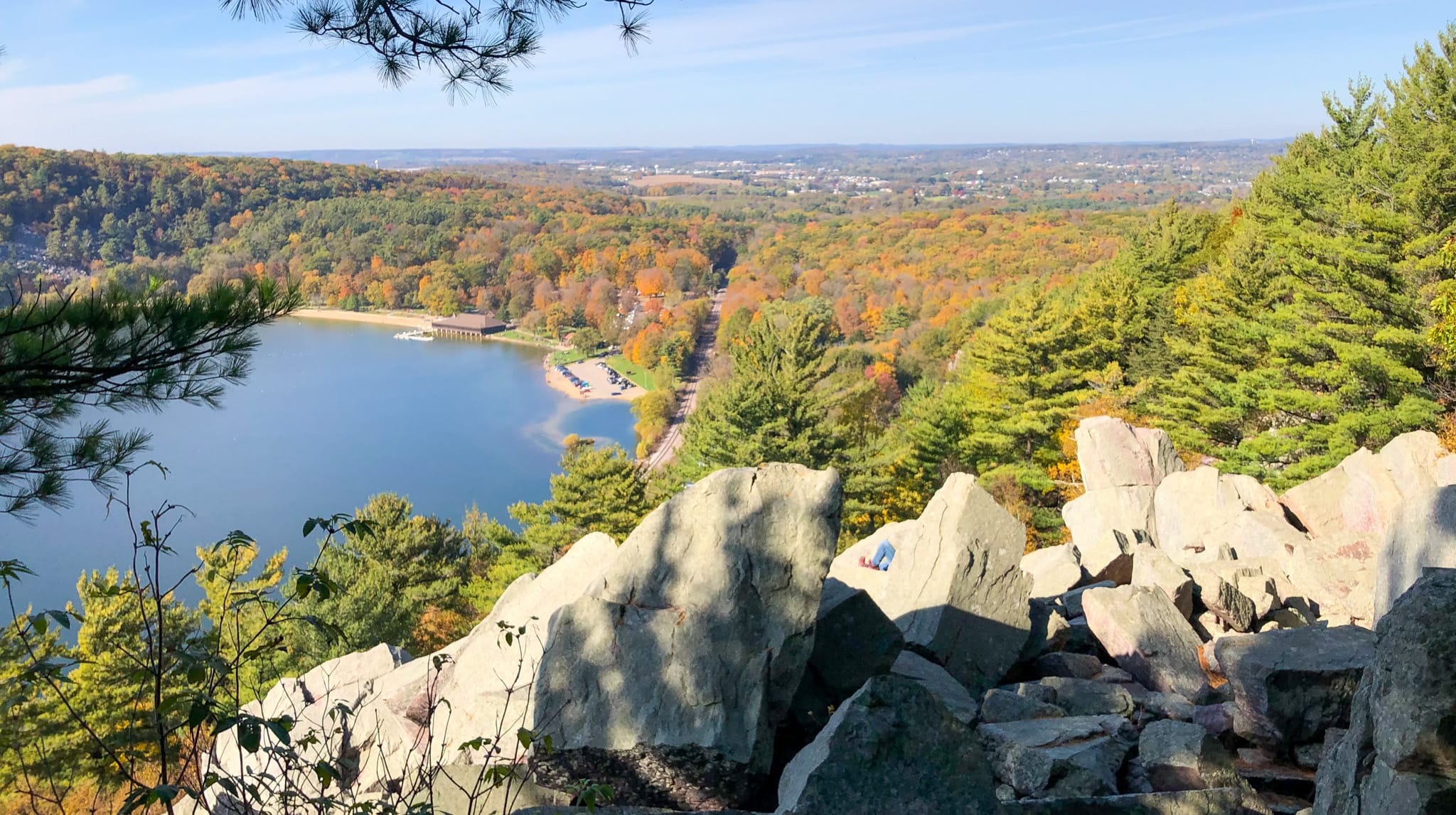
Why you should go: A popular segment of a national trail that climbs the bluffs of Devil’s Lake State Park.
- Nearest town: Baraboo
- Difficulty: Moderate to hard
- Distance: 14.7 miles
- Elevation gain: 1922 feet
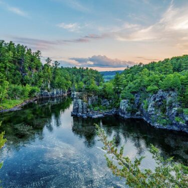
The Ice Age National Scenic Trail: Devil’s Lake Segment is a locally loved trail and one of my all-time favorite hikes in Wisconsin. It has climbs, it has views, it has variety—it has it all. Especially come fall, it becomes one of the best places to see colorful leaves contrasted beautifully against the glint of the waters of Devils Lake.
Devil’s Lake State Park has many different trails for those who simply want to climb to the top of the bluff and take in the spectacular views without logging many miles. However, this segment of the Ice Age Trail offers the perfect way to experience the park, taking you along the popular West Bluff Trail and branching off past Devil’s Doorway and Balanced Rock, two photo-worthy rock formations.
One portion of the trial takes you up and over 500-foot-fall quartzite bluffs, requiring a degree of good physical fitness to climb. Not only is Devil’s Lake great for hiking, but for camping or spending a day out in the fresh air. We always pack a picnic and our inflatable kayaks to enjoy post-hike when the weather is warm.
Peninsula State Park
Eagle Trail
Why you should go: An exciting Door County hiking trail noted for its rocky outcroppings and Lake Michigan shoreline.
- Nearest town: Ephraim
- Difficulty: Moderate to hard
- Distance: 2 miles
- Elevation gain: 150 feet
The Eagle Trail loops through thick forest and climbs limestone bluffs, from which you can take in incredible views of Lake Michigan. This cliffside trail passes unique rock formations and caves that are part of the 450-mile-long Niagara Escarpment. Although the path isn’t long, it is rocky and uneven so careful attention is essential.
You can find this popular Wisconsin hike in Peninsula State Park, one of the best places in Door County for outdoor adventure. The park boasts over 450 campsites, a sandy beach, and a historic lighthouse, making for an epic weekend getaway for all. This trail is particularly popular in the summer and fall, which means parking can fill up quickly.
Copper Falls State Park
North Country Scenic Trail
Why you should go: A segment of a national trail that rewards hikers with views of an impressive gorge and epic waterfalls.
- Nearest town: Mellen
- Difficulty: Moderate
- Distance: 7 miles
- Elevation gain: 785 feet
Experience a bit of untouched wilderness along the North Country Scenic Trail, a 4,600-mile-long national hiking trail that starts in North Dakota and ends in Vermont, cutting through northern Wisconsin. One particular segment of the trail is well worth the effort, as it cuts through the entirety of Copper Falls State Park, one of Wisconsin’s most scenic destinations for waterfalls.
This national trail overlaps with the park’s popular Doughboy’s Trail and takes you to observation decks that overlook the rushing water of Copper Falls and Browntown Falls, two of the state’s tallest waterfalls. Those itching for something longer can continue along the trail beyond the park boundary, either east toward Iron County Forest, or west through the Chequamegon-Nicolet National Forest. However, the park also offers various camping sites, including one backpacking site on the shores of the Bad River, for a bit of relaxation in the Northwoods.
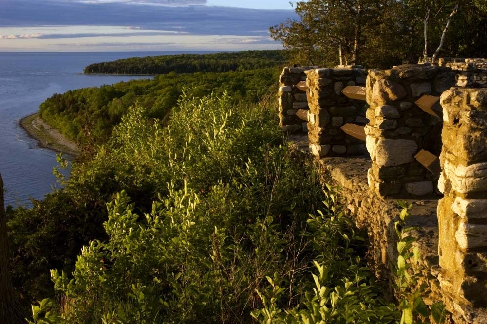
Apostle Islands National Lakeshore
Meyer’s Beach Sea Cave Trail
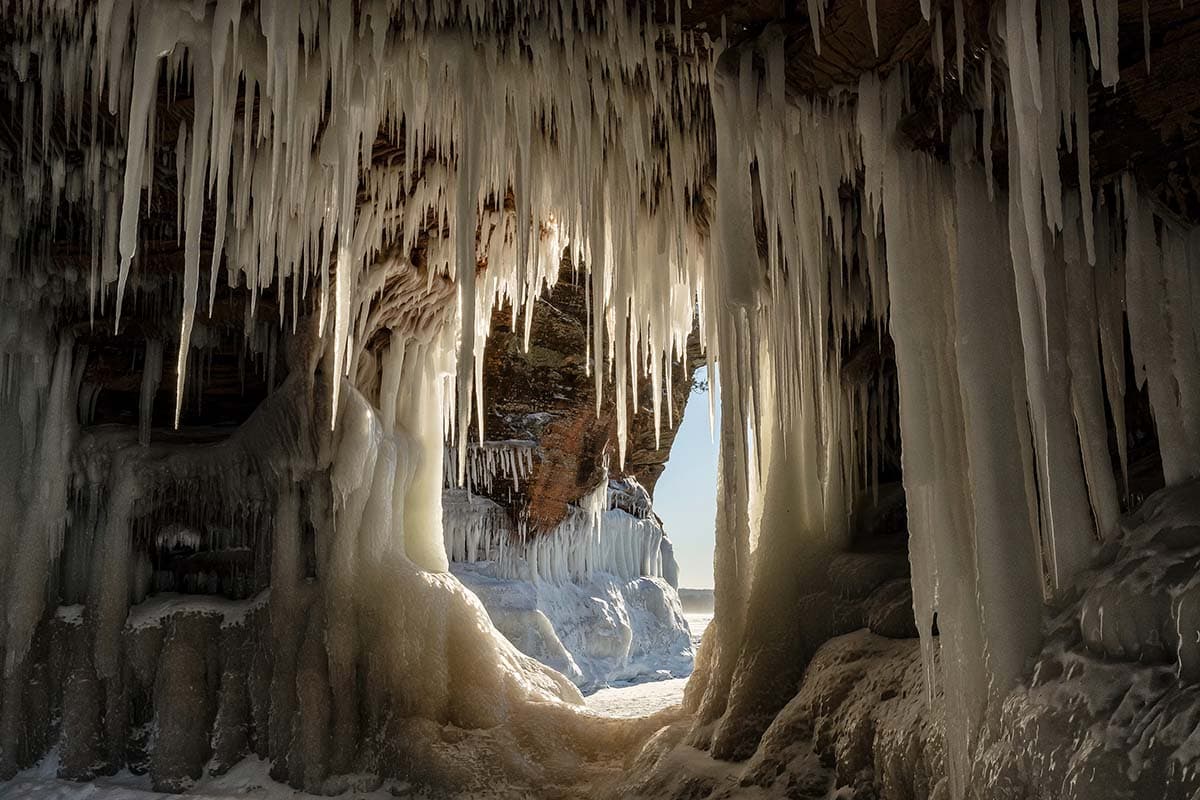
Why you should go: A lakeshore path that showcases the unrivaled beauty of the Apostle Islands mainland sea caves.
- Nearest town: Bayfield
- Difficulty: Moderate to hard
- Distance: 4.6 miles
- Elevation gain: 270 feet
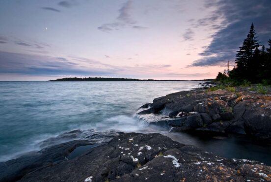
Catch sight of incredible limestone buffs that line the shores of Lake Superior with a hike along the Meyer’s Beach Sea Cave Trail. On the trail, you can witness how deep gorges cut through the forest, allowing hikers to look down onto the waters of the Great Lake. Parts of the trail are lined with boards and boardwalks and require stream crossings, adding a bit of excitement.
In the winter, impossibly large icicles form on the rocky cliffs, transforming the sea caves into glittering works of art. The Ice Caves are truly a sight to behold, but they require a hike over the frozen surface of Lake Superior. That means that access to the ice caves is limited to when weather and ice conditions are safe.
Its location in Wisconsin’s most northern point makes it a quiet destination, often free of crowds. Regardless of its far-off location—over six hours from Milwaukee, to be exact—this is one of those outdoorsy adventures that should be on every Wisconsinites’ bucket list, including my own!
Perrot State Park
Perrot Ridge to Brady’s Bluff
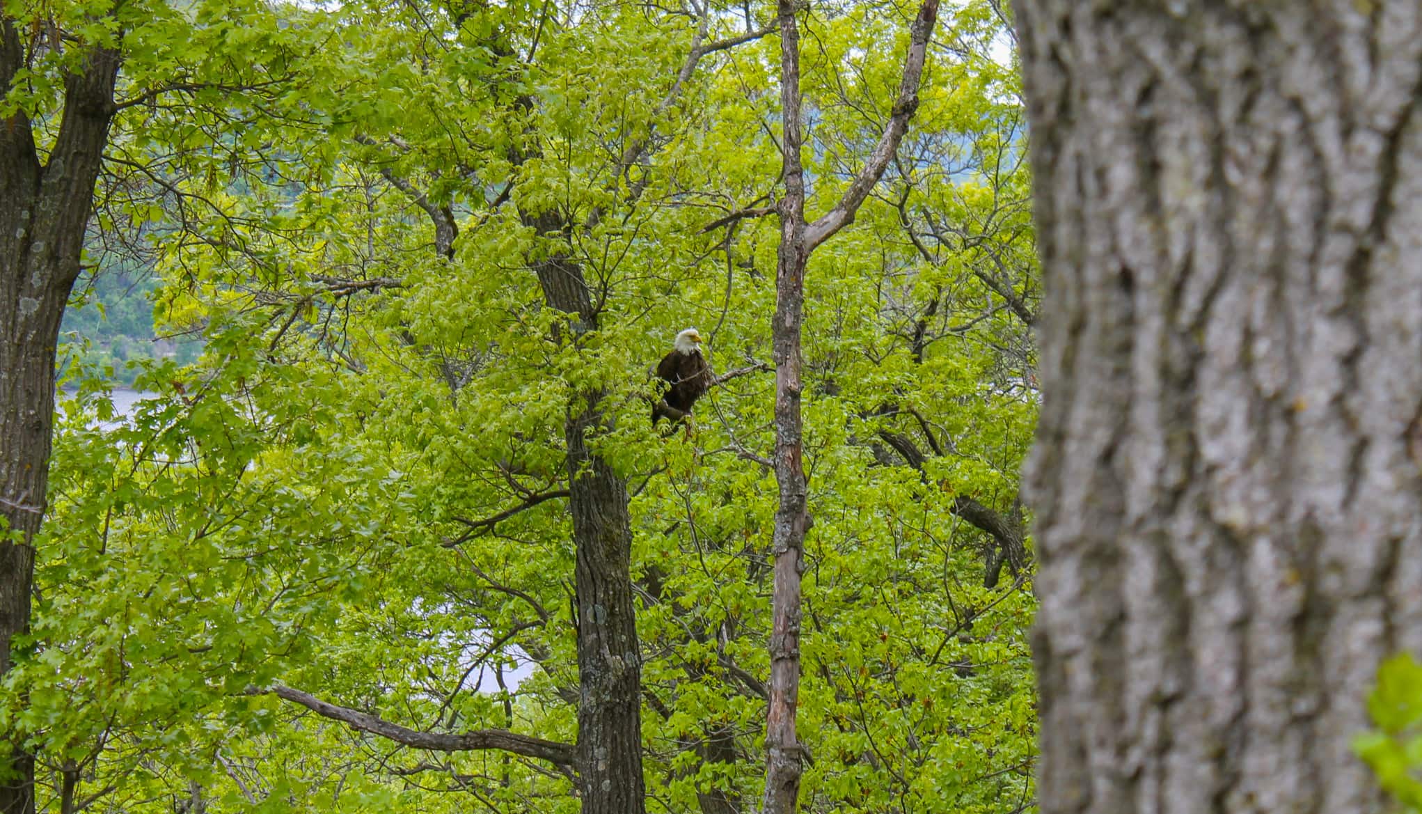
Why you should go: A hike within Perrot State Park that boasts exciting climbs and 360-degree views of the Mississippi River Valley.
- Nearest town: Trempealeau
- Difficulty: Moderate
- Distance: 3.3 miles
- Elevation gain: 810 feet
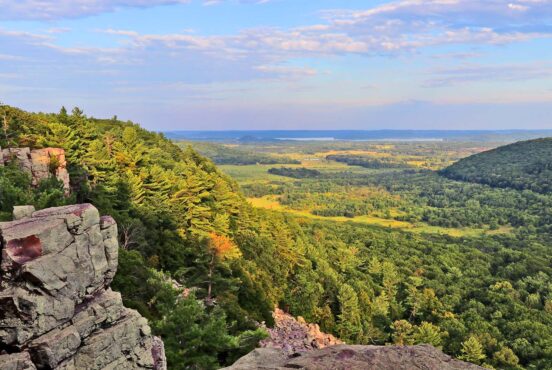
The Perrot Ridge to Brady’s Bluff trail is a perfect introduction to Wisconsin’s Driftless Area, a region left untouched by the last advancing glacier. What was left behind was a topography unique to anywhere else in the state, characterized by its rolling hills and many cold water streams.
This trail takes you along two of the park’s most popular sights: Brady’s Bluff and Perrot Ridge. Brady’s Bluff towers 460 feet above the river and is noted for its prairie plants and scenic vistas. Perrot Ridge takes hikers along a steep and narrow path that looks out onto where the Trempealeau and Mississippi Rivers meet and the pretty marshes and wooded islands in the water.
The last time I hiked Perrot Ridge, I spotted a bald eagle perched in a tree and watched on as it dug into its freshly caught dinner. It’s a sight that I’ll never forget, and if you’re lucky, you’ll experience your own bald eagle sighting on this beautiful hike.
Kohler-Andrae State Park
Cordwalk-Boardwalk Trail
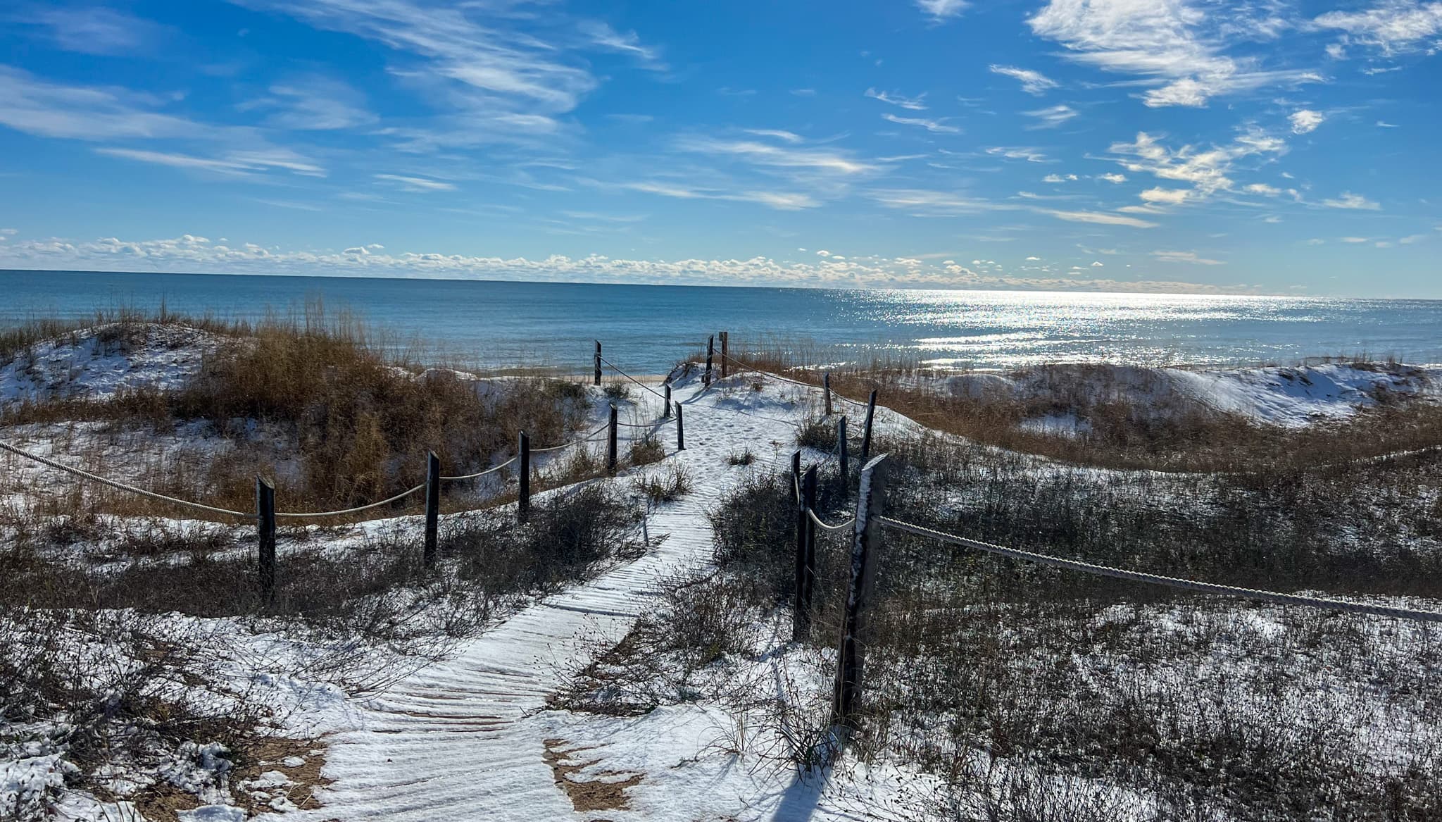
Why you should go: A leisurely boardwalk stroll over the sand dunes that stretch along the shores of Lake Michigan.
- Nearest town: Sheboygan
- Difficulty: Easy
- Distance: 3 miles
- Elevation gain: 88 feet
The Cordwalk-Boardwalk Trail is one of the best hiking trails in Wisconsin simply because of how incredibly unique the surrounding landscape is. Characterized by winding boardwalks, sweeping sand dunes, and the lapping waters of Lake Michigan, this hike makes you feel as if you’re somewhere along the East Coast instead of in the heart of the Midwest.
This easy trail is perfect for families, but unfortunately, pets are not allowed in portions of the park south of the Sanderling Nature Center. The best time to visit Kohler-Andrae State Park is in the summer when the weather is warm enough to enjoy the beach to its fullest. However, I try to avoid going on weekends as the park can get very crowded on sunny days. But contending with the crowds is worth it if that’s your only opportunity to visit. I even enjoy hiking the trail in winter, when crowds are non-existent, and snow dusts the boardwalks.
Rib Mountain State Park
Rib Mountain Yellow Trail
Why you should go: A forested trail with many inclines that takes you to the top of one of Wisconsin’s tallest hills.
- Nearest town: Wausau
- Difficulty: Moderate
- Distance: 4.4 miles
- Elevation gain: 836 feet
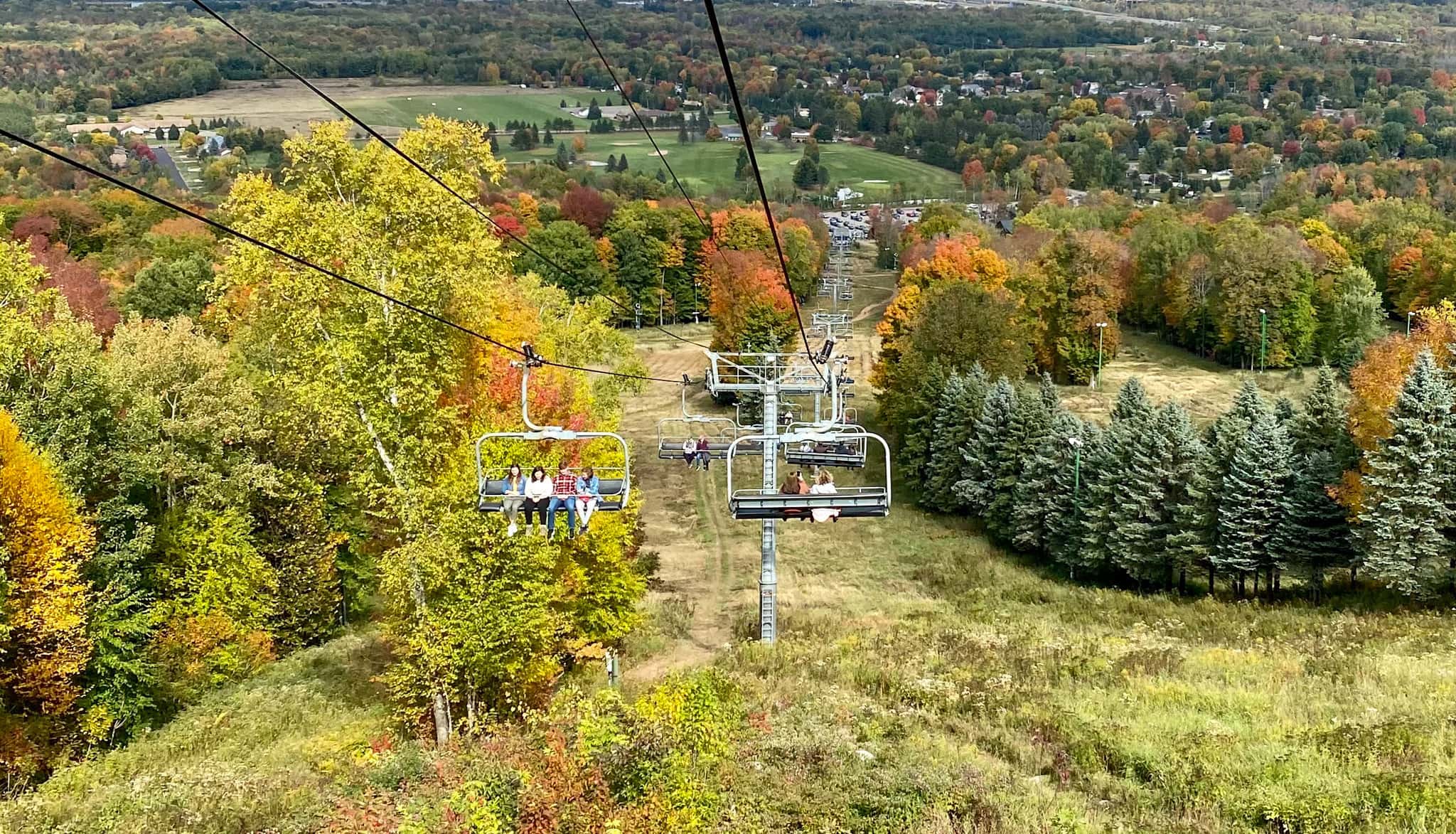
The Rib Mountain Yellow Trail is a meandering path that will get your heart racing, offering the steepest climbs within Rib Mountain State Park. This looping trail features a steady incline no matter which direction you take, promising a quality workout. At the top, your reward is the far-reaching views of Wausau and the surrounding forests. If you have more energy, I particularly enjoy walking the Quarry Loop after completing the Yellow Trail, a short 0.9-mile route that takes you through an old quartzite quarry with steep rock walls.
Rib Mountain is one of those destinations that offers year-round outdoor adventure. In the fall, thousands of visitors come to witness the beauty of the changing colors, and the park’s Granite Peak Ski Resort hosts scenic cable car rides for up-close views that don’t require heart-thumping climbs. When snow begins to fall, the trails transform into a popular place for snowshoeing, and the mountain comes alive as one of the best ski hills in Wisconsin.
Ice Age National Scenic Trail
St Croix Falls Segment
Why you should go: A hiking trail near the Minnesota border marked by stopovers in Interstate State Park and the Dalles of the St. Croix River.
- Nearest town: Dresser
- Difficulty: Hard
- Distance: 9 miles
- Elevation gain: 1014 feet
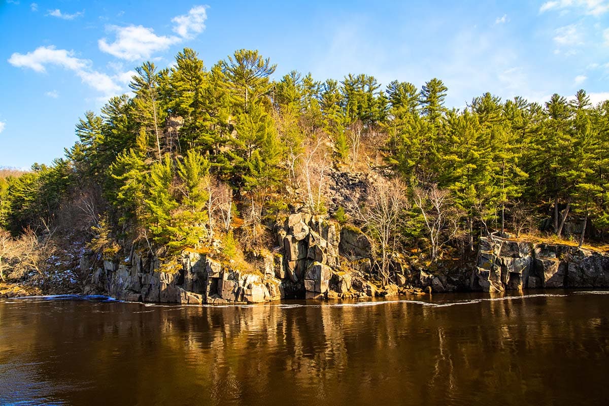
Relish the beauty of Wisconsin’s oldest state park and the lush St. Croix River Valley with a stroll along the Ice Age Trail: St Croix Falls Segment. This portion of the national trail is noted for its scenic views of the St. Croix River and substantial (by Wisconsin standards) total elevation gain.
But the most beautiful part of the trail is arguably at the western terminus, where you can witness over 200 potholes that have been carved into the region’s ancient basalt bedrock. The path features stretches that follow roadways as well as some small stream crossings. In the summer, hikers can cool off with a dip in Interstate State Park’s Lake O’ the Dalles or take kayaks out onto the river.
Wisconsin Dells
Witches Gulch Trail
Why you should go: An exciting boardwalk through a steep canyon in the Wisconsin Dells.
- Nearest town: Wisconsin Dells
- Difficulty: Easy
- Distance: 2 miles
- Elevation gain: 130 feet
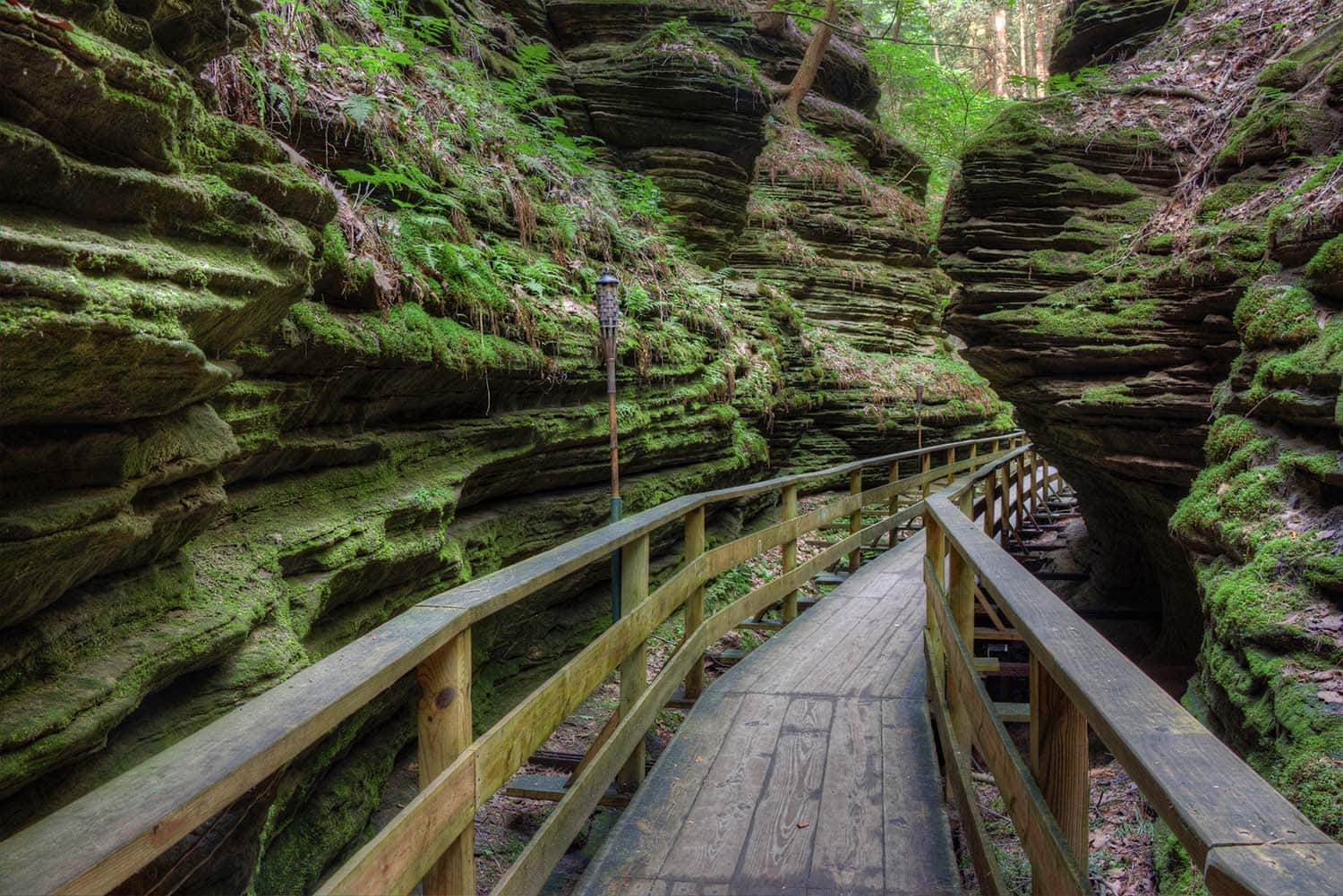
The Wisconsin Dells is best known for its family-friendly water resorts, but there’s plenty of beautiful nature for hikers to explore as well. Like the Witches Gulch nestled along the Wisconsin River, a short but beautiful trail that passes through a mossy slot canyon on the site of what was once a glacial lake. The canyon is a direct result of thousands of years of erosion and offers a glimpse of Wisconsin’s glacial past.
This incredibly scenic trail offers an opportunity to witness unique rock formations through narrow stretches of undulating sandstone canyon walls that tower feet above you. The Witches Gulch is open from mid-May to mid-September and is only reachable via a private Upper Dells Boat Tour. It’s said that the area is haunted, and those brave enough can go ghost hunting on a nighttime boat tour of the gorge for an extra unique hiking experience.
Ice Age National Scenic Trail
Holy Hill Segment
Why you should go: A point-to-point idyllic trail that passes by the famed Holy Hill in southeastern Wisconsin.
- Nearest town: Hartford
- Difficulty: Easy
- Distance: 6.75 miles
- Elevation gain: 603 feet
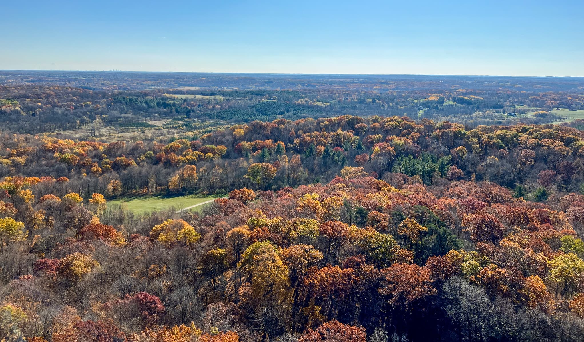
Hiking the Holy Hill Segment of the Ice Age Trail was always one of my favorite activities as a kid. The trail passes through wooded stretches of public and private lands, with limited parking along the segment. However, the best part of the trail is the detour to the top of Holy Hill, a 1,350-foot-tall glacial kame where the historic Basilica and National Shrine of Mary sits. The detour isn’t only great for its tourist attraction but also the ample parking options for hikers available on the church grounds.
Visitors from around the world come to climb the 178 steps to the top of the lookout tower to soak up far-reaching forest and farmland views. Hiking the Holy Hill Segment is a popular fall tradition when the forests shift from green to orange and local vendors begin to sell apple treats and drool-inducing fall goodies. One popular spot is Pine Hill Orchard, a stand located five minutes down the road from Holy Hill. I find that their caramel apples make for a perfect post-hike reward.
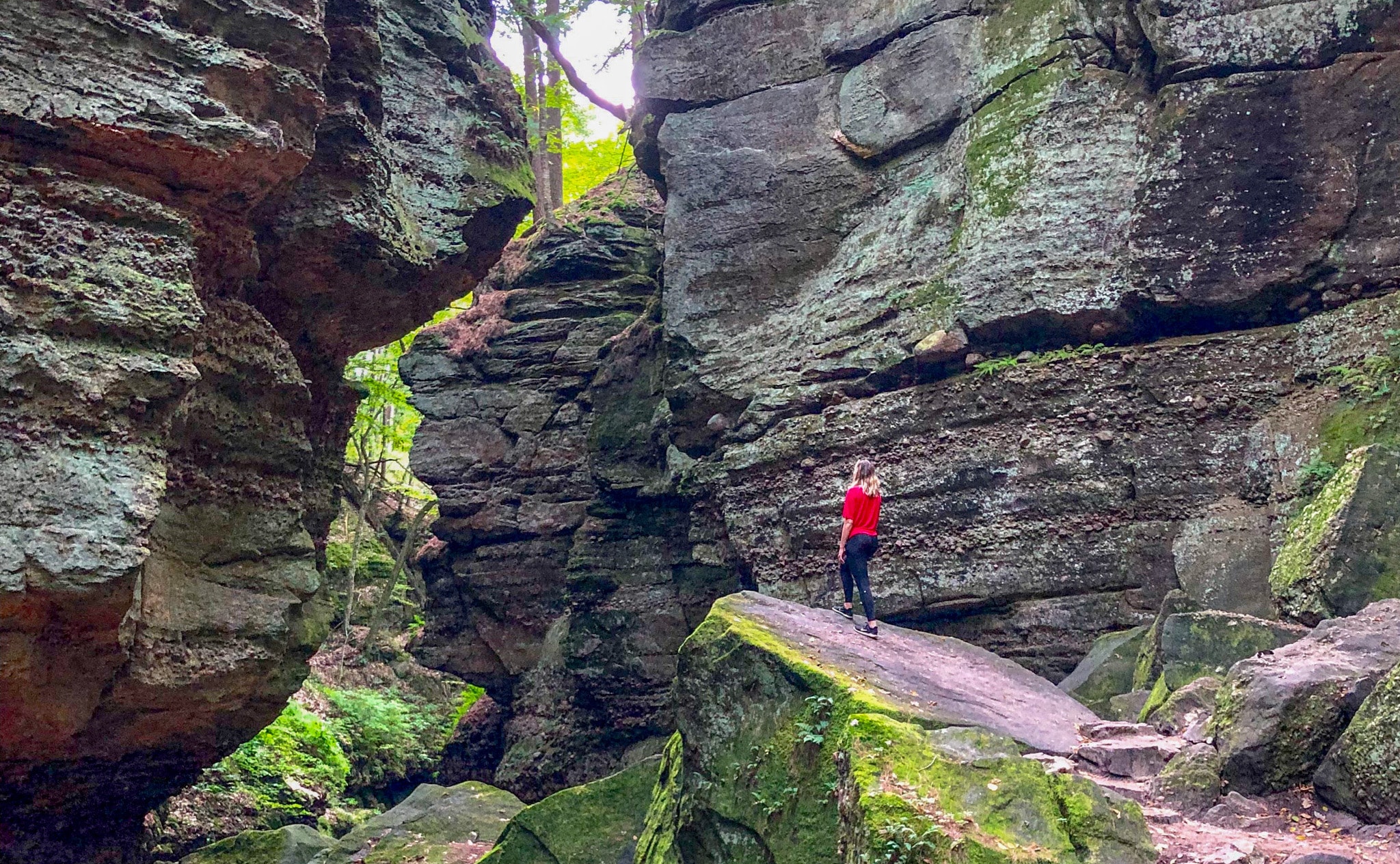
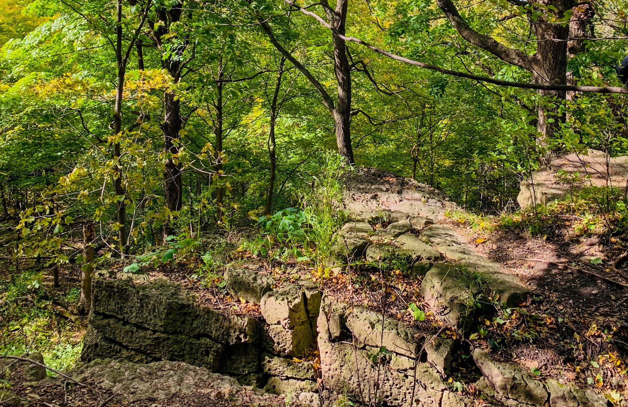
Parfrey’s Glen Wisconsin State Natural Area
Parfrey’s Glen
Why you should go: An out-and-back trail up and over epic boulders and through an eye-catching sandstone canyon not far from Devil’s Lake.
- Nearest town: Merrimac
- Difficulty: Easy
- Distance: 1.7 miles
- Elevation gain: 209 feet
The Parfrey’s Glen trail may be short, but it’s oh-so-sweet, and one of those trails that’s fun to hike over and over again. From the parking area, the trail takes you through a forest, following a babbling creek. As you get deeper into the woods, the flat terrain slowly shifts from rocky to towering cliffs. To reach the very end where a small waterfall awaits, hikers will do a little scrambling over giant boulders that will make you feel on top of the world.
I’ve always found the Parfrey’s Glen hike to be atmospheric thanks to cooler temperatures in the gorge and the magical moss-covered rocks and trees. You truly feel transported to another world, and it’s one of those rare hikes where I almost forget I’m in Wisconsin. After I hike Parfrey’s Glen, I usually stop by Wollersheim Winery, a charming vineyard serving award-winning wines and distilled spirits about 15 minutes down the road.
High Cliff State Park
Lime Kiln & Red Bird Trail
Why you should go: A scenic trail in Northeastern Wisconsin boasting cliffs, historic landmarks, and lake views less than 45 minutes from Green Bay.
- Nearest town: Sherwood
- Difficulty: Easy
- Distance: 2.7 miles
- Elevation gain: 269 feet
High Cliff State Park is one of the many Wisconsin state parks worth a visit. It is an excellent place to take in bird’s eye views of Lake Winnebago from atop limestone cliffs. One of my favorite trails in the park is the loop that follows the Lime Kiln and Red Bird Trail, a route that takes you through a peaceful stretch of forest, passing unique rocky outcroppings before climbing slowly to soaring bluffs.
The ruins of a historic lime quarry and kiln stand along the trail, offering a glimpse into the history of the region’s limestone mining industry. Be sure to make time to witness the park’s nine remaining effigy mounds, ancient Native American burial sites.
I find the trail to be well-marked and easy to follow, making it an excellent choice for beginner hikers or those visiting with kiddos. In the summer, there’s a small sandy beach where you can take a dip in the lake and enjoy a picnic. The state park also features a campground and a 40-foot-tall observation tower.
Where to Go Next in Wisconsin
Get epic travel ideas delivered to your inbox with Weekend Wanderer, our newsletter inspiring thousands of readers every week.