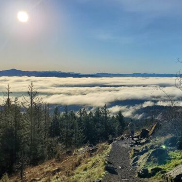
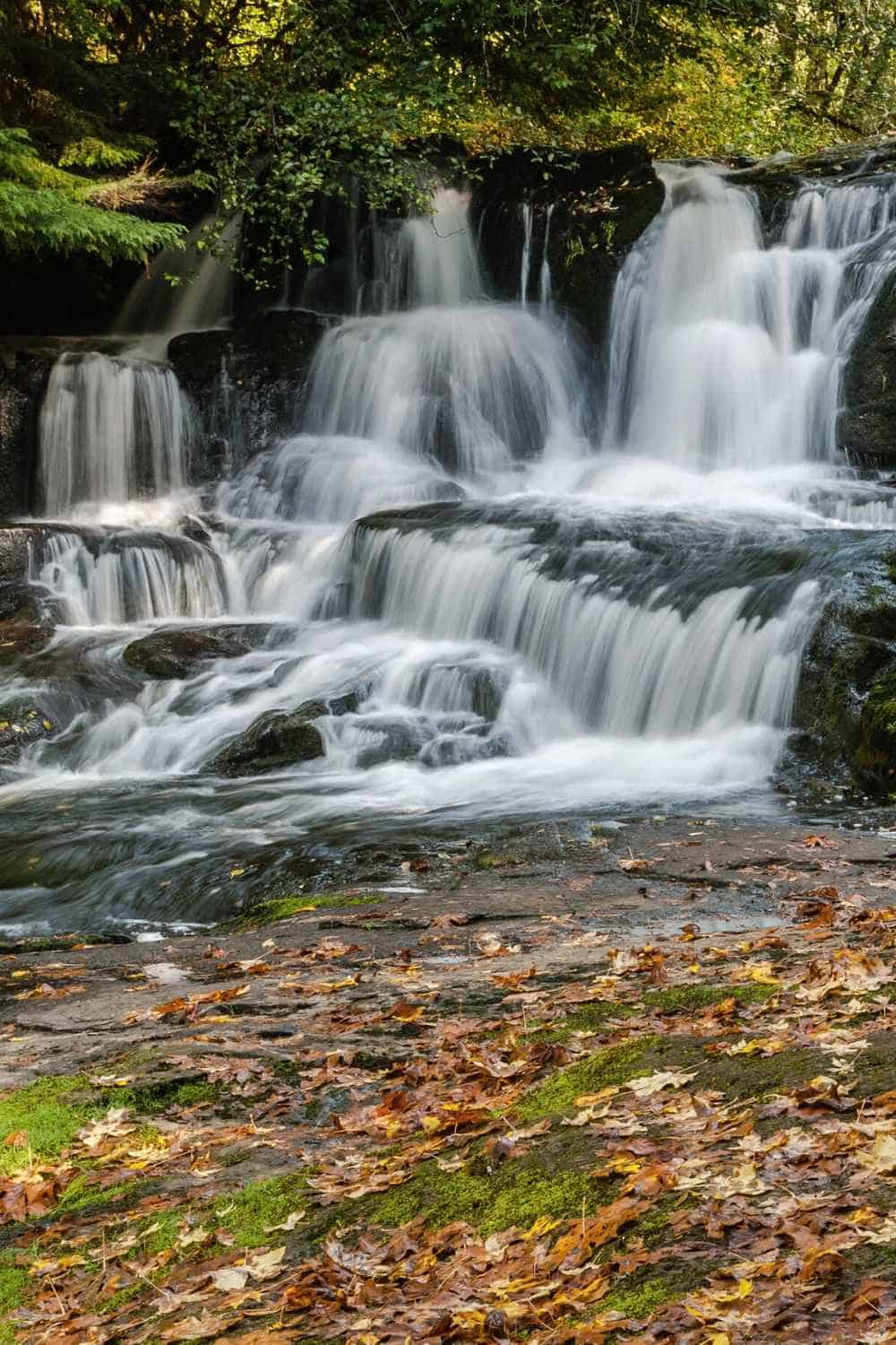
Alsea Falls and Green Peak Falls are a pair of glorious waterfalls hidden within a fairyland forest. Set in the heart of the Oregon Coast Range, this trail is a local favorite for its remote accessibility and breathtaking beauty.
Trail Details: Alsea Falls and Green Peak Falls Trail
| Details | Alsea Falls and Green Peak Falls Trail |
|---|---|
| Distance | 2.8 miles |
| Difficulty | Moderate |
| Duration | 1 hour 20 minutes |
| Trail Type | Out and back |
| Starting Elevation | 670 feet |
| Elevation Gain | 423 feet |
| Seasons | Spring, summer, fall |
| ADA Accessibility | Viewpoints, limited trail access |
| Dogs | Allowed on leash |
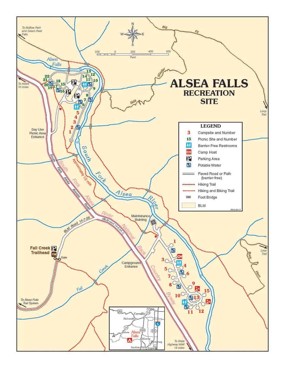
| Trail Map | Alsea Falls Recreation Site |
| Nearest Amenities | Corvallis, OR |
| Directions to Trailhead | Google Maps |
| Parking | Free. No permit required. |
| Road Conditions | Trip Check |
| Attractions | Waterfalls, rainforest, river |
| Activities | Hiking, camping, mountain biking, fishing, swimming |
The Hike
Alsea Falls Recreation Site is a popular location for hikers and mountain bikers. The Alsea Falls and Green Peak Falls Trail is primarily used by hikers, but the entire area features over 12.5 miles of trails and many forest roads where the mountain bikers like to play. Cyclists likely won’t be seen on this specific trail, but it would be wise to be on the lookout.
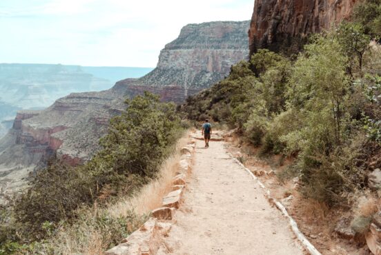
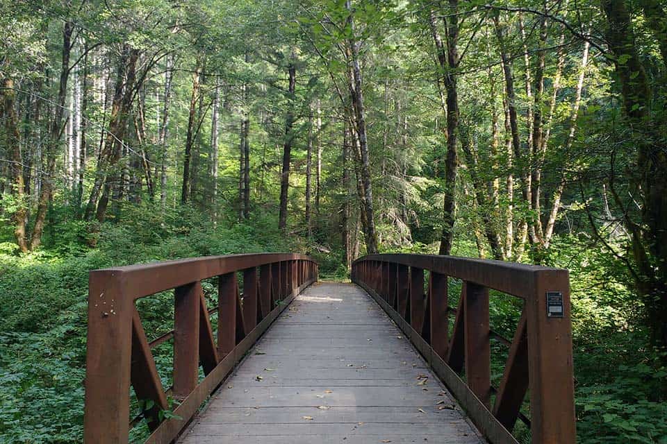
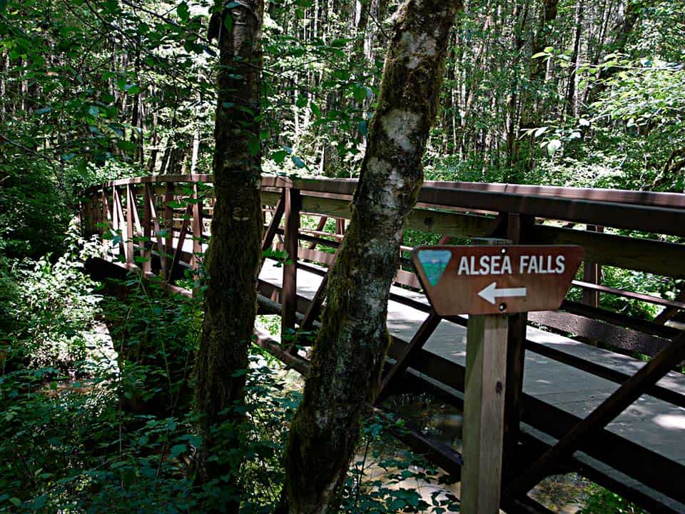
The trailhead is located on the bank of South Fork Alsea River at the parking area and starts with a bridge that crosses the waterway. Once across, there is a sign that directs hikers to travel right toward the BLM campground or left toward the falls.
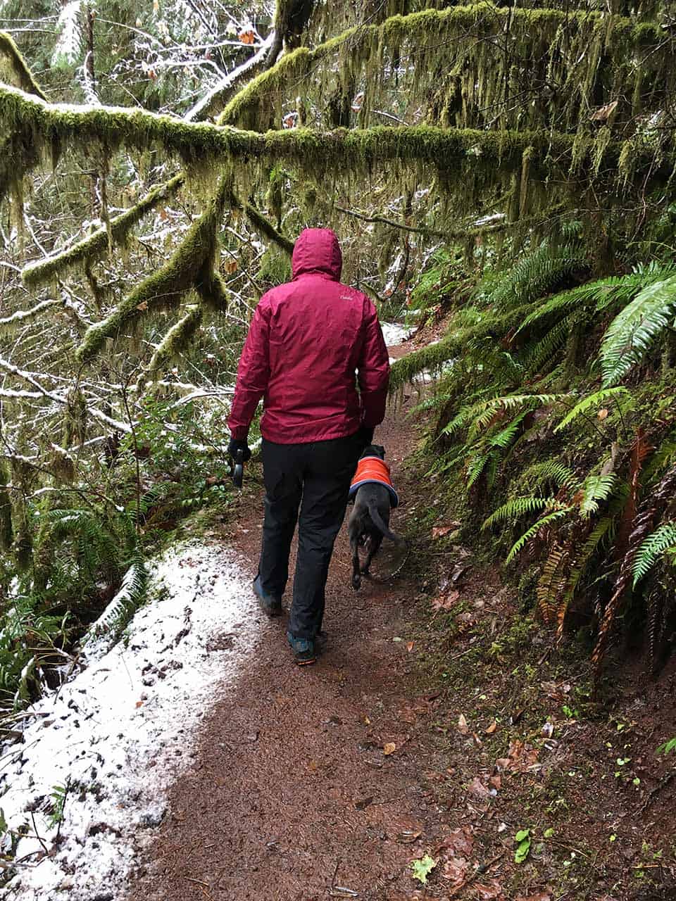
Though this trail has a gentle grade, it is usually quite muddy and can be slippery. Not only do the waterfalls expel plenty of moisture in the air, but this is also a temperate rainforest that sees a lot of rain. That’s why the woods are blanketed in moss and draped in lichen.
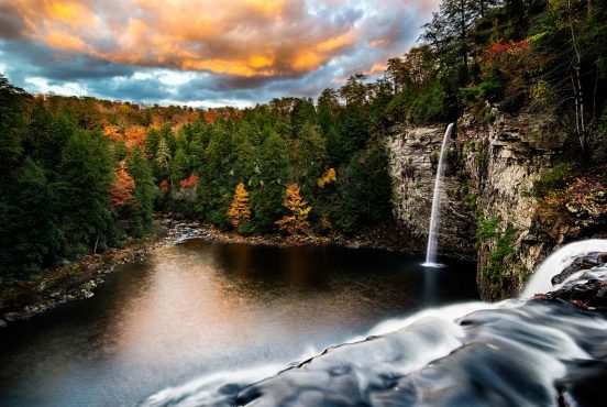
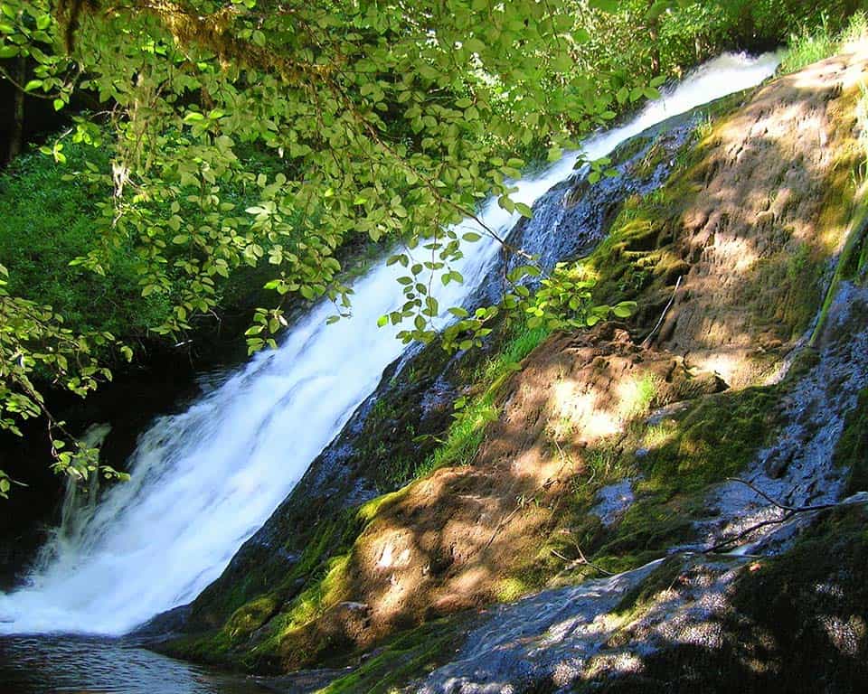
You’ll first encounter Alsea Falls not far from the trailhead. This stunning waterfall cascades over layers of rock that have been worn smooth by the river. Most hikers turn around here after enjoying the falls, but Green Peak Falls lies further ahead. It’s the larger of the two, and it is just as beautiful. If you continue on you will likely not see another person on the trail.
Continuing forward, the trail will take you to the large group campsite of Hubert K. McBee Park. Walk through the camp to the other side of the circular parking area near campsite #3 where the trail continues into the forest, following the river upstream.
This is likely to be the muddiest and slipperiest section of the hike as you make your way along the narrow trail toward the falls. The roar of the waterfall fills the forest, feeling as if it is coming at you from all directions.
You’ll end up at the base of the falls where you will quickly become drenched in its spray if you get too close. The logs and rocks will be covered in wet leaves and moss. Be careful of your footing.
The return journey follows the exact same route, and you’ll likely want to stop at Alsea Falls again. If the water levels are low, the rock shelves that form Alsea Falls become accessible, allowing you to creep close to the tumbling water. The waterfall is rather gentle in the summer when water levels are at their lowest and it becomes a popular swimming spot for locals.
When to Visit
The falls are at their most impressive in the spring, but summer and autumn are the more accessible seasons for the area. The route is paved the entire way to the trailhead, though the snow may still be several feet deep in the spring, and this road is rarely ever plowed. Downed trees could put a halt in your plans as well.
Directions to Alsea Falls Recreation Site
Despite its seclusion, the Alsea Falls Recreation Site is easy to get to from Corvallis or Eugene.
From Corvallis, head south on Highway 99W for 30 miles and then turn west onto Bellfountain Road for another 30 miles until you reach your destination. From Eugene, you’ll want to head north on 99W for 40 miles before turning onto Bellfountain Road.
There is plenty of parking at the trailhead for about 20 vehicles, and overflow parking tends to line the roadway when necessary.
Area Tips and Resources
- Muddy and slippery: It’s worth mentioning again that this is a wet hike. Be sure to wear proper footwear for walking in mud, and take care on the slippery bridges and rocks. Hiking boots are recommended.
- Camping: There are two great camping options on this route. The Alsea Falls Campground, which we featured as one the Best Campgrounds Near Eugene, is the more traditional of the two with first-come-first-served campsites, pit toilets, and fire rings. Hubert K. McBee Memorial Campground is a bit more rustic, but it has plenty of space for large RVs and other campers.
- Get snacks in Monroe: Bellfountain Road starts just outside the rural community of Monroe. The town has a couple of convenience stores where you can load up with snacks, and the newly constructed Long Timber Brewing is a fantastic spot for top-notch food and beer.
- Nearby Hikes: We put together a list of 21 Spectacular Hikes Near Eugene that includes Alsea Falls among many other great waterfall hikes in the area.
Explore Oregon
Check out more of our outdoors guides featuring the most beautiful places to explore in Oregon.
Sign up for our free email to join thousands of readers getting epic travel, hiking, camping and gear ideas every week.