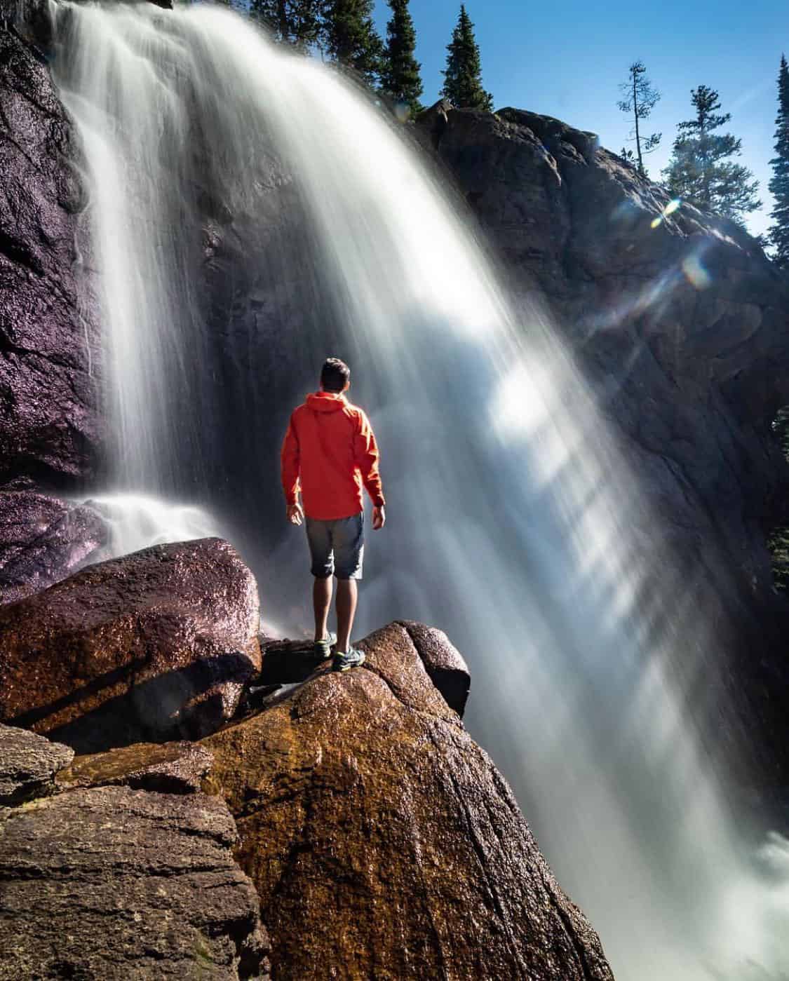
“Rocky Mountain High” — John Denver’s 1972 classic about the Centennial State’s beauty — represents the high-altitude scenery well.
“He climbed cathedral mountains, he saw silver clouds below. He saw everything as far as you can see,” sings Denver.
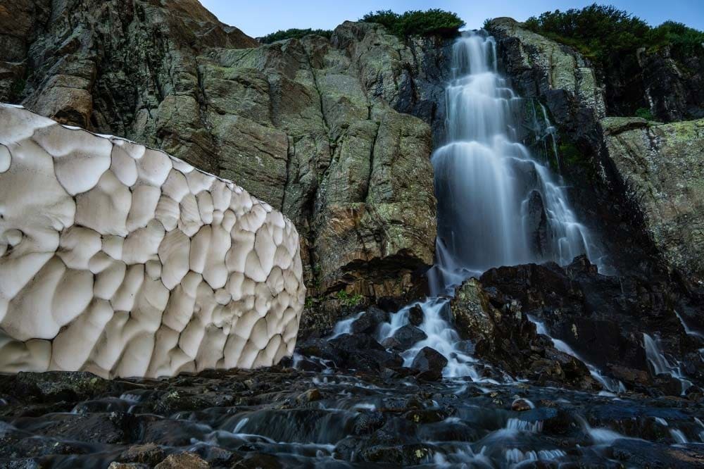
Colorado’s “2nd” state song goes on to speak of forests, streams, alpine lakes, even an eagle in flight. But when it came down to choosing a photo for the album cover of his 1972 album of the same name, Denver selected a photo of something not explicitly mentioned in the song: a waterfall.
The photo was taken at Slaughterhouse Falls near Aspen, and Denver himself stands upon a rocky outcrop in the foreground.
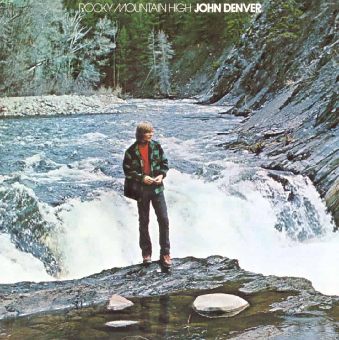
While we can only imagine the singer-songwriter’s connection with this place, but we can at least say this: waterfalls are awesome and Colorado has a shit-load of them. And God knows the spirit of John Denver wants you to go take a hike out to a great waterfall every now and then.
While Colorado contains hundreds, if not thousands of waterfall hikes, the following list focuses on 21 of the finest — and most well known. We’ve selected the elite based on a combination of natural beauty and accessibility.
There’s nothing worse than hearing about an “amazing” waterfall only to hike 16 miles off-trail to some dinky cascade. Our favorites are more or less accessible by hiking trails — most of them short, easy hikes — and feature grade-A waterfall specimens.
We’ve also broken the list out into seven regions with collections of great waterfalls: Rocky Mountain National Park, Denver, Colorado Springs, Telluride, Pagosa Springs, Glenwood Springs, and Crested Butte.
Related Read: Traveler’s Guide to the Best Colorado National Parks
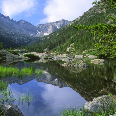
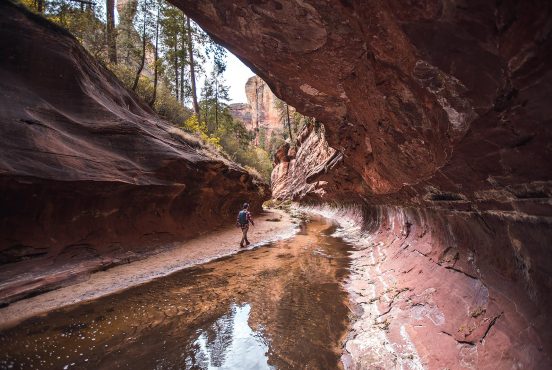
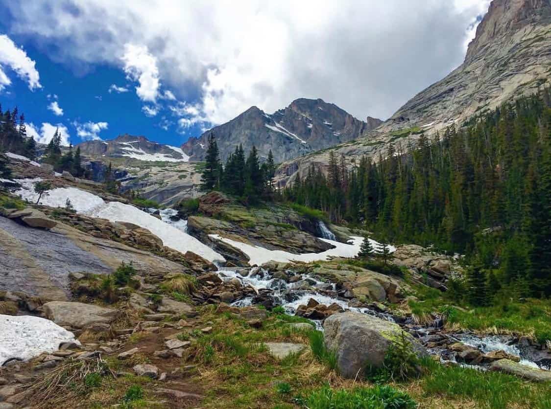
Rocky Mountain National Park
Perched in the Front Range of the Rockies high above Denver, Rocky Mountain National Park contains an insane concentration of waterfall hikes. The park’s sheer number of hiking trails makes these waterfalls more accessible than anywhere else in Colorado.
Hell, you could pick a trail at random and be hard pressed not to see a waterfall. However, since the park entrance fee ain’t exactly cheap, we’ve selected the most awe-inspiring falls in RMNP so you get the most bang for your buck.
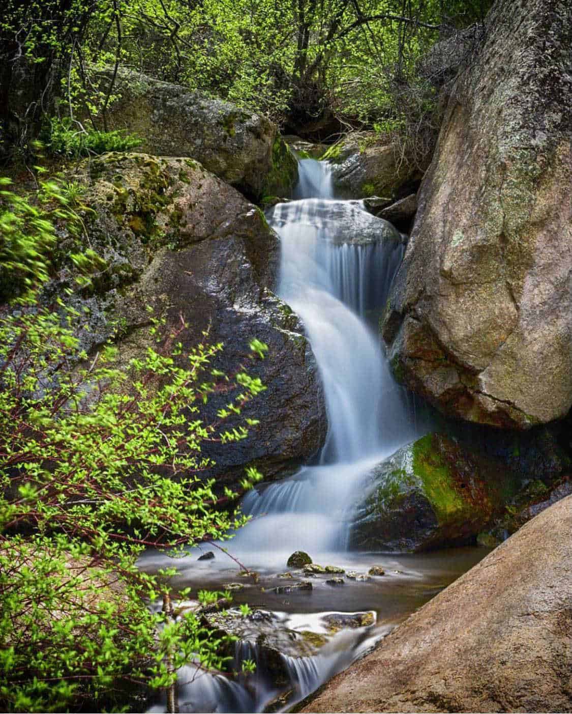
1. Alberta Falls
- Distance: 1.7 miles
- Elevation Gain: 250 feet
- Difficulty: Easy
Among the easiest-to-reach waterfalls in the park, don’t expect to have Alberta Falls to yourself. Plan to share the trail and falls with your fellow humans, and you’ll have a blast.
Although it’s only eight-tenths of a mile from the trailhead to the waterfall, give yourself extra time to enjoy the hike, especially in fall — the aspen groves are to die for.
Named after Alberta Sprague, an early settler of Estes Park, Alberta Falls tumbles 30 feet from a rocky terrace. It’s a pretty scene surrounded by a mixed pine forest and the occasional aspen.
Below the falls, Glacier Creek makes graceful cascades as it winds between a handful of large boulders. While it’s possible to scramble around and gain a closer vantage, be careful. You wouldn’t be the first to suffer a deadly fall from the cliffs into the icy stream.
More ambitious hikers can continue 3.2 miles further to reach Timberline Falls or Ribbons Falls even higher in the wilderness.
Additional Info: Rocky Mountain Hiking Trails
2. Timberline Falls
- Distance: 8 miles
- Elevation Gain: 1,330 feet
- Difficulty: Moderate
Ignoring the sweet waterfall at the end, this route is an absolute stunner on its own. After the requisite stop at Alberta Falls, this route continues steadily uphill through mixed conifer forests. Bear right on the next couple trail junctions until you’re on the Loch Vale Trail.
Another few switchbacks and you’ll reach the shore of the Loch, perched in a glacial valley 10,000 feet above sea level. With rugged, iconic peaks like the Sharktooth towering overhead, this high-altitude lake is a destination of it’s own.
Timberline Falls, a 100-footer cascading off the rocky tundra, is just another mile uphill through the woods. It’s a pretty cool waterfall, and the views back down the valley toward the Loch (and beyond) make it extra special. If you want even more, continue up — it’s a tough hike / class 2 scramble from here — to the icy waters of Glass Lake and Sky Pond.
Additional Info: Rocky Mountain Hiking Trails
3. Ribbon Falls & Black Lake
- Distance: 10 miles
- Elevation Gain: 1,500 feet
- Difficulty: Challenging
Another extension off of the Alberta Falls hike, this route overlaps quite a bit with the Timberline Falls hike, but takes a left turn into Glacier Gorge just short of reaching the Loch. Clocking in at almost 10 miles roundtrip, many will call this a strenuous hike, but beauty literally every step of the way makes it worth it.
The route passes Mills Lake and Jewel Lake, a couple more high-altitude gems. The trail crosses a boggy area after Jewel Lake, adding to the challenge.
Glacier Gorge is a pretty long valley, but eventually you’ll reach the rumbling waters of Ribbons Falls. Described as a “slide fall”, the water glides down a bed of orange and pink granite — unique for sure.
It’s worth it to continue another quarter mile up to Black Lake with its combination of glassy reflections, craggy backdrop, and Black Lake Falls tumbling off the distant cliffs.
4. Bridal Veil Falls (RMNP)
- Distance: 6.2 miles
- Elevation Gain: 1,000 feet
- Difficulty: Moderate
Let it be known, Bridal Veil is the most overused and cliche name for a waterfall, period. In the State of Colorado alone, there are at least five falls named Bridal Veil, not to mention the many others worldwide, none more famous than the one visible at Yosemite National Park’s Tunnel View.
Rocky Mountain National Park’s version isn’t even the most famous in Colorado, but still, it does make for a darn good hike.
The hike starts at McGraw Ranch, which dates back to 1884 and is now managed by the NPS. In just over three miles from the trailhead to your destination, expect to pass through brilliant meadows with views of the nearby peaks followed by dense stretches of aspen and mixed conifer forest.
For the first two miles, the hiking is deceptively flat and easy. All the elevation gain happens in the last mile or so, once you’ve turned right from Cow Creek Trail onto the split-off to Bridal Veil.
Power up 1,000 feet in a little over a mile and the view of the 20-foot tall Bridal Veil Falls is all yours. The relatively low elevation (for RMNP standards) means it’s accessible in spring, which usually means more water too. Get lucky and come during a wet summer and you’ll enjoy an equally awesome display.
Additional Info: Rocky Mountain Hiking Trails
5. Ypsilon Falls
- Distance: 8.4 miles
- Elevation Gain: 2,350 feet
- Difficulty: Challenging
High up in the Mummy Range, the beautifully tiered cascades of Ypsilon Falls feed the cool waters of Ypsilon Lake. This makes for a cool but challenging day hike, though it’s even better as a backpacking trip.
Backcountry camping is available at the Upper Chipmunk campsite, just a half-mile from Ypsilon Falls. Camping here allows for exploration above the treeline, like the scramble up to Spectacle Lakes (and a gnarly outlet waterfall) or the off-trail excursion to Chiquita Lake.
To reach the shore of Ypsilon Lake and the nearby falls, it’s a 4.2 miles slog uphill through dense forest. Start at the Lawn Lake Trailhead, but make sure to turn left onto the Ypsilon Lake Trail approximately 1.2 miles in.
To be sure, this is destination hike. We 100% recommend setting this up as a backpacker to make the trek worthwhile and enjoy the Ypsilon area to the maximum.
Additional Info: Rocky Mountain Hiking Trails
6. Wild Basin
- Distance: 5.4 miles
- Elevation Gain: 870 feet
- Difficulty: Moderate
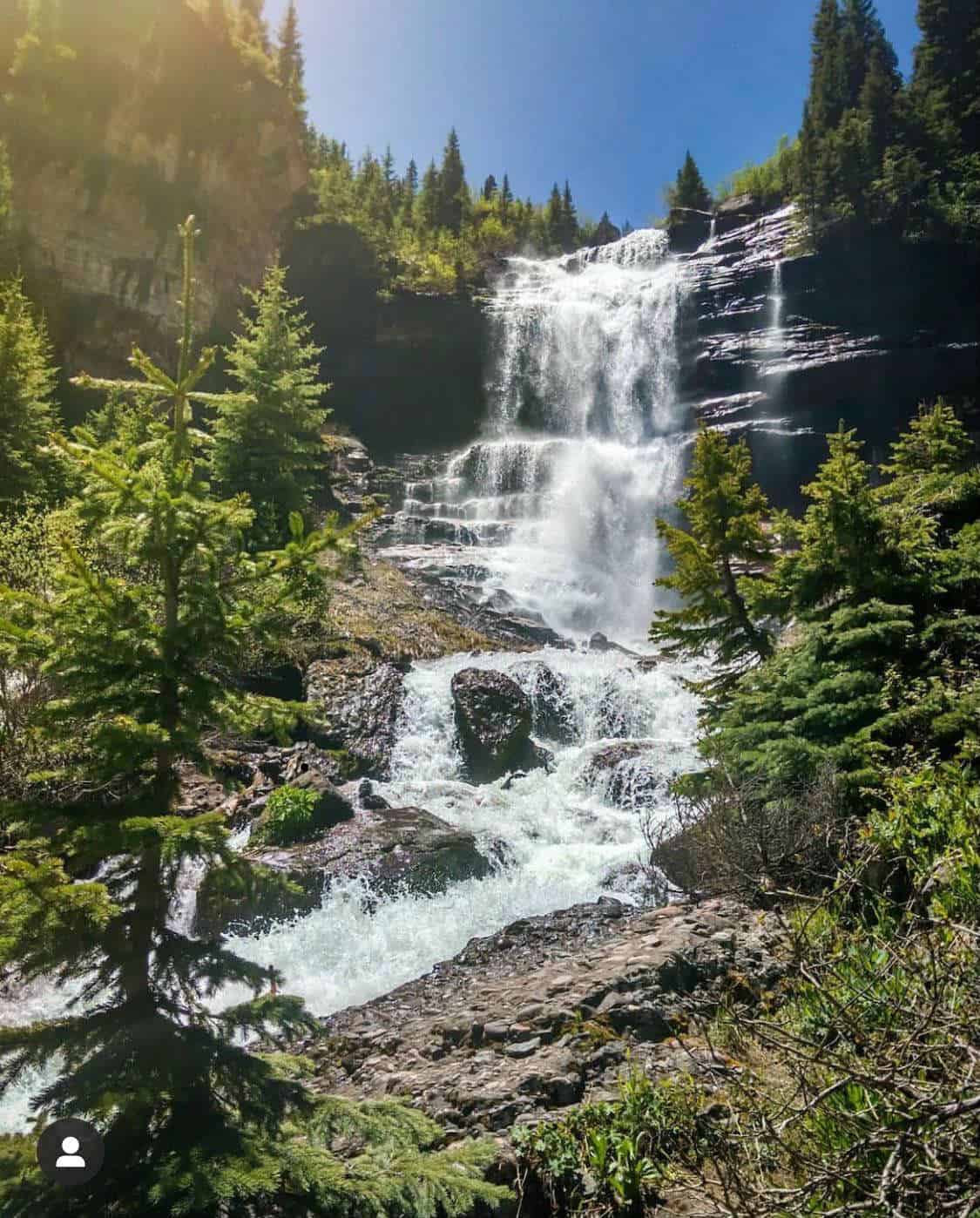
The first 2.7 miles of the Wild Basin Trail is the most waterfall-packed stretch of trail in RMNP. Embark on this journey to visit Lower and Upper Copeland Falls, Calypso Cascades, and the best of all: Ouzel Falls.
Yes, Ouzel Falls is the gem of this hike, but Wild Basin indeed lives up to it’s name and is worth your time beyond just waterfall peeping.
From the Wild Basin Trailhead, the action ramps up quickly, with the spur trail to Copeland Falls breaking off after just one-third of a mile. Enjoy both the Lower and Upper Falls — the spur spits you right back out onto the main trail in stride.
At 1.3 miles in, be sure to hang left at the junction to stay on the Wild Basin Trail. Calypso Cascades comes up quick, just another third of a mile past the junction. These cascades tumble some 200 vertical feet, and it’s an impressive sight when the creek is really flowing — plan late spring or early summer for that snow melt flow.
Another mile up the trail sits Ouzel Falls — the hike’s climax — a clean and photogenic 40-foot beauty. Stay and enjoy or continue further up into Wild Basin for more adventure — just make sure you come prepared with extra supplies.
Additional Info: Rocky Mountain Hiking Trails
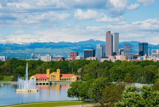
Denver
Home to almost three million people, the Denver metro area is both the most populated city and largest travel hub in Colorado. That means there are tons of folks just chomping at the bit to find an awesome waterfall hike nearby, whether they’re Denver locals or tourists.
We’ve got you covered with a trio of solid ones, all within an hour drive of downtown Denver. However, you should consider a trip in Rocky Mountain National Park or even deeper into the Rockies if you have more time to play with. If you’re looking for great Denver hikes in general, here’s our Denver hiking guide.
7. Boulder Falls
- Distance: 100 yards
- Elevation Gain: Negligible
- Difficulty: Easy
Most hikers won’t even call this a hike, but we’ll make an exception since Denver is so thirsty for waterfalls. Be grateful this one’s even an option as the trail was closed for 5 years following a flash flood in 2013, reopening in June 2018.
Boulder Falls is located in the foothills above Boulder along Highway 119. If traffic is light, you can drive from Downtown Denver to the trailhead in a little under an hour.
It’s a short 100-yard walk, and this is a popular one so expect company. In the past the trail was notorious for being pretty rough (due to overuse), although it was recently improved and widened, so hopefully it stays in better shape in the future.
The waterfall itself is a stunner. Come in late spring or early summer to see it raging, or get a mellower experience in late summer when the flow decreases and it splits into twin cascades.
Parking is limited so come early and have a plan B in case you can’t find a parking spot. There’s plenty of other nice hikes in the vicinity too.
Additional Info: Day Hikes Near Denver
8. Elk Falls
- Distance: 10.8 miles
- Elevation Gain: 900 feet
- Difficulty: Moderate / Challenging
Located on the footsteps of some of the Front Range’s highest peaks, Staunton State Park is the newest in Colorado, established in 2013. Elk Falls is the park’s crown jewel, though it’s buried deep in the park’s reaches.
This park is busy on summer weekends, so getting ahold of an annual pass will help beat the line at the gate. Park maps are available to help you navigate the trail system. There are multiple routes you can take to Elk Falls, but straying from our recommended route will result in a longer, harder hike — as long as 17 miles in length.
With relatively flat terrain through a pleasant forested valley, the hike is only challenging for visitors not used to hiking 10+ miles in day. The most direct route to the falls includes three of the park’s trails: Staunton Ranch Trail, Bugling Elk Trail, and Lion’s Back Trail.
For the most part, this hike is just a nice stroll through pine forests, but be on the lookout for Elk Falls Pond, a small but idyllic mountain lake at the intersection of the Bugling Elk and Lion’s Back Trails.
The Lion’s Back Trail will spit you out at the Elk Falls Overlook, standing on a clifftop overlooking the tall, double-tiered beauty.
Additional Info: Day Hikes Near Denver
9. Maxwell Falls
- Distance: 1 mile
- Elevation Gain: 360 feet
- Difficulty: Easy
Definitely more of hike than Boulder Falls, but still an easy one, this is a exceedingly popular family-friendly outing.
As you should be doing on every hike, please follow “leave no trace” ethics and help keep this place clean. If you see a piece of trash on the ground or in the water, be a dear and pack it out.
The easiest way to do Maxwell is via the upper trailhead, but many hike variations up to 4+ miles in length are possible, or even a shuttle from the upper to the lower trailhead.
The easy route is great for families with small children or inexperienced hikers, while expanding to a longer route can allow hiking enthusiasts to enjoy some peace and quiet while also experiencing the falls.
Additional Info: Day Hikes Near Denver
Colorado Springs
The second largest city in Colorado outside the Denver area, Colorado Springs sits along the edge of Front Range below the iconic dome of Pike’s Peak. Beyond the city’s western edge, there’s no shortage of mountain scenery — including a triplet of beautiful waterfall hikes.
10. Catamount Falls
- Distance: 2.8 miles
- Elevation Gain: 550 feet
- Difficulty: Moderate
Catamount Falls is located in the tiny burg of Green Mountain Falls, a mere 25 minutes from downtown Colorado Springs. This hike actually visits two waterfalls: Catamount Falls and Crystal Falls.
Make sure to look at Google Maps before you go where you’ll spot the Thomas Trailhead at the end of Boulder Street and the Catamount Trailhead at the end of Hondo Avenue. Indeed, you can’t park at the end of these streets, but parking is available at Gazebo Lake in the town center, with part of the hike taking place on the town’s roads.
The Thomas Trail connects the two trailheads, so we recommend doing this as a loop, starting from the Thomas Trailhead side. Once you leave Boulder Street and hit the trail, it’s only a half mile to the viewpoint for Crystal Falls, a small but nice cascade.
The trail steepens for the next three-quarters of a mile up to Catamount Falls, your real destination. Enjoy this pleasant set of cascades and then continue the same direction on the trail. This will bring you to the end of Hondo Avenue, which makes a straight shot back to the town center.
Additional Info: Day Hikes Near Denver
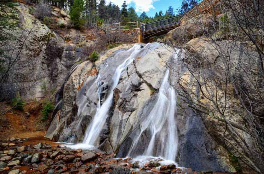
11. Helen Hunt Falls & Silver Cascade Falls
- Distance: 1.2 miles
- Elevation Gain: 300 feet
- Difficulty: Easy
To just see the gorgeous 35-foot Helen Hunt Falls, this isn’t really much of a hike. Starting from the Helen Hunt Falls Visitor Center, it’s just a hop, a skip, and a jump along a short trail. The waterfall is a beauty though, and it’s a must-do considering it’s less than a half-hour from downtown Colorado Springs.
However, we recommended taking the short trail above Helen Hunt Falls leading 0.6 miles uphill to Silver Cascade Falls. This waterfall has minimal flow, but it’s worthwhile to check out, especially with the cool views of the surrounding forests and canyons. The hike from the Helen Hunt Falls Visitor Center to Silver Cascade Falls is reflected in the hike stats above.
Another option is to take the longer hike to Helen Hunt Falls from the Stratsmore Visitor Center down the canyon and enjoy 4 miles of creekside hiking, along with over 1,000 feet of elevation gain. Smart planners will make it a shuttle so as not to turn 4 miles into 8 miles with the return trip.
Helen Hunt Falls is very popular, so go early for the best chance at parking, and always expect a crowd. Like most CO waterfalls, it flows best with snowmelt during late spring and early summer.
Additional Info: Day Hikes Near Denver
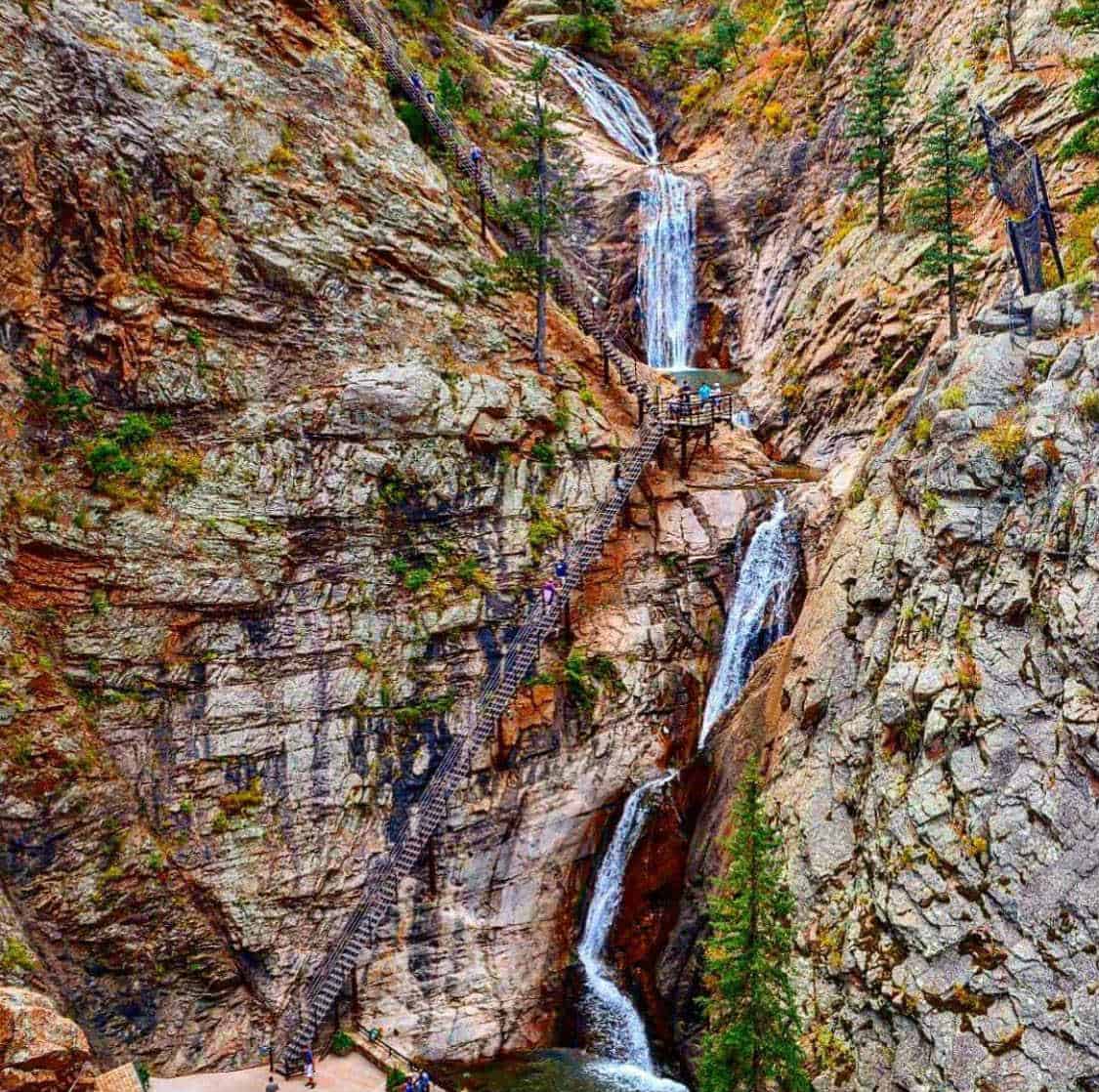
12. Seven Falls
- Distance: 1.6 miles
- Elevation Gain: 215 feet
- Difficulty: Easy
Behold, the most over-developed waterfall hike in Colorado! Seven Falls is absolutely spectacular, but requires paying a fee, riding a shuttle, and “hiking” on pavement. But it’s family-friendly and Seven Falls is a spectacle to die for. Wilderness enthusiasts, you’ve been warned.
Backstory: after a flash flood caused extensive damage in 2013, the Broadmoor bought the property, fixed the damage, and reopened it to the public. A fee had long been required to visit Seven Falls, but you must now park at 6 Lake Avenue at the Broadmoor Resort and take a mandatory shuttle to the trailhead.
The hike stats above reflect the paved walk from the shuttle to the falls and back, but there are indeed more hiking options once at Seven Falls: a 0.35 mile loop to Midnight Falls, a 1.5 mile loop to Inspiration Point, or a 3 mile loop incorporating both Midnight Falls and Inspiration Point.
If you plan to hike beyond Seven Falls, plan ahead with the extra water and snacks, be prepared to climb a tall and steep staircase, and make sure you’re back in time for the last shuttle back to your car.
Additional Info: Day Hike Near Denver
Telluride
Telluride is perched in a high-altitude basin on the north-west side of the San Juan Range. And for those in the know, the San Juan Range is Colorado at it’s finest.
Of the state’s major mountain ranges, the San Juans are the largest (by area), contain the most peaks over 13,000 feet, and get the most rain and snow. And because rain and snow feed waterfalls, the San Juans are the premier locale to view water falling from cliffs.
As such, Telluride is home to a trio of diva-status waterfalls, plus a whole heap of lush and gorgeous alpine scenery to explore. Beyond the three falls listed below, check out our guide to the top 10 hikes in Telluride.
13. Cornet Falls
- Distance: .5 miles
- Elevation Gain: 220 feet
- Difficulty: Easy
The hike to the 80-foot Cornet Falls is Telluride’s easiest waterfall hike, and starts right in town at the Jud Weibe Trailhead.
We’re calling it easy because it’s so short, but the quarter-mile from the trailhead to the falls is steep as hell with loose footing. Pick your steps carefully.
The trail skirts to the right of Cornet Creek and opens up into a red-rock amphitheater with the falls bursting off a cliff on one side. It’s a sight to see, and being so close to town, Telluride regulars can easily come back again and again.
The falls tend to lose flow toward the end of summer, so shoot for late spring or early summer if you want to see it raging.
Additional Info: Day Hikes Near Denver
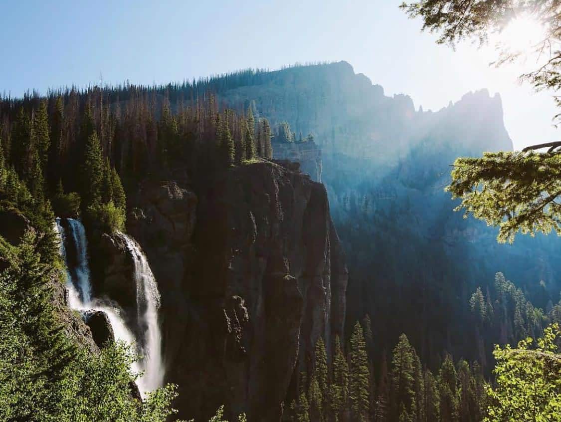
14. Bridal Veil Falls (Telluride)
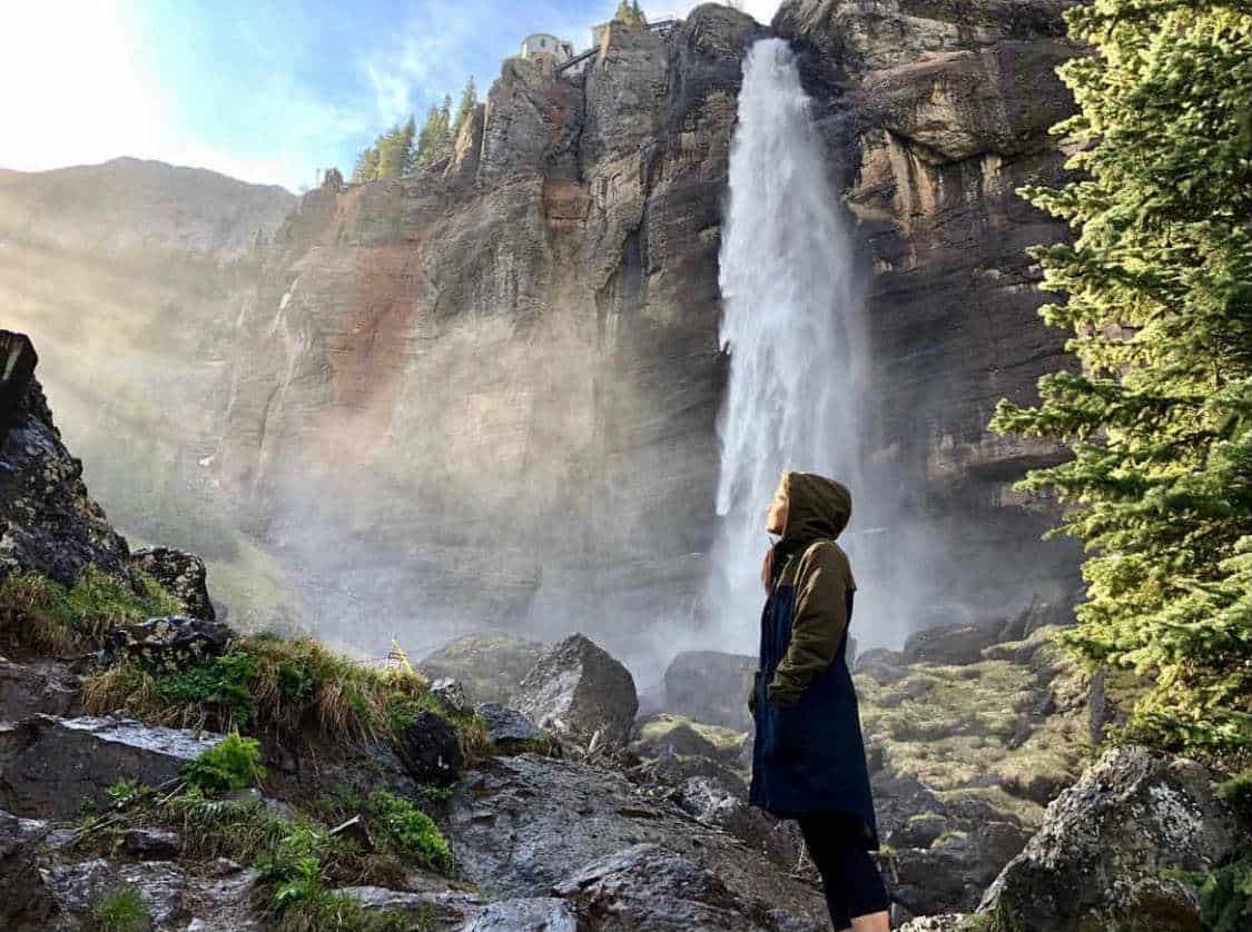
- Distance: 5 miles
- Elevation Gain: 1,350 feet
- Difficulty: Moderate
Dropping 365 feet off a sheer cliff, Telluride’s Bridal Veil Falls is the largest and most impressive waterfall on the whole list. It’ll straight knock your socks off.
This hike takes place on a 4×4 road, so if you have a high-clearance four-wheel drive vehicle, you can skip the hike and drive up. If you have the means, this is a great way to save your energy and use your foot miles to explore the wonders of Bridal Veil Basin beyond the falls.
Also note that the road goes all the way to the top of the cliff where you can access the lip of the falls, but it’s worthwhile to leave the road before the final cliff and explore the base of the falls too.
If you decide to hike to the falls, start at the Valley View Parking Area near the old Pandora Mill. All the online resources have conflicting information, but according to our calculations it’s 2.5 miles one-way to the top of the falls. With 1,350 feet of elevation gain, it’s uphill, but not too steep and definitely doable for anyone in reasonable shape.
The historic Bridal Veil Powerhouse (built in 1907) near the top of the falls is still an operating hydroelectric power plant providing Telluride with about 25% of it’s demand for electricity.
Additional Info: Telluride.com
15. Bear Creek Falls
- Distance: 4.8 miles
- Elevation Gain: 1,100 feet
- Difficulty: Moderate
While not nearly as tall as the nearby Bridal Veil, Bear Creek Falls is still a stunner. And rather than walking on a 4×4 road, this is more of a trek up into the backcountry. Don’t be fooled though, this is still a highly popular hike.
The hike starts in Telluride at the end of Pine Street. From there, the trail heads off into the forest, gradually gaining elevation for nearly 2.5 miles. For the first couple miles, you’ll be enjoying the aspens and mixed conifers overhead.
Eventually some meadows open with grander views into the basin above. At the junction with the Wasatch Trail, Bear Creek Falls is visible up ahead in the distance. Continue another third of a mile to this grand destination.
For the physically fit and truly adventurous, the moderate hike to the falls may just be the warm-up.
It’s possible to do a long loop hike by continuing up the Wasatch Trail to a high pass (topping out at 13,000′), then continuing back to town through the beautiful Bridal Veil Basin.
You’ll even pass Bridal Veil Falls along the way. This extended route clocks in at 13.5 miles and 5,000 feet of elevation gain (if you drop a shuttle car at the Valley View Parking Area), but add an extra 2 miles if you hike all the way back into town.
Additional Info: Hiking & Walking
Pagosa Springs
The first time I drove from Arizona to Colorado, I pulled into Pagosa Springs and said “Now this is Colorado.” It’s a quaint town with a million dollar backdrop.
Located in the southwest of Colorado, Pagosa sits on the southern footsteps of the eastern San Juan Mountains, far away from Denver in a quiet yet stunningly gorgeous corner of the state. The mountains here are home to a threesome of waterfalls sure to please any waterfall-loving hiker.
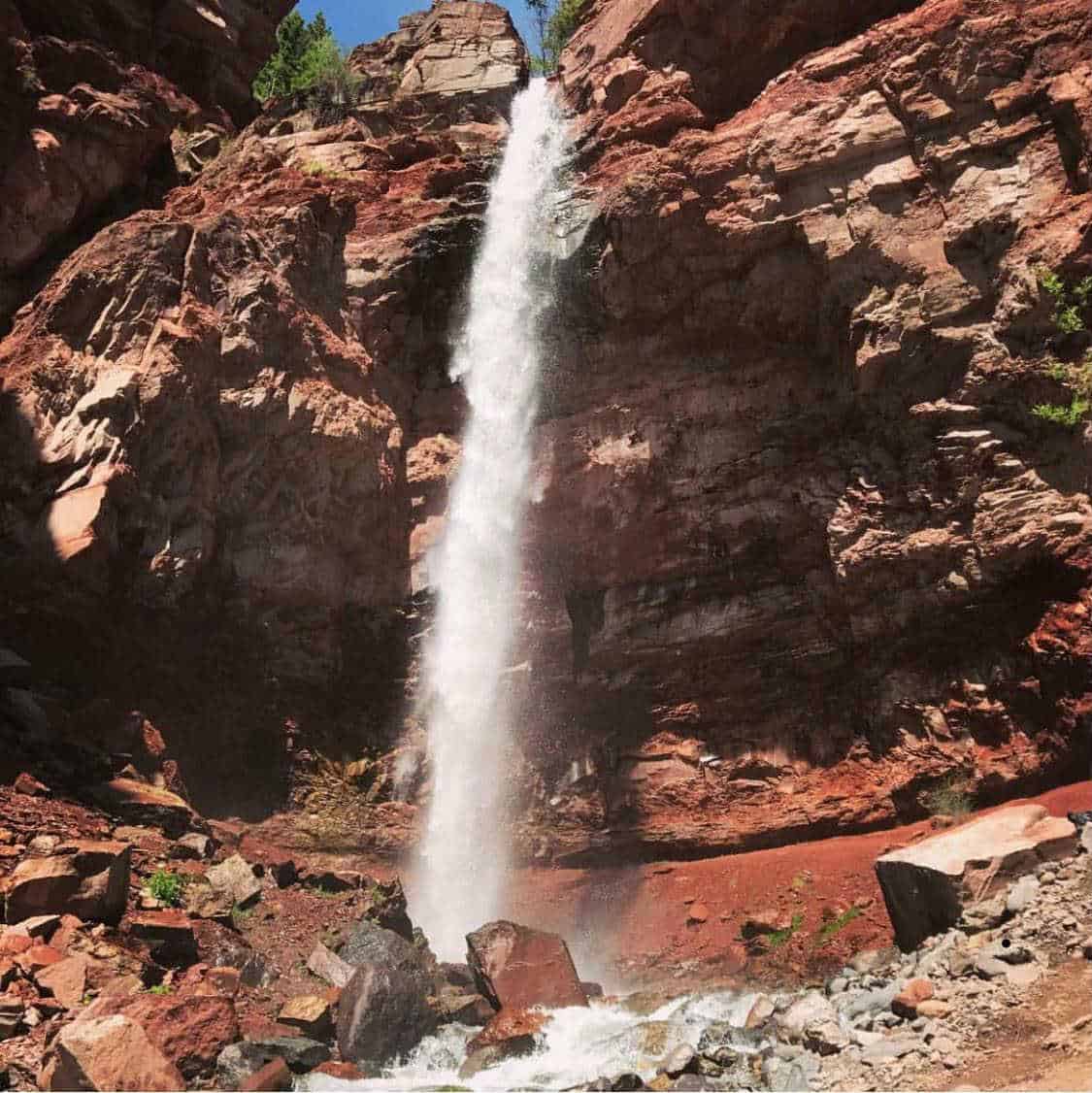
16. Treasure Falls
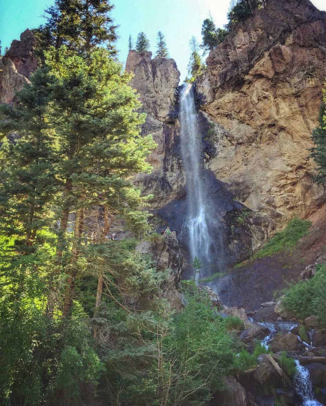
- Distance: 1 mile
- Elevation Gain: 200 feet
- Difficulty: Easy
Just a 15 minute drive from Pagosa gets you to the trailhead. From there it’s a mere half-mile uphill to the falls. Non-hikers will be sucking wind in the elevation, but anyone can do it, and the payoff is incredible.
Treasure Falls splits between a cleft in a jagged cliff and drops gracefully 105 feet. As waterfalls go, it’s easier on the eyes than most. The trail is developed with two different observation decks for viewing the falls.
Although it’s not Denver or Colorado Springs, this is a popular hike so come early on summer weekends to get a parking spot.
Additional Info: Day Hikes Near Denver
17. Piedra Falls
- Distance: 1.2 miles
- Elevation Gain: 200 feet
- Difficulty: Easy
Another Pagosa area fall, Piedra Falls is also an easy, family-friendly hike, but in a more remote location. You drive for about an hour on mostly dirt roads to get here, but it’s worth the excursion. Once you’re on the trail it’s a breeze of a half mile up to the falls.
Rugged volcanic rock makes up the canyon walls here, and Piedra is a brilliant-looking chute spilling from a cleft of dark basalt. The creek below the falls is explorable, which makes it easy to entertain the kids while the adults enjoy the view.
The more adventurous types can also use Piedra as a convenient scenic side-trip on the way into the far-eastern reaches of the backpacking paradise that is the Weminuche Wilderness. There’s assuredly a lesser known waterfall or two hidden up that way too.
Additional Info: Out There Colorado
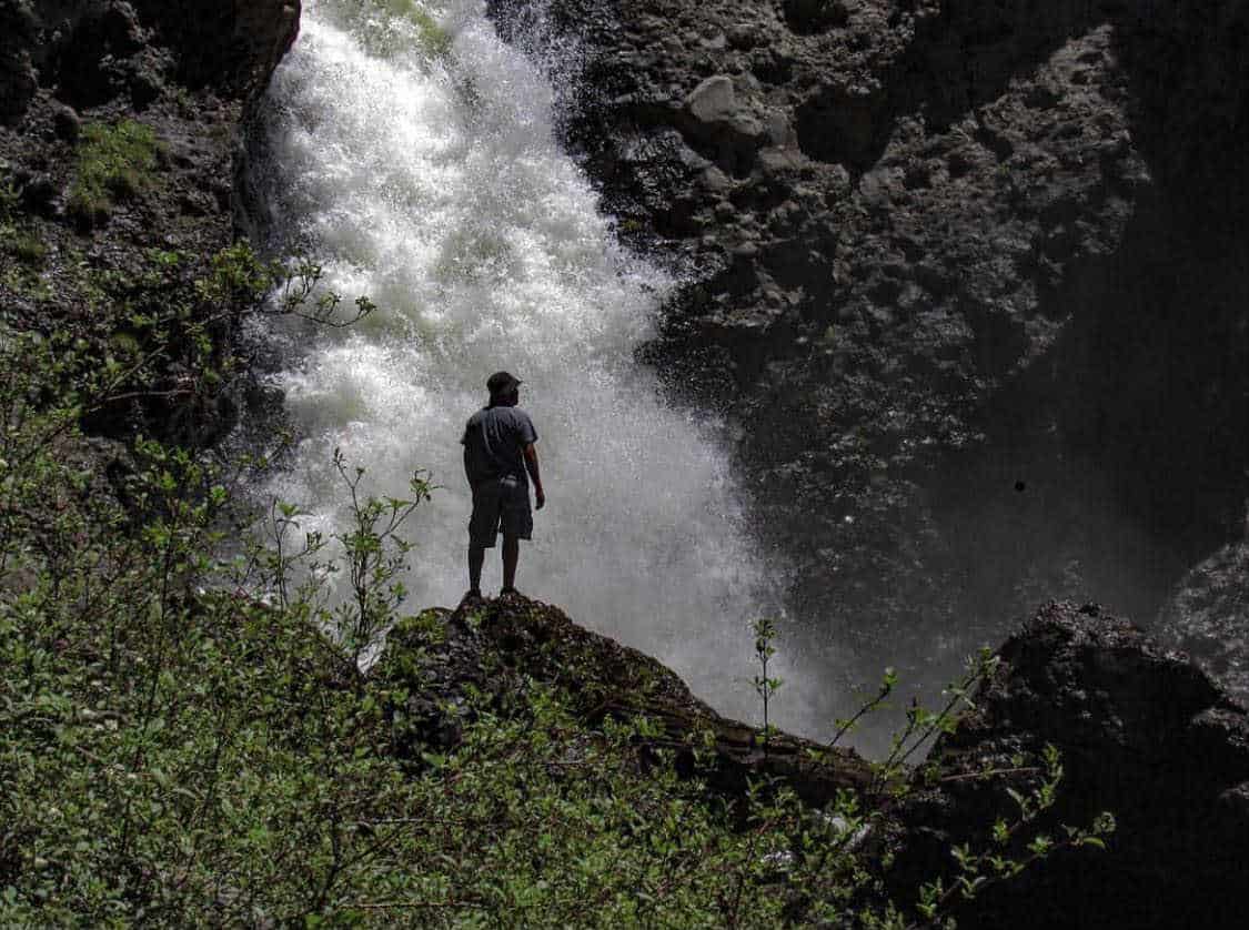
18. Fourmile Falls
- Distance: 6.5 miles
- Elevation Gain: 1300 feet
- Difficulty: Moderate / Challenging
Speaking of the Weminuche Wilderness, Fourmile Falls is a thundering pair of waterfalls in the far south-east corner of the wilderness. Just a 40-minute drive from Pagosa Springs, this is an accessible wilderness excursion that’s doable as a day hike or a backpacking trip.
From the Fourmile Trailhead, follow the Fourmile Trail steadily uphill with views of the 12,640-foot Pagosa Peak towering above. It’s a little over 3 miles to the falls, with the tall and sleek horsetail of the lower falls working as the hype man for the wider, thundering upper falls a few hundred yards further up.
If you’re looking to turn this into a backpacking trip, consider heading another 2.2 uphill-miles to Fourmile Lake. You can even make it into a loop with the Anderson Trail without adding mileage or trouble.
Additional Info: The Outbound Collective
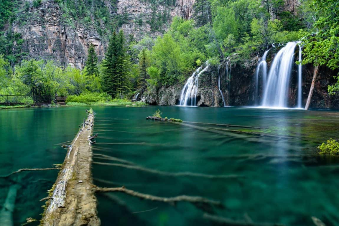
Glenwood Springs
Most famous for its proximity to Hanging Lake (we’ll get there shortly), Glenwood Springs is an awesome mountain town tucked in a high valley along I-70. And I’m not just saying it’s awesome for the hell of it — the town was hailed as the 5th best place to live in America by Outside Magazine in 2015. It’s also home to two popular but stunning waterfall hikes.
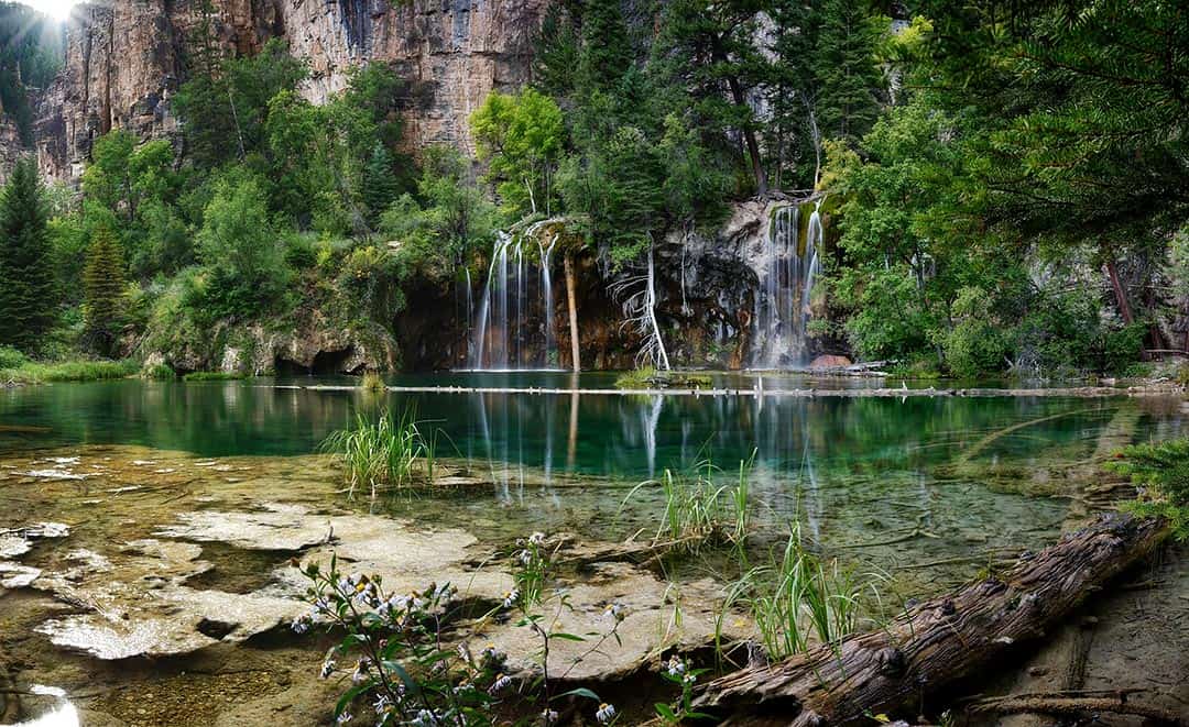
19. Hanging Lake & Sprouting Rock
- Distance: 2.6 miles
- Elevation Gain: 750 feet
- Difficulty: Moderate
Located along I-70 just east of Glenwood Springs, Hanging Lake and its waterfalls are one of the most popular tourist attractions in Colorado. If you’re planning on going during the summer and fall seasons (May to October), you’ll need an advance reservation.
As such, this hike takes some planning and you won’t have the place to yourself. But if you see the photos and decide that Hanging Lake is a bucket list item for you, do yourself a favor and take the short side-trip to Sprouting Rock, a unique waterfall just a few hundred feet off the main route.
Now, the first third of a mile is on paved bike path, so pay attention. When the Hanging Lake Trail breaks off to the north, it gains 750 feet of elevation in about a mile. That’s not insanely steep, but enough to get your heart pumping and lungs sucking air.
Once you reach the lake, the trail becomes a boardwalk suspended above the crystal-clear blue-green water, with multiple waterfalls pouring directly into the lake. Enjoy the view and then check out the nearby Sprouting Rock, a spectacle of a waterfall literally shooting straight out of a cliff-face.
Additional Info: Travel & Leisure
20. Rifle Falls
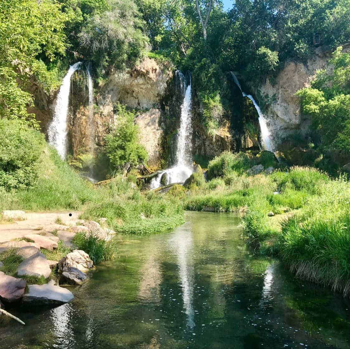
- Distance: 1.5 miles
- Elevation Gain: 100 feet
- Difficulty: Easy
Another banger of a destination, Rifle Falls is a stunning triple-headed siren. And like Hanging Lake, many a waterfall lover answer the siren’s call. Preserved by Rifle Falls State Park (fee required), this is a popular spot with limited parking, so the wise arrive at 7am when the park opens.
From the parking lot to the classic view at the base of the falls, it’s only a few hundred yards — not even considered a hike by most. But fear not, the Coyote Trail is here to offer further exploration of the cliffs and their associated caves above the falls too.
Even with the extended exploration, this is easy hiking, so bring the kids, the grandparents, and your couch-potato Uncle Fred too. It’s hard not to love Rifle Falls.
Additional Info: Day Hikes Near Denver
Crested Butte
An old coal mining town turned ski town, Crested Butte is tucked high on the southern shoulder of the Elk Mountains. It’s a wonderful place to spend an adventurous vacation, especially if you’re wanting to head off into the legendary Maroon Bells-Snowmass Wilderness to the north. Of course, there’s also room for family-friendly adventures, like the short hike to Judd Falls.
21. Judd Falls
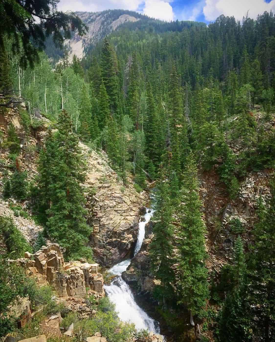
- Distance: 1 mile
- Elevation Gain: 150 feet
- Difficulty: Easy
Located just a half-hour outside Crested Butte, Judd Falls is an impressive double-tiered specimen. Like all other other easy hikes on the list, this one is popular so come early. Also note that a high-clearance vehicle is required to make it to the upper trailhead, so if you’re driving a sedan, park in the lower lot and add an extra mile to your hiking distance.
The hike itself is indeed easy, but also crosses through some beautiful aspen forest, meadows with mountain views, and even a few small ponds. Even without the waterfall at the end, this is a stunner of a one-miler.
Reach the trail’s end at the top of a cliff for an impressive view of Judd Falls careening through the forested canyon below. Unless you’re a true adventurer, the base of the falls is inaccessible, but there are multiple points from which to view the falls from the canyon rim.
Additional Info: Travel Crested Butte
Explore More in Colorado
Sign up for our free email to join thousands of readers getting epic travel, hiking, camping and gear ideas every week.
Seen in: Colorado, Hikes, Rockies, Rocky Mountain National Park