We research, evaluate and select travel destinations based on a number of factors, including our writers’ experience, user reviews and more. We may earn a commission when you book or purchase through our links. See our editorial policy to learn more.
When most people think of epic backpacking trips, West Texas is probably not the first place that comes to mind.
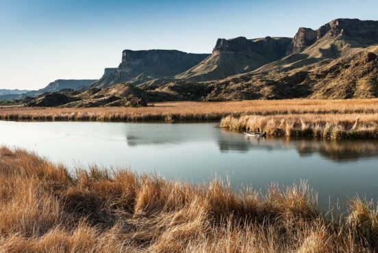
Heck, it may not even crack their top ten — which is just part of what makes backpacking in Big Bend National Park so unique. Big Bend is an ideal place to experience the solitude of the desert (and abundant sunshine), even in the winter.
Big Bend has hundreds of miles of hiking trails through deep canyons, open desert, plateaus, and mountains. It’s home to thousands of species of plants, birds, and mammals, including coyotes, road runners, javelinas, mountain lions, and even black bears.
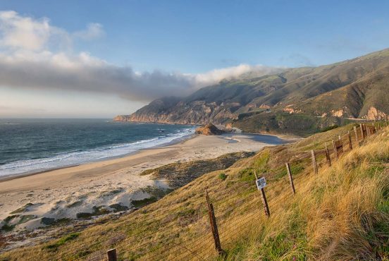
If you have time, you’ll want to drive or hike to the Rio Grande — the wild, natural border between the U.S. and Mexico. And because the park is so remote it’s hardly ever crowded like other national parks, even on weekends and holidays.
Before jumping into the best backpacking routes in Big Bend, make sure you’re knowledgable on weather, water, and permits, three very important factors when backpacking in desert terrain.
Pro tip: If you plan on doing one of the more strenuous backpacking itineraries in Big Bend, check out the Big Bend Chat. You can ask specific questions, check up-to-date water and weather reports, and download maps.
Related Read: Everything You Need to Know About Backpacking with Kids
3 Best Backpacking Routes in Big Bend National Park
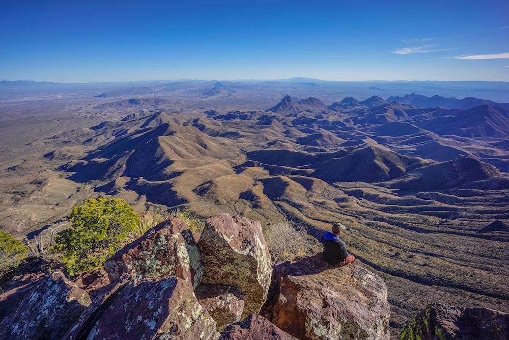
1. South Rim Trail Loop
- Distance: +/- 13 miles (16 with Emory Summit)
- Total elevation gain: 4,380 feet
- Recommended number of nights: 1
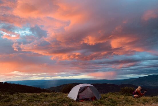
While you could cover the South Rim Trail Loop in a long, single day, why not snag a backcountry site near the rim and treat yourself to a spectacular sunrise? You won’t regret it, nor will you regret not packing all 16 miles into a single day.
This backpacking route in Big Bend is a loop that offers lots of options. Before determining the best itinerary, ask yourself: would you prefer a steep ascent and some tree coverage? If so, head out clockwise toward the Pinnacles Trail. Prefer a softer ascent, and have the knees for a steep decline? Then head counterclockwise through the Laguna Meadows to start.
Regardless of what direction you go in, you’ll have the option of adding three miles to take the Emory Peak Trail to summit Emory Peak (it starts at the intersection of the Pinnacles and Boot Canyon trails.) The out-and-back trail has stunning views and a fun, short scramble to the top. If you choose to summit the peak, take advantage of the bear lockers at the beginning of the trail so you can slackpack (i.e. not carry most of your gear) up the steep 1.5 miles to the summit.
When you reach the South Rim, you’ll be treated to panoramic views of the Chihuahuan Desert and Sierra Madres (in Mexico) that go on for miles. The South Rim viewpoint has the best views of the loop.
When planning out your backpacking route in Big Bend and selecting a campsite, use the Chisos Mountains Backcountry Trail Map as a visual reference.
Related Read: How To Go Backpacking Solo & Start Enjoying Solitude Like No Other
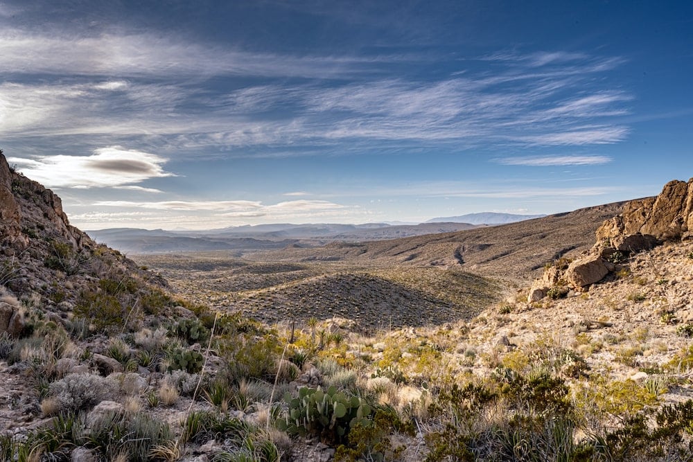
2. Marufo Vega Trail
- Distance: +/- 12.5 miles
- Total elevation gain: 2,970
- Recommended number of nights: 1
The Marufo Vega Trail is the perfect option for backpacking in Big Bend on a quieter, far less busy section of the park. The trail begins near Boquillas Canyon in Big Bends southeast corner.
Before jumping into detail about the trail, it’s important to understand that water from the Rio Grande is not potable. At all. No matter how you treat it. Even though it feels counterintuitive, you must carry all the water you’ll need.
The nearby Rio Grande Village Visitor’s Center has a store (open year-round) if you find yourself needing to restock on liquids before you set out. While you’re at the visitor’s center, you’ll want to pick up a permit for open desert (wilderness) camping.
What the trail lacks in potable water (and shade) it makes up for in limestone cliffs, plateaus, and jaw-dropping views of the Sierra del Carmens, Mexico, and the Rio Grande.
After 3.5 miles, the trail splits into north and south forks, which can be treated as out-and-back trails or connected by a trail that parallels the river; head out on the north fork for a softer descent to said river. Navigating from the north fork to the south fork is easier anyway, as the start of the ascent back to the trailhead is clearly signed (which it isn’t if you go in reverse.)
Be sure to take the spur trail down to the river banks. Pitching your tent for the night near the river (but not too close) is a definite perk of this trail. Depending on water levels, you may find rocks to jump off into the river or at least enjoy a nice private swim. But remember: don’t drink the water.
Related Read: 9 Best National Parks to Visit in December
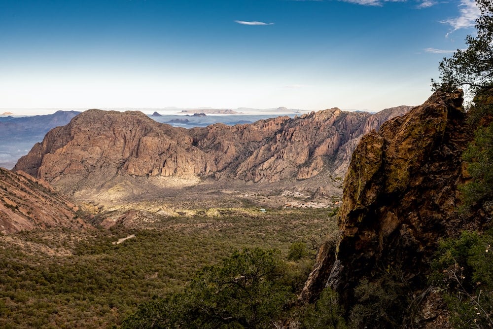
3. Outer Mountain Loop
- Distance: +/- 30 miles
- Total elevation gain: 8,280
- Recommended number of nights: 2 (though three is also nice)
The Outer Mountain Loop features 30 miles of canyons, meadows, high mountains, and desert, usually stretched over three days and two nights. It’s one of the best routes for backpacking in Big Bend as it passes some of the park’s most beautiful sights, and you only have to deal with crowds if you add on side trips to Emory Peak or the South Rim.
Be sure to make the drive to the Homer Wilson Ranch House to leave water for the second night and third day (labeled with your name and date) either the day before or morning of your departure. And plan to carry a lot of water for the first two days, which covers 21 miles.
The loop can be done many ways, but the most popular route is to park at the Chisos Basin and make your way clockwise through several trails and ecosystems. On the first day, plan to hike 10 miles to your backcountry site in the Lower Juniper area via the Pinnacles, Boot Canyon, and Juniper Canyon trails. Be sure to have your backcountry camping permits secured ahead of time.
It’s mostly well-marked trails and shade as you make your way up to the base of Emory Peak, past the giant boot-like formation (and the canyon’s namesake). Then, take the Juniper Canyon Trail to the loop’s high point at Toll Mountain Pass (7,000 feet) before you head back down into the basin, losing 2,000 feet over three miles. The campsites are in the Lower Juniper area.
Prepare to meet your match on day two as you tackle the infamous Dodson Trail. It’s exposed and long, and if you haven’t budgeted your water correctly, you’re in for a very uncomfortable day of hiking in the blazing sun. It’s also not all that well marked. To give yourself plan of time, plan for an early start. But the plus side is you’ll have gorgeous views of the South Rim as you hike. And if you’re lucky, it may be cloudy.
If you stashed water at Homer Wilson, you’ll reach it mid-afternoon. Go a half-mile past the road (as required by your permit) before you start looking for a campsite to stop for the evening. You also need to be out of sight from the road.
A big chunk of the climbing happens on day three, with the hardest section being the Blue Creek Trail at five miles and 2,000 feet of elevation gain. There’s no shade or water, but when you hit the Laguna Meadow Trail, the tough stuff is over. Enjoy your last few miles hiking back down into the Chisos Basin.
Related read: 9 Incredible Glamping Spots Near Big Bend National Park
Things to Consider
Weather While Backpacking in Big Bend National Park
The best time to visit this expansive park is November through April. With elevations ranging from 1,700 feet at the river to 7,625 feet at the top of Emory Peak, expect and plan for everything from snow to a sunburn.
The desert can be blazing hot during the day, especially toward the end of April, and literally freezing at night in winter. Depending on the elevation of your campsite, it could be far warmer or colder. Come prepare for wild temperature swings.
Water and Backpacking in Big Bend National Park
Water is simple: there’s isn’t much. Plan to cache (leave water along your route ahead of time) and carry all of your water. Natural sources of water are unreliable and most are not potable, even if treated. This is not Glacier National Park; you won’t be walking along rivers and lakes most of the time.
Permits for Big Bend Backpacking
Big Bend requires permits for all overnight backpacking in the park. These permits are available online on a rolling, six-month basis. You can also try to get a walk-up permit at the Chisos Basin or Panther Junction Visitor Centers, but there’s no guarantee anything will be available. Be prepared to select your specific site when you reserve your permit. You’ll need to describe your itinerary in detail to a ranger before departing.
The exception to that is a permit for wilderness camping; those you can only get in person at the visitors centers.
The park has 42 backcountry campsites divided into 14 camping areas throughout the park. Each site has a cleared spot for at least one tent and an animal-proof storage box (mostly for black bears).
While these primitive sites offer a secluded camping experience and often a great view, they do not have water, electricity, or toilets. They’re anywhere from one to six miles beyond the nearest trailhead and have no vehicle access. For more info including pictures of each backcountry campsite, check out the super-helpful Chisos Mountains Backcountry Guide. It’s also a good idea to reference this map of the park as you determine your itinerary.
Pro tip: No matter what backpacking adventure you choose, no backpacking trip in Big Bend is complete without a stop at the Langsford Hot Springs.
Have a high-clearance vehicle for the bumpy two-mile drive to parking at the Historic Hot Springs District (seriously, a Civic won’t cut it.) The district has the remains of an old resort and a post office. The actual springs are a quarter-mile away on the north side of the Rio Grande.
Related Read: 10 Best Hikes in Texas for Top-Notch Lone Star State Scenery
Find Your Next Texas Adventure
Sign up for the Weekend Wanderer to join thousands of readers getting epic travel and gear ideas every week.
Seen in: Backpacking, Big Bend, National Parks, Southwest, Texas