We research, evaluate and select travel destinations based on a number of factors, including our writers’ experience and expertise, user reviews and more. We may earn a commission when you book or purchase through our links. See our editorial policy to learn more.
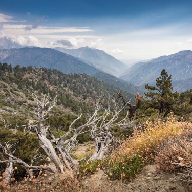
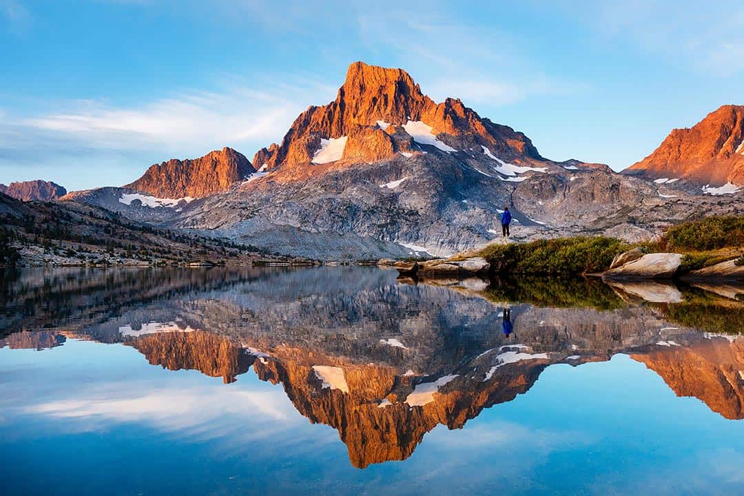
Get ready to see why John Muir famously called the Sierra Nevada the “Range of Light” in this alpine wonderland full of sapphire lakes, towering granite peaks, and delicate bursts of wildflowers.
Mammoth. Simply utter these two syllables to nearly anyone in California, and you’ll be greeted with a wistful grin and a barrage of epic stories from days spent slaying powder and cracking beers.
Though Mammoth Lakes operates as one of the most notable ski towns in the world all winter long, there’s ample reason to visit this mountain mecca during the summer months as well.
The reason? Mammoth is home to some of the finest trails in the entire Sierra Nevada. Look out, Yosemite.
Many of the trails listed here will need to be accessed via the Reds Meadow / Devils Postpile Shuttle, which typically runs June through September, depending on snowpack.
Hikers can expect to park near the main lodge and purchase a ticket day-of at the Mammoth Adventure Center. Other trailheads can be reached by car after some meandering on Mammoth’s gorgeous mountain roads.
For a little extra solitude and a glimpse at some of the most spectacular sunsets in the Sierra, consider planning a backcountry camping trip at one of the pristine, alpine lakes mentioned below. Permits are required for all overnight wilderness trips, so be sure to reserve one early to get your top choice.
A word to the wise — mosquitoes get pretty gnarly in this area in summer months. Triple check that you packed that bug spray!
The list below is full of “must see” tourist hot spots, with a few of our favorite gems thrown in for avid hikers who like a challenging ascent with a dash of solitude. Every one of these hikes starts above 7,000 feet in elevation, so keep that in mind when you plan your allotted hike time.
Related Read: 7 Beautiful Camping Spots in Mammoth Lakes, California
1. Thousand Island Lake
Why you should go: This stunning hike to the most famous lake in the Ansel Adams Wilderness boasts commanding views of Banner Peak and the entire Minaret Range.
- Distance: 17.2 miles
- Elevation Gain: 3,600 feet
- Difficulty: Challenging
With the granite fan of Banner Peak and her latticed snowfields looming large above the turquoise water, Thousand Island Lake is a perfect backdrop for amateur photographers looking to try their luck at capturing a little Sierra magic.
However, this hike is much more than a 17-mile slog to nab the perfect backcountry selfie. Taking the High Trail out of Agnew Meadows puts hikers smack dab in the middle of one of the most iconic sections of the famedPacific Crest Trail, a 2,653-mile thru-hike spanning from Mexico to Canada.
Take the shuttle from the Mammoth Main Lodge and get off at Agnew Meadows. The trail starts out with a steep set of switchbacks, gaining over 500 feet in the first mile.
After that, it’ll flatten out to a gentle ascent for the remainder of the hike. Gaze across the San Joaquin River Valley and try to catch glimpses of Shadow Creek’s towering waterfall as you meander through alpine meadows strewn with purple lupine, wavy leaf paintbrush, and corn lilies.
Despite the epic vistas along the entirety of the High Trail, the pièce de résistance of this hike is, of course, Thousand Island Lake. If you’re overnight camping, try to find a flat spot on the north side of the lake, at least a quarter-mile from the outlet.
Keep in mind that campfires are not allowed here. Instead, bathe in the quiet stillness of sunset as you watch the Milky Way fade into view.
To create a loop, return back along the River Trail rather than the High Trail.
More Information: Hikespeak
2. Convict Lake Loop

Why you should go: With jaw-dropping views of Laurel Mountain’s imposing east face, this easy 2.5-mile stroll along a scenic lake is one of the prettiest family-friendly hikes in the Sierra.
- Distance: 2.5 miles
- Elevation Gain: 215 feet
- Difficulty: Easy
Located just 2 miles of the 395 Highway, Convict Lake is a perfect, year-round pit stop for families traveling to and from Mammoth, Yosemite, and beyond. It also features an ADA accessible paved path for a good portion of the hike, making it an excellent option for those with mobility issues or small kids.
Park on the northeast side of the lake and follow the signs to hike the loop clockwise or counter clockwise. The views of Laurel Mountain and Mt. Morrison are truly magnificent as you curve around the gently graded walking path that circumnavigates Convict Lake itself.
Fishermen take note — this lake is well stocked with Alpers Trout.
Adventurous hikers can use this trail as a jumping-off point and hike an additional four miles uphill to Lake Dorothy and explore the colorful Convict Canyon, but in our opinion the crown jewel of the area is the lovely, albeit grimly named, Convict Lake.
More Information: Convict Lake Trails
3. Devils Postpile & Rainbow Falls
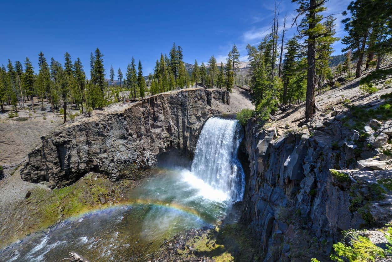
Why you should go: An easy hike accessible by shuttle that features mind-boggling geology, mountain views, and a towering waterfall.
- Distance: 4.5 miles
- Elevation Gain: 700 feet
- Difficulty: Easy
No trip to Mammoth Lakes is complete without a visit to one of its most famous landmarks — Devils Postpile. This bizarre geological formation was formed by lava flow over 100,000 years ago, with crumbling hexagonal towers of basalt forming a massive cliff-face.
Park near the Mammoth Adventure Center, pick up a shuttle ticket, and take the 30-minute shuttle ride down the mountain, gazing out at incredible views of the Minarets as you descend. Hop off the bus at the Devils Postpile shuttle stop and mosey over to the ranger station to learn about the history of the area, or lace up your boots and start hiking.
Trails in this area are well signed, and water crossings are equipped with bridges and sturdy logs.
In just a half-mile of easy walking, hikers come face to face with the huge, basalt columns of Devils Postpile. From here, backtrack about a tenth of a mile and take the signed junction climbing up towards the top of the pile itself.
Continue south along the trail, enjoying gorgeous views of the San Joaquin River for about 2.5 miles before descending towards Rainbow Falls. Enjoy the cool, iridescent mist from the falls before turning back and following signs for Reds Meadow Resort, a favorite stop for PCT hikers.
When you’re finished, feed your hiker hunger with a massive cheeseburger at the resort or simply hop back on the shuttle from this stop and enjoy the ride back to your car.
More Information: SoCal Hiker
4. Shadow Lake
Why you should go: A breathtaking day hike full of the best Mammoth has to offer —
carved river valleys, craggy peaks, roaring waterfalls, and azure alpine waters.
- Distance: 8.5 miles
- Elevation Gain: 1,580 feet
- Difficulty: Moderate
If you’re an avid hiker looking for a great workout and you’ve only got one day to spend in Mammoth, look no further than the trek up to Shadow Lake.
This hike, like many in the region, begins with a shuttle ride down from the Mammoth Adventure Center, opposite the Main Lodge. Jump off the shuttle at the Agnew Meadows stop and road walk for about .25 miles before hopping onto the Shadow Creek Trail. You’ll descend towards Olaine Lake and the rushing Middle Fork of the San Joaquin River before crossing a bridge and beginning a steady, leg-busting climb that parallels Shadow Creek.
If you’re a fan of giant, gnarled hobbit trees, this is the trail for you. Massive, ancient junipers line the trail as it climbs towards Shadow Lake.
In summer months, the fervent spray near the top of Shadow Creek Falls will be a welcome respite from the exposed, sunny switchbacks.
At the top of the climb, the trail flattens out for half a mile before joining the John Muir Trail. Turn around at the Shadow Creek bridge on the west side of the lake, or if you’re a glutton for punishment and jaw-dropping views, continue your ascent for another 2.5 miles to Ediza Lake.
More Information: Hikespeak
5. Sherwin Lakes
Why you should go: This shaded romp through aspen, Jeffrey pine, and white fir offers a chance to marvel at impeccable fall foliage on the way to a glittering subalpine lake.
- Distance: 5.1 miles
- Elevation Gain: 1,050 feet
- Difficulty: Moderate
A signed trailhead near the end of Sherwin Creek Road marks the beginning of this tree-lined trek. The trail crosses a small, babbling creek before ascending slowly but steadily towards the Sherwin Lakes. After about 500 feet of ascent, you’ll be greeted with the first of many stunning views of Long Valley and the town of Mammoth Lakes.
A series of switchbacks meander through a small burn zone before spitting hikers out at the first of the two lakes. Stop for a snack break and try to catch a glimpse of hungry Brook Trout leaping out of the water to snap up insects. In the fall, the aspens lining the lake put on a glorious color show of electric yellows and oranges.
A short, off-trail scramble will take you to the second lake before heading back downhill to the trailhead.
More Information: Modern Hiker
6. Minaret Lake
Why you should go: This burly day hike or moderate overnight trek puts hikers face to face with the sharp, granite spires and high altitude lakes that make the Ritter Range truly remarkable.
- Distance: 12.2 miles
- Elevation Gain: 2,850
- Difficulty: Strenuous
Perform a Google image search for “The Minarets” and you’ll see why this area is a fan-favorite among California hikers — jagged pinnacles of crumbling granite jut out from the earth like giant’s teeth. Of all the alpine lakes in the area, Minaret Lake boasts the best views of these harrowing rock formations, up close and personal.
Park at the Mammoth Adventure Center and take the shuttle down to the Devils Postpile stop. Pro tip: you can tack on an easy one-mile hike to see the Postpile if you’re feeling frisky.
Follow signs towards the John Muir Trail, turning right at a junction towards Johnston Lake. The trail splits again before departing the JMT and beginning an intense climb through alpine pine forests that runs parallel to the rushing waterfalls of Minaret Creek.
The final two miles of trail are by far the most difficult. You’ll be rewarded for your blood, sweat, and tears when the trail drops you off on the eastern side of Minaret Lake.
Though no campfires are allowed at the lake, these glacially carved slabs boast some epic campsites with 360-degree views of the Minarets and the valley you just climbed out of. Permits are required for overnight trips.
More Information: US Forest Service
7. Inyo Craters
Why you should go: This easy one-mile hike through towering pine trees plops hikers right into a duo of turquoise, volcanic lakes.
- Distance: 1 mile
- Elevation Gain: 100 feet
- Difficulty: Easy
This short day hike is great for families or on a hot summer day, as 90% of the trail is in a serenely shady pine forest. Amble past Jeffrey pines to a series of three volcanic craters, formed about 600 years ago. The first two craters cradle aquamarine lakes.
To get there, take the Mammoth Scenic Loop a few miles west from the 395 Highway. Turn right on the Dry Creek Road Spur and follow the signs to a small parking lot.
From here, you’ll ascend a gradual incline through the forest for half a mile before traversing a plateau from which you can view the craters and learn all about this unique geological phenomenon from the nearby signs.
More Information: U.S. Forest Service
8. Yost & Fern Lakes
Why you should go: A short but steep hike out of June Lake that’s full of majestic views, bursts of wildflowers, and two stunning alpine lakes – without the crowds!
- Distance: 6 miles
- Elevation Gain: 2,600 feet
- Difficulty: Moderate
This hike is one of those hidden gems that we discovered on a random summer weekend when all the other lakes were still frozen over, and boy were we glad we took a chance and played permit roulette!
The trail out of June Lake is steep and rocky, but you’ll quickly be rewarded for your effort when sweeping, panoramic views of the entire June Lake area come into view.
In early summer months, snowmelt from higher peaks can make for a butt-clenching stream crossing on the way up to Yost Lake. Once you’re past the creek, a motley assortment of wildflowers bursts out from the trail’s edges, with wooly mule’s ears, wavyleaf paintbrush, and purple mountain heather all strutting their stuff.
However, the crown jewel of this hike is Fern Lake, a breathtaking azure dollop surrounded by high, rocky peaks on all sides. If you’ve got the time, we recommend a long break here to take it all in or, better yet, watch the sunset paint the entire cirque in shades of coral.
Overnight permits rarely fill up for this trek, so if you’re looking to plan an epic backcountry camping adventure in one of the prettiest alpine cirques in the Sierra, look no further than Fern Lake.
More Information: US Forest Service
9. Duck Lake
Why you should go: This challenging hike is a leg buster that traverses a series of picture-perfect alpine lakes just outside the bustling ski town of Mammoth.
- Distance: 10.2 miles
- Elevation Gain: 2,650
- Difficulty: Strenuous
If you go down the Google rabbit hole of alpine lakes in the Sierra Nevada for long enough, you’re sure to come across a photo of the massive, sapphire tarn called Duck Lake. This hike is one of the most popular hikes in the area, with numerous options for side trips to smaller, picturesque lakes like Arrowhead, Skelton, Barney, and Pika.
At the Duck Pass trailhead (9,128 ft.), hikers will find a luxurious parking lot, complete with flush toilets, garbage cans, and even a water spigot to fill those bottles (you will to need it). The trail starts climbing immediately and doesn’t quit until you’re standing on top of Duck Pass around mile four, breathlessly enjoying the view from 10,814 feet above sea level.
From here, you’ll descend towards the mystic, blue waters of Duck Lake, bearing left for Pika Lake if you were lucky enough to nab one of those elusive overnight permits. Pika’s shores are far less steep, making it a great choice for tired backpackers who are ready to roll out their tent, chow down on a burrito, and hunt the night sky for shooting stars.
More Information: U.S. Forest Service
10. Crystal Lake
Why you should go: Catch the best views of iconic Crystal Crag, Lake George, and Lake Mary on this short day hike just outside Mammoth Lakes Village.
- Distance: 3.1 miles
- Elevation Gain: 750 feet
- Difficulty: Easy / Moderate
If you’ve only got time for a quick morning hike near Mammoth Lakes, this stunning trail up to Crystal Lake is sure to satiate your mountain fix in only 3 miles. Located just off Lake George Rd., this trailhead is easy to access from the town of Mammoth Lakes via passenger car or the free Mammoth Lakes Tram. Arrive early for
the best street parking!
First, you’ll meander through several shady, well-graded switchbacks that’ll make the breath-stealing altitude more bearable. Remember to look back at the enchanting views of Lake George and Lake Mary as you follow the signs marked Crystal Lake.
At the top of the trail’s crest, you’ll descend a little over 120 feet to the lovely, peacock blue water of Crystal Lake. Marvel at the view and pat yourself on the back — you just completed leg day, and it isn’t even noon yet.
More Information: US Forest Service
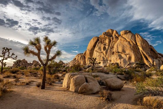
Explore More of California
Sign up for our free email to join thousands of readers getting epic travel, hiking, camping and gear ideas every week.
Seen in: Backpacking, California, Hikes, Hiking in California