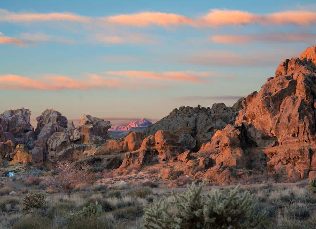
Southern California is loaded with beautiful sights, and exploring them on a scenic drive is a great way to escape the workday grind.
Whether you’re in the mood for a short, scenic drive to de-stress or a long weekend road trip to escape the chaos of the city, driving along one of Southern California’s scenic byways is as good as it gets. Wheels on the ground, windows down, and fresh tunes bumping — life hardly gets any better than this.
The scenic byway listed below all have scenic, natural, cultural, historical, recreational, or archaeological significance. That means they’ve got the sights and sounds to soothe your soul — and aside from that, they’re just incredibly fun to drive.
The best Southern California road trips head away from the urban centers of cities like L.A. and San Diego. They’re the perfect way to leave the busyness of of city life behind, at least for a little while. These roads will take your high into the mountains, across vast stretches of desert, and to awe-inspiring destinations.
Pro Tip: Don’t forget to first check the open status of many of these roads. Wildfires, extreme weather, and mudslides can temporarily close some of the more remote drives at any given time.
Related Read: 9 Amazing Scenic Drives Near Los Angeles, California
The Best Southern California Scenic Drives
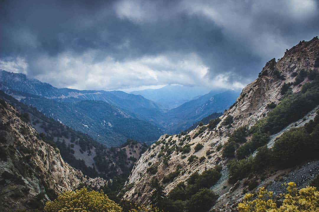
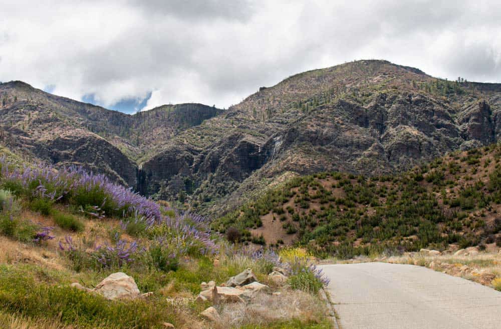
1. Angeles Crest Scenic Byway
Why you should go:A short drive with amazing views of the Mojave Desert
- Distance: 66 miles
- Drive time without stops: Approx. 2 hours
The Angeles Crest Highway begins outside of Burbank and is only minutes away from downtown Los Angeles — that is if you can avoid the usual traffic, of course. It’s a 55-mile route through the San Gabriel Mountains to the mountain town of Wrightwood.
Because the Mount Wilson Observatory sits above the hazy smog layer of Loos Angeles, it has some of Southern California’s best stargazing — and is open to the public.
Motorists will find relative seclusion on this drive, at least when compared to the sprawling metropolis of L.A.
The gorgeous mountain road climbs to a high point of 7,901 feet at Dawson Saddle and offers multiple viewpoints overlooking the Mojave Desert and the San Gabriel and Pomona Valleys. The Mount Wilson Observatory is a popular stopping point with cosmic views situated high above the Los Angeles Basin.
More Information: Go California or Angeles Crest Scenic Byway
2. Bradshaw Trail Backcountry Byway
Why you should go:A historical drive through some of California’s most remote terrain
- Distance: 70 miles
- Drive time without stops: Approx. 3 hours
Once upon a time, miners used to take the Bradshaw Trail from Los Angeles to the goldfields in New Mexico and Arizona. Now, this 70-mile dirt road provides a scenic recreation path from the Salton Sea to the Colorado River.
You’ll probably want a 4WD or AWD due to several areas of soft sand on the road. The local department of transportation periodically grades the road, however, and properly prepared vehicles should be able to make the journey without issue.
Highlights of this route include expansive views of the Chuckwalla Bench, the Orocopia Mountains, and the Palo Verde Valley, as well as numerous hiking and off-roading opportunities. There are no amenities on this byway until travelers reach Blythe to the east, so bring all the water and snacks you might need.
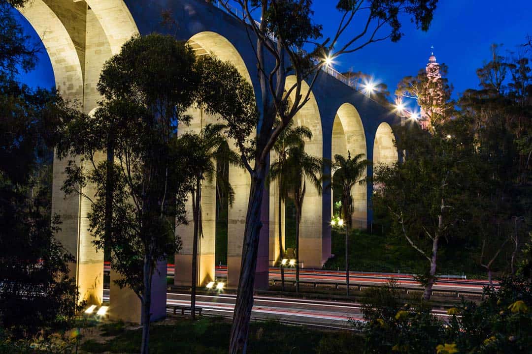
3. Cabrillo Freeway
Why you should go: A short drive through one of San Diego’s most beautiful attractions
- Distance: 1 mile
- Drive time without stops: Approx. 1 minute
Short, yet stupendous, the Chuck Coker is a state scenic highway that passes through San Diego’s magnificent Balboa Park. Historic and beautifully landscaped, this small drive is considered one of America’s most attractive parkways.
The 1,200-acre Balboa Park is home to beautifully maintained greenways and walking paths plus dozens of museums and theaters, as well as the San Diego Zoo. Though the drive may be short, you could (and probably should) spend your entire day exploring the wonders of this park.
More Information: Go California
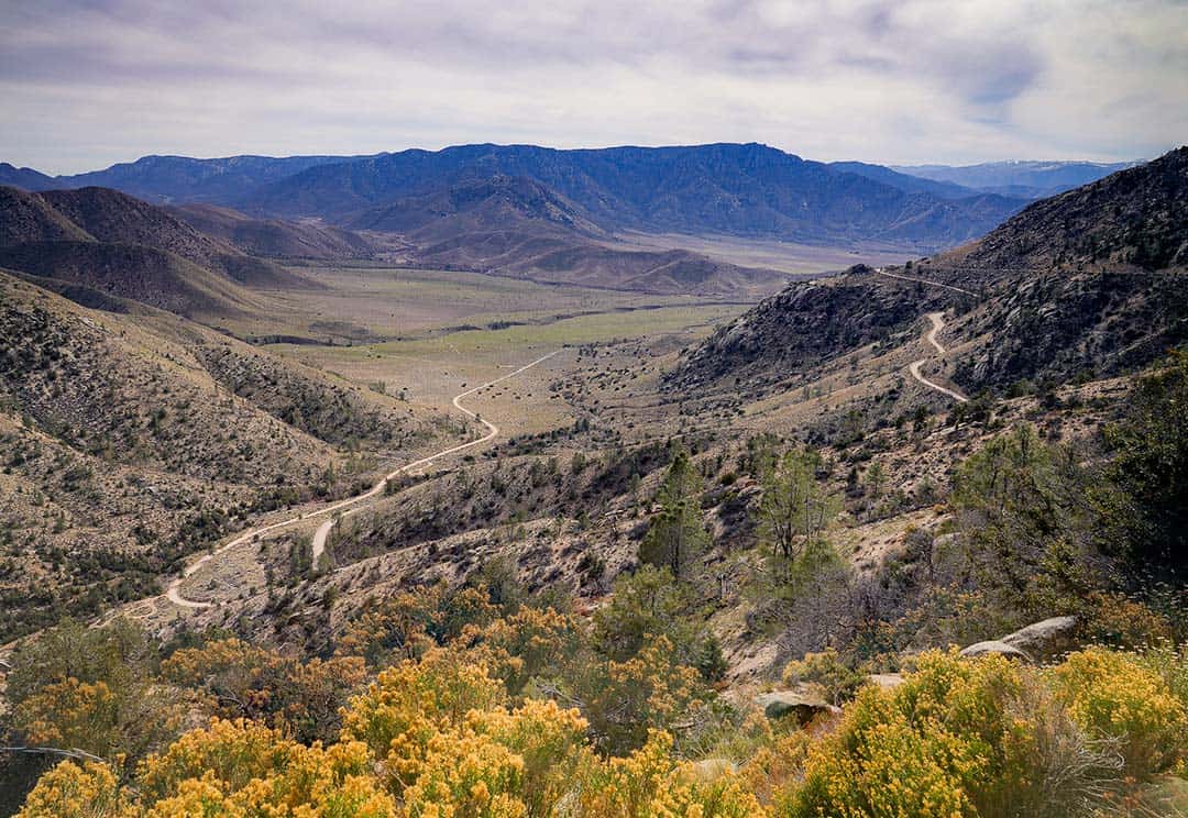
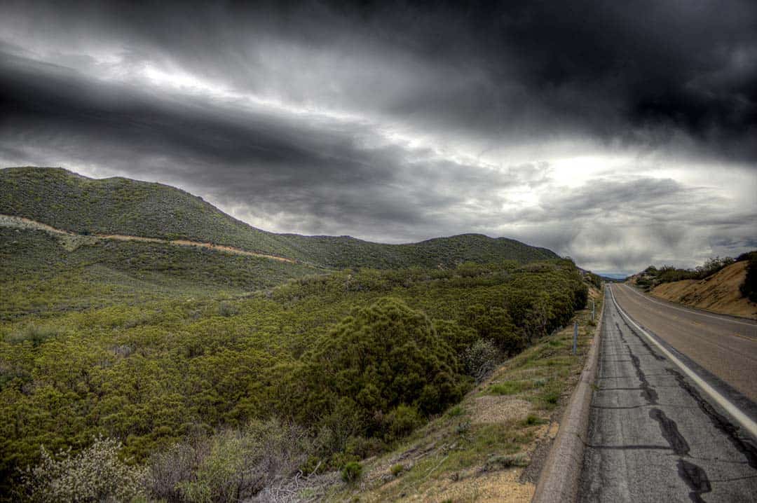
4. Chimney Peak Backcountry Byway
Why you should go: A rugged drive through stunning mountain terrain
- Distance: 39 miles
- Drive time without stops: Approx. 1.5 hours
Far away from the sights and sounds of any city, Chimney Peak Wilderness is between the Sequoia National Forest and Death Valley National Park, in the southeastern end of the Sierra Nevada Range. It’s rugged, remote, and downright stunning.
Badwater Basin in Death Valley National Park is actually below sea level, making it the lowest location in the U.S. — but it’s only about 70 miles from Mt. Whitney, the highest point in the continental U.S.
Chimney Peak Backcountry Byway is a well-graded dirt road most vehicles will be able to handle. There are hiking trails, rivers, and campgrounds along this route, as well as 50,000 acres of wilderness to explore.
This unique landscape is where the mountains fade into the desert. It’s characterized by its arid landscape, pinyon-juniper forests, and the chance to see iconic Southern California wildlife, ranging from desert-dwelling reptiles to large mountain animals such as black bears and mountain lions.
More Information: America’s Scenic Byways
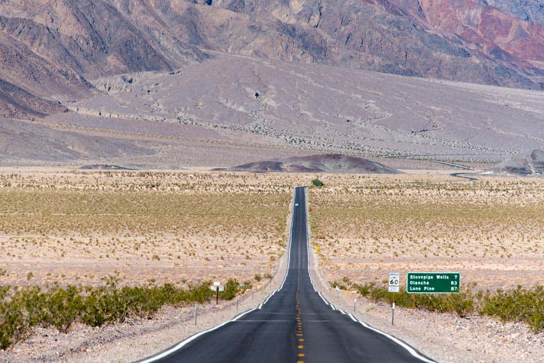
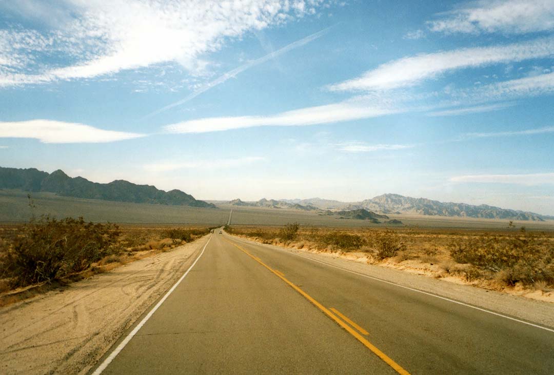
5. Death Valley Scenic Byway
Why you should go: A famous drive through the lowest and hottest points in North America
- Distance: 82 miles
- Drive time without stops: Approx. 1.5 hours
Make sure your vehicle’s air conditioner works properly before heading out onto the Death Valley Scenic Byway. This 81.5-mile stretch begins southeast of Lone Pine before weaving through the scorched hills above Panamint Valley.
You can often see military jets diving deep into the canyons early in the drive. The route continues across the valley, through the Panamint Range, past the Stovepipe Wells outpost, and down around the sand dunes of Death Valley.
Once in Death Valley, drivers should stop at the Furnace Creek Visitor Center to learn about the history of the area, the natural wonders of Death Valley National Park, and receive guidance on what areas of the park they can safely explore. Check out these lists of the best hikes and best campgrounds within the park.
More Information: U.S. Department of Transportation
6. Jacinto Reyes Scenic Byway
Why you should go: A short drive with endless sightseeing and recreation opportunities
- Distance: 37
- Drive time without stops: Approx.1 hour
The Jacinto Reyes Scenic Byway is a great way for Los Angeles-area folks to escape the noise of civilization, at least for a few hours. The 36.5-mile roadway begins in the coastal hills north of Ventura and rises to over 5,000 feet above sea level.
Dry Lakes Ridge Botanical Area and the Piedra Blanca Rock Formations are notable points of interest. The drive continuously rewards drivers with spectacular sights of the area’s breathtaking geology, and there are numerous viewpoints with interpretive signage for those interested in learning about the area’s natural history and resource management.
For a fun day of recreation, be sure to stop at the Rose Valley Recreation Area near the southern end of the byway for plenty of hiking, horseback riding, fishing, and camping opportunities.
More Information: Go California
7. Parker Dam Road
Why you should go: A short drive with endless sightseeing and recreation opportunities
- Distance: 11 miles
- Drive time without stops: Approx. 30 minutes
Near Lake Havasu along the Arizona border, Parker Dam Road is a desert drive next to the banks of the Colorado River. The paved road is passable for passenger cars, but there are plenty of places for off-roaders can access rougher, more exciting drives.
There are several resorts along this route, as well as a BLM office where the staff can help you make the most of your journey. Bridges cross the river into Arizona on both ends of the byway so you can easily access the various towns and parks in both states.
Plan to spend a little extra time at Lake Havasu and the Bill Williams National Wildlife Refuge, both near the northern end of the byway. The beautiful scenery, abundance of recreation opportunities, and luxurious resorts on either end are all fantastic reasons to explore this route.
More Information: America’s Scenic Byways
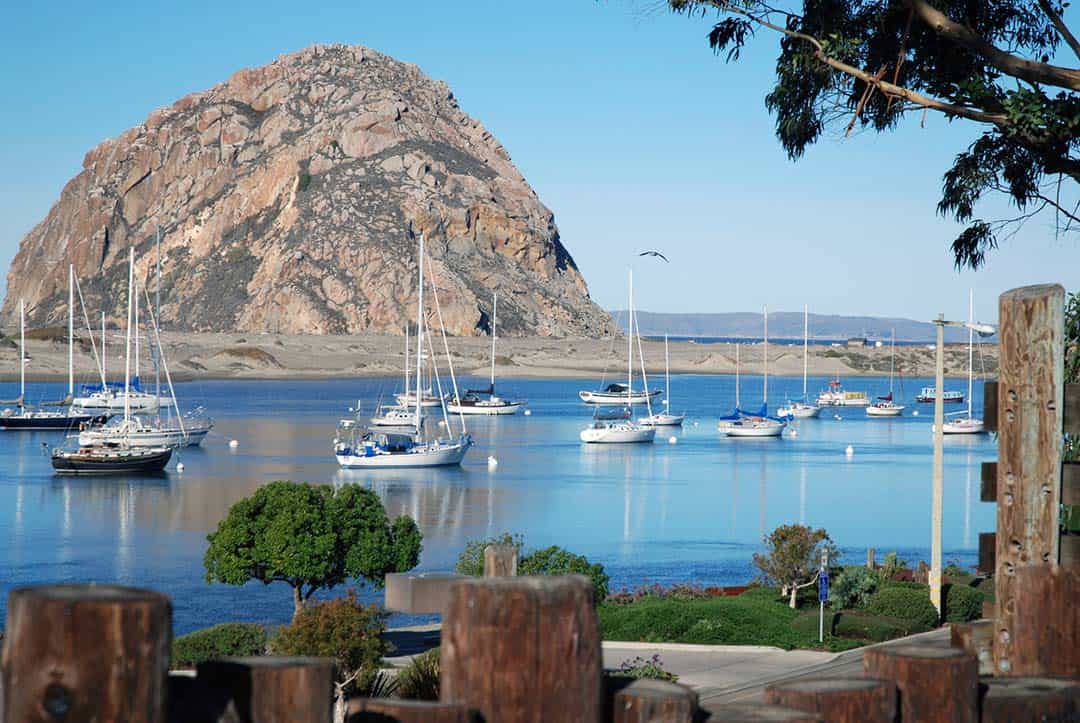
8. San Luis Obispo North Coast Highway
Why you should go: A stunning seaside drive along one of California’s most picturesque stretches
- Distance: 57 miles
- Drive time without stops: Approx. 2 hours
Just a few hours north of Los Angeles, San Luis Obispo is an idyllic town in the heavenly Los Osos Valley. This is where the San Luis Obispo North Coast Highway begins, traveling California’s Shoreline Highway for the remainder of the route.
As you head south, the scenic byway passes through lovely Morro Bay, a north coast beach town that attracts vacationers with its miles of sandy shoreline, biologically diverse bay, and romantic waterfront promenade.
Ocean vistas, small towns, and state parks line the rest of the route. Buy tickets in advance to tour Hearst Castle if you’re into grandiose architecture or history. The mansion’s beautiful hillside grounds overlook the dramatic coastline, and you can choose from multiple tours of the home’s 165 rooms.
More Information: Highway 1 Discovery Route
9. Sunrise Scenic Byway
Why you should go: A stunning seaside drive along one of California’s most picturesque stretches
- Distance: 24 miles
- Drive time without stops: Approx. 2 hours
Scaling the slopes of Mount Laguna and overlooking the striking emptiness of the Anza-Borrego Desert, the Sunrise Scenic Byway terrain offers a beautiful juxtaposition between forests and desert. The San Diego-area route has trails, campgrounds, and scenic overlooks.
You’re likely to see hikers on the road in summer and cross-country skiers in the winter. The Pacific Crest Trail follows along much of this byway, so it’s not unusual to see backpackers along the route, too. It’s also extremely popular among cyclists.
This route highlights the stark contrast of topographies, climates, and environments in Southern California as it passes through mountain meadows and pine forests. If you’re planning to do any photography on the way, make sure to pack the widest-angle lens you have.
More Information: Go California
10. Wild Horse Canyon Scenic Backcountry Byway
Why you should go: A stunning seaside drive along one of California’s most picturesque stretches
- Distance: 12 miles
- Drive time without stops: Approx. 30 minutes
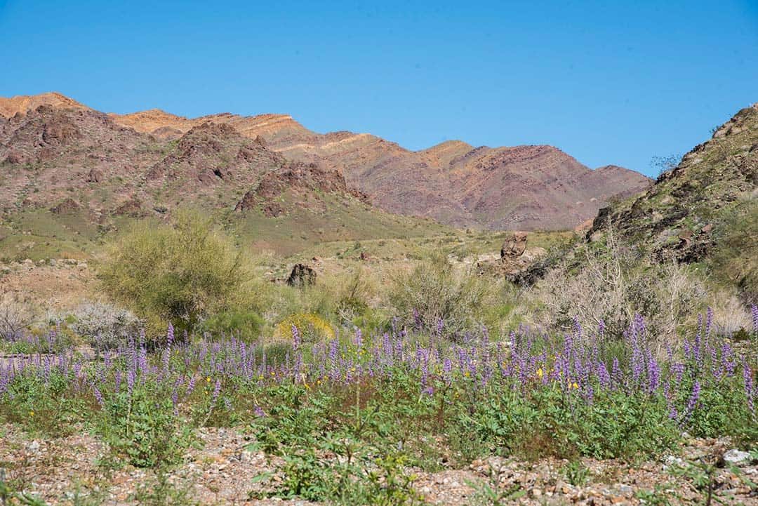
Located in the Mojave National Preserve, the road to the Wild Horse Canyon Scenic Backcountry Byway is almost a scenic journey in and of itself. But eventually, you’ll reach the actual scenic byway route, home to colorful volcanic rock formations and epic desert scenery.
If you’re into wildflower viewing, check out the Desert Wildflower Report to learn what rare, colorful blooms to look for tucked into the desert of the Mojave National Preserve.
The actual byway is a dirt road. Most passenger vehicles should have no issues, be aware of the intriguing side roads and sandy pullouts that may cause trouble for non-4WD vehicles.
Wild Horse Mesa and Hole-in-the-Wall are interesting attractions along the route. There are two campgrounds here perfect for desert stargazing. A BLM office and the Hole-in-the-Wall Information Center can provide information on the area (and a place to cool off.)
More Information: Go California
11. Twentynine Palms Highway
Why you should go: The small stretch of land passes through desolate but beautiful landscapes near Joshua Tree National Park
- Distance: 9 miles
- Drive time without stops: Approx. 15 minutes
Twentynine Palms Highway guides travelers through the high desert scenery between Joshua Tree National Park and the contrasting landscapes of Palm Springs and Mount San Jacinto.
The scenery shifts dramatically along the nine-mile stretch, making it one of the shortest but most beautiful Southern California scenic drives. The higher-elevation backpacking trails of San Jacinto can be covered in snow while the resorts of Palm Springs roast under the desert sun, while nearby Joshua Tree has an ecosystem all its own.
If you’re looking to spend some time out in these areas, take a look at this roundup of the best VRBOs in Palm Springs and the best camping near San Jacinto.
More Information: Go California
Watch on YouTube
Related read: 7 Adventurous Islands to Explore in California
Explore More on SoCal
Sign up for Weekend Wanderer to join thousands of readers getting epic travel, hiking, and camping ideas every month.
Seen in: California, Road Trips, Things to Do in California