We research, evaluate and select travel destinations based on a number of factors, including our writers’ experience, user reviews and more. We may earn a commission when you book or purchase through our links. See our editorial policy to learn more.
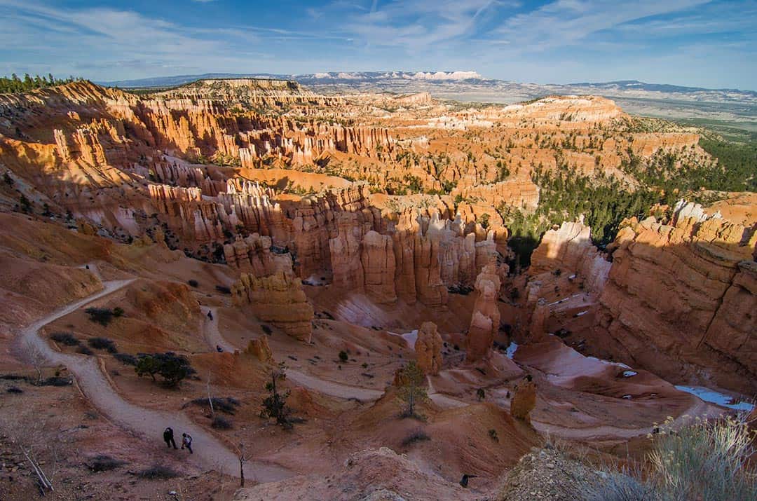
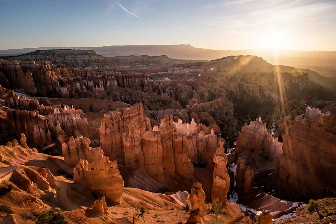
Welcome to Bryce Canyon National Park, home of the largest collection of hoodoos on the planet.
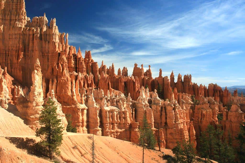
No, I’m not making words up. A “hoodoo” is the official term for irregular rocky columns, and these crimson geological wonders are the prime attraction at Bryce Canyon National Park.
Interestingly, while Bryce Canyon boasts the largest concentration of hoodoos in the world, it’s the second smallest national park in the United States, and the smallest park in the state of Utah. Spanning roughly 55 square miles, it’s not that hard to hit the canyon’s highlight reel in a single day.
Of course, Bryce Canyon isn’t actually a single canyon. It’s a series of natural amphitheaters carved into the edge of a high plateau at the top of Utah’s Grand Staircase. In addition to the hoodoos, you’ll find natural bridges, natural “windows” carved into the cliffs, and fascinating rock formations, all in a fabulous display of color.
Whether you’re looking for a challenging full-day hike or a quick afternoon traipse through this painted desert, we’ve got you covered.
Just be sure to pick up a Bryce Canyon trails map before you hit the park to make sure you don’t get lost!
Without further ado, here are the best hikes at Bryce Canyon National Park, starting with the all-time favorite Queens Garden and Navajo Loop.
Queens Garden & Navajo Loop
Why you should go: discover a mesmerizing display of hoodoos, rock formations, and natural bridges.
- Distance: 3 miles
- Elevation Gain: 615 feet
- Difficulty: Moderate
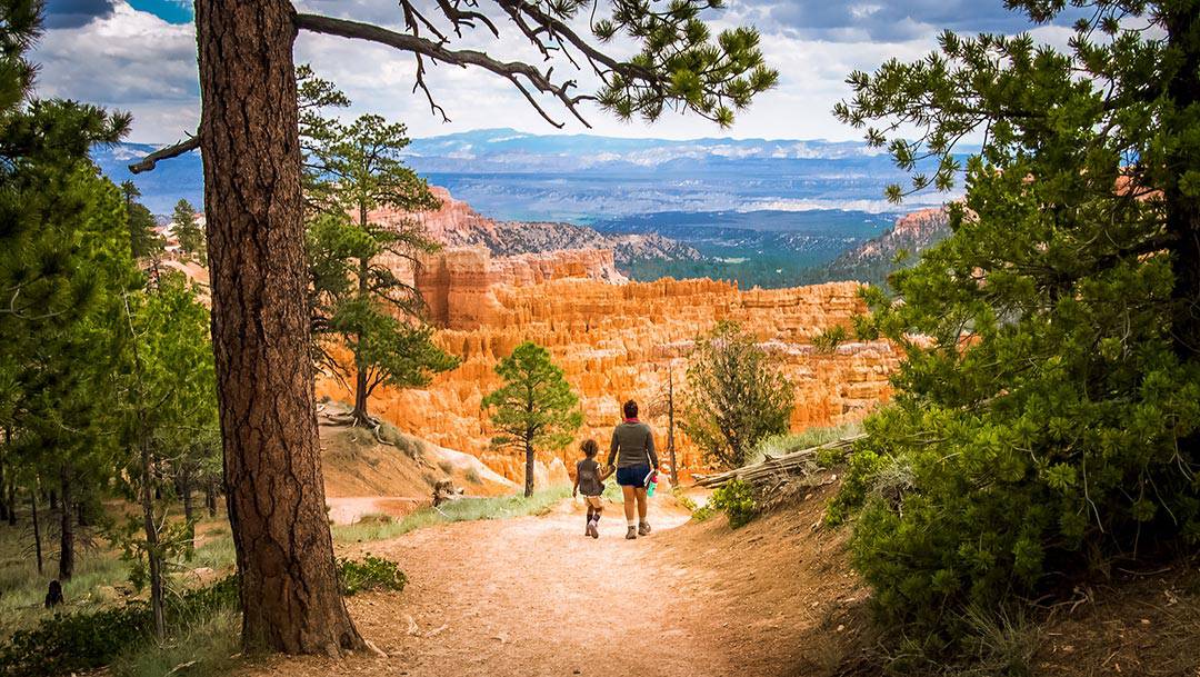
Arguably the most popular hike at Bryce Canyon National Park, the Queens Garden and Navajo Loop Trail takes visitors on a quick tour to the bottom of the canyon. There are some steep ledges that you’ll want to keep an eye on when you’re hiking with kids, but it’s generally considered a family-friendly hike.
Dropping down into the canyon from Sunrise Point, you’ll meander through multicolored spires encompassed by towering cliffs and hoodoos. After proceeding through a set of man-made tunnels and through a hoodoo-filled ravine, you’ll reach the Queen Victoria formation surrounded by her “garden” of rugged spires.
Once you complete the Queen’s Garden portion of the trail, you’ll loop back around to the starting point using the eastern portion of the Navajo Loop. Along the way you’ll pass the Two Bridges and Thor’s Hammer, though you’d need to follow the western loop for a closer look at the latter.
If you’ve already seen the Queen’s Garden, you can opt for the full 1.4-mile Navajo Loop instead.
More Information: Hiking Project
Peek-A-Boo Loop
Why you should go: a roller-coaster trail featuring hoodoo spires and natural arch windows.
- Distance: 5.2 miles
- Elevation Gain: 1,440 feet
- Difficulty: Moderate
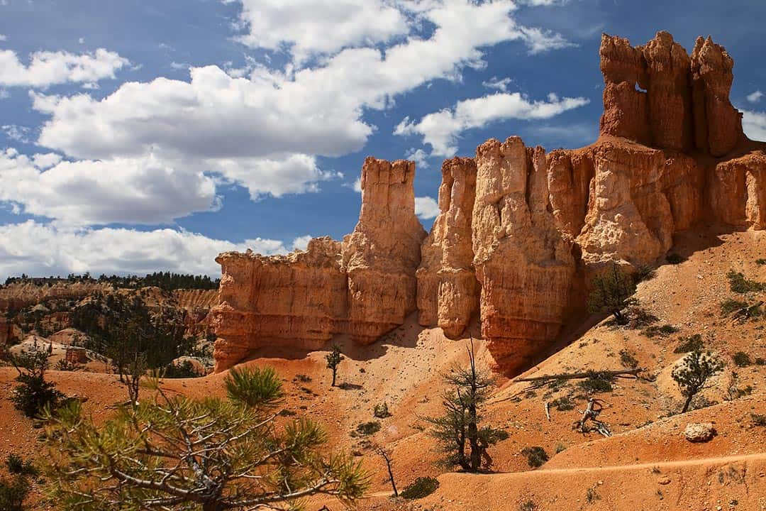
The Peek-A-Boo Trail makes you work for the scenic views, but the colorful hoodoo towers are well-worth the effort. As you’re winding up and down the switchbacks, keep an eye out for the Cathedral, Hindu Temples, and Wall of Windows. You’ll also pass the Fairy Castle rock formation towards the end of the hike.
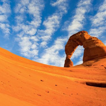
In case you’re wondering, the Peek-A-Boo Trail gets its name from the natural arch windows carved into the rocks. Unlike the natural bridges that you can see through, these windows let visitors peer into the geological heart of the cliffs at Bryce Canyon.
More Information: Hiking Project
Fairyland Loop
Why you should go: see Fairyland Point, Sinking Ship, Tower Bridge, and China Wall.
- Distance: 8.1 miles
- Elevation Gain: 1,460 feet
- Difficulty: Moderate
The Fairyland Loop pushes the limit of family-friendly hikes in terms of distance, but strong-legged kiddos should be able to handle the elevation gain. You’ll find fewer travelers on this trail, making it a nice family adventure away from the crowds.
The Fairyland Loop begins at Fairyland Point, where you’ll enjoy remarkable views of the spectacular amphitheater of hoodoos as you descend into the canyon. Peer across the Boat Mesa and you’ll see the Sinking Ship formation to the east.
Continuing along the trail you’ll eventually pass the Coliseum and Tower Bridge before climbing through Campbell Canyon and across it’s namesake creek. Ultimately you’ll pass the Chinese Wall formation, then loop back where you began at Fairyland Point.
More Information: Hiking Project
Under-The-Rim Trail
Why you should go: the best backpacking trail at Bryce Canyon.
- Distance: 22.7 miles
- Elevation Gain: 4,284 feet
- Difficulty: Moderate
The Under-the-Rim Trail is the go-to trail for backpackers visiting Bryce Canyon National Park, but you don’t have to tackle the 23-mile trail all at once.
The Under-the-Rim Trail features some incredible scenery, but don’t expect a highlight reel of Bryce Canyon’s best-known natural attractions. The trail actually skips most of the crowded areas of the park, instead leading hikers through the most secluded sections and hidden corners of the canyons.
Depending on the portion you choose to hike, you’ll have the chance to see the white hoodoo Hat Shop, Yellow Creek, Sheep Creek, Agua Canyon, and Rainbow Point — the highest elevation point in the park.
More Information: Hiking Project
Rim Trail
Why you should go: a photographer’s dreamscape featuring Sunrise, Sunset, Inspiration, and Fairyland Points.
- Distance: 5.7 miles
- Elevation Gain: 982 feet
- Difficulty: Easy
The Rim Trail is a family-friendly adventure that might become your favorite hike at Bryce Canyon. You’ll visit the national park’s best scenic viewpoints on a picturesque point-to-point trail, and the park’s shuttle system means you don’t have to retrace your steps when you’re done.
You can hike the Rim Trail in either direction, but the recommended route is south to north. You’ll start at Bryce Point, then head downhill to Inspiration Point. Next is Sunset Point, followed by Sunrise Point. You’ll wrap up your adventure at the Fairyland Point overlook, then take the shuttle from Sunrise Point back to your vehicle at the Visitor’s Center.
More Information: Hiking Project
Mossy Cave Trail
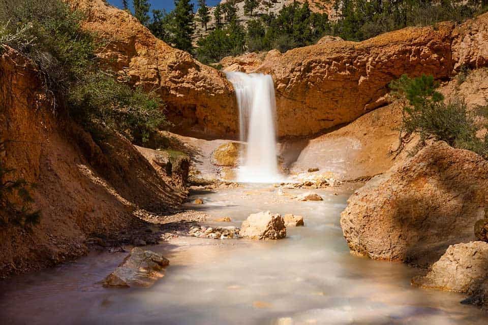
Why you should go: a family-friendly hike to a grotto with a waterfall, passing Turret Arch and the Little Windows along the way.
- Distance: 1 mile
- Elevation Gain: 120 feet
- Difficulty: Easy
The Mossy Cave Trail is a quick & easy hike that’s great for all ages and skill levels. It’s less than a half-mile to Mossy Cave, and the journey features beautiful views of nearby Turret Arch and the Little Windows.
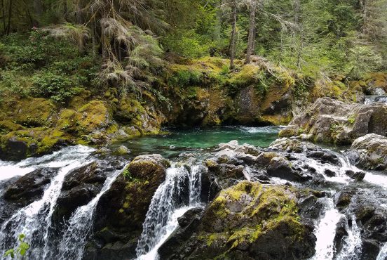
Mossy Cave isn’t a cavern — it’s a grotto, or shelter cave, created by an underground spring. There’s a waterfall nearby during spring and summer, and you’ll find a neat display of icicles over winter.
More Information: Hiking Project
Bristlecone Loop
View this post on Instagram
Why you should go: a high-elevation loop through bristlecone pine forest with views of the Four Corners.
- Distance: 1 mile
- Elevation Gain: 100 feet
- Difficulty: Easy
Another quick-and-easy family favorite, the Bristlecone Loop leads hikers through a gnarled forest of 1,800-year-old bristlecone pine. These are some of the oldest living trees on the planet, and the species only grows at precise elevations in six US states. They’re rare, resilient, and incredibly unique.
The Bristlecone Loop features a number of scenic viewpoints with deep canyon vistas and the park’s token hoodoos, so don’t forget to bring your camera along for the hike.
More Information: Hiking Project
Riggs Spring Loop
View this post on Instagram
Why you should go: a long, challenging hike that rewards adventurous souls with beautiful evergreen forests and towering cliffs.
- Distance: 8.4 miles
- Elevation Gain: 1,680 feet
- Difficulty: Hard
Most hikers explore the Riggs Spring Loop as an overnight backpacking adventure, stopping for the night at one of the three scenic campgrounds along the trail. If you don’t have a weekend to devote to the full loop, it’s still worth hiking a portion of the trail on a day-hike.
It’s hard to say what the showstopper is on this hike, the magnificent evergreen forests or the breathtaking cliffs. You’ll see a few hoodoos, but this isn’t the trail to pick if you’re looking for Bryce Canyon’s famous crimson columns.
More Information: Hiking Project
Sunset Point To Sunrise Point
Why you should go: a paved trail between two of the best scenic viewpoints at Bryce Canyon.
- Distance: 1.1 miles
- Elevation Gain: 82 feet
- Difficulty: Easy
The paved path from Sunset Point to Sunrise Point is technically part of the Rim Trail that we’ve already discussed, but it’s worth mentioning this portion separately for those looking for a nice-and-easy hike. It’s just over a half-mile between the viewpoints, so most hikers complete this as a quick out-and-back adventure.
Sunrise and Sunset Points deliver incredible views of the Bryce Amphitheater, the central attraction at Bryce Canyon. As you’re following the rim of the canyon, you’ll enjoy sweeping panoramic views from start to finish on this hike. Needless to say, don’t forget your camera.
More Information: AllTrails
Tower Bridge Trail
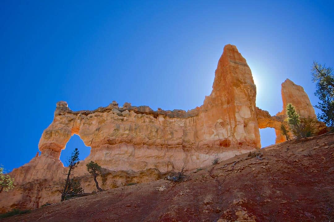
Why you should go: follow the Fairyland Loop Trail to Tower Bridge and the China Wall.
- Distance: 3.4 miles
- Elevation Gain: 826 feet
- Difficulty: Easy
You don’t have to do the full Fairyland Loop circuit to see Tower Bridge and the China Wall. Both are accessible on the Tower Bridge Trail, which follows a portion of the Fairyland Loop Trail. You can expect this adventure to take about 2-3 hours to complete, and while the elevation drop makes it a little challenging it’s definitely family-friendly.
Once you’re finished admiring Tower Bridge, feel free to head back to where you started Sunrise Point — or continue along the trail to complete the Fairyland Loop.
More Information: AllTrails
Keep Exploring Utah
Sign up for our free email to join thousands of readers getting epic travel, hiking, camping and gear ideas every week.
Seen in: Hikes, National Parks, Southwest, Utah