We research, evaluate and select travel destinations based on a number of factors, including our writers’ experience, user reviews and more. We may earn a commission when you book or purchase through our links. See our editorial policy to learn more.
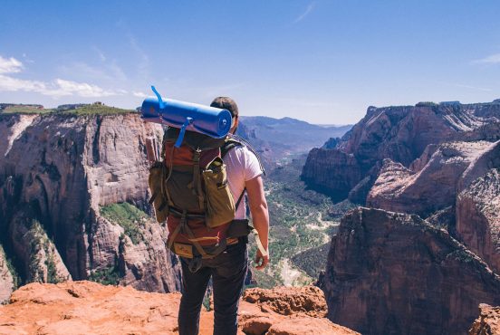
Whether you’re planning an overnight adventure or a weeklong backpacking trip, you’ll find plenty of worthy trails with stellar sights in the Beehive State.
Locals and visitors will find an unbelievably diverse range of backpacking trails at their disposal in Utah. Up north, the Wasatch-Uinta-Cache National Forest serves up an alpine paradise replete with rocky peaks, lush pine and aspen forest, pristine mountain lakes, and more waterfalls than you can count.
Down south, the scenery shifts to a red rock desert landscape with fascinating rock formations, epic canyons, and the largest collection of natural arches on the planet.
Thanks to the climate diversity, backpacking is a year-round activity in Utah. When it’s hot out, head to the mountains in northern Utah to cool off. When the weather turns cold and the Wasatch Range is covered in snow, head south to Grand Staircase-Escalante, Zion, and Arches National Parks to thaw your frozen limbs.
In short, no matter the season or how much time you can spare, there’s always a backcountry trail calling your name in Utah.
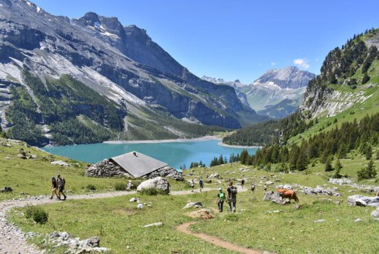
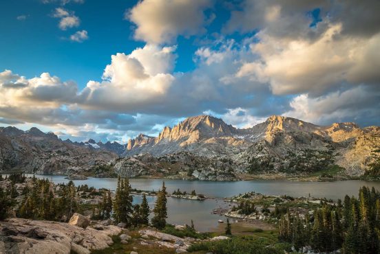
The Wasatch Range
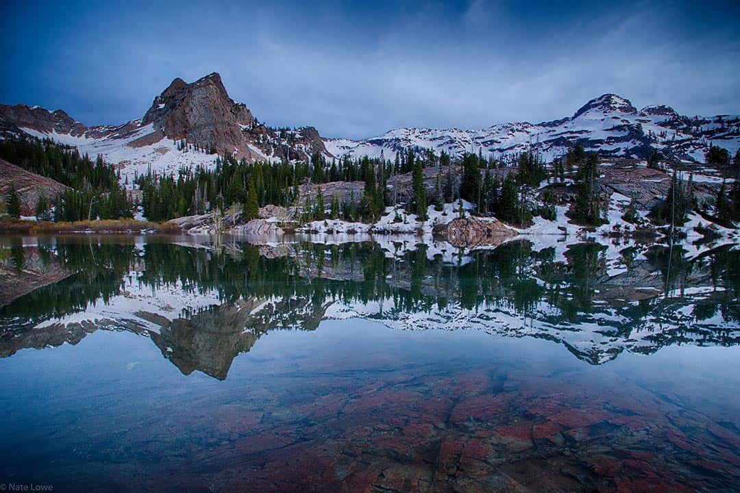
Red Pine Lakes
Why you should go: Visit two of the most popular alpine lakes in Utah.
- Distance: 6.8 miles
- Elevation Gain: 1,940 feet
- Difficulty: Hard
The trail to Red Pine Lakes delivers one of the best hikes in Little Cottonwood Canyon. The popular day-hike is even better when you make it an overnighter, providing more time to explore the picturesque Upper and Lower Red Pine Lakes and the surrounding Lone Peak Wilderness.
After you’ve had a chance to visit Red Pine Lake, plan another backpacking trip to its sister lake in Little Cottonwood Canyon — White Pine Lake. It’s a longer hike (10 miles round trip), but the intense blue water is out of this world.
More Information: Visit Utah
Lone Peak Area To Bells Canyon
Why you should go: Utah’s first congressionally designated wilderness features fascinating rock formations, alpine ridges, lush valleys, and panoramic views.
- Distance: 12 miles
- Elevation Gain: 5,000 feet
- Difficulty: Very Hard
The trek from the Schoolhouse Springs Trailhead to Bells Canyon highlights the best features of the Lone Peak Wilderness Area and Little Cottonwood Canyon.
You’ll ascend a drainage area with several mountain meadows to Lake Hardy, an alpine lake that sits directly between Big Horn and Chipman Peak near Thunder Mountain. We recommend stopping here to camp for the night — mostly for the spectacular views, but also because it’s the only reliable water source near the crest.
From here, you can either head back the way you came or continue over the ridge into Little Cottonwood Canyon. We prefer the latter as the hike to Bells Canyon explores Thunder Mountain and features more mountain lakes, streams, and waterfalls.
More Information: Visit Utah
Lake Blanche
Why you should go: Camp between three alpine lakes at the foot of Sundial Peak.
- Distance: 7 miles
- Elevation Gain: 2,720 feet
- Difficulty: Hard
Lake Blanche has been a popular destination for backpackers in Utah since the 19th century. It’s hard to say what’s more beautiful — the trio of Lake Blanche, Lake Florence, and Lake Lillian, or the imposing Sundial Peak that dominates the skyline.
The trail is also a favorite of geologists, featuring fascinating quartzite formations carved by glaciers when the canyon formed thousands of years ago.
More Information: Visit Utah
Related Read: Everything You Need to Know About Backpacking with Kids
Mount Timpanogos
View this post on Instagram
Why you should go: A simple overnighter with the best views in Utah Valley.
- Distance: 14.3 miles
- Elevation Gain: 4,566 feet
- Difficulty: Hard
Perhaps the most iconic mountain along the Wasatch Front, Mount Timpanogos beckons to every backpacker within sight of its photogenic peaks. It’s possible to reach the summit on a long day-hike, but you’ll enjoy the journey more on an overnight backpacking trip.
There are two paths to the top of Mount Timpanogos. The Timpooneke Trail is the shorter, more popular route. The Mount Timpanogos Trail from Aspen Grove is arguably more scenic, but it’s also a mile longer, steeper, and a little more challenging.
Whichever route you choose, the result is the same: stunning panoramic views in every direction as far as the eye can see, and a lifetime of bragging rights.
More Information: Hiking Project
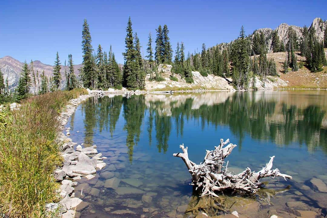
The Uinta Mountains
Ibantik Lake
View this post on Instagram
Why you should go: An overnighter with four alpine lakes and a mountain pass that delivers gorgeous views.
- Distance: 8.5 miles
- Elevation Gain: 1,123 feet
- Difficulty: Moderate
The hike to Ibantik Lake packs a lot of scenery for such a relatively short trip. You’ll pass three mountain lakes — Wall Lake, Hope Lake, and Lake Lovenia — and have the chance to spend the night near the shore of Ibantik Lake, an alpine lake that lies in a cirque. You’ll enjoy some great views along the way, especially from the Notch Mountain Pass after Hope Lake.
More Information: Hiking Project
Amethyst Basin
View this post on Instagram
Why you should go: The best backpacking adventure in the High Uintas Wilderness.
- Distance: 12 miles
- Elevation Gain: 1,900 feet
- Difficulty: Moderate
See the best features of the High Uintas Wilderness with a tour of Amethyst Basin. The picturesque basin boasts multiple alpine lakes and waterfalls surrounded by a grand mountainous landscape.
This isn’t exactly a beginner trail, but the moderately challenging hike is great for new backpackers with a healthy set of legs — especially if you break it up into three or four days.
Trail Information: The Outbound
Red Castle Lakes
View this post on Instagram
Why you should go: A red rock paradise in the High Uintas replete with a towering rock formation and several alpine lakes.
- Distance: 25 miles
- Elevation Gain: 3,010 feet
- Difficulty: Moderate
It’s a long road to Red Castle Lakes, but the slow-and-steady pace makes the elevation gain pretty doable.
You’ll wind through a lodgepole pine forest with tranquil mountain meadows, then ascend a series of switchbacks before the Red Castle comes into view. Lower Red Castle Lake is just ahead, and yes, you’re free to take a dip in the water to cool off after a long day of hiking.
Lower Red Castle Lake is magnificent, but it’s a popular camping area that can get a little crowded. For those seeking seclusion, press on another three miles to Red Castle Lake. You can also make the quick hike up to Upper Red Castle Lake and Red Castle itself to enjoy more of the local sights.
Trail Information: The Outbound
King’s Peak
View this post on Instagram
Why you should go: Summit Utah’s highest peak and enjoy astounding views of the Uinta Range.
- Distance: 26.8 miles
- Elevation Gain: 5,118 feet
- Difficulty: Very Hard
At 13,528 feet, King’s Peak takes the cake for the tallest mountain in Utah. It may not be a Colorado 14er, but King’s Peak is known for having one of the most dramatic prominences in the lower 48 states. You’ll enjoy incredible top-of-the-world views that are well worth the ascent.
There are at least four well-known trails to King’s Peak, so you can pick your starting point on any side of the mountain. Henry’s Fork Campground is the most popular place to begin, especially if you bring a fishing pole or kayak and have an extra day to spend on the water.
On your journey to the top of King’s Peak you’ll pass a number of picturesque mountain lakes, including Alligator Lake, Sawmill Lake, Bear Lake, Grass Lake, Henry’s Fork Lake, and Dollar Lake.
Trail Information: Utah Travel
Grand Staircase-Escalante National Monument
Golden Cathedral
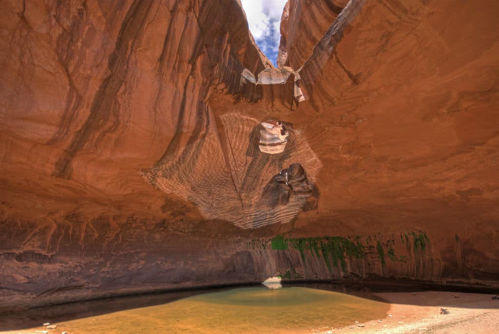
Why you should go: Picture beams of golden sunlight cutting through the sandstone ceiling to illuminate the tranquil pool below.
- Distance: 9.5 miles
- Elevation Gain: 1,260 feet
- Difficulty: Moderate
This is one of those rare backpacking adventures where the journey is nearly as magnificent as the destination. Starting at the Egypt Trailhead, you’ll immediately enjoy views of the Egypt Cliffs before descending into Neon Canyon. As the name suggests, Neon Canyon features a brilliant display of natural color as the sunlight and shadows dance across the sandstone walls.
Your ultimate destination is Golden Cathedral, a unique natural wonder where thousands of years of water erosion has carved three holes into the sandstone ceiling. At midday, the sunlight streams through the openings and lands on the pool below like a trio of natural spotlights.
Don’t let the Golden Cathedral Trail’s moderate difficulty fool you — this is a technical trail that requires canyon navigation skills and climbing gear to rappel down. The hydro-hike involves wading through multiple pools and possibly swimming through some sections if the water levels are high, so be sure to pack appropriately with waterproof gear.
More Information: Your Hike Guide
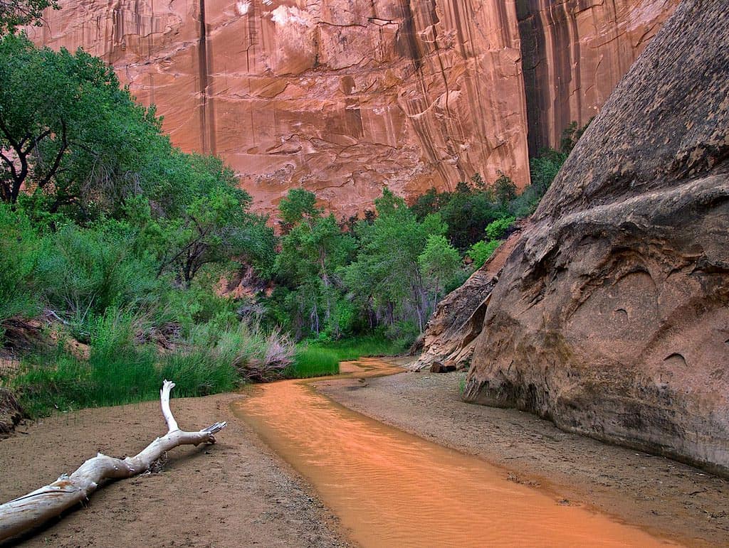
Death Hollow
View this post on Instagram
Why you should go: A hydro-hike through a deep gorge with slot canyons, waterslides, petroglyphs, and beautiful views.
- Distance: 14 miles
- Elevation Gain: 2,312 feet
- Difficulty: Hard
The Death Hollow hike takes backpackers across McGrath Point Bench and Slickrock Saddle Bench down to the narrow depths of Death Hollow. Ignore the morbid name — this surprisingly deep gorge is one of the most dramatic canyons in the area, showcasing the raw, natural beauty of the wilderness that draws adventurers to Grand Staircase-Escalante National Monument.
You’ll spend a fair amount of time wading through pools as you navigate Death Hollow, and you may find yourself swimming when the water levels are high enough. Flash floods are deadly down here, so keep a sharp eye on the weather.
More Information: Utah Travel
Glen Canyon National Recreation Area
Coyote Gulch
Why you should go: a gorgeous red rock canyon featuring two arches, a natural bridge, and multiple waterfalls
- Distance: 11.5 miles
- Elevation Gain: 1,840 feet
- Difficulty: Moderate
Coyote Gulch is a popular destination in the heart of southern Utah’s canyon country, accessible by quick day hikes, overnighters, and weeklong backpacking adventures.
Whichever path you choose, you’ll enjoy spectacular scenery from start to finish. Along the lazy river you’ll find a couple of arches, a natural bridge, ancient pictographs, and a number of small waterfalls.
More Information: Utah Travel
Reflection Canyon
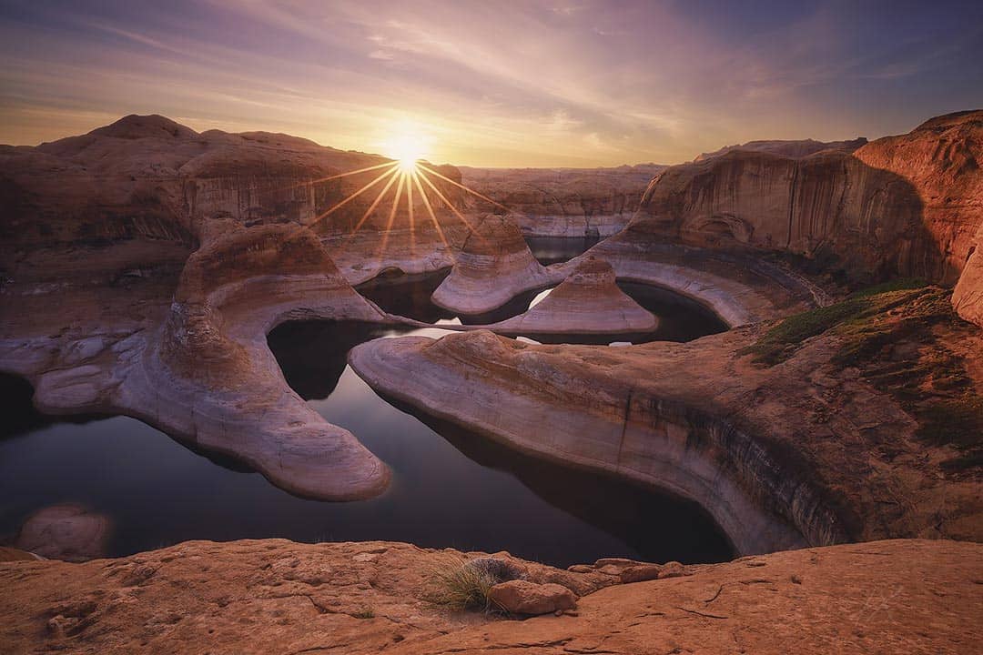
Why you should go: visit the most photogenic canyon in Glen Canyon National Recreation Area
- Distance: 20 miles
- Elevation Gain: 1,234 feet
- Difficulty: Hard
If you’re an Apple fan, you may recognize Reflection Canyon as the default screensaver back in 2012. As great as it looked in full Retina color, trust us — the view is even better in person.
Reflection Canyon flew under the radar until National Geographic photographer Michael Melford published some epic photos of the canyon in 2006. It’s steadily grown in popularity since then, though the distance and challenge do a good job of keeping the crowds down.
More Information: Outdoor Project
Bryce Canyon National Park
Bryce Canyon Under The Rim Trail
View this post on Instagram
Why you should go: Tackle the longest trail in Bryce Canyon National Park with epic views from start to finish.
- Distance: 23 miles (one-way)
- Elevation Gain: 2,700 feet
- Difficulty: Moderate
Bryce Canyon’s Under the Rim Trail delivers a legendary backpacking adventure through the country’s smallest national park. Whether you tackle the monstrous trail point-to-point or combine it with other trails to make a loop (the park has a great shuttle system to support both), you’ll enjoy distant views of Bryce Canyon’s famous slot canyons and hoodoos in relative seclusion.
Wildfires and trail damage have forced the park to close several portions of the Under the Rim Trail, so be sure to check the National Park Service website for closures when you’re planning your route.
More Information: Utah Travel
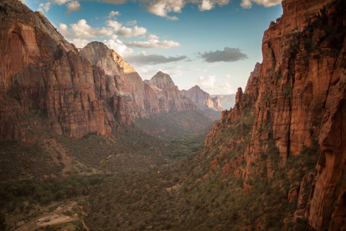
Zion National Park
Trans-Zion Trek (Zion Traverse)
View this post on Instagram
Why you should go: An epic odyssey through Zion National Park that’s been crowned one of the most scenic trails in America.
- Distance: 48.3 miles
- Elevation Gain: 6,334 feet
- Difficulty: Hard
Men’s Journal proclaimed the Trans-Zion Trek the most scenic running trail in America back in 2003. While we agree with the scenic part, we’re pretty confident that you’ll enjoy the journey’s stellar sights more at a leisurely pace.
You can easily break the Trans-Zion Trek into smaller day-hikes and overnighters, but the truly adventurous will begin their 50-mile odyssey at Lees Pass in Kolob Canyon. The 4-6 day journey takes you all the way from the northwest tip to the southwest corner of the park, concluding at the Echo Canyon Trailhead.
West Rim Trail
View this post on Instagram
Why you should go: Descend from the highest point in Zion National Park through the White Cliffs to the photogenic Grotto in Zion Canyon.
- Distance: 16.2 miles
- Elevation Gain: 3,600 feet
- Difficulty: Hard
If you don’t have a week to tackle the Trans-Zion Trail, check out the West Rim Trail. You can complete the top-to-bottom hike in 2-3 days, and you’ll still get to see some of the best sights in Zion National Park.
The West Rim Trail starts at Lava Point, where you’ll find a stellar viewpoint that serves as a preview for your backpacking adventure. Your journey will take you down past the White Cliffs into picturesque Zion Canyon, where you’ll find a magical desert grotto awaiting at the end of the trail.
Canyonlands National Park
Big Needles Loop
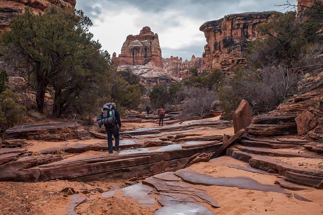
Why you should go: A long but mostly level loop hike through the colorful spires of Cedar Mesa Sandstone that comprise The Needles.
- Distance: 23.2 miles
- Elevation Gain: 600 feet
- Difficulty: Hard
With much of the area only accessible by backcountry trails, you’ll find that The Needles offers the best of Canyonlands National Park without the crowds that swarm to the Island in the Sky. Thanks to a great network of interconnected trails, you can easily put together a multi-day itinerary that fits your schedule and doesn’t rely on complicated shuttle transfers.
The four-day Big Needles Loop features enough impressive sights and viewpoints to stand on its own, but the best part about this hike is the number of side trips at your disposal. If you have time to spare, consider making detours to visit Elephant Canyon, Upper Lost Canyon, Peekaboo Spring, and Chesler Park Overlook.
More Information: Visit Utah
Harvest Scene
View this post on Instagram
Why you should go: Navigate the narrow canyons of The Maze to reach one of the most famous rock art sites in the world.
- Distance: 8.7 miles
- Elevation Gain: 1,600 feet
- Difficulty: Hard
Known for its labyrinth of narrow canyons, The Maze is the least accessible district in Canyonlands National Park. It’s been named one of the 10 most dangerous hikes in the US by Backpacker Magazine — a siren song for experienced backpackers looking for a unique and challenging desert adventure.
The Harvest Scene Hike is the only loop trail in The Maze, and it’s just the right length for an overnight backpacking trip. If you can successfully tackle the rocky labyrinth without getting lost, Harvest Scene features a miraculously well-preserved set of petroglyphs that dates back 3,000 years. ;
More Information: Visit Utah
Bears Ears National Monument
Grand Gulch
View this post on Instagram
Why you should go: An exciting hike for history buffs and archaeologists, featuring well-preserved cliff dwellings, artifacts, and pictographs of the Ancestral Puebloans.
- Distance: 20 miles
- Elevation Gain: 1,719 feet
- Difficulty: Moderate
A hidden gem, Grand Gulch was once the best-kept secret in southern Utah. The rugged, remote stretch of backcountry is only accessible by foot, providing backpackers a level of silence and solitude that’s becoming increasingly rare on the trails.
Grand Gulch features gorgeous red rock canyons, stellar stargazing, fascinating Native American ruins, and ancient pictographs. The ruins and pictographs date back 700-2000 years and are miraculously well-preserved.
More Information: Roots Rated
Dark Canyon Wilderness
View this post on Instagram
Why you should go: Enjoy peace and quiet on the trail as you traverse the forest and desert landscape of the Dark Canyon Wilderness.
- Distance: 40 miles
- Elevation Gain: 2,300 feet
- Difficulty: Moderate
The Dark Canyon Wilderness in Manti-La Sal National Forest offers a diverse range of scenery, featuring a mix of forest and desert landscape that’s dotted with ancient Native American ruins and petroglyphs. Backpacking the full 40-mile loop through Dark, Woodenshoe, and Peavine Canyons usually takes 5-7 days, though you can almost double that with all of the side trails at your disposal.
More Information: Visit Utah
Owl Creek—Fish Creek Loop
Why you should go: As you explore two incredible desert canyons you’ll pass three natural arches, ancient cliff dwellings, and rock art sites.
- Distance: 17 miles
- Elevation Gain: 1,300 feet
- Difficulty: Hard
As Grand Gulch grows in popularity, more backpackers are looking elsewhere to experience Cedar Mesa without the crowds. The Owl Creek—Fish Creek Loop is a popular alternative, taking backpackers through two deep, narrow canyons with gorgeous desert scenery, including Nevill’s Arch and two unnamed arches.
As you’re appreciating the desert scenery, keep an eye out for the Ancestral Puebloan cliff dwellings and rock art on the canyon walls.
More Information: Visit Utah
Keep Exploring Utah
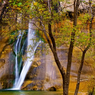
When you’re ready to swap your backpack for a daypack, check out our favorite hikes near Provo and Moab. We’ve also got the 411 on the best waterfall hikes in Utah, featuring falls from the Salt Lake area down to red rock country and everything in between. For a cushier stay in Utah, check out our favorite Airbnb rentals near Zion National Park.
More Utah Camping
Sign up for our free email to join thousands of readers getting epic travel, hiking, camping and gear ideas every week.
Seen in: Arches National Park, Backpacking, Canyonlands, Utah, Zion National Park