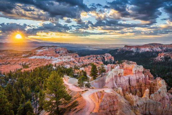
Nestled at the foot of the Wasatch Mountain Range, Provo residents and visitors have plenty of excellent hikes to choose from when planning their weekend adventures.
You don’t have to travel far from Provo to find fantastic hikes. Most of the best trails are less than 30 minutes away, so it’s safe to say that wherever you are in Utah Valley, there’s always a great hike within reach.
Thanks to the Wasatch Mountains that tower over Utah Valley, all of the hikes around here come with stellar views. Whether you’re enjoying a birds-eye view from the top of a canyon or looking up at a majestic waterfall from the valley floor, you’re sure to find plenty of panoramic shots to impress your Instagram followers.
Our list of the best Utah Valley hikes near Provo features an array of picturesque trails populated with waterfalls, hot springs, lush canyons, and of course, epic valley views.
The elevation makes many of these hikes moderately challenging, but don’t worry — we’ve included a few bunny slopes for growing hikers who are breaking in their first pair of boots.
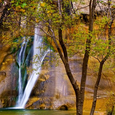
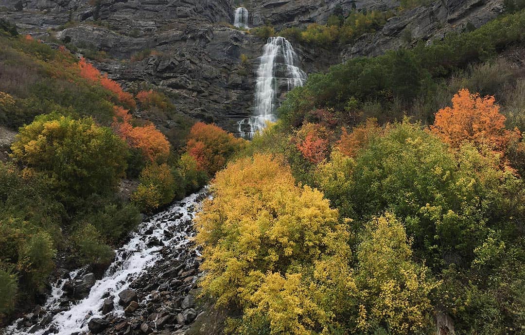
Stewart Falls
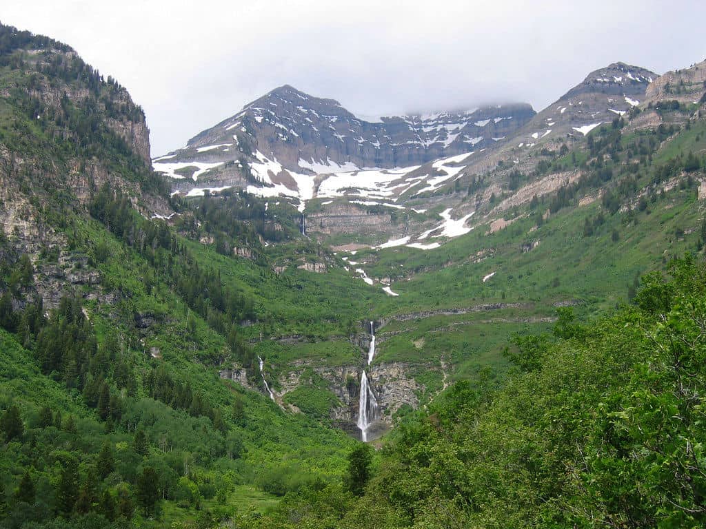
Why you should go: Enjoy one of the state’s most photogenic waterfalls as you cool off in the swimming pool at the base of the falls.
- Distance: 3.4 miles
- Elevation Gain: 646 feet
- Difficulty: Moderate
Stewart Falls is a classic Utah Valley hike that deserves a place on your summer adventure itinerary. The two-tiered, 200-foot falls are at their best during the summer, though the fall foliage has a special way of amplifying the waterfall’s natural beauty.
The complete hike takes you down to the base of Stewart Falls, where the locals like to take a dip in the pool and cool off on hot summer days. The path down to the base is a little steep, though, so if you’re hiking with small children, you may want to stop at the scenic overlook before heading back to Aspen Grove.
Parking at Aspen Grove requires a $6 parking pass, but it’s good for three days. For an alternate route, consider taking the ski lift at Sundance Ski Resort to Ray’s Summit for a shorter, more laid-back journey to Stewart Falls.
More Information: Stewart Falls Trail
Battle Creek Falls
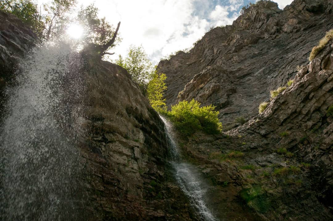
Why you should go: Family-friendly hike to a small waterfall that never fails to impress the kids.
- Distance: 1.5 miles
- Elevation Gain: 450 feet
- Difficulty: Easy
There’s two ways to tackle the Battle Creek Falls hike. The family-friendly version offers a quick 30-minute walk to the falls that’s barely 0.7 miles each way, perfect for little explorers and aging adventurers. The longer trail takes you past the falls for a more challenging four-mile hike with a substantial elevation gain of 1,847 feet.
Whichever route you choose, Battle Creek Falls is a nice little waterfall that’s worth the effort. It’s a heavily trafficked trail, though, so shoot for a weekday or early-morning hike if you want to avoid the crowds.
More Information: Battle Creek Falls Hiking Trail
Fifth Water Hot Springs
View this post on Instagram
Why you should go: The best place to relax and wind down in Utah Valley, where clothing is sometimes optional.
- Distance: 4.5 miles
- Elevation Gain: 636 feet
- Difficulty: Moderate
Fifth Water Hot Springs is one of the best-kept secrets in Utah Valley. The site features three picturesque waterfalls and a collection of natural hot springs along Fifth Water Creek, a tributary to the Diamond Fork River near Spanish Fork.
The Fifth Water Hot Springs carry the typical sulfur smell that comes with natural hot springs, but the pools are surprisingly clear. They’re a fun year-round destination, though you’ll need a 4WD vehicle to reach the trailhead during the winter.
More Information: Fifth Water Hot Springs Trail
Horsetail Falls
View this post on Instagram
Why you should go: Hidden gem featuring a photogenic cascade and impressive valley views.
- Distance: 3.9 miles
- Elevation Gain: 1,617 feet
- Difficulty: Moderate
Horsetail Falls isn’t the first waterfall on people’s minds in Utah Valley — Stewart Falls and Bridal Veil Falls usually win that contest — but make the journey and you’ll find yourself pleasantly surprised.
This underrated trail climbs a wooded canyon to a scenic viewpoint with an excellent view of the waterfall and down into Utah Valley. Experienced hikers can continue further to the base of the falls to experience the cascade up close.
More Information: Horsetail Falls Trail
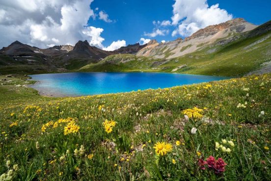
Silver Lake
Why you should go: A beautiful mountain lake perfect for afternoon picnics.
- Distance: 4.2 miles
- Elevation Gain: 1,397 feet
- Difficulty: Moderate
Located at the top of Big Cottonwood Canyon, Silver Lake is a great destination for families of all ages. There’s a boardwalk around the lake for casual strolls, picnic tables for afternoon lunches, and plenty of benches where you can simply sit down and enjoy the scenery.
Silver Lake is stocked with trout each year, making it a popular fishing spot for local anglers. Keep your eyes open and you may spot a moose or deer in the early morning hours before it gets busy.
More Information: Silver Lake Trail
Mount Timpanogos via Timpooneke Trail
Why you should go: Summit the iconic Mount Timpanogos, the second-tallest mountain in the Wasatch Range.
- Distance: 14.3 miles
- Elevation Gain: 4,556 feet
- Difficulty: Challenging
Take a gander at any landscape photo of Utah Valley and you’ll probably find Mount Timpanogos dominating the background. It’s the most iconic mountain along the Wasatch Front, which is saying a lot for an area that’s lined with snow-capped peaks.
There are actually two trails to the top of Mount Timpanogos. The Timpooneke Trail is the most popular route, ascending a grueling series of switchbacks through mountain meadows and basins to reach the summit at 11,749 feet. Most hikers knock out Timpooneke Trail as a long day hike, but it makes for a great overnight backpacking trip, too.
More Information: Timpooneke Trail to Mount Timpanogos
Mount Timpanogos Trail From Aspen Grove
View this post on Instagram
Why you should go: Pass multiple waterfalls and epic viewpoints along a challenging climb to the apex of Mount Timpanogos.
- Distance: 15.9 miles
- Elevation Gain: 5,492 feet
- Difficulty: Challenging
Consider the Mount Timpanogos Trail from Aspen Grove the road less traveled. It’s longer and steeper than the Timpooneke Trail, but you’ll get to see multiple waterfalls and cascades on your way to the summit.
You’ll know you’ve reached the summit of Mount Timpanogos when you reach the old shack at the top, originally constructed by early surveyors who used the location for triangulating. Snap a selfie inside the shack, then sit back and soak in the sweeping 360-degree views.
More Information: Mount Timpanogos Trail From Aspen Grove
The Y Mountain Trail
View this post on Instagram
Why you should go: A rite of passage for BYU freshmen and an annual tradition for visiting alumni.
- Distance: 6.6 miles
- Elevation Gain: 3,106 feet
- Difficulty: Challenging
“Hiking the Y” is a box that every Utah Valley resident should check at least once — that is, if you didn’t already knock it out after freshman orientation at BYU or Utah Valley University. It’s a deceptively challenging hike that’ll set your legs on fire by the time you reach the final viewpoint, but it’s worth it for the impressive valley views.
More Information: The Y Mountain Trail
Squaw Peak Trail
View this post on Instagram
Why you should go: Top an 11,000-foot peak with sweeping views of the Wasatch Front.
- Distance: 7 miles
- Elevation Gain: 2,739 feet
- Difficulty: Challenging
From the city, Squaw Peak kind of looks like Pride Rock — a striking ledge that juts out from the surrounding mountains, gently beckoning locals to carry their cat to the top for a Rafiki-style presentation to the valley residents. At least, that’s been my perspective since I moved to Utah (no, I haven’t actually taken my cat up there…yet).
The Squaw Peak Trail begins at Rock Canyon Park, initially providing a paved trail with five bridges over small creeks and streams. It’s all business once you reach the trail marker, though, quickly gaining elevation on a three-mile climb to the top.
When you reach the 11,000-foot peak, you’ll enjoy epic views of Utah Lake, the surrounding valley, and behind you, an unrivaled view of the Wasatch Mountains.
More Information: Squaw Peak Trail
Rock Canyon Trail
View this post on Instagram
Why you should go: Popular overnight backpacking trip with stunning views of Rock Canyon.
- Distance: 5.5 miles
- Elevation Gain: 1,709 feet
- Difficulty: Moderate
Squaw Peak isn’t the only popular trail out of Rock Canyon. For a more moderate (yet still challenging) hike, follow the Rock Canyon Trail to the Rock Canyon Campground. It’s a fun day hike, and an even better overnight backpacking trip.
More Information: Rock Canyon Trail
Bridal Veil Falls
Why you should go: an easy, family-friendly hike following a paved trail to a gorgeous 600-foot waterfall
- Distance: 1.4 miles
- Elevation Gain: 114 feet
- Difficulty: Easy
If you’re looking for a quick-and-easy afternoon hike near Provo, Bridal Veil Falls is an easy winner. There’s more than enough parking to handle weekend crowds, a wide, paved trail that’s handicap accessible, and a smattering of fire pits, BBQs, and picnic tables where you can kick back and enjoy the afternoon with your friends and family.
The nice thing about the trail to Bridal Veil Falls is that the paved trail extends in both directions, so you can tailor your hike to match any length you want. Keep it short and hurry to the falls for a quick photo-op, or take your time walking along the Provo River.
The 600-foot waterfall is at its best over summer, but in my opinion fall is the best time to visit — the explosion of color in Provo Canyon is hard to beat when the leaves start changing colors.
More Information: Bridal Veil Falls Trail
Timpanogos Cave Trail
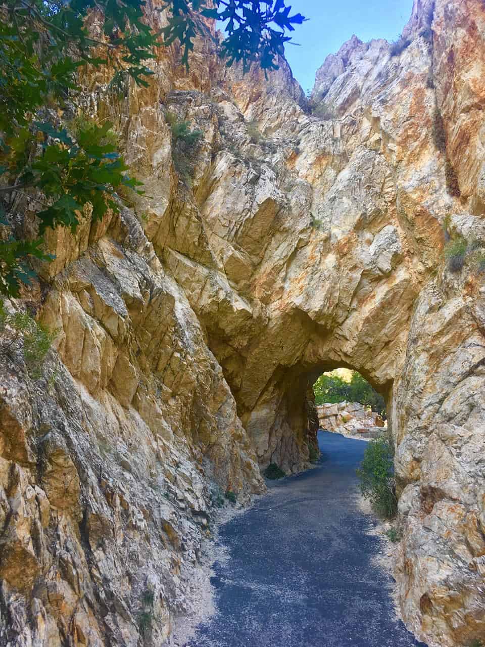
Why you should go: Steep hike with epic views that culminates with a tour through Timpanogos Cave.
- Distance: 3.1 miles
- Elevation Gain: 1,505 feet
- Difficulty: Challenging
Waterfalls and summits are cool, but it’s not every day that your hike ends with a cave. That’s exactly what you’ll get at Timpanogos Cave National Monument — a steep, challenging hike that includes a one-hour guided tour through an extensive network of caves that run deep into the mountain.
The Timpanogos Cave Trail is paved, but don’t let that fool you into thinking it’s easy. The trail climbs almost 1,100 feet in about 1.5 miles, and the final stretch is particularly brutal. It’s absolutely worth it for the killer views, though I’d recommend leaving the younger kids at home for this one.
More Information: Timpanogos Cave National Monument
Scout Falls
View this post on Instagram
Why you should go: Relatively easy hike to a small waterfall that cascades down the mountainside.
- Distance: 4.2 miles
- Elevation Gain: 1,089 feet
- Difficulty: Easy
We’ve actually already spotlighted this hike, you just didn’t know it. Scout Falls is located about two miles from the trailhead of the Timpooneke Trail, making it a nice rest stop on summit climbs and a perfectly acceptable endpoint for beginners and young children.
Scout Falls slows to a trickle in the off-season, so it’s best to hit this hike from late-spring to summer for the best spectacle.
More Information: Scout Falls Trail
Lone Peak
View this post on Instagram
Why you should go: Tackle perhaps the most challenging summit of the Wasatch Range’s eighteen 11,000-foot peaks.
- Distance: 11.1 miles
- Elevation Gain: 5,603 feet
- Difficulty: Challenging
Fair warning — you’re in for a doozy with this one. Jacob’s Ladder Trail is the steeper and more challenging of two paths to the top of Lone Peak, but the Draper Ridge Trail has fallen into disrepair and is no longer an advisable route.
You’ll have to put in work to reach the summit of Lone Peak, enduring some miserably steep sections and class 4 scrambling with serious exposure on your way to the top. Bagging Lone Peak comes with a lifetime of bragging rights, though, and you’ll enjoy some epic views of the rugged mountain range on your arduous journey to backcountry glory.
More Information: Jacob’s Ladder Trail to Lone Peak
Explore Utah
Sign up for our free email to join thousands of readers getting epic travel, hiking, camping and gear ideas every week.