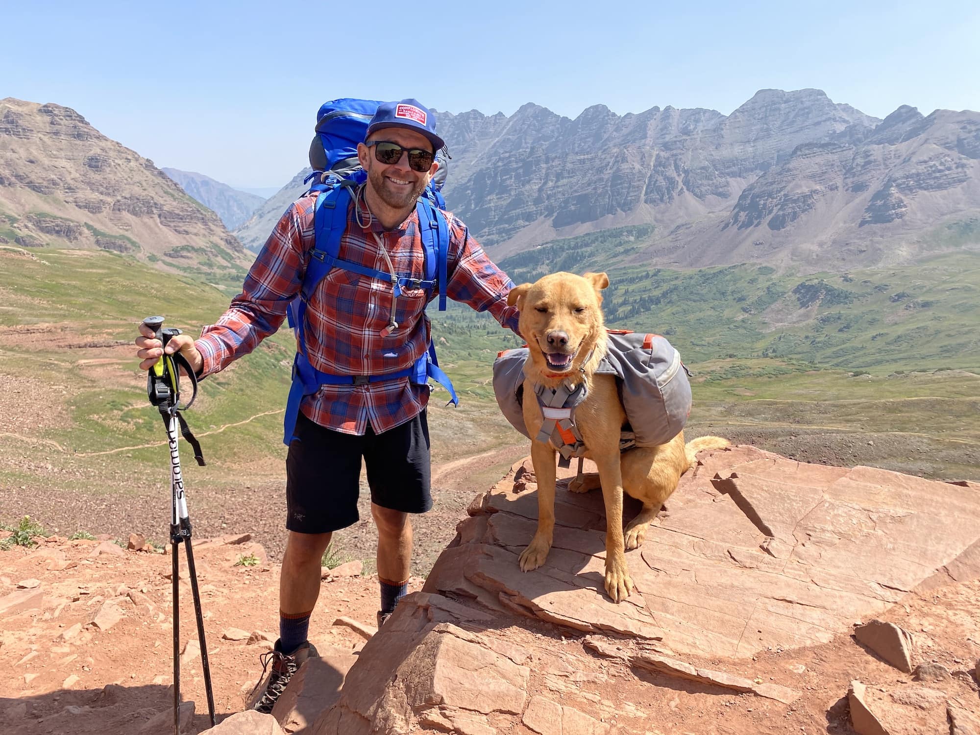
Colorado is an absolute paradise for backpackers of any skill level.
The western half of the state is chock-full of routes that can be done in a weekend, as well as lengthier routes that can get you out into the wilderness long enough to forget what cell service feels like. If you’re planning to do more than one, I’ve found that it’s most enjoyable to pick routes that are stark contrasts to each other and which are located in different parts of the state.
One weekend I was down in the San Juans and the next, I felt light years away as I hiked around Longs Peak up in Rocky Mountain National Park. It’s a whole different experience. The other key component is picking the right length and difficulty for everyone in your party to enjoy. Whether it’s a quick weekend away or some real alpine adventuring you’re after, we rounded up 6 of the best backpacking routes for you to choose from. If you’re looking for a shorter outing, check out our favorite hikes in Colorado.
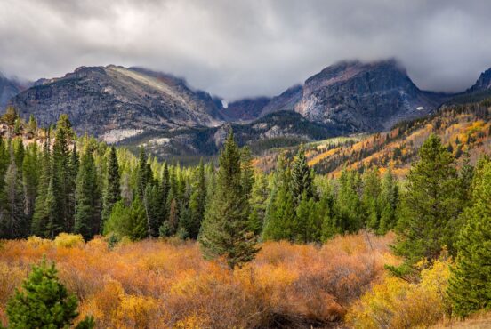
Given the altitudes of these routes, all are best attempted between July and September. Each of these routes are also located in primetime bear country. Before heading out, be sure to brush up on your bear safety knowledge, utilize proper food storage and practice Leave No Trace principles to ensure the wilderness stays wild for generations to come.
BEST FOR A QUICK WEEKEND OFF THE BEATEN PATH
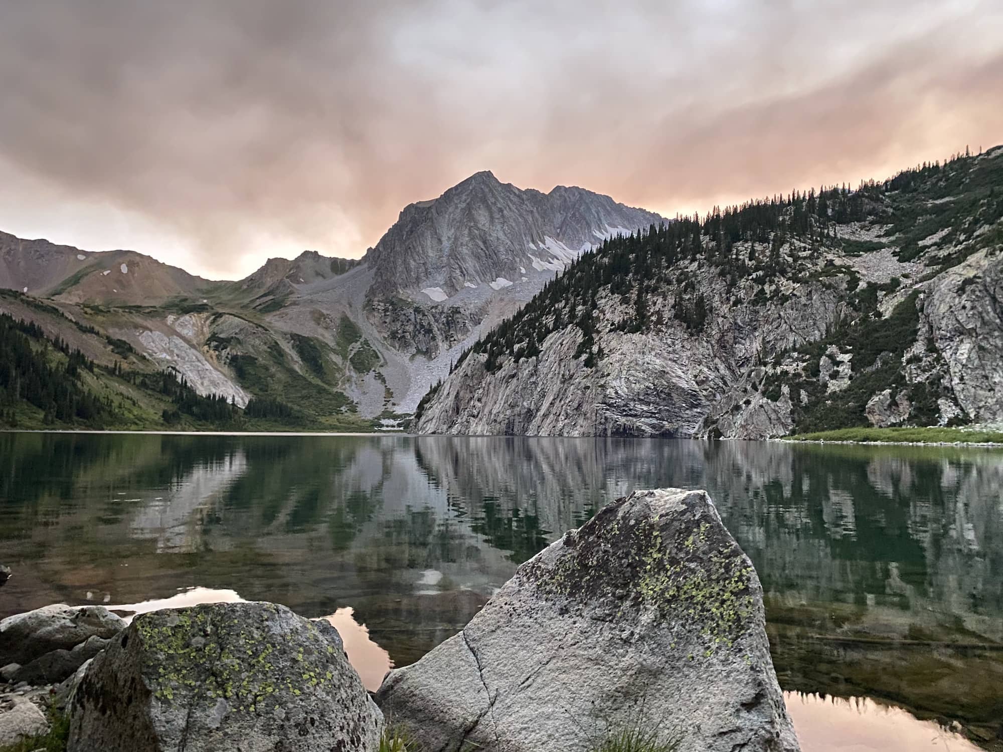
Cross Creek Trailhead to Missouri Lakes Trailhead — Holy Cross Wilderness
- Length: 18 Miles
- Duration: 2 Days
- Elevation Gain: 4,084 feet
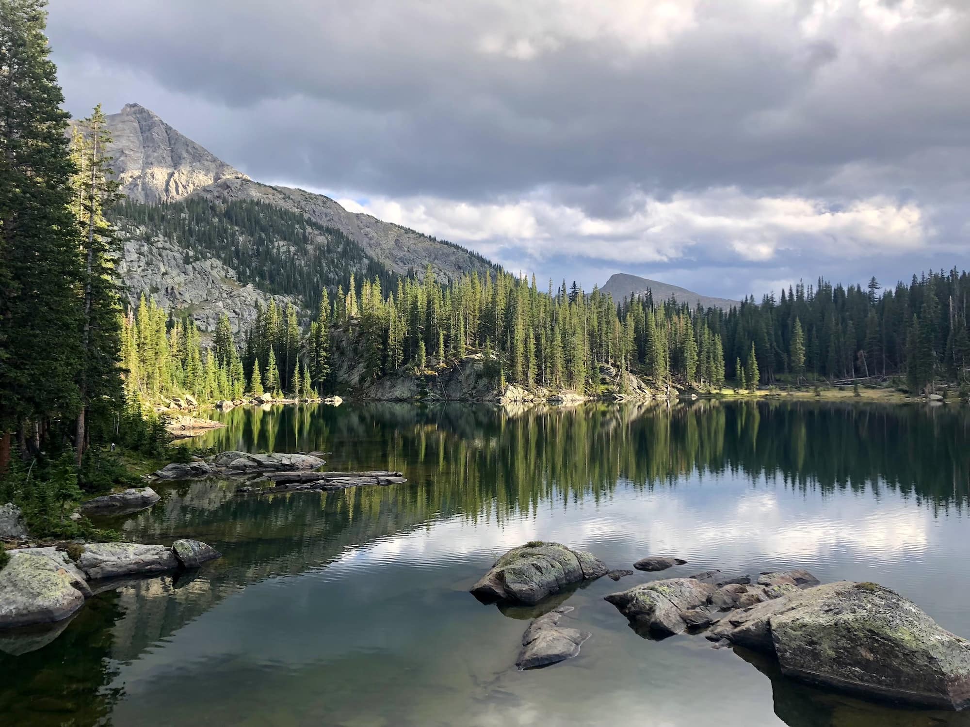
This thru-hike offers up a nice taste of Colorado’s alpine beauty to those who are looking for a quick weekend getaway. The trail meanders through lush forests and crosses crystal-clear creeks as you gain elevation on day one. It just so happened that the Saturday morning we chose to embark on this hike was a wet and gloomy one but we chose to forge on.
Thankfully, the weather cleared that afternoon and we were treated to a magnificent sky at sunset. Keep an eye out for mule deer, elk, and various bird species along the way and set up camp at Harvey Lake for a peaceful night under the stars. On day two, you’ll top out on Missouri Lakes Pass, just shy of 12,000 feet, before dropping into the cluster of lakes and green meadows for a nice finale.
Permits and Info:
- Permit: Self service kiosk at trailhead
- Dogs: permitted on-leash
- Campfires: Permitted below 11,000 feet (Check with Eagle County for seasonal fire restrictions)
Directions from Denver:
- Cross Creek Trailhead: Take I70 West to exit 171 Minturn/Leadville. Head south on CO-24 for approximately 5 miles, then turn right onto Homestead Road. Follow the signs to the Cross Creek Trailhead.
- Missouri Lakes Trailhead: Take I70 West to exit 171 Minturn/Leadville. Head south on CO-24 for approximately 12.5 miles, then turn right on CO-703. Follow this road 10 miles until you reach the trailhead.
BEST FOR A UNIQUE EXPERIENCE
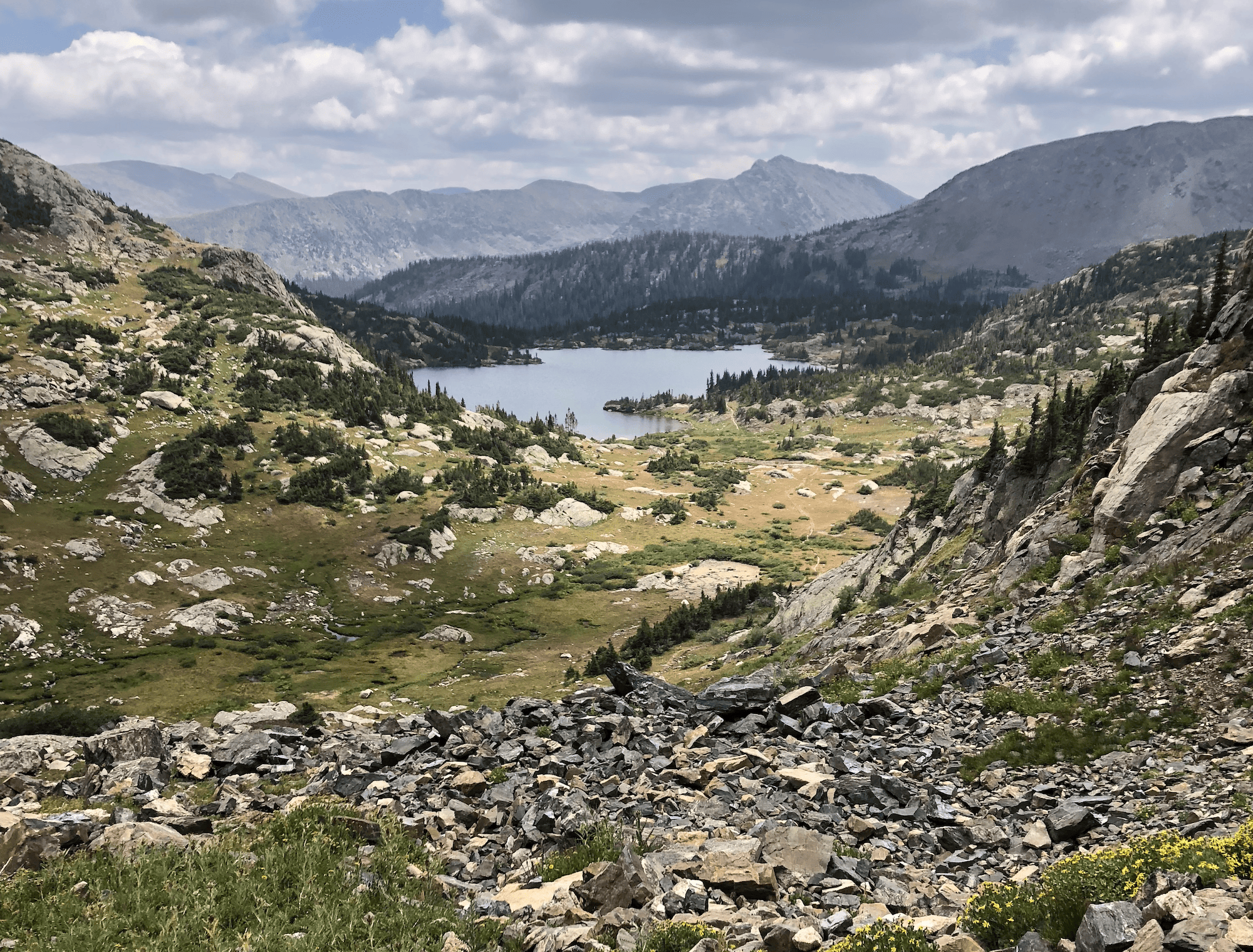
Chicago Basin – Weminuche Wilderness
- Length 12 miles + additional desired hiking/climbing
- Duration: 2-4 Days
- Elevation Gain: 3,000+
Chicago Basin is a remote backpacking adventure located in the Weminuche Wilderness and accessible via the Durango & Silverton Narrow Gauge Railroad (Must board in Durango). Hikers can ride the train between May and October and hop off at the Neddleton stop to start hiking. From here, it’s about 6 miles and 3,000 feet of elevation gain to get up to Chicago Basin, which boasts three of Colorado’s famous 14ers: Sunlight, Windom, & Eolus Peaks.
Drop your camping gear and make your way to the summit(s) or sit back and take in the breathtaking beauty of the San Juan Mountains. While you’re there, keep an eye out for local residents such as marmots, elk, black bears and mountain goats roaming the alpine terrain. We had a ton of deer roaming through our camp at night so be sure to hang your food high! When you’re ready to head back, hike down to the tracks and flag the conductor for an easy ride home.
Permits & Info:
- Permit: Not required
- Groups: Maximum of 15 per group and a maximum of 9 groups per day via train
- Camping: Must use an existing campsite and avoid camping in open meadows
- Campfires are prohibited
- Dogs are permitted
- Nat Geo Map: Weminuche Wilderness
Directions from Denver:
- Take US-285 south for approximately 190 miles
- Turn right onto CO-112 and follow until reaching Del Norte where you’ll turn right onto CO-160.
- Follow CO-160 approximately 120 miles to the train station in downtown Durango.
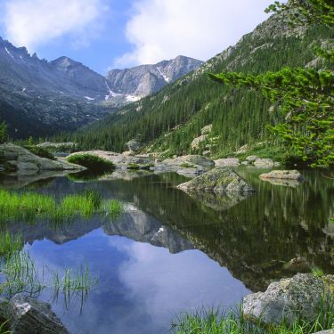
BEST FOR A TOUR OF ROCKY MOUNTAIN NATIONAL PARK
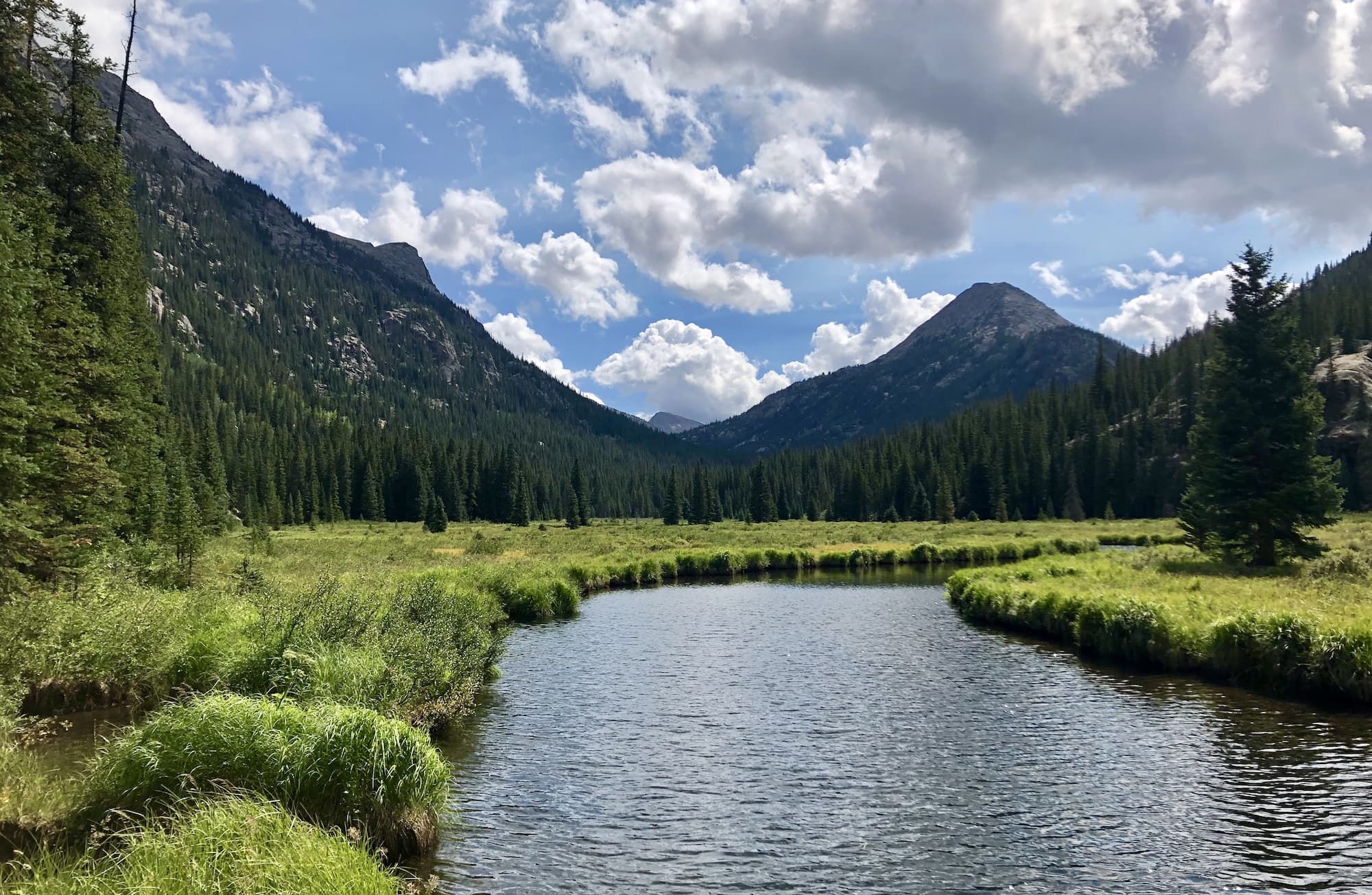
Longs Peak Valley Loop – Rocky Mountain National Park
- Length: 23 Miles
- Duration: 2-3 Days
- Elevation Gain: 5,100 feet
Just north of Denver, Rocky Mountain National Park offers an abundance of beautiful trail options, making it hard to choose just one. However, if I must, the Longs Peak Valley Loop is an excellent tour around the crown jewel of the park, offering scenic views in every direction without having to tackle too many steep grades to take them in.
Hiking clockwise, the first leg follows the Longs Peak—Keyhole Route. About three miles in, keep an eye out for the Chasm Lake Trail on your left as it’s a prime spot for capturing breathtaking photos of the Diamond—a massive shear wall on the East face of Longs Peak. This offshoot added about a mile and a half (roundtrip) to our day but was fully worth it. Next, you’ll head over Granite Pass, topping out at just over 12,000 feet, and down into Glacier Gorge where you’ll find the popular Alberta Falls. The Glacier trail will then connect you with the Wild River Trail and finally the Eugenia Mine Trail to close out the loop.
Permits & Info:
- Permit: Required and can be obtained at Recreation.gov
- Dogs: Not permitted
- Campfires: Not permitted
- Nat Geo Map: Rocky Mountain National Park
Directions from Denver:
- Take I25 North to exit 217A for US-36 West
- Follow US-36 through through Boulder and into the town of Lyons where you’ll turn left onto CO-7
- Follow CO-7 or approximately 25 miles
- Turn left onto Longs Peak Road and the trailhead will be one mile ahead.
BEST FOR A COLORADO CLASSIC
Four Pass Loop – Maroon Bells-Snowmass Wilderness
- 3-4 Days / 27 Miles
- Length: 27 Miles
- Duration: 3-4 Days
- Elevation Gain: 7,265 feet
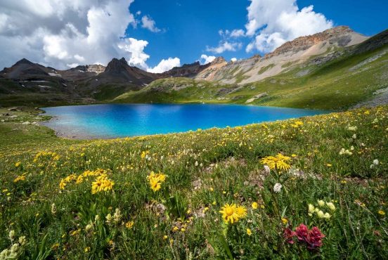
The Four Pass Loop is a renowned backpacking adventure that takes you over West Maroon Pass, Frigid Air Pass, Trail Rider Pass and Buckskin pass, located in the beautiful Elk Mountains between Aspen and Crested Butte. Just shy of 30 miles, it offers a dynamic landscape with challenging ascents, expansive valleys and pristine alpine lakes with incredible views. You can hike in either direction but I recommend clockwise, starting at Maroon Lake on the Aspen side.
The ascent up West Maroon valley is pretty mellow until the very end so it’s a good one to get out of the way while your pack is full. We did this trek over four days, choosing to start early in the afternoon on the first day and spend night one up near treeline in West Maroon Valley. This was a nice way to break in the legs and get a fresh start for day two when we would go over West Maroon and Frigid Air pass as back-to-back pushes.
If you follow that plan, you can camp lower down in Fravert Basin the following night and spend your final night camping against the incredible backdrop of Snowmass Lake. It’s jaw-dropping in the evening and morning light. Get up just before sunrise to snap some photos, hit the trail and be back in Aspen for lunch.
Directions from Denver:
- Take I70 West and use exit 195 for CO-91 S toward Copper Mountain/Leadville
- Follow CO-91 south to Leadville and then take CO-24 South for 15 miles
- Turn right onto CO-82/Independence Pass and follow this road (through the town of Aspen) for 38 miles.
- At the traffic circle, bear right onto CO-13/Maroon Creek Road.
- From Aspen, head southwest on Maroon Creek Road (CO-82) for approximately 4.5 miles to reach Maroon Lake and the trailhead.
Permits and Info:
- Parking: Reservations and shuttle info can be found on the RFTA website.
- Permits: Required and can be obtained at Recreation.gov
- Dogs: Permitted
- Nat Geo Map: Maroon Bells, Redstone, Marble
BEST FOR A REWARDING LONG-HAUL
Collegiate West (Continental Divide Trail) — Collegiate Peaks Wilderness
- Length: 83 Miles
- Duration: 5-8 Days
- Elevation Gain: 17,800 feet
The Colorado trail stretches some 486 miles from Denver, southwest to Durango. In 2012, a new section was officially designated as part of the CT, adjacent to the existing route and running along the continental divide on the western side of the Sawatch Range. This is known as the Collegiate West route and offers a rugged, week-long adventure through high-alpine terrain.
Embarking from the Interlaken trailhead in Twin Lakes, Colorado, the route delivers a distinctive and challenging experience that rewards you with awe-inspiring vistas of towering peaks and namesake 14ers such as Mount Yale, Harvard and Columbia. With the majority of time being spent at high elevation, you should be keenly aware of rapidly changing weather conditions.
As we approached Cottonwood Pass (CO-306 between Buena Vista and Almont) one afternoon, we saw a rather fierce storm coming toward us and debated our options. We knew we could weather it if we needed to but ultimately decided to hitch a ride into town for the night where we were also able to re-up on a few supplies as a bonus. The next day, we hitched back out and resumed hiking under sunny skies!
Aside from weather, be ready for demanding terrain that includes steep mountain passes and chilly creek crossings. The route ends atop Monarch pass where you’ll need to hitchhike to town or have a ride/car waiting for you.
Permits & Info
- Permit: Self service kiosk at trailhead
- Campfires: Permitted (Check with Chaffee County for possible local fire restrictions)
- Dogs: Permitted
- Nat Geo Map: Colorado Trail – Collegiate Loop
Directions from Denver:
- Take I70 West to exit 195 for CO-91 S toward Copper Mountain/Leadville
- Follow CO-91 south to Leadville and then take CO-24 South for 15 miles
- Turn right onto CO-82 and follow it 0.8 miles
- Turn left onto CO-25 where you’ll find the Interlaken trailhead just ahead.
BEST FOR NON-TRADITIONAL COLORADO
Central Circuit – Lost Creek Wilderness
- Length: 28 Miles
- Duration: 3-4 Days
- Elevation Gain: 4,900 feet
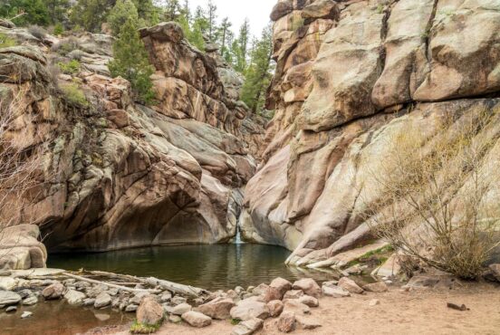
Named after the creek which disappears underground only to remerge downstream, the Lost Creek Wilderness loop is great for those who don’t have a lot of time to travel but want to immerse themselves in true wilderness. Instead of the high alpine terrain boasted by many Colorado routes, the LCW offers thick forests full of lodgepole and ponderosa pines, as well as arctic tundra and a radically different geologic profile than other parts of the state.
Here you’ll find a plethora of interesting granite domes, spires and even arches dotting the landscape. We did the route in mid-July and Mosquitoes were out in full force so I might recommend going a little later in the summer. The route is enjoyable in either direction but some would argue that the highlight is the Brookside-McCurdy trail, which is a nice finish if you hike the route clockwise.
Permits & Info:
- Permit: Self service kiosk at trailhead
- Dogs: Permitted.
- Campfires: Permitted (Check with Park County for possible local fire restrictions)
- Nat Geo Map: Tarryall Mtns. / Kenosha Pass
Directions from Denver:
- Take US-285 southwest for 67 miles
- Just before the town of Jefferson, turn right onto County Road 56 (Lost Park Road).
- Follow this road for 9 miles until you reach the Lost Park
Explore Colorado
Get epic travel ideas delivered to your inbox with Weekend Wanderer, our newsletter, inspiring more than 10,000 readers every week.
Seen in: Backpacking, Colorado, Rockies