We research, evaluate and select travel destinations based on a number of factors, including our writers’ experience, user reviews and more. We may earn a commission when you book or purchase through our links. See our editorial policy to learn more.
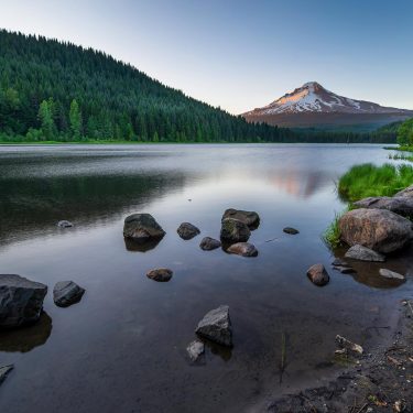
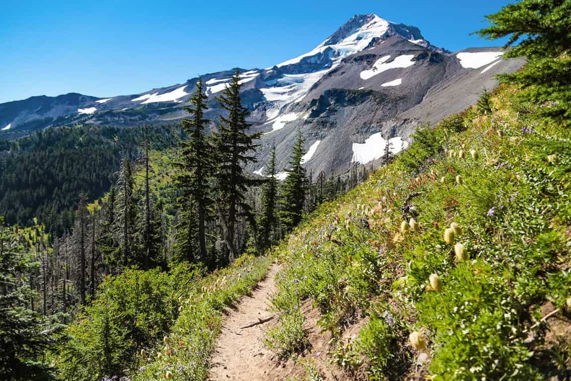
Located in the heart of the Pacific Northwest, if Oregon’s biggest treasure is Mount Hood’s snow-capped peak, then the Timberline Trail is its shining tiara.
Offering sweeping vistas, stunning mountain views, and a great variety of alpine terrain, the Timberline Trail is a veritable feast for the eyes — and the soul. The trail represents the best of the Pacific Northwest: lush biodiversity, beautiful views, and diverse landscapes.
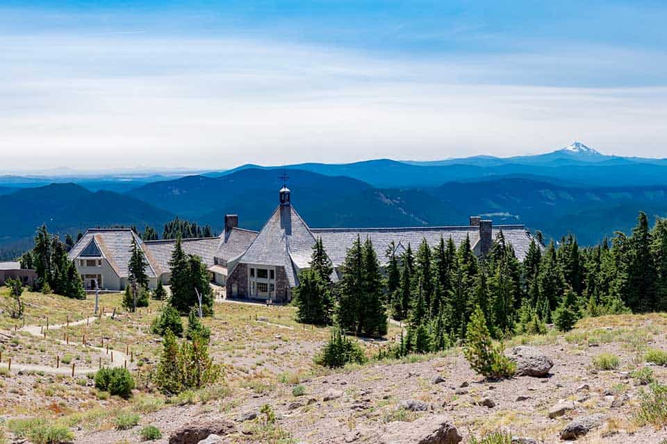
The Timberline Lodge is the center of outdoor recreation on the mountain and where most hikers begin and end their journeys.
Both backpackers and day hikers will find plenty of adventure on the trail as they cross glaciers, ford streams, and climb through canyons.
There’s something new to discover around every bend, and the Timberline Trail guide below will ensure you know the basics as you start planning your adventure.
As always, don’t forget to follow Leave No Trace principles when hiking, like minimizing your impact and properly disposing of waste. Learn more here.
Trail Details: Timberline Trail
| Details | Timberline Trail |
|---|---|
| Distance | 38.5 miles |
| Difficulty | Moderate |
| Duration | 2–4 days |
| Trail Type | Loop |
| Starting Elevation | 5,135 feet |
| Elevation Gain | 9,000 feet |
| Seasons | Summer, fall |
| ADA Accessibility | None |
| Dogs | Leash required |
| Trail Map | Mount Hood Recreation Map or Timberline Trail Org |
| Nearest Amenities | Timberline Lodge or Government Camp |
| Directions to Trailhead | Google Maps |
| Parking | Free at Timberline Lodge. Fees or passes required elsewhere. |
| Road Conditions | Trip Check |
| Attractions | Waterfalls, alpine lakes, mountain basin, mountain peaks, panoramic vistas |
| Activities | Hiking, backpacking, horseback riding, mountain climbing, skiing, snowshoeing |
The Hike
Timberline Trail, Day 1
Starting from behind the Timberline Lodge, hikers have a few choices of route. The clockwise option starts relatively easy and ends with a challenging uphill climb through sand; the counterclockwise route is the reverse. This guide follows the clockwise loop.
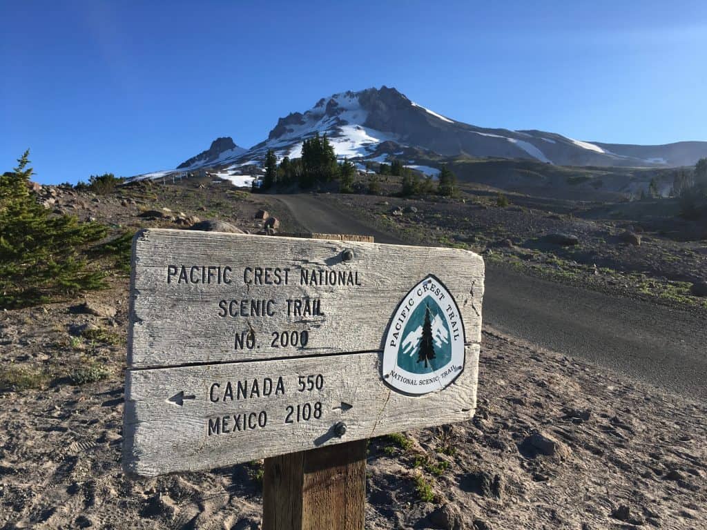
The trip starts on the Pacific Crest Trail. The PCT is one-third of the entire loop around the mountain, connecting the southern and northwestern points of the Timberline Trail. People often refer to the entire loop, including this part of the PCT, as the Timberline Trail.
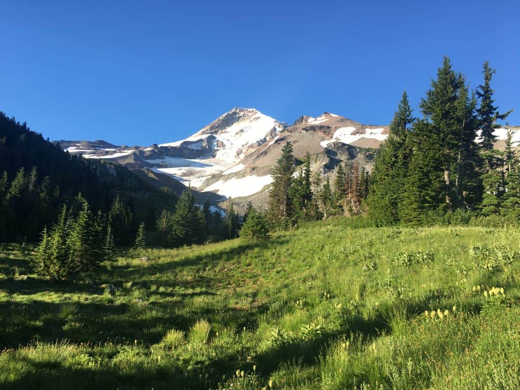
Mount Hood’s regal summit will be in plain view at the starting point — and for most of the hike — and you’ll see Oregon’s other iconic Cascade peaks standing like giants to the south. Leaving the ski slopes and civilization behind, you’ll descend around 2.5 miles into the verdant Zigzag Canyon, made lush by the melting glaciers.
Just before the 10-mile mark, you’ll meet your first difficult water crossing at the Sandy River (around Ramona Falls.) Early-season hikers should beware of the potentially dangerous current as glacial melt is strongest in the spring. Morning crossings are advised if possible.
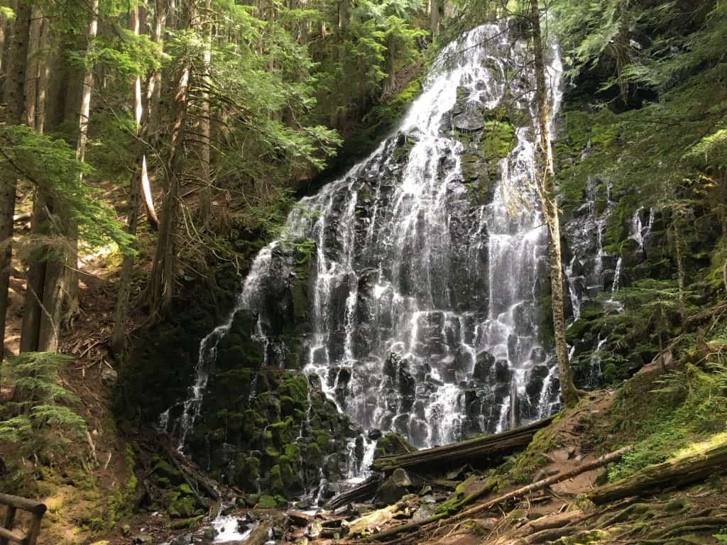
The trail usually gets crowded at Ramona Falls. This area is accessed by a shorter trail popular with day hikers. It’s also where backpackers leave the PCT and join the official Timberline Trail. There are several great camping spots around the falls, making it a good place to stop for the first night.
Timberline Trail, Day 2
Mount Adams, Mounts St. Helens, and Mount Rainier will come into view as the journey turns north, as will burnt forests and fields of vibrantly colored wildflowers. Around mile 15, you’ll see a cut-off trail, which cuts off some of the mileage as the actual trail loops and backtracks for a few miles. If you take it, you’ll still be able to camp at Cairn Basin (around 18 miles in) or Elk Cove (around 21.5 miles in.)
Both are popular camping areas for the second night and both have plenty of water, flat tent sites, and breathtaking scenery. Different Timberline trail guides may advise that one is better than the other, but really, it just comes down to whether you want to add on the extra miles to reach Elk Cove on day two.
Timberline Trail, Day 3
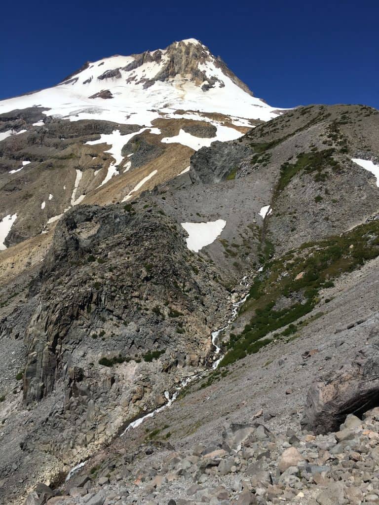
From here, the difficulty gets dialed up a notch. You’ll begin the ascent to the Timberline Trail’s high point, but not before crossing another tricky glacial melt stream at Elliot Creek. After the creek is a steep climb to the Cloud Cap Saddle Campground, which rewards your efforts with picnic tables and the only toilet on the trail.
The following section of trail is infamously known as “the beach” as it’s the driest section. It begins at approximately 27 miles in. Hikers must climb over several miles of gravel and soft sand to reach the trail’s high point, Lamberson Spur, at 7,350 feet.
This is where you’ll discover the best view: a grand vista of all the state’s famous peaks, stretching east to Oregon’s high desert. Most hikers choose to stop soon after this point for the day. Newton Creek, around mile 33, is a popular camping area.
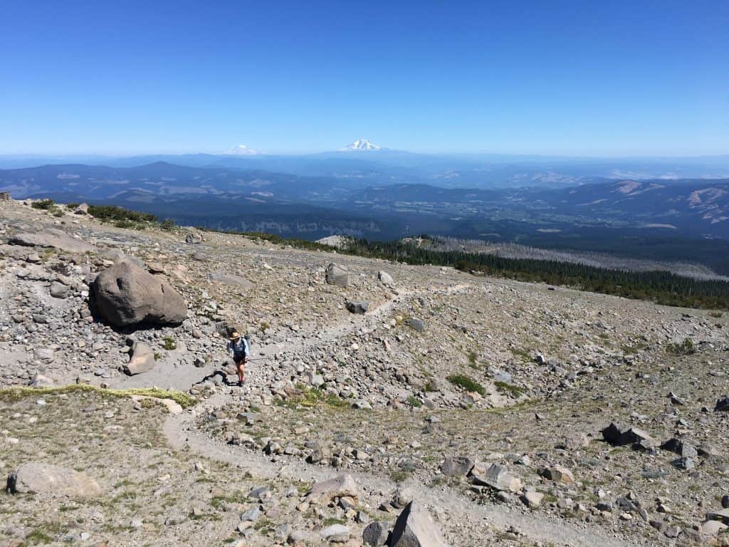 Photo: Arthur McMahon
Timberline Trail, Day 4
From here, it’s downhill and the walking gets easier, crossing small glaciers and past the impressive Gnarl Ridge. The long descent ends at the vast, awe-inspiring White River Canyon. This glacial wash is humungous, and though the river is usually shallow, it’s wide and the current can be strong. Use caution — most Timberline trail guides will advise that you not rush this crossing.
The trail across the canyon can be quite difficult to find and changes every year due to washouts. As you enter the canyon, you’ll see a sign advising you to aim for a copse (thicket) of trees directly across the river.
The final stretch from the canyon to the Timberline Lodge is a sandy, uphill slog that will drain whatever energy you have left. Back at the lodge, you can grab a drink, a hot meal, and a cozy room to relax in to celebrate your accomplishment.
When to Visit
Summer and early autumn are the only seasons in which the entire trail can be completed without skis or snowshoes. Backpackers will want to start from the lodge as the parking is free.
Day hikers can visit any time of the year as the lodge is open year-round. The Ramona Falls Loop is a great access point for the trail, as are the Top Spur Trail and the Cloud Cap – Tilly Jane North Trailhead.
Directions to the Timberline Trail
From Portland, hop on I-84 East, then turn south through Gresham onto US-26 East for about 40 miles until you come across the Timberline Highway. Turn left onto the twisty road to the lodge and keep driving until you get to the parking lot. Expect about 90 minutes of driving.
An alternative and more scenic route will have you stay on I-84 through the Columbia River Gorge until you get to the town of Hood River. Then, you can cut south around the eastern side of Mount Hood on OR-35 until you reach the Timberline Highway. This route takes about 30 minutes longer.
Leave No Trace
Visited by millions of people every year, Mount Hood is often mistreated by the crowds of people coming through. It’s the responsibility of every hiker and visitor to protect the mountain.
Mount Hood is the primary source of drinking water for one-third of all Oregonians, and its glacial flows provide essential nutrients and habitat to spawning salmon and other area wildlife. Please do not camp near or otherwise disturb these vital headwaters.
Set up your camp and expel waste at least 200 feet away from any water source. This helps keep our waterways clean and healthy for the wildlife who depend on them.
Learn more about important Leave No Trace principles here.
Area Tips and Resources
- Lodging: There are plenty of great lodging options on Mount Hood. The Timberline Lodge is an operational National Historic Landmark and should be at the top of your list. If you’d rather stay in town, Government Camp has a host of hotels and vacation rentals.
- More outdoor fun: There are dozens of trails in the Mount Hood area and the Columbia River Gorge has many incredible waterfall hikes. Mount Hood is also one of a select few places in the world with year-round ski slopes. The SkiBowl Adventure Park is a terrific year-round playground for families. Most visitors centers should have Timberline trail guides, area hiking guides, and plenty of printed resources if you’re out of cell service.
- Portland: Rip City itself is only a little over an hour away. If you’re spending time there, check out Portland’s best hikes and camping options for you to explore.
Plan for Your Trip
Sign up for our free email to join 50,000+ readers getting epic travel, hiking, and camping ideas every month.
Seen in: Backpacking, Oregon, West