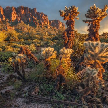
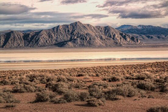
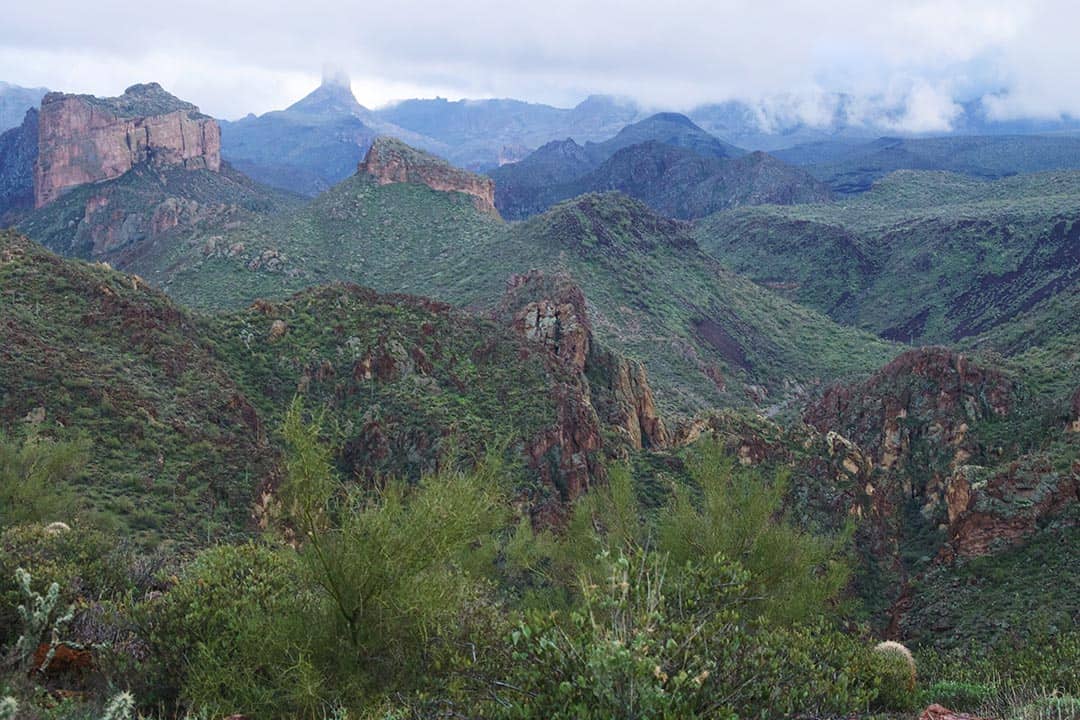
Boulder Canyon Trail is a treasure-chest of a hike in the Superstition Mountains. You won’t find the Lost Dutchman’s gold, but you will get luminous views of Weaver’s Needle, Four Peaks, Battleship Mountain and Canyon Lake.
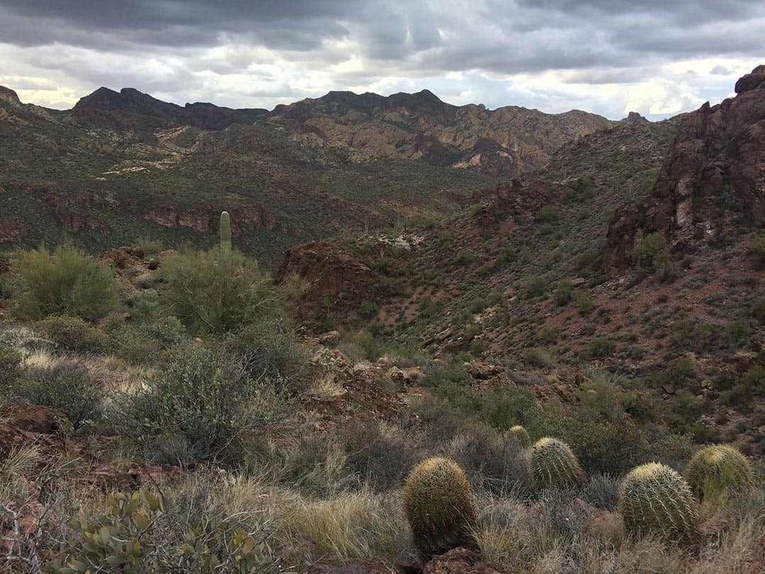
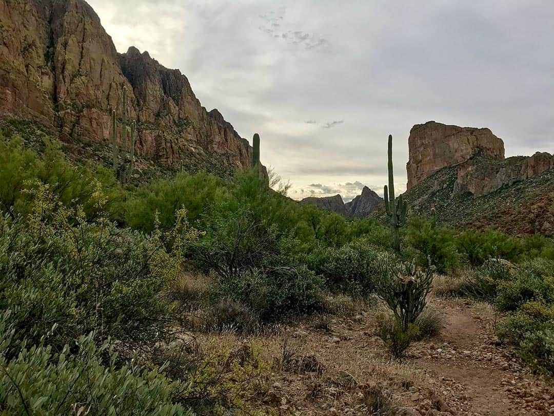
This trail lifts you high above the rugged mountains of the Supes. You will see all the layers against the horizon that weave together to create an almost unearthly desert landscape. It’s one that us locals have come to know, love and cherish.
Sometimes I’ve done this hike with friends and family. Other times I’ve done it alone. Whether I wanted to introduce someone to the place I call home, unpack life with a dear friend, or contemplate decisions in solitude, I’ve always walked away from this trail feeling renewed.
Related: 10 Epic Things to Do in Rocky Mountain National Park
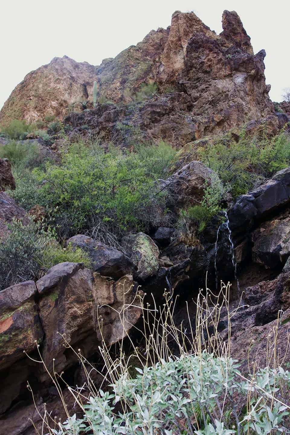
Depending on the time of year, a layer of white may blanket the tops of the mountains. Wild flowers might dance along the nourished terrain. After a solid storm, La Barge Creek might be filled—welcoming you for a swim—while cascades flow throughout the region.
I haven’t tackled every hike in the Supes, but I’ve done a fair share. And I have to say, this one is my favorite. Plus, you probably won’t come in contact with many other hikers.
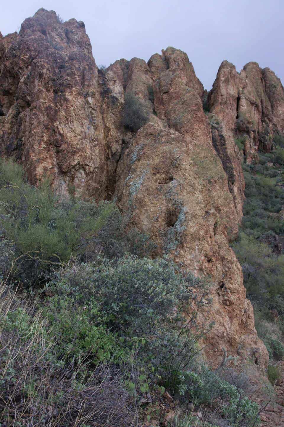
Keep all of these pleasant details in mind when you begin this trek. The first section can be a bit strenuous. The landscape out here is rocky, harsh and unforgiving. But it’s also humbling, and the rewards (views and feelings of accomplishment) are fruitful.
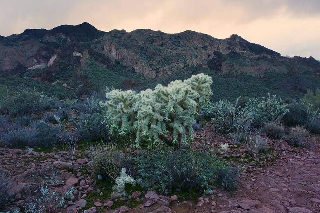
The array of desert plants will encourage you to keep trekking, and if you need to take a breather, turn around and have a look at Canyon Lake.
Along the way, you will reach a fork. Be sure to stay to left, and once you reach the first lookout, take a load off. Have a snack, think about life—anything. Just be sure to marvel at those views for a few moments. It’s not every day that you are elevated to this extent.
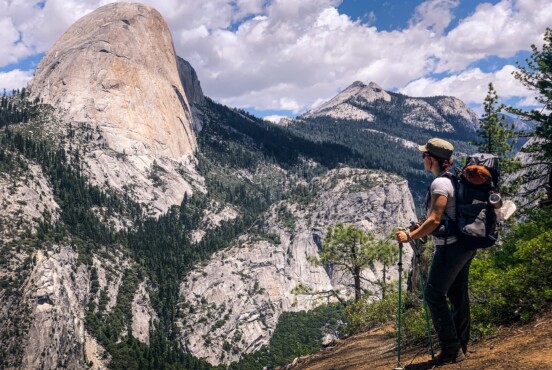
Onward from feeling like you’re on top of the world, the trail starts to level out, but the views hardly give way. You will weave through the thriving desert of Saguaros, Chollas, and Creosote trees. And more than just the desert life, you walk alongside massive mountain walls that deserve observation.
Eventually, you will begin your descent to La Barge Creek. It’s a nice change of pace after the climb, but just remember you’ll have to climb out again.
If you’re hiking this trail near or around summertime, be very cautious of rattlesnakes, especially if the creek is flowing. They love this area. They could also make their presence known in the early stages of the hike, but if they haven’t sent you any signals yet, this is the time to keep your eyes and ears open.
Seeing as the coast is clear and the creek isn’t roaring to the point where you can’t continue (which can be the case after storms), the trail continues to the west. If you’re doing a day hike, this is usually a good turn-around point for most trekkers, but if you’re still feeling determined—onward!
You will reach a saddle where you may come across a section of land that Natives would use to extract clay, as well as the “stove” area for pottery.
After your descent into the actual Boulder Canyon, you’ll start coming up to intersections with other trails, like Second Water, and eventually the Cavalry Trail.
The end of the Boulder Canyon Trail is once you’ve reached the intersection with the Dutchman Trail. This last section can be a bit of a doozy due to multiple intersections and indistinct trail management. Best to have a GPS or download a map.
Because of the various intersections, you can tack on extra miles and make your hike unique to you. Some options include: La Barge Lower – Box Loop or a shuttle hike to the First Water Trailhead.
There’s also areas for you to camp, if you want to do a backpack. One morning while hiking this trail, I saw a group that had set up shop over one of the lookouts along the way. I could only imagine experiencing the Supes under the moonlight, with a sunrise to greet me the following morning.
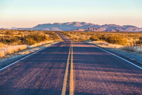
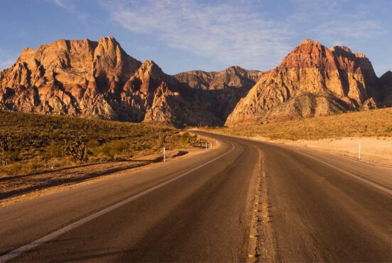
Getting to the trailhead is also part of your adventure. As you begin approaching Canyon Lake from the AZ-88, the road swivels back and forth as you observe an obvious change in your environment. It’s where the water meets the desert.
Canyon Lake is one of four reservoirs that are linked together in the Tonto National Forest and doesn’t get nearly as many visitors as Saguaro Lake does. This lake is a stellar choice for kayaking or paddle boarding on a day with minimal wind.
Relative to Boulder Canyon Trail, though, you’ll want to park at the marina. There is a restroom, in case you need, as well as a restaurant if you need your post-trek meal as soon as possible and can’t wait to get back to town.
Directions & Deets
Getting there: For anyone living in the north side of the Valley, hop on the 202 going east. Take exit East Brown Road/26 and turn left. Continue east on Brown Road for about seven miles until you come up to a stop sign at North Apache Trail/AZ-88. Turn left. Continue on the 88 for 12.5 miles. Once you reach Canyon Lake, continue past two bridges. After the second bridge, the parking lot will be on your left.
For anyone living on the south side of the Valley, take the 60 going east. Take exit South Idaho Road/196 and turn left. Continue for just over two miles until the road turns into North Apache Trail/AZ-88. Follow directions from previous paragraph once you reach Canyon Lake.
Difficulty: Moderate. Initial climb is strenuous, and the middle of the trek levels out before a descent to the creek — just remember you have to climb out.
Elevation: 1,817 feet
Distance: 14.6 miles
Dogs: Yes, but must be kept on a leash. Rattlesnakes are out and about during warmer months, and if it’s 85 degrees or more outside, best to leave your furry friend(s) at home.
Best time to go: Spring, Fall, Winter.
Explore More of the Sonoran Desert
We’ve got all sorts of hiking write-ups going on for the Superstition Mountains and beyond. If you’re into hiking the Sonoran Desert, check out this stuff:
- Rugged Beauty: 20 Best Hikes in the Superstition Mountains
- Ride the Desert Surf on Arizona’s Wave Cave Trail
- Most Livable Trails: Best Hikes in Scottsdale
- 21 Must-See Waterfall Hikes in Arizona
- 16 Best Places to Camp in Arizona
Hit the trail and be sure to tag it with #findyourterritory when you blast it on Insta.