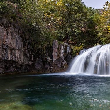
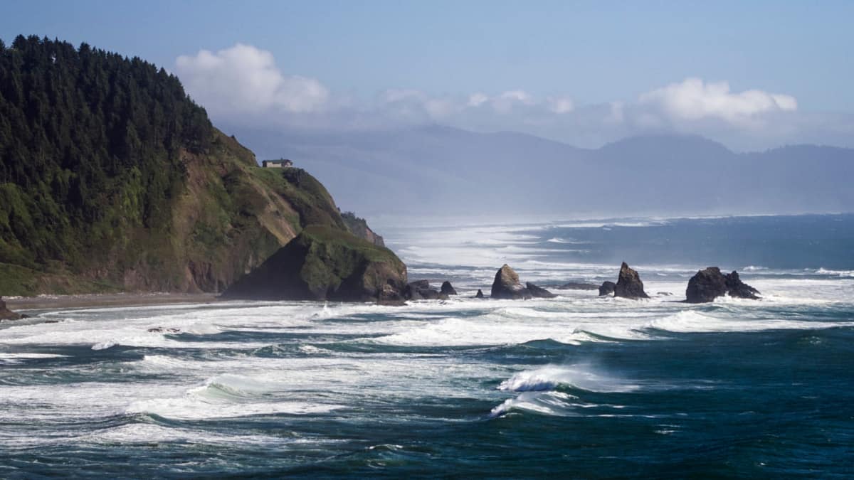
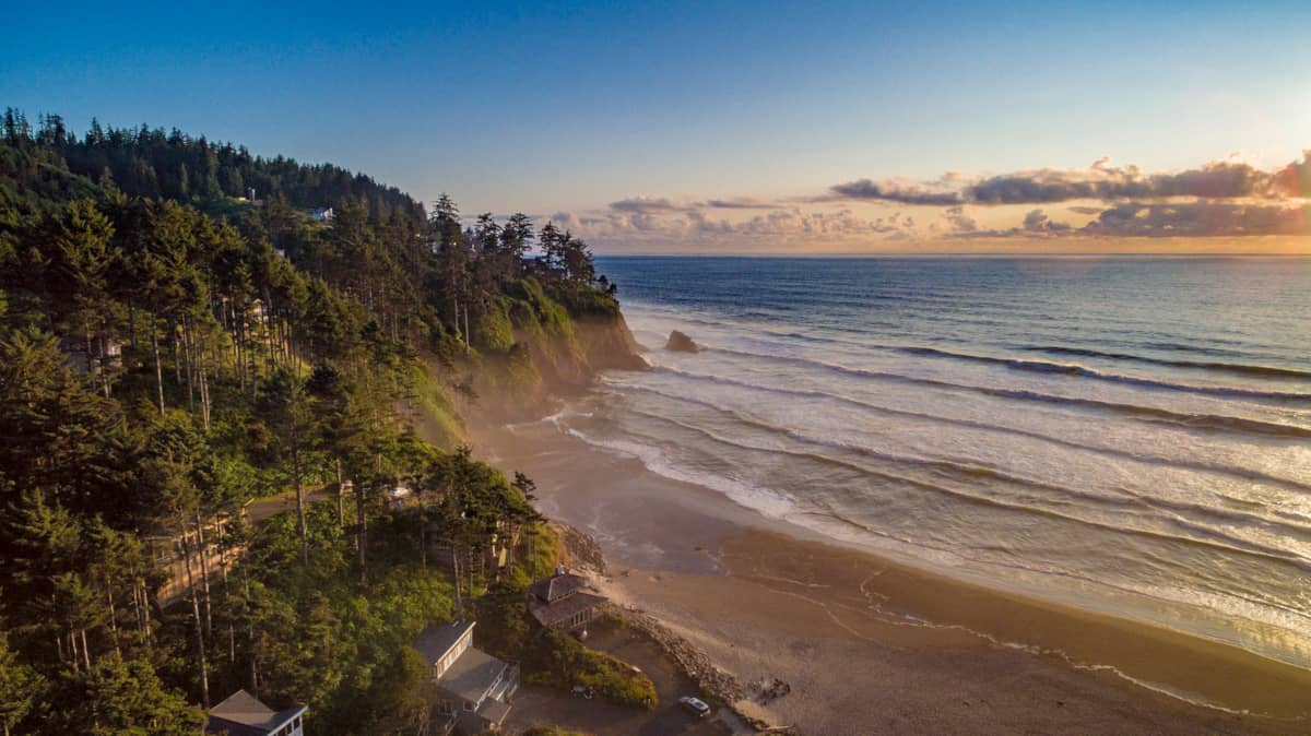
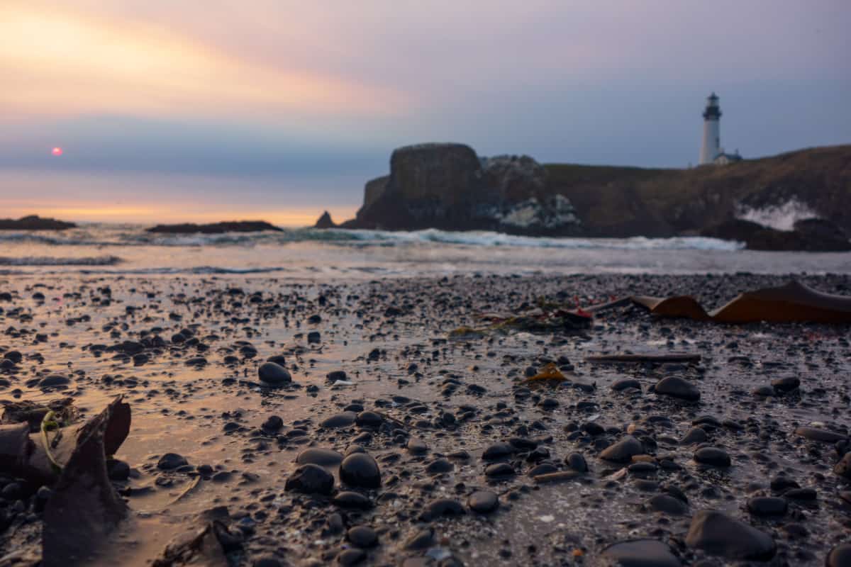
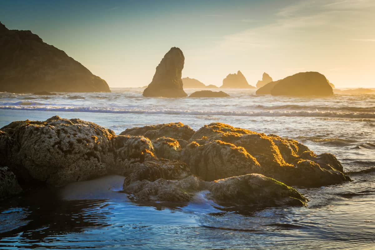
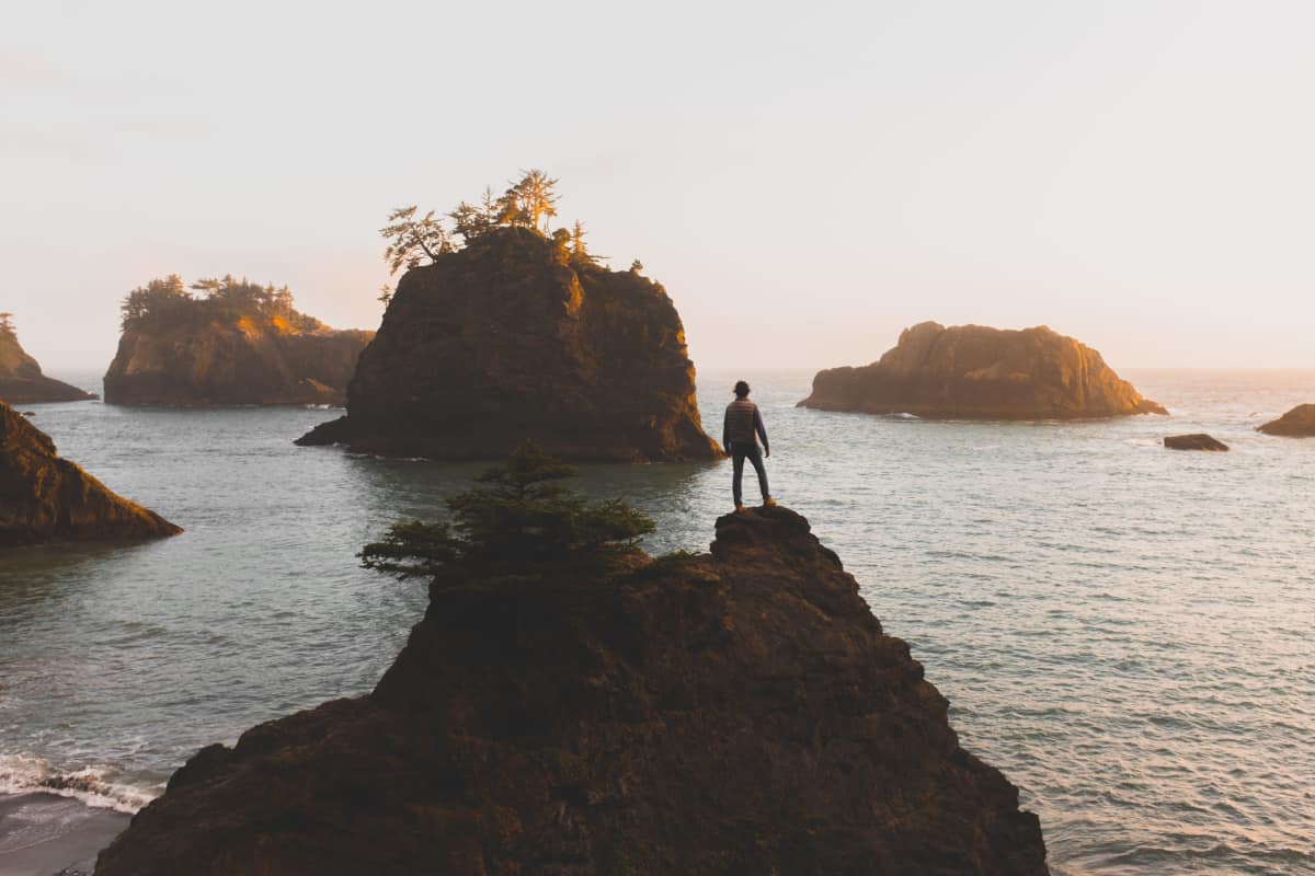
Every summer, my family makes an annual pilgrimage from the arid southwest desert up to the frigid waters of the Oregon Coast.
When we post our Seaside vacation pictures to social media, I’ll usually see a comment or two asking why we’re wearing fleece jackets on the beach in July. Aside from the obvious (try wearing a swimsuit in 55-degree water and get back to me), my answer is pretty simple: I visit the Oregon coast for the scenery, not the surf.
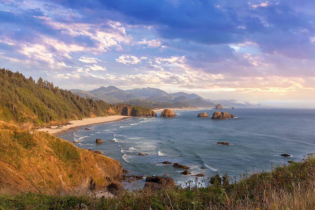
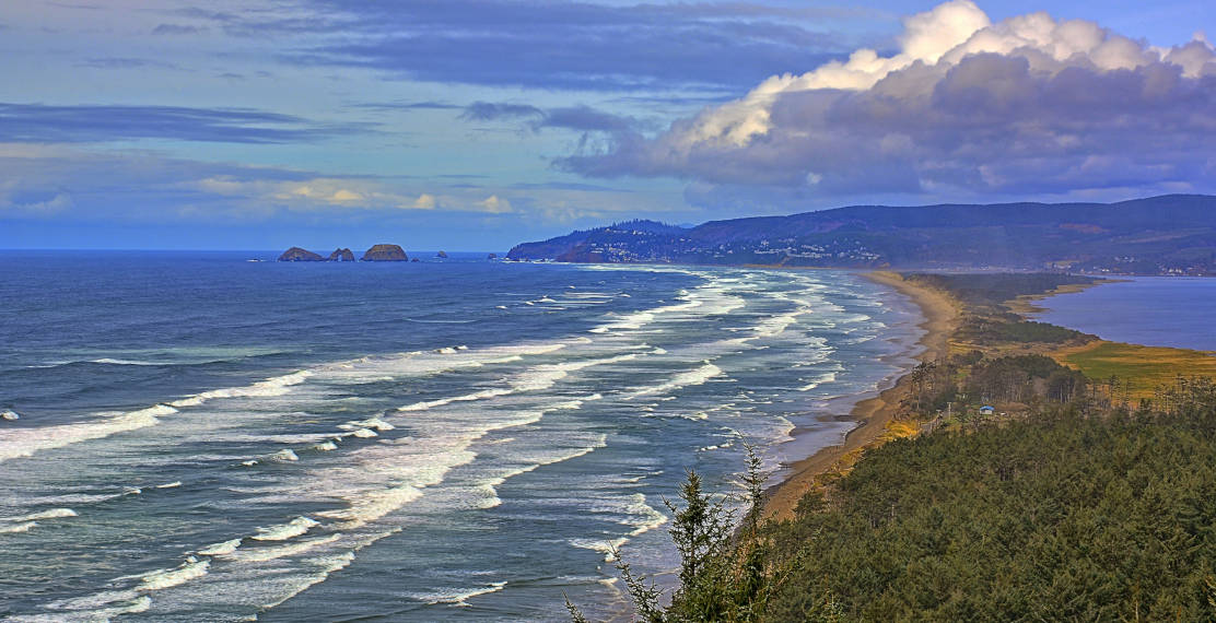
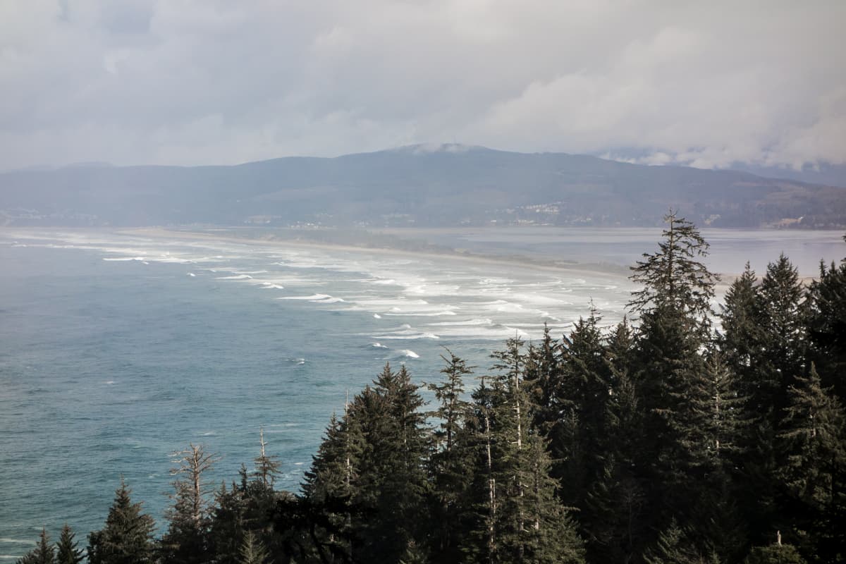
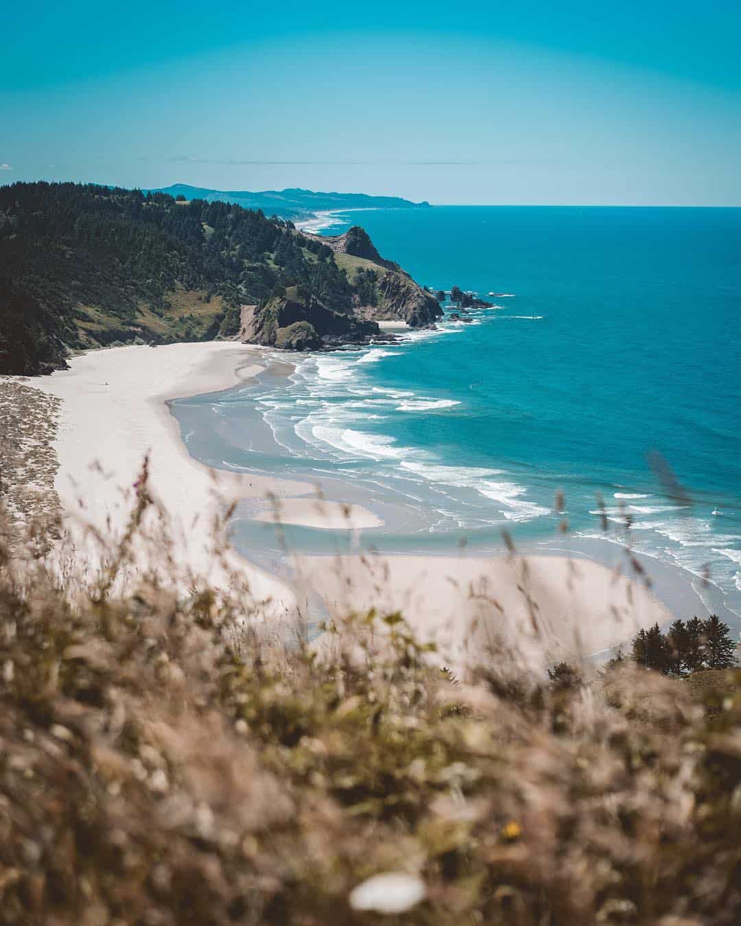
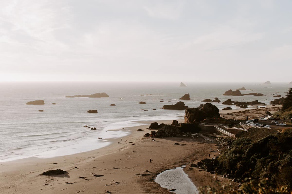
Take a minute to google Cannon Beach and you’ll quickly see my point. Oregon’s picturesque coastline features a unique, alternating combination of rocky headlands and sandy coves formed by millions of years of wave erosion.
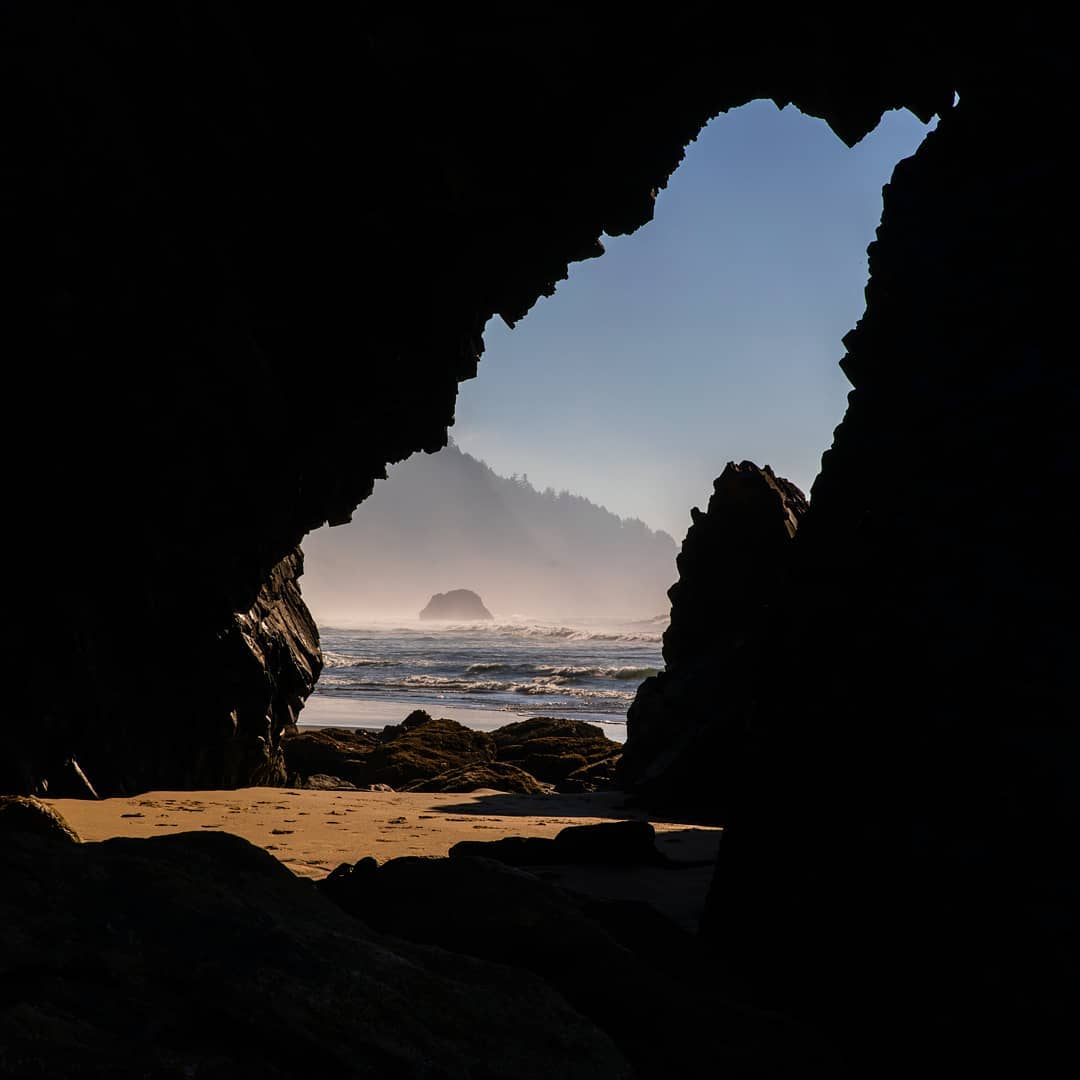
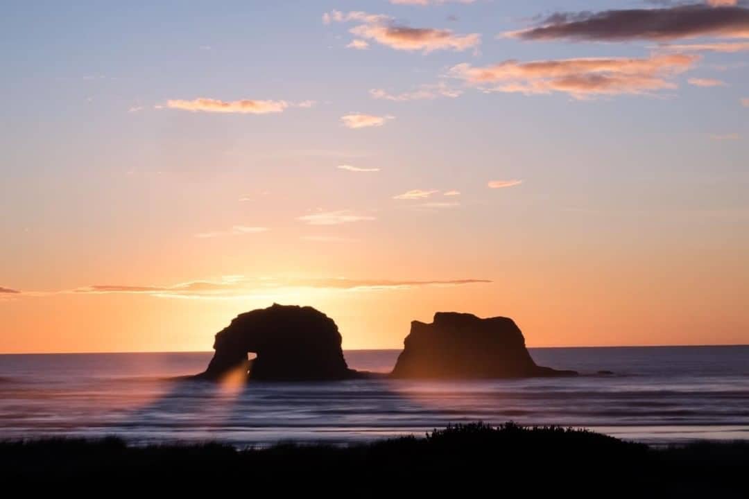
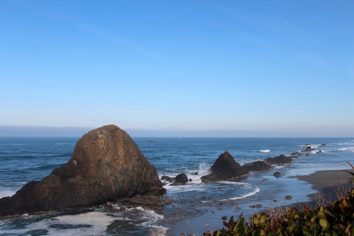
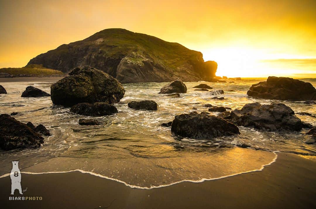
The beaches feature towering sea stacks and natural arches carved from the headlands, and you’ll often find sea caves chiseled into the rocky cliffs — evidence that the sea continues to shape the old lava formations and sandstone.
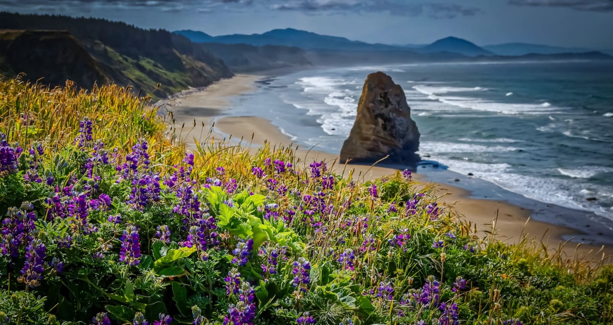
The rugged coastline is picture-perfect, but it’s more than just a prime background for your next selfie. Head down to the cove and you’ll see firsthand how the rocky shores around the headlands provide ideal conditions for tide pools teeming with colorful sea creatures.
Gaze up at the sea stacks and you’ll see flocks of seabirds whose nesting grounds are protected by the Oregon Islands National Wildlife Refuge. Point your binoculars out to sea, and you’ll see seals, sea lions, and migrating gray whales who thrive in the local ecosystem.
Need a place to stay on the Oregon Coast? Check out these amazing vacation rentals & campgrounds:
Hiking the Oregon Coast
Most of the beaches and scenic viewpoints along the Oregon coast are accessible by car, but the best way to experience the splendid scenery is to strap on your boots and hit the trails.
Be prepared to get your feet wet, though — the beach trails often involve crossing a few streams and creeks emptying into the ocean, and scrambling around a headland at low tide is rarely a dry adventure. Unless you’re a barefoot trailblazer with hardened hobbit feet, you’ll want to bring a towel and appropriate footwear.
Thousands of miles of trails dot the coastline, but none of them match the scale and grandeur of the Oregon Coast Trail — a 382-mile trail running along the coast from the Columbia River all the way down to the California border. Most of the Oregon Coast Trail sticks to the sandy beaches, though there are some impassible headlands requiring a detour through state parks and public lands.
You probably don’t have the time to knock out the entire Oregon Coast Trail in one trek, so we’ve gone ahead and narrowed down the best portions for you. Our list of the top 25 Oregon coast hikes covers the best headlands and beaches from Ecola Point down to Harris Beach. Whether you choose a leisurely stroll through the sand or a challenging climb through headland forests, you’ll enjoy breathtaking views of the coast’s natural wonders.
Be sure to consult the tide charts when planning your hike, and keep an eye on your watch while you’re on the trail. Many of the beaches and headlands on this list are impassible at high tide, so you’ll want to begin your hike around low tide. You don’t want to get marooned on a pocket beach when the tide comes in!
Finally, keep the whale migration seasons in mind if you plan to do any whale-watching. In the spring, you’ll see the most action from late March to June. During the winter, the best times are mid-December to mid-January. There are a few resident pods that frequent locations like Depoe Bay, but you’ll have a much better experience during peak seasons when there are 60,000+ gray whales migrating along the coast.
Northern Oregon Coast
Crescent Beach Trail
Why you should go: Hike to a secluded beach with caves, tide pools, and sea stacks.
- Distance: 3.6 miles
- Elevation Gain: 310 feet
- Difficulty: Easy
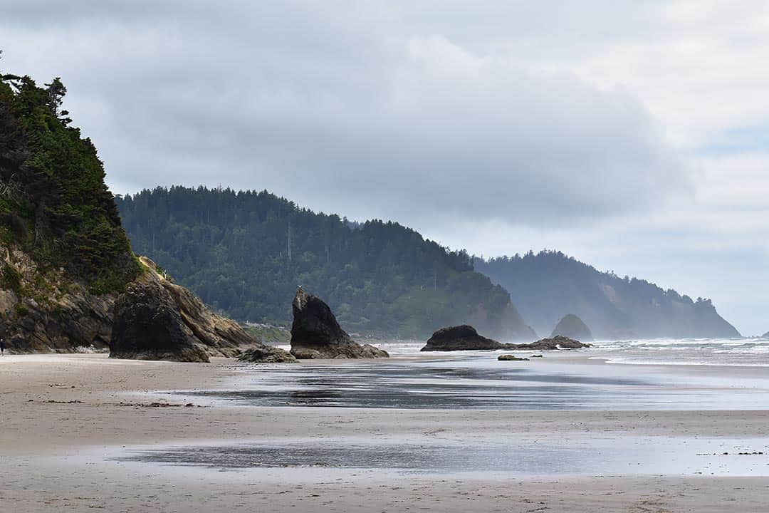
Crescent Beach is only 1 ¼ miles from the Ecola State Park parking lot, but it’ll feel like you have the entire beach to yourself. With stunning views of the local sea stacks, plus numerous caves and tide pools to explore, it’s surprising that so few hikers make the day-trip to Crescent Beach. Their loss is your gain, as you’ll get to enjoy these splendors in relative isolation.
Your journey begins at the Ecola State Park Trailhead. After a short walk through the woods, you’ll cross a service road and meet Ecola Park Road. The trail picks up again 70 yards down the road, leading to a scenic clifftop before diving into a lush spruce forest teeming with elk and deer.
The trail continues with alternating sections of woods, views, and even a creek crossing on a plank bridge. When you hit the trail junction, head right for Crescent Beach. The trail winds through more alder and spruce woods with six switchbacks before you finally reach Crescent Beach.
Head north along the beach and you’ll come across a small waterfall cascading down to the driftwood-lined beach. There are a few caves and a couple of tunnels you can walk through at Ecola Point. At low tide you can make your way around the point to an even more isolated pocket of hidden beaches.
Chapman Point and the John Yeon Natural Site are on the south end of Crescent Beach. Bring along your camera for some great shots of Bird Rocks and Thimble Rock offshore. You can walk around the point at low tide to reach Chapman Beach, where you may be lucky enough to spot some sea lions, seals, and pelicans.
Additional Info: Crescent Beach Hike
Cannon Beach
Why you should go: Traverse the most popular beaches on the Oregon Coast with picturesque sea stacks and epic headlands.
- Distance: 10.2 miles
- Elevation Gain: 25 feet
- Difficulty: Moderate
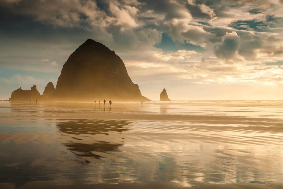
A list of the best hikes on the Oregon Coast would be incomplete without Cannon Beach, the state’s most famous stretch of coastline. Picturesque Haystack Rock is the main attraction here, but breathtaking views abound at Silver Point, Humbug Point, and Hug Point.
Starting at the Cannon Beach Trailhead, head west until you reach Hemlock Street. Take a right, follow the street for half a block, then take a left on 2nd Street to reach the beach. You’ll pass Kramer Point, where Ecola Creek meets the Pacific Ocean. To the right is Chapman Beach, and to the left is Cannon Beach.
Haystack Rock commands your attention the moment you step on the sand. This 235-foot sea stack is home to flocks of cormorants, puffins, murres, and other seafowl, whose nesting grounds on Haystack Rock and the surrounding sea stacks (known collectively as The Needles) fall under the protection of the Oregon Islands National Wildlife Refuge. The surrounding tide pools are an aquatic explorer’s dreamscape, filled with starfish, anemones, chitons, crabs, and colorful sea slugs.
Next up is Silver Point, a headland along Tolovana Beach with a low sea cave. The beach is backed by a towering, multi-layered sedimentary bluff, and offers a close-up view of Jockey Cap offshore.
A little further south is Humbug Point, a small basalt headland marking the northern tip of Arcadia Beach. As you scramble over the rocks, take a gander at Lion Rock and see if you can make out the sphinx created by 15 million years of erosion carving into the headland. When you reach the Arcadia Beach Recreation Site, take note of the colorful cliffs and fascinating layers twisted and contorted by millions of years of tectonic force.
Last but not least is Hug Point, a headland with enough sea caves to hold One-Eyed Willy’s long-lost Oregon treasure. There’s an old road carved into the headland that you can use to round the bend. When you’re safely on the other side, enjoy the sea caves, waterfalls, and views of the pocket beaches at Austin Point. In the distance, you can also see Castle Rock and the old Tillamook Rock Lighthouse offshore.
Additional Info: Cannon Beach Hike
Arch Cape Loop
Why you should go: A beach with magic rocks, a natural arch with developing sea caves, and a relaxing walk through the woods.
- Distance: 5.5 miles
- Elevation Gain: 520 feet
- Difficulty: Moderate
The Arch Cape Loop offers a comprehensive coastal hiking experience with a stroll along the beach, a scramble around a lava headland, and a trek through the forest. You can only pass Arch Cape during low tide and the beach is entirely reclaimed by the sea during high tide, so it’s best to start at the Tide Road Trailhead about an hour before low tide.
The first stop is Cove Beach, nicknamed Magic Rocks Beach by the lava cobbles that clatter around during high tide. The official hike doesn’t include a walk down to Cape Falcon, but it’s worth a detour if you’re a fan of tide pools. Walking north along the beach, you’ll cross several creeks and enjoy views of Gull Rocks and Castle Rock offshore.
When you reach Arch Cape at the north end of Cove Beach, climb over the barnacle-crusted boulders or wade through the shallow wash to reach the base of the lava headland. Take a stroll through the natural arch and check out the developing sea caves around the headland.
After exiting the beach, watch for an Oregon Coast Trail marker. A short walk through the town followed by a dip under Highway 101 brings you to the Shingle Mill Trailhead, where a suspension bridge transports you over Arch Cape Creek. You’ll cross a footbridge over a tributary before entering a forest. Continuing along the Oregon Coast Trail, you’ll pass “Parodice Gardens” (noted by a sign with a pair of dice) with giant cedar stumps and Skimmia Japonica.
Towards the end of the Arch Cape Loop, the Oregon Coast Trail crosses Highway 101 and moves into the mossy woods of Tillamook County. The path undulates and crosses over three footbridges before bringing you to Falcon Cove Road, a little less than a mile from where you started.
Additional Info: Arch Cape Loop Hike
Cape Falcon
Why you should go: Cape Falcon offers spectacular views of the coastline and Neahkahnie Mountain.
- Distance: 4.8 miles
- Elevation Gain: 160 feet
- Difficulty: Moderate
The Cape Falcon hike is a fairly level out-and-back hike along the Oregon Coast Trail. The trail gets muddy in the spring and can be a little rough in some areas, but it’s easily passable. Moreover, it’s worth the muddy shoes and sweat for the magnificent views of the coastline and Neahkahnie Mountain from Cape Falcon.
Beginning at the Cape Falcon Trailhead, you’ll follow the side of a forested ridge above Short Sands Creek until you reach a junction at the halfway mark. Take a left to reach Short Sand Beach and Smuggler’s Cove if you have time for a detour. Otherwise, bear right for the main trail to Cape Falcon.

Continuing along the trail you’ll cross a few creeks and pass a large slide zone before reaching Blumenthal Falls — a charming little waterfall down a large basalt slope. For the adventurous hiker, there’s a side trail that brings you to the base of the upper tier, then to the lip of the larger lower tier. From there, the creek cascades down to the rocky shoreline.
It’s a relatively short walk to Cape Falcon from Blumenthal Falls. When you reach the cape, look south for the best views of Neahkahnie Mountain and Manzanita.
Additional Info: Cape Falcon Hike
Neahkahnie Mountain Loop
Why you should go: Old growth forest, clifftop views, and a mountaintop viewpoint.
- Distance: 8 miles
- Elevation Gain: 2300 feet
- Difficulty: Moderate
The Neahkahnie Mountain Loop follows the Oregon Coast Trail from Short Sand Beach to Neahkahnie Mountain before descending to the town of Manzanita. One of the best hikes in Oswald West State Park, you’ll see majestic old growth forest around Necarney Creek and stellar cliff top views of Devil’s Cauldron, Smuggler’s Cove, and Cape Falcon.
Your mountain adventure begins at the Short Sand South Trailhead. A short hike brings you to Necarney Creek, which runs along bedrock in a rich, old-growth forest of Sitka spruce and western hemlock. When you reach the Oregon Coast – Necarney Creek Trail Junction, head left and proceed across a narrow, swinging footbridge over the creek.
Take a left at the next junction for Elk Flats Trail on the Oregon Coast Trail. After a few switchbacks you’ll reach a meadow leading to a wicked cliff top view of Devil’s Cauldron — a cliff-rimmed inlet with developing sea caves. During the spring and summer, flocks of pelagic cormorants nest on the cliffs and the inlet’s lone sea stack, Cube Rock. Gaze north to see the sea arch at Cape Falcon.
Shortly after Devil’s Cauldron you’ll reach another clifftop vista on Overlook Trail with views of Cape Falcon and Smuggler’s Cove. Across the highway, rejoin the Oregon Coast Trail for more views of the ocean, Cape Falcon, and Devil’s Cauldron as you proceed along switchbacks up the mountain.
While the higher north summit is heavily timbered and inaccessible by trail, the trail ultimately winds up to the Neahkahnie Mountain Viewpoint on the south summit. This rocky viewpoint delivers breathtaking views of Neahkahnie Beach, Manzanita, and Nehalem Bay Mouth further down the coast. There’s a path up to the peak from the viewpoint, but it’s steep and potentially dangerous.
On your way down the mountain, you’ll enjoy views of Nehalem Bay before entering a secondary forest. Ultimately the trail leads down to Highway 101, which you’ll follow to the North Neahkahnie Mountain Trailhead. This leads back to the return trail through Devil’s Cauldron Meadow.
Additional Info: Neahkahnie Mountain Loop Hike
Twin Rocks Beach
Why you should go: A leisurely stroll past giant sea stacks on Twin Rocks Beach and panoramic views from the Barview Jetty.
- Distance: 9.2 miles
- Elevation Gain: 30 feet
- Difficulty: Moderate
The Twin Rocks Beach hike begins at the Barview Jetty overlooking the Tillamook Bar, and ends at Rockaway Beach a few miles up the coast. You’ll need to wade through Watseco Creek along the way, but the close-up views of the Twin Rocks sea stacks from the beach are worth getting a little wet.
From the parking lot at the Barview County Park Trailhead, follow a sandy trail that drops down and runs parallel to the jetty. You’ll see the remains of the rail trestle atop the boulders, where trains ferried the giant boulders used to construct the jetty in 1900. Keep to the northern edge of the trail and avoid the wetland area, which floods at high tide.
When you reach the Barview Jetty Trailhead, head up to the observation tower for panoramic views of the area. Next, walk along the jetty towards the ocean. You’ll have to do some boulder-hopping as some of the jetty surface has been washed away. When you reach the beacon near the end of the jetty, you’ll have an excellent vantage of Three Arch Rocks, Pyramid Rock, Cape Meares, the South Jetty, and Kincheloe Point at the tip of the Bayocean Peninsula.
Scramble down the jetty boulders or walk through the picnic area to reach the low dunes below the jetty. After wading through Watseco Creek, the beach bulges outwards under the protection of Twin Rocks and affords an excellent vantage of the massive sea stacks. As you continue north toward Rockaway Beach, look back at the stacks to see the natural arch of Elephant Head.
Your final destination, Rockaway Beach, lies up ahead past Saltair Creek. When you’re finished beachcombing, you can head inland to the Rockaway Beach Trailhead and explore the visitor center, or head back to the starting point.
Additional Info: Twin Rocks Beach Hike
Cape Meares
Why you should go: Oregon’s tallest Sitka spruce, an octopus-shaped tree, a lighthouse perched 200 feet above the waves, gorgeous clifftop vistas.
- Distance: 5.4 miles
- Elevation Gain: 885 feet
- Difficulty: Moderate
The Cape Meares hike begins north of the cape at the Cape Meares Beach Trailhead. The beach transitions from sand to cobbles, boulders, and slick gray mudstone. The last part is difficult to pass at high tide, so it’s best to start your hike about an hour before low tide. When you reach the mudstone section, look south to see the arches and caves under Cape Meares’ cliffs.
Getting off the beach can be a little tricky, as you’ll need to follow a rope up a slick, soft gully. The trail climbs above a swamp into the Cape Meares National Wildlife Refuge. Keep your head on a swivel to enjoy magnificent views of Saddle Mountain, Tillamook Head, Bayocean Spit, and the hills behind Garibaldi.
The next junction near the Big Spruce Trailhead leads you to the Big Spruce, Oregon’s largest Sitka spruce, taking over the title when the Klootchy Creek Giant fell in 2007.
After admiring the Big Spruce, head back to the Big Spruce Trailhead and hike a half-mile down to the Cape Meares Light Trailhead. There’s a viewing deck on the right side of the parking lot where you can take in the sweeping vista of Pillar Rock, Pyramid Rock, and the surrounding beach cliffs. The cliffs are home to flocks of guillemots, peregrine falcons, bald eagles, murres, puffins, and cormorants, so the platform is a top-notch birding location.
Follow a paved trail past a few more viewpoints to the Cape Meares Lighthouse. Built in the 1890s, the small lighthouse sits about 200 feet above the waves. From this vantage, you will have a great view of the sea lions at Three Arch Rocks and migrating whales further out to sea.
For the final leg of your journey, follow a fenced trail up the south side of Cape Meares for views of Maxwell Point, Short Beach, and Three Arch Rocks. Take a short detour to see the Octopus Tree, then enjoy one last look at Three Arch Rocks from the high bluffs before heading back down the trail.
Additional Info: Cape Meares Hike
Oceanside to Netarts
Why you should go: Stroll along the beach with towering Three Arch Rocks, secluded coves, and a century-old tunnel.
- Distance: 6.4 miles
- Elevation Gain: 20 feet
- Difficulty: Easy
The hike from Oceanside to Netarts begins at the Oceanside Beach Trailhead. You’ll have a great vantage of Three Arch Rocks from the beach, and you should see some sea lions loafing around Seal Rock. In the spring, you’ll also see common murres and tufted puffins flying around the stacks.
Sheer-sided Maxwell Point lies on the north end of Oceanside Beach. You can walk around the point at low tide, but the best way to access the secret beaches on the other side is through the Maxwell Point Tunnel. Originally constructed in 1926 by the founding family of Oceanside, the tunnel was closed in 1979 and reopened in 1999. The tunnel is damp and occasionally flooded, so proceed with caution. You’ll find Tunnel Beach (aka Isolation Beach) on the other side of the tunnel, with a few small sea stacks on the far side of the beach.
Past Tunnel Beach sits Agate Beach, named for the colorful agates hidden in the sand. If you’re lucky enough to reach Agate Beach during a minus tide, head over to the headland on the north end of the beach to explore Lost Boy Cave Beach. The beach’s namesake cave is carved into the headland.
When you’re finished exploring Agate Beach and Lost Boy Cave, head back down to Oceanside Beach. Cross Baughman Creek, pass some mudstone cliffs, then head inland a bit to find a log to cross Fall Creek. Next is Hodgdon Creek, which can be challenging to cross at high tide. Round the point into Netarts Bay, then head over to the picnic benches by O’Hara Creek to watch the boats and seals bobbing in the tranquil bay.
Additional Info: Oceanside to Netarts Hike
Cape Lookout North
Why you should go: a coastal headland hike through the forest with cliff top vistas.
- Distance: 9.6 miles
- Elevation Gain: 2340 feet
- Difficulty: Moderate
Beginning at the Cape Lookout Day Use Trailhead, your first stop is the Dick Winsor Memorial. Built to honor a former state park superintendent, the site affords excellent views of Sphinx Island and Cape Lookout. The memorial site also provides details about Cape Lookout State Park and a map of the trail system.
From the Dick Winsor Memorial, follow the North Trail under a tall Sitka spruce. Use the footbridge to cross a creek, then follow a gravelled maintenance track to the first junction. The Cape Lookout North trail proceeds to the right, or you can take a left for a detour to Cape Lookout’s South Beach.
The North Trail’s prime viewpoints appear up ahead, starting with a view of Cape Lookout itself just past the second junction. Following some switchbacks and a steep ascent, you’ll enjoy a commanding view to the north of Three Arch Rocks, Oceanside, and Netarts Spit.
You’ll eventually reach the Cape Lookout Trailhead parking lot, a good midpoint if you’d like to split up the hike and avoid the day use fee. From here, the Cape Trail drops to junction with the South Trail, then continues down towards the coast with excellent southward views to Cape Foulweather, Cascade Head, Cape Kiwanda, and Sand Lake.
When you reach the Cape Lookout Crash Site, prepare for some muddy boots. The path is known to be quite muddy between here and Cape Lookout, though there should be wooden palettes to keep you from sinking into the muck. The trail continues to drop until you reach a boardwalk, then you’ll climb back up for a view to the north of Cape Meares and Maxwell Point.
The final leg of the hike follows a stepped boardwalk with great southward views. After a few switchbacks and drops, you’ll reach the viewpoint at the tip of Cape Lookout. You should see plenty of gray whales from here during migration season, and possibly some sea lions below in the swells. There’s a steep fisherman’s trail that leads down to a rock bench at the base of the cape, but it’s cold, windy, and wet, so only proceed if you’re prepared for exposure.
Additional Info: Cape Lookout North Hike
Cape Kiwanda
Why you should go: a quick and easy hike with stunning headland views.
- Distance: 2.2 miles
- Elevation Gain: 230 feet
- Difficulty: Easy
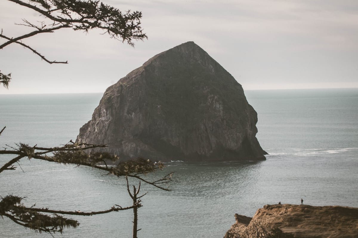
Ever hear of Oregon’s other Haystack Rock? Formerly named Chief Kiwanda Rock after the lead of the local Nestucca tribe, the giant sea stack off Cape Kiwanda is actually one of three sea stacks named Haystack Rock on the Oregon Coast. The one in Cannon Beach is the most famous of the three, but the stack off Cape Kiwanda is actually larger.
The Cape Kiwanda Hike begins at the Pacific Avenue Trailhead. You’ll have an excellent view of Haystack Rock from the beach, and as you proceed north you’ll notice the sea stack’s distinctive “ponytail” feature on the north face. This portion of the beach features brilliant yellow and orange sandstone layers. At low tide, you may even be able to find some fossils in the soft sandstone.
As you trudge up the sand towards the crest of Cape Kiwanda, follow the fenceline protecting sensitive areas of the site. Looking down, you’ll see a rocky cove and cave below the cape’s forested crest. There’s a brilliantly colorful sandstone stack at the end of the fenceline, which partially conceals the peninsula of Cape Lookout. When you reach the summit, you’ll enjoy views of Cape Lookout’s cliffs, Sand Lake, and Tierra del Mar Beach.
Additional Info: Cape Kiwanda Hike
Central Oregon Coast
Neskowin Beach to Porter Point
Why you should go: Beach hike with sea stacks, shallow caves, and an ancient drowned forest.
- Distance: 9.6 miles
- Elevation Gain: 15 feet
- Difficulty: Moderate
The hike from Neskowin Beach to Porter Point begins at the Neskowin Beach Trailhead. As you’re leaving the parking lot, take a peek at the Haida carving of a fish — an appropriate decoration as the word “neskowin” roughly translates to “plenty fish.” When you reach the beach, head north towards Cape Kiwanda, Haystack Rock, and Cape Lookout.
When you reach the creek draining Daley Lake, you’ll need to ford through the water. There’s a rope to help you over one section, or you can try to pass by on the rocks between incoming waves. Next, head over to the notch between the cliffs and the sea stack to explore a small cave. One more wet passage around the rocks and you’ll reach Porter Point beneath the cliffs of Cannery Hill. Enjoy the views of the Nestucca Bay Mouth while keeping an eye out for harbor seals, then head back to Neskowin Beach.
Back on Neskowin Beach, hike over to Proposal Rock, a basalt sea stack where local legend says a sea captain proposed to his beloved. You should be able to reach the rocky base at low tide. A path takes you to the top of the forested island, where you may be lucky enough to spot a bald eagle high in the trees.
When you’re done exploring Proposal Rock, drift further south past Neskowin Creek towards the cliffs of Cascade Head. You’ll pass a ghost forest along the way that’s visible in the waves at low tide. These 200 stumps were part of a coastal woodland drowned by tsunami forces over 2,000 years ago.
Additional Info: Neskowin Beach to Porter Point Hike
Cascade Head
Why you should go: Salt spray meadows with gorgeous panoramic views, endangered butterflies, and rare plants.
- Distance: 6.8 miles
- Elevation Gain: 1310 feet
- Difficulty: Moderate
Cascade Head fosters a rare environment known as a coastal headland salt-spray meadow. Trees cannot survive in these meadows due to high winds and shallow soil, leaving the headland with incredible, unobstructed cliff top vistas. The trail up to Cascade Head’s salt-spray meadows can be quite steep at times, but it’s worth the climb for the panoramic views.
You’ll find the first scenic vista when you reach the lower viewpoint just past Teal Creek. This salt spray meadow offers excellent views to the south, but the real treasures are right in front of you. Keep an eye out for two rare flowering plants: the Cascade Head Catchfly and the Hairy-Stemmed Checkermallow. Even more elusive is the endangered Oregon Silverspot Butterfly, found in only five places around the world. These brown and orange butterflies feature bright metallic silver spots on the bottom of their wings, and you’ll often find them fluttering amongst the violets on the hill.
Further up the trail is the upper viewpoint, an even larger salt spray meadow with superb views to the south. On a clear day, you can see the coast from the Salmon River Estuary down to Lincoln City. There’s a parking lot at the Upper Trailhead where you can park a second car to drive home, or you can hike back to the Cascade Head Lower Trailhead.
Additional Info: Cascade Head Hike
The Thumb
Why you should go: Stunning views of the Salmon River and Cascade Head.
- Distance: 4.6 miles
- Elevation Gain: 1025 feet
- Difficulty: Moderate
The Thumb (aka God’s Thumb) is a basalt formation in Siuslaw National Forest. This unique formation is part of a basalt dike formed during the late Eocene era, which has gradually been whittled down by the waves over millions of years. Like the stacks and rocks scattered in the adjacent cove, The Thumb will eventually become an isolated stack (though we’re a long way from that happening).
The trail begins at the Roads End Trailhead, and initially involves some road-walking until you reach the last house on Sal La Sea Drive. Past the gate, follow an old road bed until you reach The Knoll. As you’re climbing to the crest of the ridge, look back for excellent views of Lincoln City and Devil’s Lake. Keep an eye out for elk, too, as this ridge is a popular bedding site.
Spectacular views abound when you reach the top of The Thumb. To the north is Cascade Head across the Salmon River, and to the south is Lincoln City. Offshore, there are a number of sea stacks dotting the nearby coves.
Additional Info: The Thumb Hike
Depoe Bay
Why you should go: Follow a sea wall to a headland trail with views of rugged coastal bluffs and migrating whales.
- Distance: 2.2 miles
- Elevation Gain: 60 feet
- Difficulty: Easy
Depoe Bay is a small coastal city wedged between the hills and a lava ocean front. It’s one of the best whale-watching spots on the Oregon Coast, with a state-sponsored Whale Watching Center and numerous charter companies that’ll take you out to sea for a closer look. The bay features sandstone formations on the adjacent headland, and gorgeous coastal views of Pirate Cove.
This quick and easy hike begins at the Depoe Bay Trailhead near the Whale Watching Center. Follow the seawall north towards the headland. Look down and you’ll see the dark pillow lavas from the Grand Ronde member of the Columbia River Basalt flows. These are the same flows that formed the walls of the rugged canyons at Silver Falls State Park. You may also spot another lava feature called a spouting horn, where the waves funnel up a narrow crack and erupt in a fountain of sea spray from a hole in the lava rock.
Take a quick detour to Depoe Bay Scenic Park, and sit down for a picnic lunch at one of the tables under the shade of the shore pines. You’ll have a great view of the deeply eroded colorful sandstone “fingers” of the lava headland at the north end of the bay. There’s a rough path to the lava shore, then another section of the park that offers closer views of the sandstone fingers.
Continuing along the trail, you’ll reach a lone Sitka spruce with a rope attached to the trunk. Use the rope to navigate the slippery path down through the salal to a pocket beach near the natural arch. You’ll see some low cliffs here that are stained by iron and algae.
Back on the trail again, head past the Depoe Bay Scenic View Area towards the lava headland. The trail ultimately leads to the Pirate Cove Viewpoint, a clifftop vista with a beautiful view of the sandstone inlet.
Additional Info: Depoe Bay Hike
Yaquina Head
Why you should go: A combo of five short trails exploring the lava headland’s cove, beach, and panoramic vistas.
- Distance: 3.4 miles
- Elevation Gain: 490 feet
- Difficulty: Easy
There are five trails you can follow to explore the southernmost lava peninsula of the 14 million year-old Columbia Basalt Flows. These trails easily stack together for a half-day adventure taking you from Cobble Beach and Quarry Cove up to the scenic vistas of Communications Hill and Salal Hill. There’s also the the old Yaquina Head Lighthouse, which offers incredible panoramic views up and down the coast.
The first trail on the south side of the Yaquina Head Outstanding Natural Area Visitor Center leads down to Quarry Cove. You’ll enjoy views of the cove and nearby Agate Beach on your way down. When you reach Quarry Cove, you’ll find tide pools brimming with colorful sea creatures. There are also some interesting informational signs explaining the local basaltic breccia, crystalline basalt, and columnar basalt formations.
Next up is Communications Hill. As you follow the gravel road, you’ll enjoy northern views of Beverly Beach, Moolack Beach, and Otter Crest. When you reach the Coast Guard communications tower, you’ll have a clear view across to Newport and the surrounding beaches.
After snapping some pictures on Communications Hill, head down to Cobble Beach. Named for its intriguing rounded lava stones, the beach developed over millions of years under the waves. In the spring, you should see seals and their pups offshore on Seal Island.
Head back up the trail to the Yaquina Head Lighthouse. The lighthouse was built in 1873, and the volunteers often dress in period costumes for guided tours that’ll take up you to the lantern. From the viewing area, check out the gulls, cormorants, and murres nesting on Colony Rock in the spring. The lighthouse makes a prime viewpoint for gray whales during migration seasons.
Last on the list is Salal Hill, a small hill overflowing with blue-eyed grass, irises, cow parsnip, and of course salal. The summit affords expansive views in every direction, and includes some informational signs about how the lava headland formed 14 million years ago.
Additional Info: Yaquina Head Hike
Ona Beach to Seal Rock
Why you should go: Hunt for fossils on Ona Beach, then explore the natural marvels of the Seal Rock State Recreation Site.
- Distance: 5.5 miles
- Elevation Gain: 120 feet
- Difficulty: Moderate
The hike from Ona Beach to the Seal Rock State Recreation Site begins at the Ona Beach Trailhead. A short walk across a wooden bridge over Beaver Creek brings you to Ona Beach (“ona” being the Chinook term for razor clams). The wave-cut sandstone platform here is from the Yaquina Formation, and it’s a veritable treasure trove for fossil hunters.
Heading south along Ona Beach, you’ll begin to see the Giant’s Causeway and Castle Rock offshore, both part of the Seal Rocks archipelago. There’s a viewing platform near the Seal Rock Trailhead offering a great close-up of the Giant’s Causeway. Looking north, Yaquina Head is usually visible in the distance, too.
Follow a paved viewpoint trail south for views of basalt-columned Elephant Rock, the southernmost feature of the Columbia River Basalts. Elephant Rock and the surrounding sea stacks create a unique lagoon of shallow water here, which you can explore down on the beach.
The remnants of Hill Creek cascade through the gullies, and a one-foot-wide basalt dike runs through the formation. At low tide, you’ll find plenty of crabs, anemones, starfish, and sculpins in the tide pools, and possibly a few harbor seals and sea lions sunbathing on the rocks.
You may be tempted to spend all afternoon exploring Seal Rock, and the area is certainly worth a lengthy stay, but the hike isn’t over yet. Continuing south along the beach, you’ll cross Little Creek before scrambling over a basalt dike to another beach.
Past the small cove is Smith Point, a rocky headland adorned with pink-blooming sea thrift during spring and summer. If you’re in the mood for even more beach walking, you can scramble past Smith Point at low tide to reach a 4.5-mile stretch of beach leading to Waldport.
Additional Info: Ona Beach to Seal Rock Hike
Hobbit Beach to Heceta Head
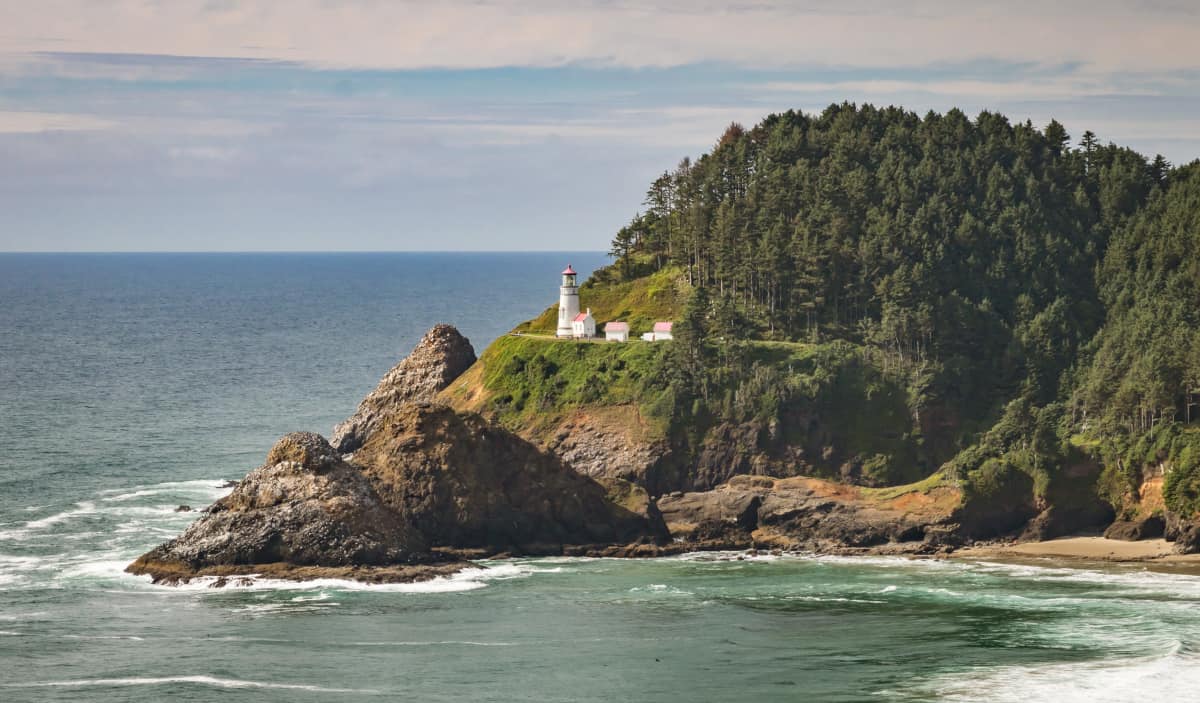
Why you should go: Enjoy a stroll through the sand on Hobbit Beach, then climb up the headland to the Heceta Head Lighthouse.
- Distance: 6.3 miles
- Elevation Gain: 910 feet
- Difficulty: Moderate
The hike from Hobbit Beach to Heceta Head begins at the Washburne State Park Trailhead. A paved trail through a tunnel of stunted sitka spruce and shore pine brings you to Hobbit Beach. With a colorful backdrop of sandstone cliffs to the east, Cape Perpetua to the north, and Heceta Head to the south, views abound in every direction. After a long, leisurely walk on the beach, follow the Hobbit Trail up to the Hobbit Beach Trailhead. From there, it’s a short walk to the Heceta Head Trail.
The Heceta Head Trail winds through Sitka spruce and salal up to a ridgecrest vista with views of Hobbit Beach. The trail continues to rise before descending through thick, dark forest to another viewpoint on the north side of the headland. From there, the trail quickly reaches its terminus at the Heceta Head Lighthouse.
Recently restored to reflect its original glory, the Heceta Head Lighthouse was built in 1894 to fill the gap between the Yaquina Bay Lighthouse and the Umpqua River Lighthouse. Tours are available year-round, and there’s a charming bed and breakfast where the chief lightkeeper’s house once stood. From the lighthouse viewpoint, you’ll have sweeping views of Devil’s Elbow, Devil’s Elbow Beach, Conical Rock, and the Cape Creek Bridge.
Additional Info: Hobbit Beach to Heceta Head Hike
Southern Oregon Coast
Oregon Dunes Loop
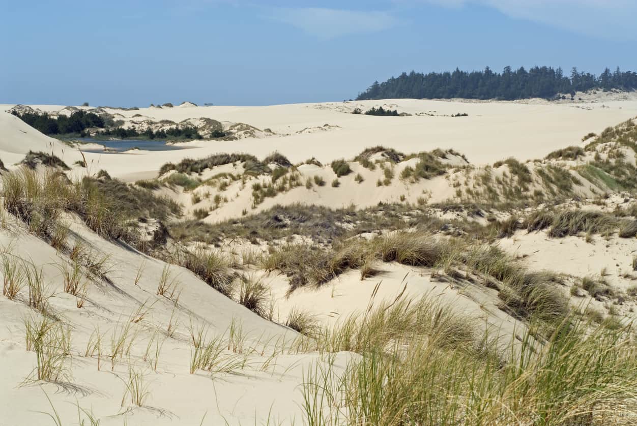
Why you should go: Vistas of the coast, Tahkenitch Creek, and the largest set of sand dunes in North America.
- Distance: 4.8 miles
- Elevation Gain: 195 feet
- Difficulty: Easy
While most hikes make you work before rewarding a scenic vista, the Oregon Dunes Loop begins with the hike’s best viewpoint. The Oregon Dunes Overlook platform is right off the parking lot by the Oregon Dunes Trailhead, affording a beautiful view of the waves beyond the sandy expanse.
You’ll see tree islands with hummocks and Sitka spruce bound together by European beachgrass, various ponds, and, in the distance, the deflation plain supporting thickets of Sitka spruce, wax myrtle, willow, huckleberry, spirea, and stunted shore pines.
From the Oregon Dunes Overlook, the trail heads south towards the Tahkenitch Creek Overlook. You’ll enjoy sporadic views of Tahkenitch Creek along the way, but the overlook offers a superior view from higher ground. The trail then cuts west to the beach with a boardwalk through the deflation plain.
Walking north along the beach, you’ll see Sea Lion Cape to the north. There’s nothing extraordinary about this particular stretch of beach, but it’s a pleasant stroll through the sand. The trail cuts back to the starting point at emergency marker #113, though this portion of the path may be flooded during the wet season — in which case you’ll have to loop back around the way you came in.
Assuming the latter portion isn’t flooded, there are some secluded picnic tables along the crest of an old dune where you can stop for a picnic lunch.
Additional Info: Oregon Dunes Loop Hike
Bandon Beach
Why you should go: tour Bandon’s iconic knockers — Table Rock, Black Rock, Elephant Rock, Face Rock, Komax, Cat and Kittens Rocks, and Oregon’s third Haystack Rock.
- Distance: 7.4 miles
- Elevation Gain: 45 feet
- Difficulty: Easy
This long but leisurely mosey along the beach begins at the Coquille River South Jetty Trailhead. The jetty’s distinctive blueschist rocks were quarried from a local stack called Grandmother Rock, an unfortunate choice as the rock was a sacred site for the local Coquille Indians.
Grandmother Rock is gone now, but its sister stacks lining Bandon Beach — “knockers” formed during the Jurassic period — are now protected by the Oregon Islands National Wildlife Refuge. Home to countless sea lions, seals, and seafowl, this expansive array of sea stacks is the primary attraction on Bandon’s picturesque coastline.
Walking south down Bandon Beach, the first knockers you’ll encounter are Table Rock and Black Rock. Next is Coquille Point with its tangle of rocky offshore islets. There’s a path up to a vista on the south side of the point, where you’ll find a small trail system, picnic area, and parking.
For those who prefer the road less traveled, you can scramble around the point through a narrow gap between the rocks. You’ll have to time your trip around low tide to pull this off, but it’s worth it to see Elephant Rock’s natural arch.
As you round Coquille Point and head south along the beach, take a gander at Face Rock and the surrounding knockers. According to local legend, Ewauna, the daughter of Coquille Chief Siskiyou, was seized by the sea monster Seatka when she swam out into the ocean during a ceremonial feast.
Ewauna successfully fought Seatka’s attempts to place her under his spell, but she and her pets became monuments of stone when they were unable to return to the shore. Face Rock represents Ewauna, while the surrounding knockers — Cat and Kittens Rocks and Komax — represent her pets.
When you reach Grave Point, take a few minutes to explore the tunnel and sea cave before climbing up the staircase to the Face Rock State Scenic Viewpoint. As you continue moving south past Grave Point you’ll pass some smaller knockers before reaching Oregon’s third Haystack Rock, aka Fish Rock. The trail concludes with a trek up the bluff to the Devil’s Kitchen Trailhead, where you’ll find a gorgeous vista with sweeping views of the area.
Additional Info: Bandon Beach Hike
Cape Blanco
Why you should go: incredible panoramic views up and down the coast from the oldest continuously-running lighthouse in Oregon.
- Distance: 9.4 miles
- Elevation Gain: 435 feet
- Difficulty: Moderate
There are a few ways to explore Cape Blanco, Oregon’s westernmost piece of territory. The South Loop (6.1 miles) follows the Oregon Coast Trail down to the Elk River Mouth before looping back along the beach, while the North Loop (4.2 miles) leads up to the Sixes River Mouth. We recommend hiking both loops for the best experience, with a short detour to the Cape Blanco Lighthouse in the middle.
For the South Loop, start at the Cape Blanco Trailhead and follow the South Cape Trail. You’ll quickly reach a whale watching viewpoint where you can spot gray whale calves with their mothers at Blanco Reef during the summer.
The trail leads past state park campgrounds to a grassy bluff with expansive southward views to Port Orford Heads and Humbug Mountain. A mile down the trail is the Elk River Mouth, where you can ford across and continue along the beach towards Port Orford Heads, or follow the South Loop along the beach towards Cape Blanco.
When you reach Needle Rock, walk around to the seaward side to find a small window where you can see the silhouettes of sunbathing cormorants. Look out to the sea for a great vantage of the rocky islets of Blanco Reef and NW Rock.
Most hikers like to visit the Cape Blanco Lighthouse at this point, though you may have to plan around when the tours are available. The greeters occasionally allow people to see the lighthouse’s Fresnel lens without paying for a tour, but only in groups of two when it isn’t busy.
When you’re ready to begin the North Loop, head down to the beach for a look at the 250-foot cliffs that earned Cape Blanco her name when Spanish explorer Martin de Aguilar spotted them from the sea in 1603. Fun fact — Aguilar’s spotting made Cape Blanco the first documented part of the Oregon territory by European explorers.
Walking north along the beach, you’ll pass some smaller rocks on the shoreline with Gull Rock looming in the background offshore. It’s about 1.5 miles to the Sixes River Mouth, where you’ll have an excellent vantage of Castle Rock and its smaller sister stacks. The return loop follows the River Trail into the sedge flats of the Sixes River Estuary. Heading uphill, you’ll reach a spur leading to another view of the bay from a 200-foot vantage point.
Additional Info: Cape Blanco Loop Hike
Port Orford Heads
Why you should go: tour the historic lifeboat station and enjoy sweeping views up and down the coast from this 300-foot-tall headland.
- Distance: 1.2 miles
- Elevation Gain: 170 feet
- Difficulty: Easy
From the Port Orford Lifeboat Station Trailhead, head up the rail-guided path to the historic lifeboat station. The museum — housed in the old barracks building — provides a fascinating account of the lifeboat station’s history and rescue missions from 1934 to 1970, including the mission to rescue survivors from an American tanker torpedoed by a Japanese submarine during WWII.
When you finish exploring the lifeboat station, follow the Cove Trail south for a view of Nellie’s Cove. You’ll see the remains of the old boathouse that burned down in the 1970s, and the breakwater connecting two of the three sea stacks. There’s a staircase leading down to where they used to keep the lifeboats, but it’s off-limits.
Continuing on the loop, you’ll enjoy expansive views to the south of Humbug Mountain and Redfish Rocks before reaching the Port Orford Lookout Tower Site. This is where the lifeboat station spotters would scan the sea for ships distress, though there are only a few concrete pads remaining. Still, the viewpoint offers a beautiful view of the ocean, and it’s a good whale watching spot during migration seasons.
Heading north, you’ll bear left at the next two junctions to reach the out-and-back Headland Trail. The trail offers views of Cape Blanco and the offshore rocks, including Klooqueh Rock with its distinctive pyramid shape. At the end of the trail is a sweeping vista with views to the north of the Cape Blanco Lighthouse, Garrison Lake, and Elk River.
Additional Info: Port Orford Heads Loop Hike
Sisters Rocks
Why you should go: A fairly new state park with a historic beach, epic sea stacks, and a roiling sea cave.
- Distance: 1.6 miles
- Elevation Gain: 260
- Difficulty: Easy
Sisters Rocks became a state park in 2009 thanks to proceeds from the Oregon State Lottery. In addition to the namesake sea stacks, the state park also covers Frankport Beach — named for the S.H. Frank Tannery in Redwood City, CA — that maintained a shipping dock here for 12 years until 1905. Decades after the dock closed, Frankport Beach hosted a rock quarry from the 1950s to the 1980s. Long before that, the sheltered cove was a popular landing spot for prospectors during the gold rush in the 1850s and 1860s.
As you’re heading down the trail toward Sisters Rocks, look north for views of Humbug Mountain, Lookout Rock, and Cape Blanco. Swivel your head to the south for views of Nesika Point and Devil’s Backbone.
When you reach the base of the largest sea stack (Big Sister), climb up to the large opening to view Sisters Sea Cave — a churning sea cave that becomes particularly active around high tide. You can scramble around the base of the sea stack to the left to see the two lower mouths to the cave, and take a closer look at Middle Sister nearby and Little Sister just offshore.
When you’re done exploring Sisters Rocks, head back up the trail to reach the secluded Frankport Beach. Take a few minutes to search the sand for red and green quartz-veined rhyolite, then head further south towards the rocks and sea stacks at the end of the beach. The adjacent beach features a sea stack linked to the mainland with a sand bridge (called a tombolo), and there’s another secluded beach beyond the jumble of rocks at the end.
Additional Info: Sisters Rocks Hike
North Island to Arch Rock
Why you should go: visit natural arches and bridges, sea stacks, cliffs, coves, headlands, and a few secluded beaches.
- Distance: 8.4 miles
- Elevation Gain: 1080 feet
- Difficulty: Moderate
Starting at the North Island Viewpoint Trailhead, hike through forest and meadows to Thomas Point. This viewpoint offers a good vantage of North Island offshore and the Thomas Creek Bridge — Oregon’s tallest bridge at 345 feet — to the south. Loop under the stunted spruce trees to see China Beach to the north.
Head back to the North Island Viewpoint Trailhead, then follow the Oregon Coast Trail north toward China Beach. When you reach the beach, head north across China Creek. There’s a small waterfall cascading down onto the beach, and numerous sea stacks along the shoreline. Round the cliff promontory at the north end of China Beach and you’ll find another waterfall on Spruce Creek.
Head up through a series of switchbacks and footbridges to Highway 101, where you’ll follow the trail along the highway past a few cliff top viewpoints. The trail drops away from the highway past Horse Prairie Creek, and leads you along a steep path to two natural bridges.
You can stand on the first natural bridge, but the larger bridge is an outlet for the enclosed cove behind it. Follow the main trail to a viewing platform with an excellent vantage of the cove and natural bridges.
Continuing along the forested trail, you’ll reach a small headland with prime views of Thunder Rock Cove (aka Seal Cove) and another natural arch. A few junctions later, you’ll see another natural bridge with some offshore sea stacks. Head left at the second junction to descend to Miners Beach (aka Secret Beach). When you reach the sand, check out the Miner’s Creek waterfall.
After exploring Miners Beach, hike back up and follow the trail towards Deer Point — a vista with sweeping views of Leaning Rock, Black Rock, and Spruce Island to the north. The trail rises and falls through another series of switchbacks before reaching the Spruce Island Viewpoint. For the final leg, follow the trail through a few gullies to reach the Arch Rock Trailhead. Head left from the trailhead to Windy Point, where you’ll conclude with views of Arch Rock.
Additional Info: North Island to Arch Rock Hike
Lone Ranch Beach to House Rock
Why you should go: A highlight reel of the Samuel H. Boardman Scenic Corridor with sea stacks, secret beaches, and clifftop vistas.
- Distance: 5.7 miles
- Elevation Gain: 1140 feet
- Difficulty: Moderate
The hike from Lone Ranch Beach to House Rock showcases the best features of the Samuel H. Boardman State Scenic Corridor. You’ll enjoy picturesque seascapes dotted with sea stacks, secret beaches, and cliff top views from Point St. George up to Cape Sebastian. Visit during the spring and you’ll see thousands of wildflowers in bloom on Cape Ferrelo, and gray whales migrating north along the coast.
Beginning at the Lone Ranch Beach Trailhead, head down the beach and cross Lone Ranch Creek. Follow the beach north until you reach a grassy footpath leading up an open moor. On your way up the moor, look south for views of the bay, Twin Rocks, and Goat Island. On a clear day, you’ll see California’s Point St. George on the southern horizon. When you crest the moor, you’ll see Barnacle Rock, House Rock, and a view of the rocky cove below. Past a promontory, House Rock Beach and the towering cape of House Rock Point come into view.
From here, follow the Oregon Coast Trail to the Cape Ferrelo Trailhead — an excellent whale watching spot during migration season. Continuing on the Oregon Coast Trail, you’ll eventually reach a junction with an unsigned trail leading southwest down to House Rock Beach. If you’re up for a little detour, head down this steep quarter-mile trail and explore House Rock Creek, tide pools, and the sea stacks at the base of the cliff. Otherwise, continue north to the House Rock Trailhead.
The hike concludes at the House Rock Viewpoint. The trees obscure some views, but you should be able to see Cape Sebastian, Crook Point, and Whalehead Beach to the north. Turn south and you’ll see from Cape Ferrelo down to Point St. George. There’s also a monument honoring Samuel H. Boardman, the first superintendent of the Oregon State Parks program.
Additional Info: Lone Ranch Beach to House Rock Hike
Harris Beach
Why you should go: sea stacks, offshore islands, and a breathtaking viewpoint 300 feet above the swells.
- Distance: 2.8 miles
- Elevation Gain: 305 feet
- Difficulty: Easy
Harris Beach — named after George Harris, a Scotsman who settled in the area during the late 19th century — is one of the most popular campgrounds on the Oregon Coast. The area can get a little crowded around holiday weekends, but there’s plenty of room for everyone to enjoy the incredible views of the sea stacks offshore.
Beginning at the Harris Beach Trailhead, follow the trail down to the beach. As you cross Harris Creek, look up to see the rugged, gorse-filled slopes of the nearly 300-foot tall Harris Butte. Heading north along the beach, you’ll pass a number of sea stacks scattered in the waves offshore before reaching the tide pools at the end of the beach. Take some time to explore the tide pools and appreciate the colorful sea creatures before turning around and heading back down the beach.
Rounding the base of the rhyolite knoll, you’ll need to find a path over a pile of boulders to reach Rock Beach. From here, you’ll have an excellent view of Goat Island, aka Bird Island — the largest island in the Oregon Islands National Wildlife Refuge. During spring and summer, you’ll find over 100,000 nesting seafowl on the island, including tufted puffins and Leach’s storm petrels.
Past Rock Beach is South Harris Beach, a sandy expanse backed by a steep slope of alder, spruce, willow, wax myrtle, and silktassel. Take a leisurely stroll down South Harris Beach to visit the headland past Ransom Creek, then return to the bluff near Eiler Creek. You’ll find the trail leading back to the parking area near emergency locator #192.
When you reach the parking area, follow the Sunset Point Trail along the bluff to a scenic viewpoint with a great view of Goat Island and the surrounding sea stacks. There’s another viewpoint with a great vantage of Arch Rock off of the other parking area, but you’ll find the best vista at the top of Harris Butte.
The summit offers breathtaking panoramic views in every direction — north to Cape Ferrelo, south to Brookings Harbor and California, and of course west to the archipelago of sea stacks offshore. Be sure to pack your binoculars for top notch whale watching and birding.
Additional Info: Harris Beach Loop Hike
Explore More Oregon
We’ve got even more advice on how to enjoy your time on in Oregon:
Get epic travel ideas delivered to your inbox with Weekend Wanderer, our newsletter inspiring thousands of readers every week.