Alum Cave Trail is one of the most popular hikes in Great Smoky Mountains National Park. But, for a long time, I avoided it. With 11.5 million visits in 2025, the park remains the most-visited national park in the United States (and the second most hikeable national park). For hikers like me, the draw to the Smokies is obvious. The ancient mountainous landscape is crisscrossed with nearly 900 miles of trails that ford cool rivers, climb craggy peaks, traverse shaded hollers, and meander loamy forests.
While living in East Tennessee in 2023, I joined the Great Smoky Mountains 900 Miler Club. This was a growing community of locals and other Smokies enthusiasts who have hiked every single trail in the park. For the first half of that nearly three-year journey, I avoided Alum Cave Trail like the plague.
Let me explain: It’s not that I thought the Alum Cave Trail would be too hard. I simply kept putting off the hike because it’s SO popular. As a result, I’d built a story in my head that it would be miserably crowded and therefore unenjoyable. Instead, when I finally made the trek, I learned why everybody loves this trail.
Alum Cave Trail at a Glance
Alum Cave Trail is a classic Great Smoky Mountains experience that offers equal parts physical challenge, historic landmarks, scenic views, interesting geology, and botanical wonder. It’s a full-day adventure. Plus, you get a rewarding climb to the hike-in-only LeConte Lodge for a break before your descent.
While it’s not the park’s quietest trail, there are ways to find more peace along the journey, and given the range of Smokies boxes it checks, its popularity is well earned.
Alum Cave Trail Distance, Difficulty & Elevation Gain
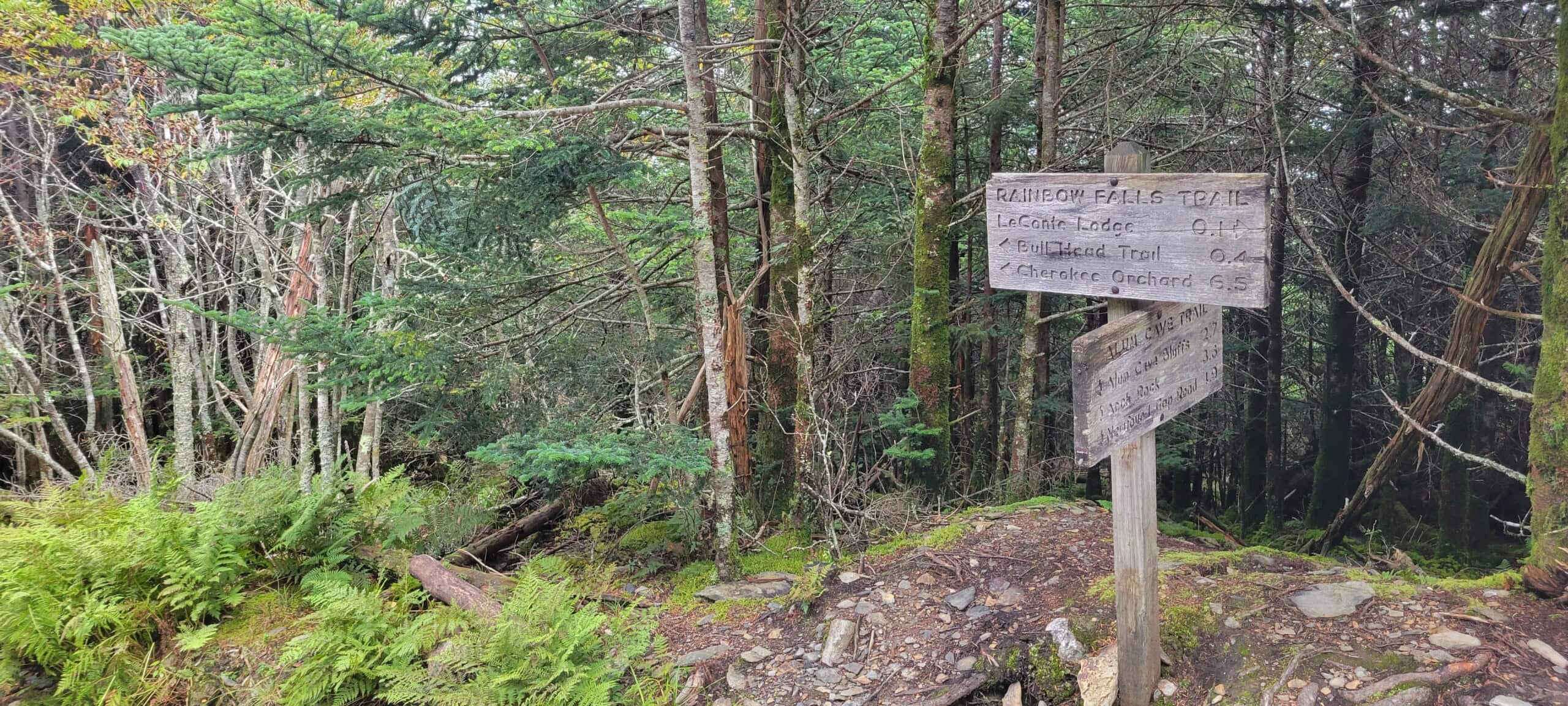
Alum Cave Trail runs 4.9 miles from its trailhead on Newfound Gap Road (U.S. 441) to its intersection with the Rainbow Falls Trail. If you make it to this junction, however, it’s worth heading right for another 0.1 miles to reach the LeConte Lodge. From there, explore nearby side trails for lunch with a view. In total, expect to hike about 10 miles round-trip on this out-and-back trip.
The trail’s difficulty is moderate to strenuous, depending on your overall fitness. There are five main trails that lead to Mount Le Conte in the Smokies. While Alum Cave Trail is the shortest of these trails, it’s also the steepest. Expect to gain about 2,700 feet in elevation. You’ll also encounter some uneven, rocky terrain that can be slick when wet and icy in the winter. Some narrow rocky passages have wire cables you can hold onto for extra support.
While it can be a challenging hike, Alum Cave Trail is also doable. As long as you’re prepared with the ten essentials and take your time up the mountain, you can enjoy this iconic ascent. Trekking poles are also particularly helpful for navigating the trail’s terrain.
How to Get to the Alum Cave Trailhead
The Alum Cave trailhead is located about 8.6 miles south of the park’s Sugarlands Visitor Center near Gatlinburg, Tennessee. Look for the parking areas between mile markers 10 and 11 on Newfound Gap Road (U.S. 441). You can use “Alum Cave Trailhead Parking Area, 3639 Newfound Gap Rd, Gatlinburg, TN 37738” in Google Maps for navigation.
There are two small parking lots on either side of the trail, with a pit toilet at the northern lot. Roadside parking is prohibited, and spaces fill quickly, so plan to arrive around sunrise or dinnertime for best availability, or expect to circle for a spot. To avoid the hassle, consider reserving a ride with one of the park’s authorized shuttle providers.
If you drive, you’ll need a parking tag. While Great Smoky Mountains National Park has no entrance fee, vehicles parked longer than 15 minutes must display a tag under the Park It Forward program to help fund critical services. Passes cost $5 daily, $15 weekly, or $40 annually and can be purchased online, at park kiosks, or through local vendors. Interagency passes (like America the Beautiful) are not accepted. You can learn more on the park’s website.
What to Expect on the Alum Cave Trail
From the parking area, Alum Cave Trail begins with a small wooden footbridge across Walker Camp Prong. It then continues as a gentle walk through an old-growth hardwood forest alongside Alum Cave Creek with a few more bridged stream crossings along the way. In addition to towering eastern hemlocks and tulip poplars, expect dense thickets of rosebay rhododendrons and mountain laurel, with mosses and ferns thriving in the moist understory.
About 1.4 miles in, directly after a log crossing over the creek, you’ll reach Arch Rock. This 20-foot-wide arched opening through the slate rock was formed naturally over thousands of years by a freeze-thaw erosion cycle. It’s the only arch in the park you can hike directly through via a set of stone stair steps.
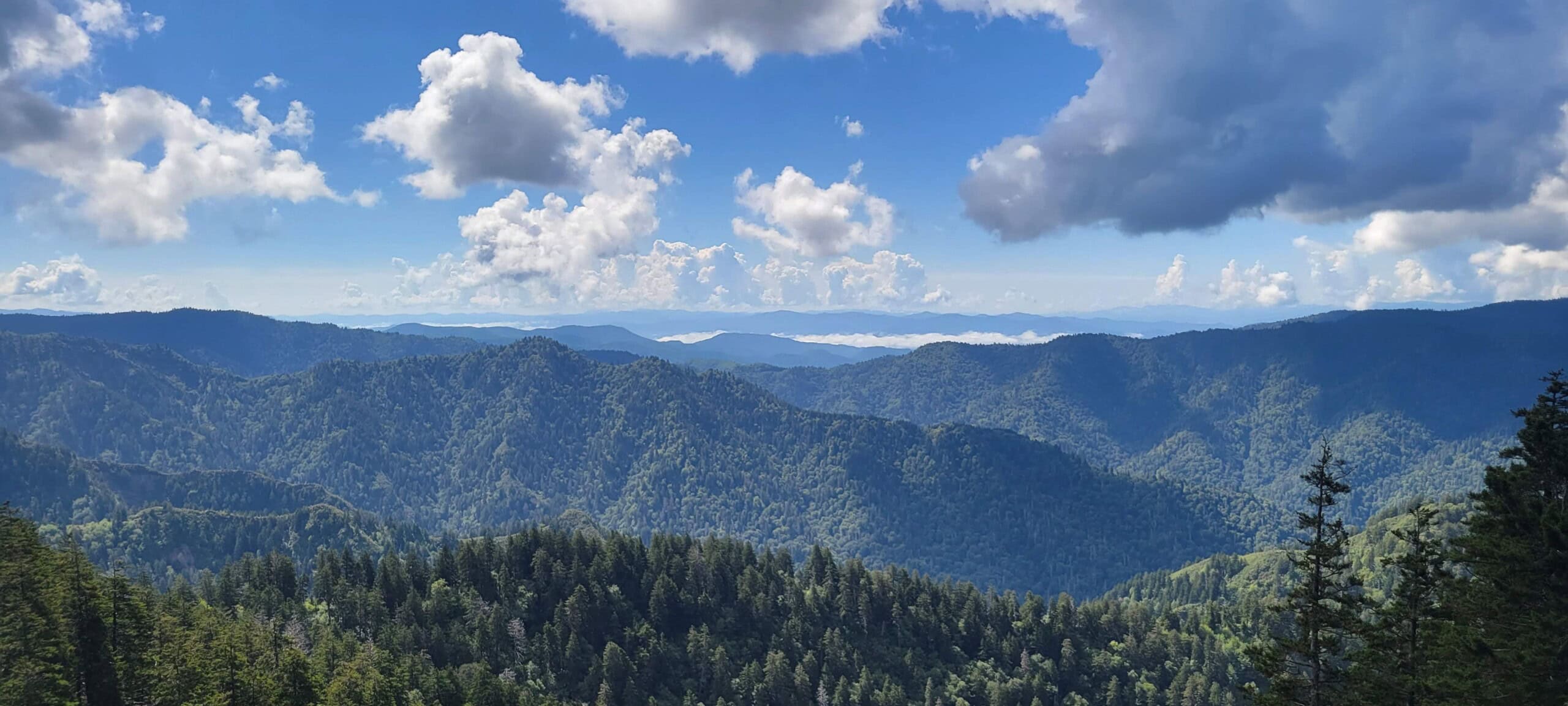
From here, the climb begins to noticeably increase. About two miles in, you’ll reach a rocky outcrop at a switchback known as Inspiration Point. While the Smokies are known for “peek-a-boo” views through otherwise densely forested trails, this is one spot where the view really opens up to the surrounding rolling mountains and valley below.
At 2.3 miles in, you’ll arrive at the impressive, amphitheater-like Alum Cave Bluffs. While not an actual cave, this 80-foot-tall, 500-foot-wide concave slate overhang offers a sheltered spot to take a break. The ground in the area has a sandy texture, and the bluff collects icicles in the winter. The area was a mining site in the 1800s for various minerals, such as alum and magnesium sulfate.
Look for where the trail continues just past the bluffs for about another two miles of climbing toward the junction with Rainbow Falls Trail at 4.9 miles. Take a right here for opportunities to explore various nearby sites:
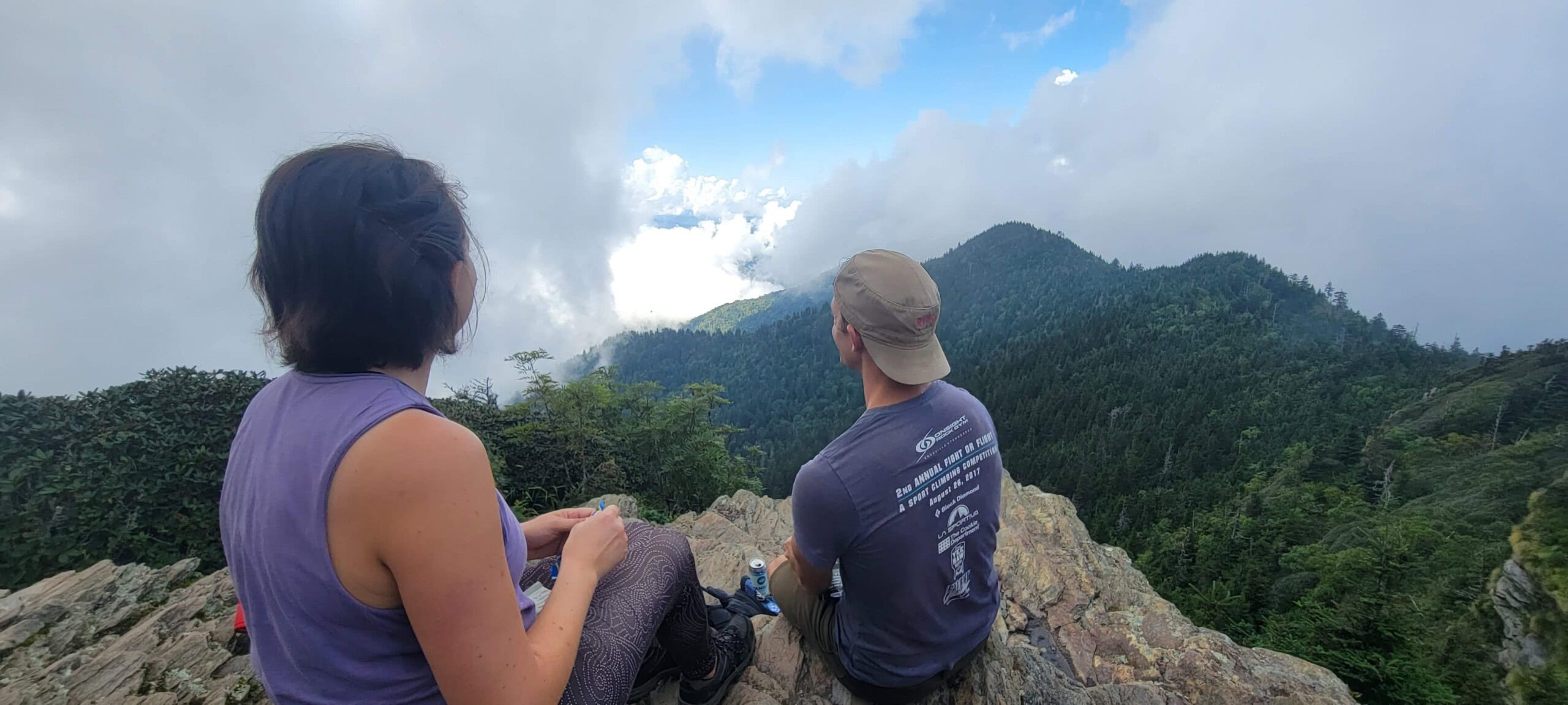
- Cliff Top: Shortly after turning at the trail junction, you’ll see the Cliff Top Viewpoint Access Trail on your right. Follow this for 0.2 miles to a scenic rocky overlook that’s a great place to sit for lunch.
- LeConte Lodge: On your left, just past the Cliff Top spur, this historic, hike-in lodge (est. 1925) is the highest of its kind in the eastern U.S. at 6,360 feet. Open mid-March through mid-November, it offers guests off-grid cabins and family-style meals. Day hikers are also welcome to use its pit toilets and potable water sources. In addition, there’s a small gift shop to buy souvenirs or a bagged lunch and sign the guestbook. All supplies to the lodge arrive by llama train, which is a lucky sighting for some hikers!
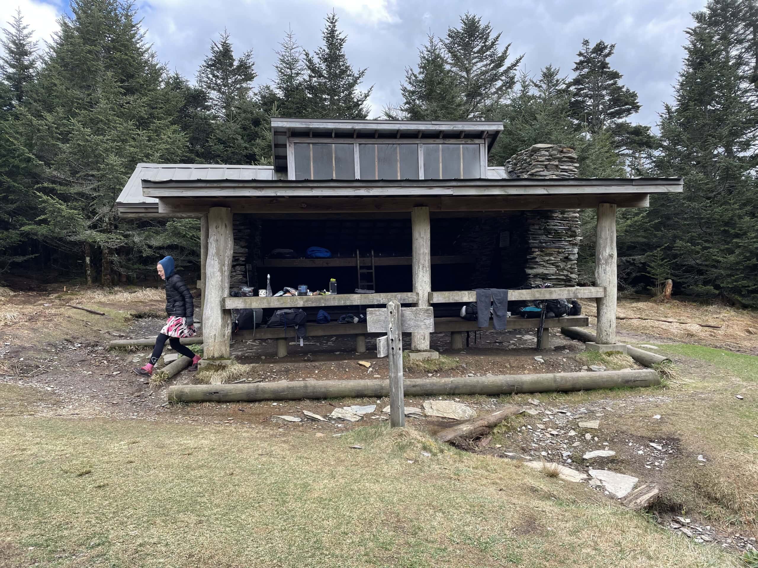
- Mount Le Conte Summit: If you continue on the trail another 0.2 miles or so past the lodge, you’ll see a pile of rocks in a clearing to your right. This is the official summit of Mount Le Conte at 6,593 feet. On the way, you’ll pass a wooden shelter on your right, which backpackers can get a permit to stay in overnight.
- Myrtle Point: About a half-mile from the summit, there will be a split in the trail. Stick to the right for a side trail to Myrtle Point, which offers additional sweeping high-elevation views similar to Cliff Top.
To get back to your car, descend the way you came.
Best Time to Hike Alum Cave Trail
For a quieter experience and better parking odds, start at sunrise or, in longer spring and summer days, around dinnertime. Weekdays are typically less busy, and avoiding major holidays and spring break can make a big difference.
The trail is lovely in all seasons. Spring brings beautiful blooms like trilliums, Dutchman’s breeches, yellow trout lilies, violets, and mountain laurel. Summer continues the show with grass-of-parnassus, narrowleaf gentian, and flame azaleas, while the trail’s higher elevation offers relief from the heat and humidity in town.
Fall presents a tapestry of colorful foliage, though be aware that leaf-peeping season also brings significant added traffic to the park. Winter is a unique experience, with expanded views from the fallen leaves and a chance for snow, but be prepared with microspikes, trekking poles, and layers, and be aware that Newfound Gap Road may close due to weather.
Tips for Hiking Alum Cave Trail
My main advice for hiking Alum Cave Trail is to take your time and enjoy all the stops. It’s a truly distinct and fun climb. If you make it to the lodge to add your name to the guestbook, you’ll see that many signers note how many times they’ve made the trek in their lifetime: some have summited Mount Le Conte hundreds or even thousands of times! It’s a real tradition for many and the viewpoints and peace up top are worth lingering for a while.
Besides that, here are a few tips to help plan a good trip.
Be prepared to outwait the fog
The Great Smoky Mountains get their name thanks to regularly occurring hazy blue mist. Sometimes, this likes to settle in at the viewpoints, so be prepared for a classic Smoky Mountain view of, well, dense fog. However, the fog is often fairly kinetic, so if you get to Cliff Top and the view is socked in, I recommend taking a seat and enjoying your lunch anyway. With some patience, the Smokies may still reveal their glory.
Bring layers even on hot days
Given the change in elevation, Mount Le Conte’s summit can sometimes be up to 20 degrees cooler than in-town temperatures. Even if it’s a balmy day in Pigeon Forge or Gatlinburg, pack some layers so you’re comfortable while resting up top.
Consider your options
Alum Cave Trail is a very popular hike. If you arrive and the parking lot is full or it just seems too busy for your preferences, consider other nearby options. Some other favorites in the area with comparable views include the Chimney Tops Trail (out-and-back for 3.5 miles round-trip) and the Appalachian Trail from the parking area at Newfound Gap to Charlies Bunion (out-and-back for 8 miles round-trip).
Additionally, if you have access to a shuttle and are up for a longer hike, you can plan a trip up Alum Cave Trail and then descend via one of the other trails that go to the summit: Rainbow Falls Trail, Trillium Gap Trail (the route the llama train uses), The Boulevard Trail, Bullhead Trail, or Brushy Mountain Trail.
Your best bet is to stop by the Sugarlands Visitor Center. Obtain maps, get current conditions, buy your parking permit, and plan your route with a ranger.
Seen in: Hikes